Queensbury, New York

Last updated

Queensbury
Warren County Municipal Center.JPG
Warren County Municipal Center
Motto: 
Home of Natural Beauty ... A Good Place to Live
Queensbury New York.PNG
Location of Queensbury within Warren County
USA New York location map.svg
Red pog.svg
Queensbury
Location of Queensbury in New York
Coordinates(Seat of town government): 43°21′34″N73°39′25″W / 43.35944°N 73.65694°W / 43.35944; -73.65694
Country United States
State New York
County Warren
Established1786
Named for Charlotte of Mecklenburg-Strelitz
SeatQueensbury Town Center
Government
[1]
   Supervisor John Strough (Democrat)
Area
[2]
  Total64.84 sq mi (167.93 km2)
  Land62.83 sq mi (162.73 km2)
  Water2.01 sq mi (5.20 km2)  2.78%
Elevation
[3]
502 ft (153 m)
Population
 (2020) [4] [5]
  Total29,169
Time zone UTC-5 (EST)
  Summer (DST) UTC-4 (EDT)
ZIP code
12804
Area code 518
Official butterfly [6] Karner Blue
Website https://www.queensbury.net

Queensbury is a town in Warren County, New York, United States. [7] The population was 29,169 at the 2020 census. [5] [4]

Contents

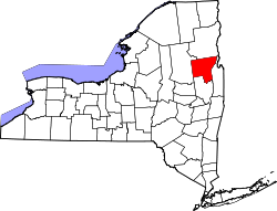
It contains the county seat of Warren County, located at a municipal center complex on U.S. Route 9 south of the village of Lake George. [8] It was moved to the complex in 1963 from the original county seat of Lake George. [9] The town is located in the southeastern corner of the county and is part of the Glens Falls Metropolitan Statistical Area. [10] It is named in honor of Queen Charlotte. [11] Although primarily located north of the city of Glens Falls, Queensbury surrounds the city on three sides. [12]

Six Flags Great Escape and Hurricane Harbor, a Six Flags theme park, is located in northwest Queensbury. West Mountain, a downhill skiing area, is located in the southwestern part of town. [12]

History

Major efforts at settlement began with the Queensbury Patent in 1762, which enticed Quaker settlers to move into the area known as the "Township of Queensbury" the next year. The Quakers left during the Revolutionary War and returned in 1783 when hostilities ended in the area. [13]

In 1786, the town was re-established as the town of Queensbury. In 1788, the town included all of what is today Warren County. It lost territory in 1792 when the town of Fairfield (Lake Luzerne) was formed and again in 1810 to form part of the town of Caldwell (Lake George). In 1908, the then largest village within Queensbury, Glens Falls, incorporated as a city and became a separate municipality. [13] [14] The population of Queensbury has exceeded that of Glens Falls since the 1980 Census. [15]

In 2003, with permission from Queensbury, [16] Glens Falls annexed approximately 49 acres (0.20 km2) of the town. The land, known as Veterans Field [17] or the Northway Industrial Park, is on Veterans Road between Luzerne Road and Sherman Avenue [16] and is just east of I-87. [18] The land was vacant at the time. [16] A thin, 0.5 miles (0.80 km) strip of Sherman Avenue [19] was part of this annexation, [17] in order to comply with state law regarding contiguity of annexed land. Both the city and town now share ownership of this stretch of highway as a result. [19]

The Sanford House and Asa Stower House are listed on the National Register of Historic Places. [20]

Geography

According to the United States Census Bureau, the town has a total area of 64.81 square miles (167.9 km2), of which 63.01 square miles (163.2 km2) is land and 1.80 square miles (4.7 km2) (2.78%) is water. [21] The town is located within the southeastern part of the Adirondack Mountains. The western town line is the border with the town of Lake Luzerne. The southern town boundary is defined by the border with the city of Glens Falls and the Hudson River, across which lies Saratoga County. The eastern town line is the border of Washington County, also New York State. The northern border is defined by the town of Lake George [22] and, according to the town and Warren County, by the shoreline of the body of water, Lake George, itself. [23] [24] However, several maps, including those published by the USGS, depict the northern boundary as including part of the lake, including Speaker Heck Island and Happy Family Islands. [25]

Parts of western and northern Queensbury are within the Adirondack Park. [22]

Demographics

Historical population
CensusPop.Note
1820 2,433
1830 3,08026.6%
1840 3,78923.0%
1850 2,597−31.5%
1860 7,146175.2%
1870 8,38717.4%
1880 9,80516.9%
1890 2,340−76.1%
1900 2,3771.6%
1910 2,66712.2%
1920 2,584−3.1%
1930 3,16922.6%
1940 4,19932.5%
1950 5,90740.7%
1960 10,00469.4%
1970 14,50645.0%
1980 18,97830.8%
1990 22,63019.2%
2000 25,44112.4%
2010 27,9019.7%
2020 29,1694.5%
U.S. Decennial Census [26] [27]

As of the census of 2000, there were 25,441 people, 9,948 households, and 7,162 families residing in the town. The population density was 403.8 inhabitants per square mile (155.9/km2). There were 11,223 housing units at an average density of 178.1 per square mile (68.8/km2). The racial makeup of the town was 97.54% White, 0.55% African American, 0.20% Native American, 0.71% Asian, 0.02% Pacific Islander, 0.22% from other races, and 0.76% from two or more races. Hispanic or Latino of any race were 1.12% of the population. [5]

There were 9,948 households, out of which 34.0% had children under the age of 18 living with them, 59.1% were married couples living together, 9.4% had a female householder with no husband present, and 28.0% were non-families. 22.6% of all households were made up of individuals, and 11.0% had someone living alone who was 65 years of age or older. The average household size was 2.52 and the average family size was 2.97. [5]

In the town, the population was spread out, with 25.3% under the age of 18, 6.1% from 18 to 24, 28.3% from 25 to 44, 25.1% from 45 to 64, and 15.2% who were 65 years of age or older. The median age was 39 years. For every 100 females, there were 92.2 males. For every 100 females age 18 and over, there were 89.4 males. [5]

The median income for a household in the town was $47,225, and the median income for a family was $54,880. Males had a median income of $39,260 versus $25,036 for females. The per capita income for the town was $24,096. About 3.8% of families and 5.0% of the population were below the poverty line, including 7.4% of those under age 18 and 2.2% of those age 65 or over. [5]

Government

Queensbury is a town of the first class, and as such has a town board with a town supervisor and four councilmen. [1] Town residents petitioned to establish a ward system in 1981 [28] and again in 1985 [29] whereby the town would be divided into four wards. In a ward system, whereas the supervisor is elected by the entire town electorate, each councilman is elected by only the electorate of the ward he or she will be representing. [1] Having been approved by the voters by referendum in 1985, the first town board to be elected under the ward system convened in 1986. [30] Queensbury is one of only ten towns out of New York's 932 towns that had a ward system as of 2000. [31] The town has an ethics board, planning board, and zoning board of appeals. [32]

As of 2018, the town government officials are:

Supervisor John Strough

Anthony Metivier - Councilman, Ward 1

Harrison Freer - Councilman, Ward 2

George Ferone - Councilman, Ward 3

Timothy McNulty - Councilman, Ward 4

In county government, Queensbury is entitled to five of the 20 seats on the Warren County Board of Supervisors. (Glens Falls also gets five seats, whereas the remaining ten towns in the county receive one seat each.) Four of Queensbury's seats are filled by town-wide election, whereas the fifth is reserved for the town supervisor. [33]

Emergency services

Emergency services can be accessed by dialing 9-1-1, which routes calls to Warren County's 911 Communications Center. [34]

Law enforcement and other police services are provided by the Warren County Sheriff's Office [34] and are supplemented by the New York State Police, which maintains a barracks in the town. [35] Queensbury has not had its own police force since disbanding it in 1982. [36]

The town is divided into five fire protection districts: Bay Ridge, North Queensbury, Queensbury Central, South Queensbury, and West Glens Falls. Each district contains at least one fire station, with Queensbury Central and West Glens Falls each having two stations. [37]

Three emergency medical services (EMS) districts provide out-of-hospital acute care and ambulance services: Bay Ridge EMS, North Queensbury EMS, and West Glens Falls EMS. [38]

A State Emergency Management Office (SEMO) regional office is located on Fox Farm Road. [39]

Culture

Queensbury was the home of the Lake George Opera Festival from 1965 to 1998. During this period, the festival was held in the 875-seat Queensbury High School auditorium, producing three to seven operas per year. [40]

Education

Public school districts

The town of Queensbury falls within four public school districts: [41]

Postsecondary education

Notable people

Communities and locations in the Town of Queensbury

Related Research Articles

<span class="mw-page-title-main">Warren County, New York</span> County in New York, United States

Warren County is a county in the U.S. state of New York. As of the 2020 census, the population was 65,737. The county seat is Queensbury. The county was established in 1813 and is named in honor of General Joseph Warren, an American Revolutionary War hero of the Battle of Bunker Hill. The county is part of the Capital District region of the state.

<span class="mw-page-title-main">Clarkstown, New York</span> Town in New York, United States

Clarkstown is a town in Rockland County, New York, United States. The town is on the eastern border of the county, located north of the town of Orangetown, east of the town of Ramapo, south of the town of Haverstraw, and west of the Hudson River. As of the 2020 census, the town had a total population of 86,855. The hamlet of New City, the county seat of Rockland County, is also the seat of town government and of the Clarkstown Police Department, the county sheriff's office, and the county correctional facility. New City makes up about 41.47% of the town's population.

<span class="mw-page-title-main">Moreau, New York</span> Town in New York, United States

Moreau is a town in Saratoga County, New York, United States. The population was 16,202 at the 2020 census. The town is located in the northeast part of the county, north of Saratoga Springs. Moreau is named after Jean Victor Moreau, a French general, who visited the area just before the town was formed. The town contains a village called South Glens Falls.

<span class="mw-page-title-main">Glens Falls, New York</span> City in New York, United States

Glens Falls is a city in Warren County, New York, United States and is the central city of the Glens Falls Metropolitan Statistical Area. The population was 14,830 at the 2020 census. The name was given by Colonel Johannes Glen, the falls referring to a large waterfall in the Hudson River at the southern end of the city.

<span class="mw-page-title-main">Lake Luzerne, New York</span> Town in New York, United States

Lake Luzerne, formerly the Town of Fairfield and then Luzerne, is a town in southern Warren County, New York, United States. The town is located within the Adirondack Park. The town is part of the Glens Falls Metropolitan Statistical Area. Lake Luzerne is west of the city of Glens Falls. The town population was 3,079 at the 2020 census.

<span class="mw-page-title-main">Thurman, New York</span> Town in New York, United States

Thurman is a town in the western part of Warren County, New York, United States. It is part of the Glens Falls Metropolitan Statistical Area. The town population was 1,199 at the 2000 census. The town is named after John Thurman, an early landowner. The town lies entirely inside the Adirondack Park.

<span class="mw-page-title-main">West Glens Falls, New York</span> CDP and hamlet of Queensbury in New York, United States

West Glens Falls is a census-designated place (CDP) and hamlet in Warren County, New York, United States. The population was 9,473 at the 2020 census. It is part of the Glens Falls Metropolitan Statistical Area.

<span class="mw-page-title-main">Hampton, New York</span> Town in New York, United States

Hampton is a town in Washington County, New York, United States. It is part of the Glens Falls Metropolitan Statistical Area. The town population was 938 at the 2010 census, an increase of 7.2% since the 2000 census. The town of Hampton is located in the northeastern corner of Washington County.

<span class="mw-page-title-main">Putnam, New York</span> Town in Washington County, New York, US

Putnam is a town in northern Washington County, New York, United States. It is part of the Glens Falls Metropolitan Statistical Area. The town population was 645 at the 2000 census. The town is named after Israel Putnam, a hero of the American Revolution.

<span class="mw-page-title-main">New York State Route 9L</span> State highway in Warren County, New York, in the United States

New York State Route 9L (NY 9L) is a state highway in Warren County, New York, in the United States. The road is 18.58 miles (29.90 km) long and is a suffixed highway of U.S. Route 9 (US 9). NY 9L goes through three municipalities in Warren County: the city of Glens Falls, the town of Queensbury and the town of Lake George. It starts at an intersection with US 9 and NY 32 in Glens Falls and ends at a junction with US 9 and NY 9N in Lake George. NY 9L is a scenic route for people traveling to Lake George as the road provides many views of the lake. The route was assigned as part of the 1930 renumbering of state highways in New York along the path of an old military road originally built during the American Revolution.

<span class="mw-page-title-main">New York State Route 149</span> Highway in New York and Vermont

New York State Route 149 (NY 149) is an east–west state highway that runs for 32.20 miles (51.82 km) through the Capital District of New York in the United States. It begins at exit 20 on the Adirondack Northway in the Warren County town of Queensbury and intersects U.S. Route 9 (US 9), US 4, and NY 22, among other routes, as it progresses eastward to its eastern end at the Vermont state line in the Washington County village of Granville. Here, the highway becomes Vermont Route 149 (VT 149) and continues for an additional 1.302 miles (2.095 km) to an intersection with VT 30 in Rutland County. Both NY 149 and VT 149 traverse mostly rural areas.

<span class="mw-page-title-main">New York State Route 254</span> New York state highway

New York State Route 254 (NY 254) is a state highway that extends for 6.01 miles (9.67 km) through Warren and Washington counties in the Capital District of New York in the United States. The route runs from exit 19 along the Adirondack Northway in Queensbury and follows Aviation Road, Quaker Road, and Lower Warren Street through Queensbury to Hudson Falls, where it terminates at an intersection with U.S. Route 4 (US 4) in the center of the village.

<span class="mw-page-title-main">Kattskill Bay, New York</span> Hamlet in New York, United States

Kattskill Bay is a hamlet in the towns of Queensbury in Warren County and Fort Ann in Washington County in the state of New York, United States. The hamlet is located along the shore of Warner and Van Warmer Bays of Lake George. Kattskill Bay was part of the proposed East Lake George village. Pilot Knob Road is the major highway that runs through the hamlet. The hamlet is located at the base of Buck Mountain.

<span class="mw-page-title-main">New York State Route 32B</span> State highway in the Capital District region of New York, in the United States

New York State Route 32B (NY 32B) was a state highway in the Capital District region of New York, in the United States. The western terminus of the route was at an intersection with NY 32 in Queensbury. Its eastern terminus was at a junction with U.S. Route 4 (US 4) in Hudson Falls. NY 32B, named Warren Street in Queensbury and River Street in Hudson Falls, ran along the banks of the Hudson River as it went from Glens Falls to Hudson Falls. It crossed over the Glens Falls Feeder Canal near its junction with NY 32 in Queensbury.

<span class="mw-page-title-main">Glens Falls metropolitan area</span> Human settlement in United States of America

The Glens Falls Metropolitan Statistical Area, as defined by the United States Census Bureau, is an area consisting of two counties in Upstate New York, anchored by the city of Glens Falls. It is considered to be a part of the greater Capital District. As of the 2010 census, the MSA had a population of 128,942.

<span class="mw-page-title-main">East Lake George, New York</span> Hamlet in New York, United States

East Lake George is a hamlet within the towns of Queensbury and Fort Ann in the U.S. state of New York. East Lake George attempted to incorporate as a village, a measure rejected by voters in 2010.

<span class="mw-page-title-main">Oneida Corners, New York</span> Hamlet in New York, United States

Oneida Corners is a hamlet within the town of Queensbury in Warren County in the U.S. state of New York.

<span class="mw-page-title-main">Lake George (town), New York</span> Town in New York, United States

Lake George is a town in Warren County, New York, United States. The population was 3,502 at the 2020 census. The town is named after the lake, Lake George. The town is part of the Glens Falls Metropolitan Statistical Area.

<span class="mw-page-title-main">Fort Ann, New York</span> Town in New York, United States

Fort Ann is a town in Washington County, New York, United States. It is part of the Glens Falls Metropolitan Statistical Area. The town population was 5,812 at the 2020 census. The town contains a village, also called Fort Ann, located in its southeastern corner.

References

  1. 1 2 3 "Town Government". Town of Queensbury. Archived from the original on March 24, 2009. Retrieved March 12, 2009.
  2. "2016 U.S. Gazetteer Files". United States Census Bureau. Retrieved July 5, 2017.
  3. "Queensbury topographic map". Topographic map.
  4. 1 2 US Census 2020 Report, QUickFacts Queeensbury town https://www.census.gov/quickfacts/queensburytownwarrencountynewyork
  5. 1 2 3 4 5 6 "U.S. Census website". United States Census Bureau . Retrieved January 31, 2008.
  6. "Karner Blue Butterfly". Town of Queensbury. April 23, 2001. Archived from the original on April 30, 2010. Retrieved August 4, 2010.
  7. "Find a County". National Association of Counties. Archived from the original on August 4, 2010. Retrieved August 9, 2010.
  8. Google Maps (1340 U.S. Route 9, Lake George, New York), Retrieved January 14, 2015.
  9. PostStar, Lake George Officials Consider New Use For Old Courthouse; retrieved January 14, 2015.
  10. "Metropolitan Areas and Components, 1999, with FIPS Codes". US Census Bureau. Retrieved July 7, 2009.
  11. VanDyke, Marilyn. "Brief History of Queensbury, NY". Historian, Town of Queensbury. Archived from the original on July 4, 2008. Retrieved March 18, 2009.
  12. 1 2 "Recreational Opportunities" (PDF). Department of Community Development, Town of Queensbury. Archived from the original (PDF) on November 28, 2010. Retrieved April 23, 2009.
  13. 1 2 3 4 5 6 7 VanDyke, Marilyn. "Oneida Hamlet". Archived from the original on May 8, 2009. Retrieved March 17, 2009.
  14. Bridging The Years: Glens Falls, New York 1763-1978. Glens Falls, NY: Glens Falls Historical Association. 1978. ISBN   0-8081-3885-5.
  15. "1990 Census of Population and Housing" (PDF). Bureau of the Census. p. 526/PDF p. 538 (Table 45). Retrieved July 12, 2010.
  16. 1 2 3 Randall, Thom (May 21, 2003). "Town to cede industrial park". The Post-Star. Retrieved July 14, 2010.
  17. 1 2 Thompson, Maury (October 26, 2003). "Glens Falls Common Council". The Post-Star. Retrieved July 14, 2010.
  18. Overview of 2003 Annexation (Map). Cartography by NAVTEQ. Yahoo! Inc. Retrieved February 27, 2011.
  19. 1 2 Gereau, John (April 4, 2002). "City, town to share Sherman Avenue strip". The Post-Star. Retrieved July 14, 2010.
  20. "National Register Information System". National Register of Historic Places . National Park Service. March 13, 2009.
  21. "New York by Place and County Subdivision". American FactFinder. Archived from the original on February 12, 2020. Retrieved April 10, 2009.
  22. 1 2 3 Town of Queensbury (PDF) (Map). Town of Queensbury Community Development Department. April 2004. Archived from the original (PDF) on November 28, 2010. Retrieved February 27, 2011.
  23. "Full Environmental Assessment Form" (PDF). Town of Queensbury. March 14, 2003. p. 5. Archived from the original (PDF) on December 21, 2010. Retrieved February 27, 2011.
  24. Warren County Spatial Data Viewer (Map). Warren County GIS. Archived from the original on August 17, 2011. Retrieved February 27, 2011.
  25. 1 2 Lake George Digital Raster Quadrangle (Map). 1:24,000. New York State Department of Transportation. 1992. Retrieved January 22, 2010.
  26. "Census of Population and Housing". Census.gov. Retrieved June 4, 2015.
  27. US Census 2020 Report, QuickFacts Queeensbury town https://www.census.gov/quickfacts/queensburytownwarrencountynewyork
  28. "Special Town Board Meeting - October 1, 1981". p. 3. Retrieved February 13, 2010.[ permanent dead link ]
  29. "Town Board Meeting - March 26, 1985". Town of Queensbury. p. 5. Retrieved February 13, 2010.[ permanent dead link ]
  30. "Organizational Meeting - January 3, 1986". Town of Queensbury. p. 10. Retrieved February 13, 2010.[ permanent dead link ]
  31. "Local Government Handbook" (PDF) (6th ed.). New York State Department of State. 2009. pp. Handbook 63/PDF 71. Archived from the original (PDF) on May 27, 2020. Retrieved February 13, 2010. (section "Town-wide Organization and Services", heading "Elective Processes")
  32. "Boards and Committees - Town of Queensbury". Town of Queensbury. Archived from the original on August 1, 2009. Retrieved December 5, 2017.
  33. "Board of Supervisors". Warren County. Archived from the original on July 19, 2010. Retrieved July 11, 2010.
  34. 1 2 "Warren County Sheriff's Office". Warren County Sheriff's Office. Archived from the original on March 21, 2008. Retrieved July 11, 2010.
  35. "Contact Troop G". New York State Police. Retrieved July 11, 2010.
  36. "Town of Queensbury, NY - Town Code -- Chapter 32: Police Department". General Code. Retrieved December 5, 2017.
  37. Fire Protection Districts (PDF) (Map). Town of Queensbury Community Development Department. Archived from the original (PDF) on May 9, 2010. Retrieved July 11, 2010.
  38. Emergency Response Districts (PDF) (Map). Town of Queensbury Community Development Department. Archived from the original (PDF) on May 9, 2010. Retrieved July 11, 2010.
  39. Bramen, Lisa (August 10, 2005). "If disaster strikes, SEMO's ready". The Post Star. Retrieved July 11, 2010.
  40. Palmer, Robert V. (2001). "Queensbury". In Sadie, Stanley; Tyrrell, John (eds.). The New Grove Dictionary of Music and Musicians (2nd ed.). London: Macmillan Publishers. ISBN   978-1-56159-239-5.
  41. "(Map of Queensbury School Districts)" (PDF). Town of Queensbury Community Development Department. Archived from the original (PDF) on June 9, 2011. Retrieved March 15, 2009.
  42. "SUNY: Complete Campus List". The State University of New York. Retrieved March 15, 2009.
  43. "Brendan Harris Statistics & History". Sports Reference LLC. Retrieved March 24, 2011.
  44. "Johnny Podres Statistics and History". Sports Reference LLC. Retrieved March 28, 2011.
  45. Goldstein, Richard (January 14, 2008). "Johnny Podres, Series Star, Dies at 75". The New York Times. Retrieved March 28, 2011.
  46. "Derek Richardson profile". IMDb.com. Retrieved March 24, 2011.
  47. "Derek Richardson profile". ABC Medianet. Archived from the original on January 22, 2007. Retrieved December 25, 2015.
  48. "Adam Terry Stats". ESPN Internet Ventures. Retrieved October 4, 2011.
  49. Roman, Dayelin (August 26, 2010). "East Lake George proposal is defeated". The Post-Star. Retrieved August 27, 2010.
  50. 1 2 Warren County; Glens Falls Queensbury Lake George; New York State (Map) (8th ed.). JIMAPCO, Inc. 1996.
  51. 1 2 "Urbanized Area Outline Map (Census 2000); Glens Falls, NY" (PDF). U.S. Census Bureau. Retrieved May 13, 2009.
  52. History of Warren County, H. P. Smith - Chapter XXV: History of the Patent and Town of Queensbury - Part 4
  53. Glens Falls Digital Raster Quadrangle (Map). 1:24,000. New York State Department of Transportation. 1991. Retrieved January 22, 2010.
  54. Hudson Falls Digital Raster Quadrangle (Map). 1:24,000. New York State Department of Transportation. 1992. Retrieved January 22, 2010.
  55. MAP OF WARREN Co NEW YORK (Map) (1858 ed.). E.A. Balch & W.O. Shearer. Archived from the original on December 5, 2010. Retrieved January 16, 2010.