Related Research Articles

Washington Parish is a parish located in the interior southeast corner of the U.S. state of Louisiana, one of the Florida Parishes. As of the 2010 census, the population was 47,168. Its parish seat is Franklinton. The parish was founded in 1819.

Broome is a town in Schoharie County, New York, United States. The population was 947 at the 2000 census. The town is named after John Broome.

Franklinton is a town in Franklin County, North Carolina, United States. The population was 2,023 at the 2010 census.
Franklinton may refer to a place in the United States:

Ohio's 11th congressional district is represented by Representative Marcia Fudge, a Democrat, having been elected after the death of Stephanie Tubbs Jones. This district includes most of the majority-black precincts between Cleveland and Akron, as well as it has the largest population of Jewish residents of Ohio's congressional districts.
Perry Stream is an 18.6-mile (29.9 km) long river in northern New Hampshire in the United States. It is a tributary of the Connecticut River, which flows south to Long Island Sound, an arm of the Atlantic Ocean.

The Blackhead Mountains range is located near the northern end of the Catskill Mountains, in Greene County, New York, United States, where it divides the towns of Windham and Jewett. The three named peaks in the range — Thomas Cole Mountain, Black Dome, and Blackhead Mountain — are the fourth-, third-, and fifth-highest peaks in the Catskills, respectively. The gap between Thomas Cole and Black Dome is, at 3,700 feet, the highest in the Catskills.
Mill Creek is a 26.7-mile-long (43.0 km) tributary of the Conestoga River in Lancaster County, Pennsylvania, in the United States.

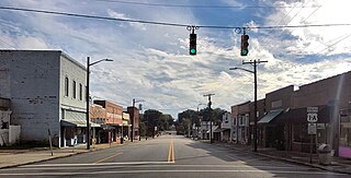
Franklinton is a town in and the parish seat of Washington Parish, Louisiana, United States. The population was 3,857 at the 2010 census. The elevation is an average of 155 feet (47 m) above sea level. Franklinton is located 61 miles (98 km) north of New Orleans.

Helmer is an unincorporated community in Salem Township, Steuben County, in the U.S. state of Indiana.

Bearpen Mountain is a mountain located in the Catskill Mountains of New York. The mountain's highest peak is in Greene County, but its northwest subpeak at 42°16.42′N74°29.05′W is the highest point in Delaware County. Bearpen Mountain is flanked to the north by Roundtop, and to the southeast by Vly Mountain.
Fultonham is a hamlet in Fulton, Schoharie County, New York, United States. Fultonham is located within the historic Schoharie Valley.

New Church is a census-designated place (CDP) in Accomack County, Virginia, United States. The population as of the 2010 Census was 205.
Mount Pleasant is a populated place in Shandaken town in Ulster County, New York, USA. Mount Pleasant is located along New York State Route 28 within Catskill State Park, to the south of Phoenicia and to the north of Boiceville. The community is located at 42°02′54″N74°17′21″W.
Oliverea is a populated place in Ulster County, New York, United States. Mount Tremper is situated along Ulster Country Route 47 within Catskill State Park. The community is located at 42°03′55″N74°27′37″W in the Town of Shandaken. Home of Herb Van Barens Oliverea maple.

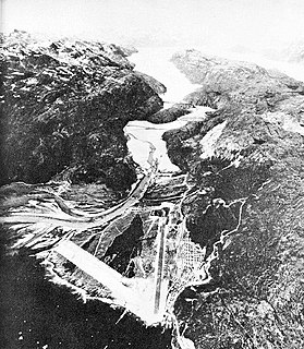
Bluie was the United States military code name for Greenland during World War II. It is remembered by the numbered sequence of base locations identified by the 1941 United States Coast Guard South Greenland Survey Expedition, and subsequently used in radio communications by airmen unfamiliar with pronunciation of the Inuit and Old Norse names of those locations. These were typically spoken BLUIE (direction) (number), with direction being east or west along the Greenland coast from Cape Farewell.

Catskill Creek is a 46.0-mile-long (74.0 km) tributary of the Hudson River that drains the northeastern Catskill Mountains of the U.S. State of New York. From its source at Franklinton Vlaie in Schoharie County it flows southeast through parts of Albany County and Greene County to its mouth at the village of Catskill on the Hudson River.

Franklin is an unincorporated community in Lane County, Oregon, United States. It is located near Veneta, and is approximately 20 miles (32 km) northwest of Eugene.
Bible Grove is an unincorporated community in Mount Pleasant Township, Scotland County, Missouri, United States.
References
- ↑ U.S. Geological Survey Geographic Names Information System: Franklinton Vlaie
- ↑ Gannett, Henry (1905). The Origin of Certain Place Names in the United States. Govt. Print. Off. pp. 128.
Coordinates: 42°31′52″N074°18′16″W / 42.53111°N 74.30444°W
| This article about a location in Schoharie County, New York is a stub. You can help Wikipedia by expanding it. |
| This article related to a river in New York is a stub. You can help Wikipedia by expanding it. |