Independence Township is a charter township of Oakland County in the U.S. state of Michigan. The population was 36,686 at the 2020 census.

Berlin is a town in Rensselaer County, New York, United States. The population was 1,880 at the 2010 census. The town is named after Berlin in Germany, although natives pronounce the name differently, with the accent on the first syllable.

Grafton is a town in Rensselaer County, New York, United States. The population was 2,130 at the 2010 census. It is believed that the town received its name from Grafton, Vermont, where the first town supervisor, Nathaniel Dumbleton, was originally from. The town is an interior town near the north-central part of the county. NY Route 2 passes across the town.

Sand Lake is a town in south-central part of Rensselaer County, New York, United States. Sand Lake is about 13 miles east of Albany, New York. Within the town are three hamlets: Averill Park, Glass Lake and the hamlet of Sand Lake. Its four lakes are a source of recreation. Many commercial enterprises of the 19th century and into the 20th century relied on power generated from the Wynants Kill Creek and Burden Lake mills. The area is known for fertile soil for grazing and agriculture. The estimated population for 2016 census was 8,490.

The Ozarks, also known as the Ozark Mountains, Ozark Highlands or Ozark Plateau, is a physiographic region in the U.S. states of Missouri, Arkansas, Oklahoma and the extreme southeastern corner of Kansas. The Ozarks cover a significant portion of northern Arkansas and most of the southern half of Missouri, extending from Interstate 40 in central Arkansas to Interstate 70 in central Missouri.

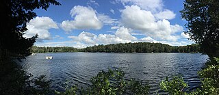
Spring Lake is a small glacial lake in the Town of Berlin, Rensselaer County, New York, United States. The lake is privately administered by the Spring Lake Association, which consists of the owners of cottages around the perimeter. There is no public access. The lake is located on a geologic formation known as the Rensselaer Plateau.
The Viphya Mountains, also known as the Viphya Plateau or Viphya Highlands, are a mountain range in Malawi's Northern Region.

Central Oregon is a geographic region in the U.S. state of Oregon and is traditionally considered to be made up of Deschutes, Jefferson, and Crook counties. Other definitions include larger areas, often encompassing areas to the north towards the Columbia River, eastward towards Burns, or south towards Klamath Falls. These three counties have a combined population of 200,431 as of the 2010 census, with Deschutes the largest of the three counties, having approximately four times the population of the other two counties combined. As of 2015, the most populous city in the region is Bend, with an estimated 87,014 residents. As defined by the three county definition, Central Oregon covers 7,833 square miles (20,290 km2) of land. Central Oregon has had 3 record tourism years beginning in 2012. Over 2.2 million people visited Central Oregon in 2012 and again in 2013.

Lake Boon is a lake in eastern Massachusetts covering about 163 acres (0.66 km2) in the towns of Stow and Hudson, Massachusetts. The lake is approximately 1.5 miles long and consists of four basins connected by narrows. The first and largest basin at the north-west end of the lake stretches from a dam along Barton Road in Stow down to narrows just above the towns south border. It is the only part of the lake that is completely within Stow. The second basin is about half the size of the first and straddles the border with Hudson. The 3rd and 4th basins at the eastern end of the lake are much smaller and less easily navigable due to shallow waters and significant plant-growth.

The neighborhoods of Albany, New York are listed below.
Great Island Pond, known officially as Island Pond, is a 77-acre (310,000 m2) pond in Plymouth, Massachusetts, one of three ponds known as Island Pond within the town. The pond is located in the eastern portion of The Pinehills development south of Little Island Pond. The Pinehills has a private sewer treatment facility near this pond, which was also formerly used as a holding facility by The Pine Hills LLC Golf Club until the spring of 2003. The Golf Club currently is permitted to withdraw water from four interceptor wells located between the sewer treatment facility and the pond.

The Little River is a tributary of the Red River, with a total length of 217 miles (349 km), 130 miles (210 km) within the Choctaw Indian Reservation in southeastern Oklahoma and 87 miles (140 km) in southwestern Arkansas in the United States. Via the Red, it is part of the watershed of the Mississippi River. Six large reservoirs impound the Little River and its tributaries. The drainage basin of the river totals 4,204 square miles (10,890 km2), 2,204 square miles (5,710 km2) in Oklahoma and 2,036 square miles (5,270 km2) in Arkansas. The Little River and its upper tributaries are popular for recreational canoeing and kayaking.

The Poesten Kill is a 26.2-mile-long (42.2 km) creek in upstate New York located entirely in Rensselaer County, which flows westerly from its source at Dyken Pond in the town of Berlin to its mouth at the Hudson River in the city of Troy. It has been used historically as a source of water for local inhabitants and farmers and became even more important as a source of water power during the Industrial Revolution, during which many mills and factories sprung up along its banks{{Citation needed}}.

Willard Pond is a small, protected lake in Antrim, New Hampshire, United States. The lake, located in southwestern New Hampshire, is about 108 acres (44 ha) in size with an average depth of 25 feet (7.6 m) and a maximum depth of 58 feet (18 m). No petroleum motors are allowed, and fly fishing is the only form of fishing allowed. It is part of the dePierrefeu Wildlife Sanctuary, which is owned by the New Hampshire Audubon Society. Because the pond and the land around it are part of the sanctuary, the shore is unable to be developed. Therefore, there are no buildings around the pond and there won't be in the foreseeable future. Willard is instead surrounded by extensive amounts of wilderness and hiking trails that lead around the pond and to the summits of Bald Mountain and Goodhue Hill. Willard is a popular fishing, boating and hiking destination, and it has become more popular with its mention in numerous magazines and newspapers.

Taborton is a hamlet located within the town of Sand Lake in Rensselaer County, New York, United States. It is served by the Taborton Fire Department. Two large ponds, Big Bowman Pond and Little Bowman Pond, are in the immediate vicinity.
Pennsylvania State Game Lands Number 12 are Pennsylvania State Game Lands in Bradford County and Sullivan County, in Pennsylvania, in the United States. The game lands have an area of nearly 24,480 acres (9,910 ha) in Bradford County. The area is mainly mountainous and wooded and major streams in the area include Schrader Creek, Sugar Run, and Little Schrader Creek. Game animals within the game lands include black bear, gray squirrel, whitetail deer, and wild turkey. The main hardwood tree species include American basswood, American beech, black cherry, black birch, red maple, sugar maple, white ash, and aspen. The main conifer species include eastern hemlock, eastern larch, plantation Norway spruce, plantation red pine, and white pine.

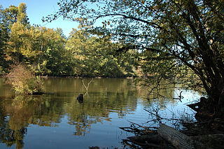
Round Pond is a small glacial lake in the Town of Berlin, Rensselaer County, New York, United States. The lake is located on a geologic formation known as the Rensselaer Plateau.

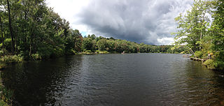
Little Bowman Pond is a small glacial lake in the Taborton section of the Town of Sand Lake, Rensselaer County, New York, United States. The lake is located on a geologic formation known as the Rensselaer Plateau.

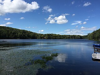
Big Bowman Pond is a small glacial lake in the Taborton section of the Town of Sand Lake, Rensselaer County, New York, United States. The lake is located on a geologic formation known as the Rensselaer Plateau.
The Northwestern Forested Mountains is a Level I ecoregion of North America designated by the Commission for Environmental Cooperation (CEC) in its North American Environmental Atlas.


