Eagle, New York

Last updated

Eagle, New York
NY 39 west in Eagle hamlet.jpg
Route 39 westbound in Eagle hamlet.
Wyoming County NY Eagle town highlighted.svg
Location within Wyoming County and New York
USA New York location map.svg
Red pog.svg
Eagle
Location within the state of New York
Usa edcp location map.svg
Red pog.svg
Eagle
Eagle (the United States)
Coordinates: 42°34′4″N78°15′17″W / 42.56778°N 78.25472°W / 42.56778; -78.25472
Country United States
State New York
County Wyoming
Government
   Town Supervisor Brett Hastings (R)
Area
[1]
  Total36.47 sq mi (94.46 km2)
  Land36.28 sq mi (93.97 km2)
  Water0.19 sq mi (0.49 km2)
Elevation
1,913 ft (583 m)
Population
 (2010)
  Total1,192
  Estimate 
(2016) [2]
1,168
  Density32.19/sq mi (12.43/km2)
Time zone UTC-5 (Eastern (EST))
  Summer (DST) UTC-4 (EDT)
FIPS code 36-21369
GNIS feature ID0978914

Eagle is an incorporated town in Wyoming County, New York. The population was 1,194 at the 2000 census. The town is on the south border of the county.

Contents

History

The town of Eagle was established in 1817 from a division of the town of Arcade.

Geography

According to the United States Census Bureau, the town has a total area of 36.5 square miles (95 km2), of which 36.4 square miles (94 km2) is land and 0.1 square miles (0.26 km2) (0.38%) is water.

Due to a prevailing wind, Eagle is the home of the Bliss Wind Farm.

The south town line is the border of Allegany County, New York.

Demographics

Historical population
CensusPop.Note
1840 1,187
1850 1,38116.3%
1860 1,312−5.0%
1870 1,040−20.7%
1880 1,20315.7%
1890 1,131−6.0%
1900 1,114−1.5%
1910 1,1412.4%
1920 1,059−7.2%
1930 960−9.3%
1940 922−4.0%
1950 868−5.9%
1960 8963.2%
1970 99611.2%
1980 1,21622.1%
1990 1,155−5.0%
2000 1,1943.4%
2010 1,192−0.2%
2016 (est.)1,168 [2] −2.0%
U.S. Decennial Census [3]

As of the census [4] of 2000, there were 1,194 people, 424 households, and 326 families residing in the town. The population density was 32.8 inhabitants per square mile (12.7/km2). There were 535 housing units at an average density of 14.7 per square mile (5.7/km2). The racial makeup of the town was 98.66% White, 0.25% African American, 0.08% Native American, 0.17% Asian, and 0.84% from two or more races. Hispanic or Latino of any race were 0.08% of the population.

There were 424 households, out of which 37.7% had children under the age of 18 living with them, 63.2% were married couples living together, 10.4% had a female householder with no husband present, and 23.1% were non-families. 18.6% of all households were made up of individuals, and 7.3% had someone living alone who was 65 years of age or older. The average household size was 2.82 and the average family size was 3.21.

In the town, the population was spread out, with 30.8% under the age of 18, 4.9% from 18 to 24, 30.9% from 25 to 44, 23.4% from 45 to 64, and 10.0% who were 65 years of age or older. The median age was 36 years. For every 100 females, there were 99.7 males. For every 100 females age 18 and over, there were 96.7 males.

The median income for a household in the town was $36,765, and the median income for a family was $41,116. Males had a median income of $32,007 versus $22,216 for females. The per capita income for the town was $20,829. About 6.7% of families and 11.3% of the population were below the poverty line, including 17.3% of those under age 18 and 4.8% of those age 65 or over.

The population of cows in Eagle is larger than the human population.

Communities and locations in Eagle

42°32′55″N78°17′53″W / 42.54861°N 78.29806°W / 42.54861; -78.29806

Related Research Articles

<span class="mw-page-title-main">Huxley, Iowa</span> City in Iowa, United States

Huxley is a city in Story County, Iowa, United States. The population was 4,244 at the time of the 2020 census. It is part of the Ames, Iowa Metropolitan Statistical Area, which is a part of the larger Ames-Boone, Iowa Combined Statistical Area.

<span class="mw-page-title-main">Eagle, Nebraska</span> Village in Nebraska, United States

Eagle is a village in southwest Cass County, Nebraska, United States. As of the 2020 census, the village population was 1,065.

Houghton is a hamlet located in the Town of Caneadea in Allegany County, western New York, United States. The population was 1,693 at the 2010 census.

Hume is a town in Allegany County, New York, United States. The population was 2,094 at the 2020 census. The town is on the northern border of Allegany County.

Wirt is a town in Allegany County, New York, United States. The population was 1,059 at the 2020 census. The town is in the southwest part of the county and east of Olean.

Ashford is a town in Cattaraugus County, New York, United States. The population was 1,974 at the 2020 census. The town is on the county's northern border.

<span class="mw-page-title-main">Niles, New York</span> Town in New York, United States

Niles is a town in Cayuga County, New York, United States. The population was 1,194 at the 2010 census. Niles lies in the eastern part of the county, southeast of Auburn.

Smithfield is a town in Madison County, New York, United States. Administrative offices are in the hamlet of Peterboro. The town and hamlet both are named after Peter Smith, an original land owner. As of the 2010 Census, the population was 1,288.

<span class="mw-page-title-main">Gaines, New York</span> Town in New York, United States

Gaines is a town in Orleans County, New York, United States. The population was 3,378 at the 2010 census. The town is named after General Edmund P. Gaines, who defended the area during the War of 1812.

<span class="mw-page-title-main">Covington, New York</span> Town in New York, United States

Covington is an incorporated town in Wyoming County, New York. The population was 1,231 at the 2010 census. The town was named after General Leonard Covington.

<span class="mw-page-title-main">Java, New York</span> Town in New York, United States

Java is an incorporated town in Wyoming County, New York. The population was 2,057 at the 2010 census. The Town of Java is on the western border of Wyoming County.

<span class="mw-page-title-main">Granville South, Ohio</span> Census-designated place in Ohio, United States

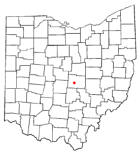
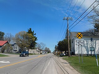
Granville South is a census-designated place (CDP) in Licking County, Ohio, United States. The population was 1,420 at the 2020 census.

<span class="mw-page-title-main">Freedom Township, Adams County, Pennsylvania</span> Township in Pennsylvania, United States

Freedom Township is a township in Adams County, Pennsylvania, United States. The population was 825 at the 2020 census.

<span class="mw-page-title-main">Tipton, Pennsylvania</span> Census-designated place in Pennsylvania, United States

Tipton is a census-designated place (CDP) in Antis Township, Blair County, Pennsylvania, United States. The population was 1,083 at the 2010 census. It was a stop on the former Pennsylvania Railroad Main Line between Tyrone and Altoona.

<span class="mw-page-title-main">Burnside Township, Clearfield County, Pennsylvania</span> Township in Pennsylvania, United States

Burnside Township is a township in Clearfield County, Pennsylvania, United States. The population was 1,064 at the time of the 2020 census.

<span class="mw-page-title-main">Pine Creek Township, Jefferson County, Pennsylvania</span> Township in Pennsylvania, United States

Pine Creek Township is a township in Jefferson County, Pennsylvania, United States. The population was 1,325 at the 2020 census. The township was named for the abundance of pine trees in the area.

<span class="mw-page-title-main">Lafayette Township, McKean County, Pennsylvania</span> Township in Pennsylvania, United States

Lafayette Township is a township in McKean County, Pennsylvania, United States. The population was 1,766 at the 2020 census.

<span class="mw-page-title-main">Bridgewater, New York</span> Town in New York, United States

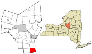
Bridgewater is a town in Oneida County, New York, United States. The population was 1,522 at the 2010 census.

<span class="mw-page-title-main">Pike, New York</span> Town in New York, United States

Pike is an incorporated town in Wyoming County, New York. The population was 1,114 at the 2010 census.

<span class="mw-page-title-main">Rib Mountain, Wisconsin</span> Village in Wisconsin, United States

Rib Mountain is a village located in Marathon County, Wisconsin, United States. The population was 7,313 at the 2020 census. A suburb of Wausau, it is part of the Wausau Metropolitan Statistical Area. The census-designated place of Rib Mountain is located in the village.

References

  1. "2016 U.S. Gazetteer Files". United States Census Bureau. Retrieved July 5, 2017.
  2. 1 2 "Population and Housing Unit Estimates" . Retrieved June 9, 2017.
  3. "Census of Population and Housing". Census.gov. Retrieved June 4, 2015.
  4. "U.S. Census website". United States Census Bureau . Retrieved January 31, 2008.