
Newhaven Fort is a Palmerston fort built in the 19th century to defend the harbour at Newhaven, on the south coast of England. It was the largest defence work ever built in Sussex and is now open as a museum.

Shoreham Redoubt is a historical military defensive structure and scheduled monument at the entrance to Shoreham harbour, at the mouth of the River Adur in West Sussex, England. It was planned in the 1850s during a period of political alarm in the United Kingdom. Construction of the fort was completed in June 1857 at a cost of £11,685. The design is similar to that of Littlehampton Fort, which had been built in 1854.

The Western Heights of Dover are one of the most impressive fortifications in Britain. They comprise a series of forts, strong points and ditches, designed to protect the country from invasion. They were created in the 18th and 19th centuries to augment the existing defences and protect the key port of Dover from both seaward and landward attack; by the start of the 20th century Dover Western Heights was collectively reputed to be the 'strongest and most elaborate' fortification in the country. The Army finally withdrew from the Heights in 1956–61; they are now a local nature reserve.

Fort Luton was built between 1876 and 1892 south of Chatham, Medway, South East England. It is one of the five late Victorian land front forts built to defend the overland approaches to Chatham. It is the smallest of the Chatham forts and was built near to the village of Luton.

Beacon Hill Battery is a late-19th and 20th century coastal fortification that was built to defend the port of Harwich, Essex. It is a scheduled ancient monument.

Crownhill Fort is a Royal Commission Fort built in the 1860s in Crownhill as part of Lord Palmerston's ring of land defences for Plymouth. Restored by the Landmark Trust, it is now home to several small businesses, museums, exhibitions and a holiday apartment sleeping up to eight people. The Fort is open to the public on the last Friday of each month and hosts tours for local schools and societies at other times.

Fort Fareham is one of the Palmerston Forts, in Fareham, England. After the Gosport Advanced Line of Fort Brockhurst, Fort Elson, Fort Rowner, Fort Grange and Fort Gomer had been approved by the Royal Commission on the Defence of the United Kingdom a decision was made to build an outer line of three more forts two miles in advance of the Gosport Advanced Line. Of these three projected forts only Fort Fareham was built due to the need to cut costs. It acted as a hinge between the forts on Portsdown Hill and those of the Gosport Advanced Line, filling the gap at Fareham. It has been a Grade II Listed Building since 1976.

A caponier is a type of defensive structure in a fortification. Fire from this point could cover the ditch beyond the curtain wall to deter any attempt to storm the wall. The word originates from the French caponnière, meaning "chicken coop".

Fort Brockhurst is one of the Palmerston Forts, in Gosport, England, and a Scheduled Ancient Monument. It is now an English Heritage property.
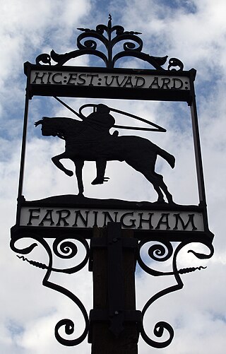
Farningham is a village and civil parish in the Sevenoaks District of Kent, England. It is located 3 miles (5 km) south-east of Swanley. It has a population of 1,314.

A scarp and a counterscarp are the inner and outer sides, respectively, of a ditch or moat used in fortifications. Attackers must descend the counterscarp and ascend the scarp. In permanent fortifications the scarp and counterscarp may be encased in stone. In less permanent fortifications, the counterscarp may be lined with paling fence set at an angle so as to give no cover to the attackers but to make advancing and retreating more difficult.

The Séré de Rivières system was named after Raymond Adolphe Séré de Rivières, its originator. The system was an ensemble of fortifications built from 1874 along the frontiers and coasts of France. The fortresses were obsolescent by 1914 but were used during the First World War.

In military engineering, a ditch is an obstacle designed to slow down or break up an attacking force, while a trench is intended to provide cover to the defenders. In military fortifications the side of a ditch farthest from the enemy and closest to the next line of defence is known as the scarp while the side of a ditch closest to the enemy is known as the counterscarp.

Fort Rowner is one of the Palmerston Forts, in Gosport, England.

The Fort des Ayvelles, also known as the Fort Dubois-Crancé, is a fortification near the French communes of Villers-Semeuse and Les Ayvelles in the Ardennes, just to the south of Charleville-Mézières. As part of the Séré de Rivières system of fortifications, the fort was planned as part of a new ring of forts replacing the older citadel of Mézières with dispersed fortifications. With advances in the range and destructive power of artillery, the city's defensive perimeter had to be pushed away from the city center to the limits of artillery range. The Fort des Ayvelles was the only such fortification to be completed of the ensemble, as resources were diverted elsewhere. At the time of its construction the fort controlled the Meuse and the railway line linking Reims, Montmédy, Givet and Hirson. The Fort des Ayvelles was reduced in status in 1899, its masonry construction rendered obsolete by the advent of high-explosive artillery shells. However, it was re-manned for the First World War before it was captured by the Germans on 29 August 1914. The fort was partly destroyed in 1918. During the Battle of France in 1940 the fort was bombarded. French resisters were executed at Ayvelles during both world wars. At present the fort is maintained by a preservation society, and may be visited.

A Carnot wall is a type of loop-holed wall built in the ditch of a fort or redoubt. It takes its name from the French mathematician, politician, and military engineer, Lazare Carnot. Such walls were introduced into the design of fortifications from the early nineteenth century. As conceived by Carnot they formed part of an innovative but controversial system of fortification intended to defend against artillery and infantry attack. Carnot walls were employed, together with other elements of Carnot's system, in continental Europe in the years after the final defeat of Napoleon in 1815, especially by the Prussians, other Germans and Austrians. Their adoption was initially resisted by the French themselves and by the British.

Woodland Fort is a Royal Commission Fort built in the 1860s as part of Lord Palmerston's ring of land defences for Plymouth, England. Currently owned by Plymouth City Council, the site is in use but largely derelict.

Camden Fort Meagher is a coastal defence fortification close to Crosshaven, County Cork, Ireland. Together with similar structures at Fort Mitchell, Fort Davis (Whitegate), and Templebreedy Battery, the fort was built to defend the mouth of Cork Harbour. Though originally constructed in the 16th century, the current structures of the fort date to the 1860s. Originally named Fort Camden and operated by the British Armed Forces, the fort was handed-over to the Irish Defence Forces in 1938. Renamed Fort Meagher in honour of Thomas Francis Meagher, it remained an Irish military installation until 1989 when the Irish Army handed the fort over to Cork County Council. It remained largely overgrown until 2010 when a group of local volunteers began restoration and development of the fort for heritage and tourism purposes. The fort was renamed Camden Fort Meagher and is now open seasonally to visitors, with exhibits on the fort's Brennan torpedo installation.

The fortifications of Plymouth in Devon are extensive due to its natural harbour, its commanding position on the Western Approaches and its role as the United Kingdom's largest naval base. The first medieval defences were built to defend Sutton Harbour on the eastern side of Plymouth Sound at the mouth of the River Plym, but by the 18th century, naval activity had begun to shift westward to Devonport at the mouth of the River Tamar. During the Victorian era, advances in military technology led to a huge programme of fortification encompassing the whole of Plymouth Sound together with the overland approaches. Many of these works remained in military use well into the 20th century.
