Tyre, New York

Last updated

Tyre, New York
NY 89 south at Tyre line.jpg
New York State Route 89 southbound entering Tyre.
USA New York location map.svg
Red pog.svg
Tyre, New York
Location within the state of New York
Coordinates: 42°59′N76°48′W / 42.983°N 76.800°W / 42.983; -76.800
Country United States
State New York
County Seneca
Settled1794
EstablishedMarch 26, 1829 [1]
Government
  Type Town Board
   Supervisor Elizabeth L. Partee
   Clerk Carolyn Sosnowski [2]
   Court Justice Gregory Guy
Justice Kathy Jans-Duffy
Area
[3]
  Total33.11 sq mi (85.76 km2)
  Land30.06 sq mi (77.85 km2)
  Water3.06 sq mi (7.92 km2)
Elevation
433 ft (132 m)
Population
 (2020) [4]
  Total1,002 Increase2.svg
  Estimate 
(2021) [4]
999
  Density32.24/sq mi (12.45/km2)
Time zone UTC-5 (Eastern (EST))
  Summer (DST) UTC-4 (EDT)
Area code(s) 315 and 680
FIPS code 36-75902
GNIS feature ID0979567
Website Official website

Tyre is a town in Seneca County, New York, United States. The population was 1,002 at the 2020 census. [4] The town is named after the Lebanese city of Tyre.

Contents

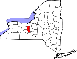
The Town of Tyre is located in the northeastern part of the county, northeast of Geneva. It has a hamlet, also called Tyre. Government offices for the Town of Tyre are located in the new town hall on New York State Route 318 just west of the hamlet of Magee, New York. [5]

There is no post office in the Town of Tyre. The primary postal district covering the area is ZIP Code 13148 for Seneca Falls. [6] A small section of addresses west of N.Y. Route 414 to the town border have a ZIP Code of 13165 for Waterloo. [7]

History

The region was in the Central New York Military Tract, reserved for veterans, but a reservation was established at the northern end of Cayuga Lake for natives who returned to the area. A tract at the hamlet of Tyre was granted to Revolutionary War Colonel James Livingston. The first outside settler, Ezekiel Crane, arrived about 1794. [8] Other early settlers were Asherr Halsey, Lewis Winans, Asa Smith and Caleb Woodworth. James Magee, a prominent physician for many years, came in 1811.

The town was created from the eastern part of the Town of Junius in 1829. [1]

The town is part of the Erie Canalway National Heritage Corridor. [9] Erie Canal Lock 25 is located off Mays Point Road (CR 105A) in the hamlet of Mays Point. It was built around 1912, and has a lift of 6 feet (1.83 m) to the west. [10]

The Hiram Lay Cobblestone Farmhouse was listed on the National Register of Historic Places in 2009. [11]

Geography

According to the United States Census Bureau, the town has a total area of 33.1 square miles (86 km2) of which 30.1 square miles (78 km2) is land and 3.0 square miles (7.8 km2) (8.97%) is water.

The northern town line is the border of Wayne County, and the eastern town line, partly marked by the Seneca River, is the border of Cayuga County.

A large eastern part of the town is in the Montezuma Marsh.

The Erie Canal and the Cayuga-Seneca Canal (Seneca River) pass through Tyre.

New York State Thruway (Interstate 90) crosses the town, passing through the Montezuma Marsh. New York State Route 89 and New York State Route 414 are north-south highways in the town, and New York State Route 318 is an east-west highway. New York State Route 31 crosses the northeastern corner of the town.

Demographics

Historical population
CensusPop.Note
1830 1,482
1840 1,5061.6%
1850 1,356−10.0%
1860 1,4376.0%
1870 1,280−10.9%
1880 1,168−8.7%
1890 991−15.2%
1900 954−3.7%
1910 900−5.7%
1920 798−11.3%
1930 743−6.9%
1940 724−2.6%
1950 7290.7%
1960 81511.8%
1970 8372.7%
1980 8876.0%
1990 870−1.9%
2000 8993.3%
2010 9819.1%
2020 1,0022.1%
2021 (est.)999 [4] −0.3%
U.S. Decennial Census [12]

At the 2010 census, [13] there were 981 people, 356 households and 263 families residing in the town. The population density was 32.6 inhabitants per square mile (12.6/km2). The racial makeup of the town was 97.6% White, 0.0% Black or African American, 0.2% Native American, 0.3% Asian, 0.0% Pacific Islander, 0.5% from other races, and 1.4% from two or more races. Hispanic or Latino of any race were 1.4% of the population.

There were 356 households, of which 29.5% had children under the age of 18 living with them, 56.7% were married couples living together, 8.7% had a female householder with no husband present, and 26.1% were non-families. 19.7% of all households were made up of individuals, and 8.2% had someone living alone who was 65 years of age or older. The average household size was 2.76 and the average family size was 3.14.

In the town, the population was spread out, with 29.5% under the age of 20, 5.6% from 20 to 24, 21.1% from 25 to 44, 30.3% from 45 to 64, and 13.3% who were 65 years of age or older. The median age was 40.0 years. For every 100 females, there were 101.9 males. For every 100 females age 18 and over, there were 101.1 males.

The median income for a household in the town was $43,750, and the median income for a family was $64,250. Males had a median income of $42,679 versus $31,125 for females. The per capita income for the town was $24,383. About 6.3% of families and 12.6% of the population were below the poverty line, including 16.1% of those under age 18 and 15.2% of those age 65 or over.

Housing

There were 419 housing units at an average density of 13.9 per square mile (5.4/km2), of which 15.0% of housing units were vacant.

There were 356 occupied housing units in the town; 303 were owner-occupied units (85.1%), while 53 were renter-occupied (14.9%). The homeowner vacancy rate was 1.3% of total units. The rental unit vacancy rate was 3.6%. [13]

Communities and locations in the Town of Tyre

Casino

The town is the site of a new casino called Del Lago Resort and Casino. [14] It was one of three projects selected by the New York State Gaming Facility Location Board on December 17, 2014, for possible licensure by the New York State Gaming Commission. [15] [16] The casino opened to the public in 2017. [14]

Related Research Articles

<span class="mw-page-title-main">Seneca County, New York</span> County in New York, United States

Seneca County is located in the U.S. state of New York. As of the 2020 census, the population was 33,814. The primary county seat is Waterloo, moved there from the original county seat of Ovid in 1819. It became a two-shire county in 1822, which currently remains in effect and uses both locations as county seats although the majority of Seneca County administrative offices are located in Waterloo. Therefore, most political sources list only Waterloo as the county seat. The county's name comes from the Seneca Nation of the Haudenosaunee (Iroquois), who occupied part of the region. The county is part of the Finger Lakes region of the state.

<span class="mw-page-title-main">Aurelius, New York</span> Town in New York, United States

Aurelius is a town in Cayuga County, New York, United States. The population was 2,610 at the 2020 census. The town was named after the Roman emperor Marcus Aurelius. It is at the western edge of the county and borders the city of Auburn.

<span class="mw-page-title-main">Brutus, New York</span> Town in New York, United States

Brutus is a town in Cayuga County, New York, United States. The population was 4,311 at the 2020 census. It is the most populous town in the county. The name was assigned by a clerk interested in the classics. The town court is located in the village of Weedsport, the largest settlement in the town.

<span class="mw-page-title-main">Conquest, New York</span> Town in New York, United States

Conquest is a town in Cayuga County, New York, United States. The population was 1,796 at the 2020 census. The name was chosen to mark the victory of those who wished to form the town. Conquest is on the western border of Cayuga County and is west of Syracuse.

<span class="mw-page-title-main">Mentz, New York</span> Town in New York, United States

Mentz is a town in Cayuga County, New York, United States. The population was 2,114 at the 2020 census. The town is in the central part of the county, 7 miles north of Auburn.The town's name has never been determined, but it is locally believed that it derived from Mainz, in Germany.

<span class="mw-page-title-main">Montezuma, New York</span> Town in New York, United States

Montezuma is a town in Cayuga County, New York, United States. The population was 1,277 at the 2010 census.

<span class="mw-page-title-main">Lysander, New York</span> Town in New York, United States

Lysander is a town in Onondaga County, New York, United States. As of the 2020 Census, the population was 23,074. The town was named after Lysander, a Spartan military leader, by a clerk interested in the classics. Lying to the northwest of Syracuse, much of the town is suburban in character.

Dix is a town in Schuyler County, New York, United States. The population was 3,723 at the 2020 census.

Fayette is a town in Seneca County, New York, United States. The population was 3,617 at the 2020 census. The town is in the north-central part of the county and is southeast of Geneva, New York.

<span class="mw-page-title-main">Clyde, New York</span> Village in New York, United States

Clyde is a village in Wayne County, New York, United States. The population was 2,093 at the 2010 census. It was named after the River Clyde, in Scotland, and the village sits on the Clyde River, a tributary of the Seneca River.

<span class="mw-page-title-main">Galen, New York</span> Town in New York, United States

Galen is a town in Wayne County, New York, United States. The population was 4,290 at the 2010 census. The town is named after the classical physician Galen.

<span class="mw-page-title-main">Savannah, New York</span> Town in New York, United States

Savannah is a town in the southeast portion of Wayne County, New York, United States. The population was 1,730 at the 2010 census.

<span class="mw-page-title-main">Seneca Falls, New York</span> Town in New York, United States

Seneca Falls is a town in Seneca County, New York, United States. The population was 9,027 at the 2020 census.

<span class="mw-page-title-main">New York State Route 5</span> State highway in New York, US

New York State Route 5 (NY 5) is a state highway that extends for 370.80 miles (596.74 km) across the state of New York in the United States. It begins at the Pennsylvania state line in the Chautauqua County town of Ripley and passes through Buffalo, Syracuse, Utica, Schenectady, and several other smaller cities and communities on its way to downtown Albany in Albany County, where it terminates at U.S. Route 9 (US 9), here routed along the service roads for Interstate 787 (I-787). Prior to the construction of the New York State Thruway, it was one of two main east–west highways traversing upstate New York, the other being US 20. West of New York, the road continues as Pennsylvania Route 5 (PA 5) to Erie.

Montezuma National Wildlife Refuge is a wildlife preserve operated by the United States Fish and Wildlife Service, encompassing part of the Montezuma Swamp at the north end of Cayuga Lake. The 10,004-acre preserve is composed of swamps, pools and channels and is a stopping point for migratory birds. It is the largest contiguous wetland complex in the northeastern United States and comprises a portion of the larger Montezuma Wetlands Complex, which is a partnership between the USFWS, the New York State Department of Environmental Conservation, as well as several other non-profit support organizations.

<span class="mw-page-title-main">New York State Route 318</span> Highway in New York

New York State Route 318 (NY 318) is an east–west state highway in the Finger Lakes region of New York in the United States. The western terminus of the route is at an intersection with NY 14 at New York State Thruway exit 42 in the town of Phelps. The eastern terminus is at an intersection with U.S. Route 20 (US 20) and NY 5 northeast of the hamlet of Seneca Falls. All but 0.70 miles (1.13 km) of the 10.90-mile (17.54 km) route is located in Seneca County.

<span class="mw-page-title-main">New York State Route 414</span> North–south state highway in New York

New York State Route 414 (NY 414) is a north–south state highway in the Southern Tier and Finger Lakes regions of New York in the United States. It extends for 83.20 miles (133.90 km) from an intersection with NY 352 in the Steuben County city of Corning to a junction with NY 104 in the Wayne County town of Huron. NY 414 spans five counties and roughly parallels NY 14 between Watkins Glen and Huron. It intersects every major east–west arterial in western New York, including the Southern Tier Expressway, U.S. Route 20 (US 20) and NY 5, and the New York State Thruway (I-90). The route passes through mostly rural areas as it travels between the several villages and cities along its routing.

<span class="mw-page-title-main">New York State Route 89</span> State highway in central New York, US

New York State Route 89 (NY 89) is a north–south state highway in central New York in the United States. It extends for 62.35 miles (100.34 km) from an intersection with NY 13, NY 34, and NY 96 in the Tompkins County city of Ithaca to an interchange with NY 104 in the Wayne County town of Wolcott. The route spans a total of three counties, connecting the heart of the Finger Lakes Region to a point 6 miles (10 km) south of Lake Ontario. Along the way, NY 89 intersects two regionally important highways: the conjoined routes of U.S. Route 20 (US 20) and NY 5 in Seneca Falls and NY 31 in Savannah. NY 89 runs along the western edge of Cayuga Lake from Ithaca to Seneca Falls.

<span class="mw-page-title-main">Clyde River (New York)</span> River in New York, United States

The Clyde River is a main tributary which feeds the Seneca River in Seneca County, New York, United States. It begins at the hamlet of Lyons in nearby Wayne County and meanders for approximately 27 miles from west to east before emptying into the Seneca River in the town of Tyre at Montezuma National Wildlife Refuge. Much of the original river has been channeled through to form part of the Erie Canal. A number of tributaries feed the Clyde River along its route.

<span class="mw-page-title-main">Mays Point, New York</span> Hamlet in New York, United States

Mays Point is a hamlet in the Town of Tyre, Seneca County, New York, United States, near the Wayne and Cayuga county lines. It is located seven miles (11 km) northeast of the hamlet of Seneca Falls, at an elevation of 381 feet (116 m). The primary intersection in the hamlet is at N.Y. Route 89 and Mays Point Road. Mays Point is situated along the Erie Canal near the junction of the Seneca and Clyde rivers within the Montezuma Marsh. The New York State Thruway passes just south of the hamlet.

References

  1. 1 2 Sullivan, James; Williams, Melvin E.; Conklin, Edwin P.; Fitzpatrick, Benedict, eds. (1927), "Chapter IV. Seneca County.", History of New York State, 1523–1927 (PDF), vol. 2, New York City, Chicago: Lewis Historical Publishing Co., p. 635, hdl:2027/mdp.39015019994048, Wikidata   Q114149636
  2. Town of Tyre, Services Archived August 12, 2019, at the Wayback Machine , Retrieved May 25, 2019.
  3. "2016 U.S. Gazetteer Files". United States Census Bureau. Retrieved July 5, 2017.
  4. 1 2 3 4 Bureau, US Census. "City and Town Population Totals: 2020—2021". Census.gov. US Census Bureau. Retrieved October 12, 2022.
  5. Town of Tyre, New York, Retrieved June 11, 2015.
  6. United States Postal Service (Seneca Falls, New York Post Office), Retrieved June 3, 2015.
  7. United States Postal Service (Waterloo, New York Post Office), Retrieved June 3, 2015.
  8. Town of Tyre, New York - A Brief History of Tyre, Retrieved June 3, 2015.
  9. National Park Service - Erie Canalway National Heritage Corridor Brochure, New York, Retrieved June 11, 2015.
  10. NY Canals (Index of Locks), Retrieved June 11, 2015.
  11. "National Register Information System". National Register of Historic Places . National Park Service. July 9, 2010.
  12. "Census of Population and Housing". Census.gov. Retrieved June 4, 2015.
  13. 1 2 "U.S. Census website". United States Census Bureau . Retrieved January 31, 2008.
  14. 1 2 del Lago Resort & Casino, Retrieved June 30, 2017.
  15. "SELECTION OF THE NEW YORK GAMING FACILITY LOCATION BOARD" (PDF). Retrieved February 7, 2024.
  16. "REPORT AND FINDINGS OF THE NEW YORK GAMING FACILITY LOCATION BOARD" (PDF). Retrieved February 7, 2024.

42°59′N76°48′W / 42.983°N 76.800°W / 42.983; -76.800