Varick, New York

Last updated

Varick, New York
USA New York location map.svg
Red pog.svg
Varick, New York
Location within the state of New York
Coordinates: 42°46′26″N76°51′54″W / 42.77389°N 76.86500°W / 42.77389; -76.86500
Country United States
State New York
County Seneca
Settled1794
EstablishedFebruary 6, 1830 [1]
Government
  Type Town Council
   Supervisor Bob Hayssen
   Clerk Donna Karlsen
   Court Justice Jeff Hogue [2]
Area
[3]
  Total45.67 sq mi (118.28 km2)
  Land31.99 sq mi (82.86 km2)
  Water13.68 sq mi (35.42 km2)
Elevation
663 ft (202 m)
Population
 (2020) [4]
  Total1,656
  Estimate 
(2022) [5]
1,644
  Density51.76/sq mi (19.98/km2)
Time zone UTC-5 (Eastern (EST))
  Summer (DST) UTC-4 (EDT)
Area code(s) 315 and 680
FIPS code 36-76958
GNIS feature ID0979578
Website http://varicknewyork.com/

Varick is a town in Seneca County, New York, United States. The population was 1,656 at the 2020 census. [4] The town is named after Richard Varick, an officer in the American Revolution, mayor of New York City, and uncle of the first Town Supervisor, Anthony Dey.

Contents

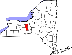
The Town of Varick is located in the central part of the county and is southeast of Geneva.

There is no post office in the Town of Varick. The primary postal district covering the area is Zip Code 14541 for Romulus. [6]

History

The land that is now the Town of Varick was occupied by the Cayuga and Seneca tribes of the Iroquois Confederacy before European settlement. Jesuits made missionary visits from 1656 to 1684. [7]

The Sullivan Expedition of 1779 passed through the town to destroy villages of the Cayuga and Seneca tribes. After the American Revolution, most of the current Town of Varick was placed in the Central New York Military Tract (1788), land reserved for veterans, with an eastern part in the Cayuga Indian Reservation (1790 until 1795). White settlement followed. [8]

The town was formed from the Town of Romulus in 1830.

During World War II, a large part of the town was appropriated by the US Government to form the Seneca Army Depot (1941–2001), which was a major employer and the only large industry.

Over the years since 1985, Varick has become home to five wineries, all closer to the eastern end of the town, along Cayuga Lake. From north to south, the five are Swedish Hill Vineyard, Cobblestone Farm Winery, Lakeshore Winery, Knapp Winery and Vineyard Restaurant, and Goose Watch Winery. (All but Lakeshore Winery are participating members of the Cayuga Lake Wine Trail, and while the Seneca Lake Wine Trail certainly runs through Varick, none of its stops quite fall within its town lines.)

The Simon Ritter Cobblestone Farmhouse was listed on the National Register of Historic Places in 2008. [9]

Geography

According to the United States Census Bureau, the town has a total area of 45.7 square miles (118 km2), of which 32.0 square miles (83 km2) is land and 13.7 square miles (35 km2) (29.95%) is water.

The eastern town boundary, defined by Cayuga Lake, is the border of Cayuga County. The western town line, at Seneca Lake is the border of Ontario County on the western shore of Seneca Lake. The town is in the Finger Lakes Region of New York.

New York State Route 89, New York State Route 96, New York State Route 96A, and New York State Route 414 are all north–south highways in the town. New York State Route 336 is a short east–west state highway mostly on the north town line.

Demographics

Historical population
CensusPop.Note
1830 1,890
1840 1,9714.3%
1850 1,872−5.0%
1860 1,9041.7%
1870 1,741−8.6%
1880 1,739−0.1%
1890 1,388−20.2%
1900 1,270−8.5%
1910 1,173−7.6%
1920 1,020−13.0%
1930 1,013−0.7%
1940 1,0564.2%
1950 1,0862.8%
1960 1,48036.3%
1970 1,70014.9%
1980 1,8689.9%
1990 2,16115.7%
2000 1,729−20.0%
2010 1,8577.4%
2020 1,656−10.8%
2022 (est.)1,644 [5] −0.7%
U.S. Decennial Census [10]

As of the census [11] of 2010, there were 1,857 people, 676 households, and 460 families residing in the town. The population density was 57.5 inhabitants per square mile (22.2/km2). The racial makeup of the town was 95.2% White, 2.5% Black or African American, 0.2% Native American, 0.2% Asian, 0.0% Pacific Islander, 0.1% from other races, and 1.8% from two or more races. Hispanic or Latino of any race were 1.1% of the population.

There were 676 households, out of which 26.6% had children under the age of 18 living with them, 57.1% were married couples living together, 6.5% had a female householder with no husband present, and 32.0% were non-families. 25.1% of all households were made up of individuals, and 10.5% had someone living alone who was 65 years of age or older. The average household size was 2.58 and the average family size was 3.09.

In the town, the population was spread out, with 32.5% under the age of 20, 4.0% from 20 to 24, 17.4% from 25 to 44, 30.7% from 45 to 64, and 15.4% who were 65 years of age or older. The median age was 40.7 years. For every 100 females, there were 105.4 males. For every 100 females age 18 and over, there were 100.3 males.

The median income for a household in the town was $57.841, and the median income for a family was $66,667. Males had a median income of $46,406 versus $40,714 for females. The per capita income for the town was $27,821. About 5.9% of families and 11.8% of the population were below the poverty line, including 23.3% of those under age 18 and 2.1% of those age 65 or over.

The farmland in the eastern part of the town is now largely worked by Amish farmers, and in the northern part by Mennonite farmers. Farmland on the eastern slope to Cayuga Lake is largely devoted to wine grapes.

Housing

There were 888 housing units at an average density of 27.5 per square mile (10.6/km2); 23.9% of housing units were vacant.

There were 676 occupied housing units in the town, of which 570 were owner-occupied units (84.3%), while 106 were renter-occupied (15.7%). The homeowner vacancy rate was 2.9% of total units. The rental unit vacancy rate was 18.9%. [11]

NOTE: It is common for resort communities to have higher than normal vacant house counts. Many are vacation homes which are seasonal and not regularly occupied.

Communities and locations in the Town of Varick

Notable people

Related Research Articles

<span class="mw-page-title-main">Seneca County, New York</span> County in New York, United States

Seneca County is located in the U.S. state of New York. As of the 2020 census, the population was 33,814. The primary county seat is Waterloo, moved there from the original county seat of Ovid in 1819. It became a two-shire county in 1822, which currently remains in effect and uses both locations as county seats although the majority of Seneca County administrative offices are located in Waterloo. Therefore, most political sources list only Waterloo as the county seat. The county's name comes from the Seneca Nation of the Haudenosaunee (Iroquois), who occupied part of the region. The county is part of the Finger Lakes region of the state.

<span class="mw-page-title-main">Aurelius, New York</span> Town in New York, United States

Aurelius is a town in Cayuga County, New York, United States. The population was 2,610 at the 2020 census. The town was named after the Roman emperor Marcus Aurelius. It is at the western edge of the county and borders the city of Auburn.

<span class="mw-page-title-main">Mentz, New York</span> Town in New York, United States

Mentz is a town in Cayuga County, New York, United States. The population was 2,114 at the 2020 census. The town is in the central part of the county, 7 miles north of Auburn.The town's name has never been determined, but it is locally believed that it derived from Mainz, in Germany.

<span class="mw-page-title-main">Montezuma, New York</span> Town in New York, United States

Montezuma is a town in Cayuga County, New York, United States. The population was 1,277 at the 2010 census.

<span class="mw-page-title-main">Owasco, New York</span> Town in New York, United States

Owasco is a town in Cayuga County, New York, United States. It is part of the traditional territory of the Cayuga nation. The population was 3,793 at the 2010 census. Owasco is in the eastern part of Cayuga County and is at the southeast city line of Auburn. The town borders Owasco Lake, from where it gets its name.

<span class="mw-page-title-main">Springport, New York</span> Town in New York, United States

Springport is a town in Cayuga County, New York, United States. The population was 2,367 at the 2010 census. The name is derived from the local springs and lakeports. Springport is on the western border of the county and is southwest of Auburn.

Hector is a town in the northeastern corner of Schuyler County, New York, United States. The population was 4,916 at the 2020 census. The town is named after Hector Ely, who at the time was the firstborn son of the town founders. Hector is west of Ithaca.

Covert is a town in Seneca County, New York, United States. The population was 2,135 at the 2020 census.

Fayette is a town in Seneca County, New York, United States. The population was 3,617 at the 2020 census. The town is in the north-central part of the county and is southeast of Geneva, New York.

Romulus is a town in Seneca County, New York, United States. The population was 3,203 at the 2020 census. The town is named after the mythical founder of Rome, Romulus, a name assigned by a clerk with an interest in the classics. It is located in the central part of the county, northwest of Ithaca, New York.

<span class="mw-page-title-main">Tyre, New York</span> Town in New York, United States

Tyre is a town in Seneca County, New York, United States. The population was 1,002 at the 2020 census. The town is named after the Lebanese city of Tyre.

<span class="mw-page-title-main">Savannah, New York</span> Town in New York, United States

Savannah is a town in the southeast portion of Wayne County, New York, United States. The population was 1,730 at the 2010 census.

Lodi is a town in Seneca County, New York, United States. The population was 1,469 at the 2020 census.

Ovid is a village in Seneca County, New York, United States. The population was 602 at the 2010 census. The town was named by a clerk interested in the classics.

Ovid is a town in Seneca County, New York, United States. The population was 2,847 at the 2020 census. The town is named after the Roman poet Ovid, a name assigned by a clerk interested in the classics.

<span class="mw-page-title-main">Seneca Falls, New York</span> Town in New York, United States

Seneca Falls is a town in Seneca County, New York, United States. The population was 9,027 at the 2020 census.

<span class="mw-page-title-main">Waterloo, New York</span> Town in New York, United States

Waterloo is a town in Seneca County, New York, United States. The population was 7,378 at the 2020 census. The town and its major community are named after Waterloo, Belgium, where Napoleon was defeated.

<span class="mw-page-title-main">New York State Route 89</span> State highway in central New York, US

New York State Route 89 (NY 89) is a north–south state highway in central New York in the United States. It extends for 62.35 miles (100.34 km) from an intersection with NY 13, NY 34, and NY 96 in the Tompkins County city of Ithaca to an interchange with NY 104 in the Wayne County town of Wolcott. The route spans a total of three counties, connecting the heart of the Finger Lakes Region to a point 6 miles (10 km) south of Lake Ontario. Along the way, NY 89 intersects two regionally important highways: the conjoined routes of U.S. Route 20 (US 20) and NY 5 in Seneca Falls and NY 31 in Savannah. NY 89 runs along the western edge of Cayuga Lake from Ithaca to Seneca Falls.

Lansing is a town in Tompkins County, New York, United States. The population was 11,565 at the 2020 census.

Romulus is a hamlet located in the Town of Romulus, Seneca County, New York, United States on the border with the Town of Varick. The population was 409 at the 2010 census.

References

  1. Sullivan, James; Williams, Melvin E.; Conklin, Edwin P.; Fitzpatrick, Benedict, eds. (1927), "Chapter IV. Seneca County.", History of New York State, 1523–1927 (PDF), vol. 2, New York City, Chicago: Lewis Historical Publishing Co., p. 635, hdl:2027/mdp.39015019994048, Wikidata   Q114149636
  2. Town of Varick, Retrieved May 25, 2019.
  3. "2020 U.S. Gazetteer Files". United States Census Bureau. Retrieved March 8, 2024.
  4. 1 2 "Profile of General Population and Housing Characteristics: 2020 Demographic Profile Data (DP-1): Varick town, Seneca County, New York". United States Census Bureau . Retrieved March 8, 2024.
  5. 1 2 "City and Town Population Totals: 2020—2022". Census.gov. US Census Bureau. Retrieved March 8, 2024.
  6. United States Postal Service (Romulus, New York Post Office), Retrieved June 3, 2015.
  7. Sullivan, James; Williams, Melvin E.; Conklin, Edwin P.; Fitzpatrick, Benedict, eds. (1927), "Chapter IV. Seneca County.", History of New York State, 1523–1927 (PDF), vol. 2, New York City, Chicago: Lewis Historical Publishing Co., p. 629, hdl:2027/mdp.39015019994048, Wikidata   Q114149636
  8. http://www.co.seneca.ny.us/history/Early%20Settlement%20in%20Seneca%20County.pdf Early Settlement in Seneca County. Retrieved December 12, 2010
  9. "National Register Information System". National Register of Historic Places . National Park Service. March 13, 2009.
  10. "Census of Population and Housing". Census.gov. Retrieved June 4, 2015.
  11. 1 2 "U.S. Census website". United States Census Bureau . Retrieved June 2, 2015.
  12. http://www.varickny.com/CompPlan/FayetteVarickCPC.html Land Use Overview in Fayette Varick Comprehensive Plan