U.S. Route 63 in Minnesota

Last updated

US 63.svg

U.S. Highway 63

U.S. Route 63 in Minnesota
U.S. 63 highlighted in red
Route information
Maintained by MnDOT
Length96.483 mi [1]  (155.274 km)
Existed1934–present
Major junctions
South endUS 63.svg US 63 at the Iowa state line near Chester, IA
Major intersections
North endUS 63 (WI).svg US 63 at the Mississippi River in Red Wing
Location
Country United States
State Minnesota
Counties Fillmore, Mower, Olmsted, Wabasha, Goodhue
Highway system
  • Minnesota Trunk Highway System
MN-62.svg MN 62 MN-64.svg MN 64

U.S. Route 63 (US 63) is a highway in southeastern Minnesota that runs from the Minnesota-Iowa border south of Spring Valley to the Mississippi River at Red Wing. It connects the cities of Spring Valley, Stewartville, Rochester, and Lake City.

Contents

The route in Minnesota is 96 miles (154 km) in length.

Route description

U.S. 63 enters the state in Fillmore County, just north of Chester, Iowa. It travels north to Spring Valley where it becomes concurrent with State Highway 16, following it west for five miles entering Mower County. It continues north through Racine, then into Stewartville, after passing into Olmsted County, where it becomes a divided highway. Immediately after Stewartville, it intersects Interstate 90, near Rochester International Airport. The highway then enters Rochester 1 mile after the I-90 junction, where it is an expressway south of U.S. 52 (slowly becoming a freeway). It then follows U.S. 52 west of downtown Rochester to 75th Street NW, where it departs from U.S. 52. It follows 75th Street eastward to Olmsted County 33, where it continues north from a roundabout.

US-63 in southern Minnesota US-63.jpg
US-63 in southern Minnesota

It continues north through Olmsted and Wabasha counties. A short segment of the highway is built to four-lane expressway standards just north of Zumbro Falls. It meets U.S. Highway 61 at Lake City and overlaps it into the city of Red Wing. U.S. 63 turns off from U.S. 61 and then curves back northwest to cross over 61, and then reaches the Red Wing Bridge where it crosses the Mississippi River and enters the state of Wisconsin.

Nearly all of the route is legally defined as Constitutional Route 59 in the Minnesota Statutes, [2] except for the part between Red Wing and the Mississippi River, which is Legislative Route 161. [3]

History

U.S. 63 was extended into Minnesota in 1934. [4] [5] The route had previously been marked the year before as U.S. 59, except for the segment running from U.S. 61 to the river crossing, which had been State Highway 58. [4] U.S. 63 was an original 1926 U.S. Route and terminated in Des Moines, Iowa until it was extended north. The U.S. 59 designation was simultaneously reassigned to a new highway running from Laredo, Texas to Pembina, North Dakota. The 32-mile (51 km) leg north of Rochester was originally blazed as the Lake City and Rochester Stage Road in 1858. [6]

The route was paved when it was marked. [5]

In the spring of 2014, it was rerouted to follow U.S. Highway 52 west of downtown Rochester. This makes the route longer, but reduces transit time due to higher speed limits and fewer traffic lights. The segment of the old route 63 between 37th Street NE and 75th Street NE was turned over to Olmsted County, and renamed County route 33. Plans for the change were announced in April, 2012. [7]

Major intersections

CountyLocationmi [1] kmDestinationsNotes
Fillmore Beaver Township 0.0000.000South plate.svg
US 63.svg
US 63 south New Hampton, Waterloo
Continuation into Iowa
0.5030.810North plate blue.svg
MN-56.svg
MN 56 north (Shooting Star Scenic Byway) Le Roy
2.9654.772County 26 (MN).svgCounty 44 (MN).svg CSAH 26  / CSAH 44  Harmony Formerly MN 44
Spring Valley 13.56921.837East plate blue.svg
MN-16.svg
County 1 (MN).svg MN 16 east (Historic Bluff Country Scenic Byway / Laura Ingalls Wilder Historic Highway) / CSAH 1  Preston
Eastern end of MN 16 overlap; CSAH 1 formerly MN 74
Mower Frankford Township 18.64930.013West plate blue.svg
MN-16.svg
MN 16 west (Historic Bluff Country Scenic Byway) Grand Meadow, Dexter
Western end of MN 16 overlap
Olmsted Stewartville 28.75646.278East plate blue.svg
MN-30.svg
MN 30 east Chatfield
Southern end of MN 30 overlap
High Forest Township 30.79449.558I-90.svg I-90  Albert Lea, La Crosse I-90 exits 209A-B; interchange.
Rochester 33.07653.231West plate blue.svg
MN-30.svg
County 16 square.svgAirport Sign.svg MN 30 west / CSAH 16
Northern end of MN 30 overlap; interchange; access to Rochester International Airport
35.72757.49748th Street SouthInterchange
36.51258.76040th Street SouthInterchange
37.40560.198South plate.svg
US 52.svg
US 52 south to I-90 east Preston
Interchange; southern end of US 52 overlap
39.57163.683County 25 square.svg CR 25 (16th Street SW)
39.98164.343East plate.svg
US 14.svg
US 14 east (12th Street SW) Winona
No access northbound, southern end of US 14 overlap
40.75565.5896th Street SWNo southbound access
41.06566.088Hospital sign.svg 2nd Street SWAccess to Mayo Clinic, Saint Marys Hospital
41.69267.097West plate.svg
US 14.svg
US 14 west (Laura Ingalls Wilder Historic Highway) / Civic Center Drive NW Owatonna
Partial cloverleaf, northern end of US 14 overlap
42.57068.51019th Street NW, Elton Hills Drive NW Single point urban interchange
43.92470.689East plate.svg
County 22 square.svg
CR 22 east (37th Street NW/41st Street NW)
45.27372.86055th Street NW
46.28274.48465th Street NW
47.28576.098North plate.svg
US 52.svg
US 52 north / 75th Street NW St. Paul
Northern end of US 52 overlap
Farmington Township 55.70989.655East plate blue.svg
MN-247 wide.svg
MN 247 east Plainview
Wabasha Zumbro Falls 64.343103.550MN-60.svg MN 60  Zumbrota, Wabasha
Lake City 79.180127.428South plate.svg
US 61.svg
US 61 south (Lake Shore Drive / Laura Ingalls Wilder Historic Highway) Wabasha, Winona
Southern end of US 61 overlap
Goodhue Red Wing 95.987154.476North plate.svg
US 61.svg
End plate blue.svg
MN-58.svg
US 61 north (Main Street) / MN 58 ends (Plum Street) Hastings
Northern end of US 61 overlap; northern end of MN 58
96.059154.592South plate blue.svg
MN-58.svg
MN 58 south (Plum Street) Zumbrota
Southern end of MN 58 overlap
Mississippi River 96.483155.274 Red Wing Bridge (Minnesota–Wisconsin state line)
Pierce Hager City North plate.svg
US 63 (WI).svg
US 63 north Ellsworth
Continuation into Wisconsin
1.000 mi = 1.609 km; 1.000 km = 0.621 mi

Future

The Minnesota Department of Transportation also has plans to turn Highway 63 into a controlled-access freeway between U.S. 52 and Interstate 90.

Related Research Articles

<span class="mw-page-title-main">U.S. Route 14</span> Numbered Highway in the United States

U.S. Route 14 or U.S. Highway 14 (US 14), an east–west route, is one of the original United States Numbered Highways of 1926. It currently has a length of about 1,445 miles (2,326 km), for much of which it runs roughly parallel to Interstate 90 (I-90).

<span class="mw-page-title-main">U.S. Route 55</span> Former highway in the United States

U.S. Highway 55 was a north–south United States highway. Though it was part of the original 1926 numbering plan, it was deleted within 10 years.

<span class="mw-page-title-main">U.S. Route 63</span> Highway in the United States

U.S. Route 63 (US 63) is a 1,286-mile (2,070 km), north–south United States Highway primarily in the Midwestern and Southern United States. The southern terminus of the route is at Interstate 20 (I-20) in Ruston, Louisiana; the northern terminus is at US 2 eight miles (13 km) west of Ashland, Wisconsin.

<span class="mw-page-title-main">U.S. Route 218</span> Highway in the United States

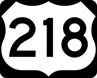
U.S. Highway 218 (US 218) is an original United States Highway that was created in 1926. Although technically a spur of US 18, US 218 neither begins nor ends at US 18, but overlaps US 18 for eight miles (13 km) near Charles City, Iowa. US 218 begins at U.S. 136 in downtown Keokuk and ends 319 miles (513 km) away at Interstate 35 (I-35) and US 14 at Owatonna, Minnesota. A large portion of US 218 in Iowa is part of the Avenue of the Saints, which connects St. Louis, Missouri, and Saint Paul, Minnesota.

<span class="mw-page-title-main">Legislative route (Minnesota)</span>

In the U.S. state of Minnesota, a legislative route is a highway number defined by the Minnesota State Legislature. The routes from 1 to 70 are constitutional routes, defined as part of the Babcock Amendment to the Minnesota State Constitution, passed November 2, 1920. All of them were listed in the constitution until a 1974 rewrite. Though they are now listed separately in §161.114 of the Minnesota Statutes, the definitions are legally considered to be part of the constitution, and cannot be altered or removed without an amendment. Legislative routes with numbers greater than 70 can be added or deleted by the legislature.

The Laura Ingalls Wilder Historic Highway is a named road connecting historic areas that relate to the life of author Laura Ingalls Wilder, best known for writing Little House on the Prairie. The highway was first designated in 1995 as U.S. Route 14 from Lake Benton in southwest Minnesota to Mankato in the south-central part of the state. Since then, it has been extended into South Dakota, Iowa, and Wisconsin.

<span class="mw-page-title-main">Minnesota State Highway 74</span> State highway in Minnesota, United States

Minnesota State Highway 74 (MN 74) is a 34.956-mile-long (56.256 km) highway in southeast Minnesota that runs from its intersection with U.S. Highway 52 and State Highway 30 in Chatfield and continues north to its northern terminus at its intersection with U.S. Highway 61 at Weaver along the Mississippi River. It is the only remaining road in the state highway system that is still partially unpaved.

<span class="mw-page-title-main">Minnesota State Highway 24</span> State highway in Minnesota, United States

Minnesota State Highway 24 (MN 24) is a 47.832-mile-long (76.978 km) highway in central Minnesota, which travels from its intersection with U.S. Highway 12 (US 12) and MN 22 in Litchfield and continues northeast to its intersection with US 10 and Sherburne County Road 6 in Clear Lake.

<span class="mw-page-title-main">Minnesota State Highway 58</span> State highway in Minnesota, United States

Minnesota State Highway 58 (MN 58) is a 23.538-mile-long (37.881 km) highway in southeast Minnesota, which runs from its interchange with U.S. 52 / State Highway 60 (co-signed) in Zumbrota and continues north to its northern terminus at its intersection with U.S. Highway 61 in Red Wing.

<span class="mw-page-title-main">Minnesota State Highway 56</span> State highway in Minnesota, United States

Minnesota State Highway 56 (MN 56) is a 99.121-mile-long (159.520 km) highway in southeast Minnesota, which runs from its intersection with U.S. Highway 63 near the Iowa state line and Chester, Iowa, and continues north to its northern terminus at its junction with U.S. Highway 52 and State Highway 50 in Hampton.

<span class="mw-page-title-main">Minnesota State Highway 20</span> State highway in Minnesota, United States

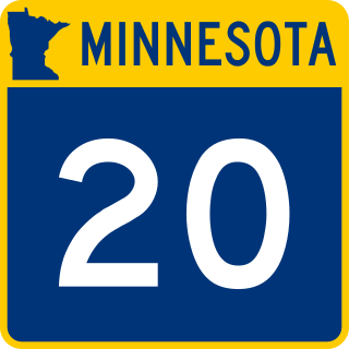
Minnesota State Highway 20 is a short 7.471-mile-long (12.023 km) highway in southeast Minnesota, which runs from its intersection with State Highway 19 in Cannon Falls and continues north to its northern terminus at its intersection with State Highway 50 near Miesville, 400 feet west of U.S. 61.

<span class="mw-page-title-main">Minnesota State Highway 25</span> State highway in Minnesota, United States

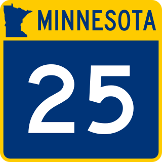
Minnesota State Highway 25 (MN 25) is a 156.066-mile-long (251.164 km) highway in Minnesota, which runs from its interchange with U.S. Highway 169 in Belle Plaine and continues north to its intersection with State Highway 210 in Brainerd.

<span class="mw-page-title-main">Minnesota State Highway 60</span> State highway in Minnesota, United States

Trunk Highway 60 (MN 60) is a 221.532-mile-long (356.521 km) highway in southern Minnesota, which runs from Iowa Highway 60 at the Iowa state line and continues east-northeast to its eastern terminus at the Wisconsin state line, where the route becomes Wisconsin Highway 25 upon crossing the Mississippi River.

<span class="mw-page-title-main">Minnesota State Highway 30</span> State highway in Minnesota, United States

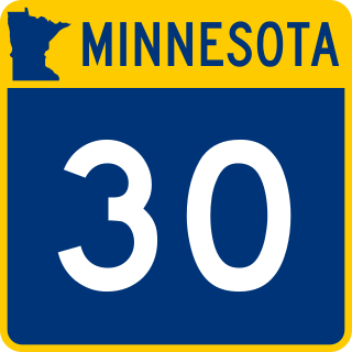
Minnesota State Highway 30 (MN 30) is a 265.503-mile-long (427.286 km) highway in southwest and southeast Minnesota, which runs from South Dakota Highway 34 at the South Dakota state line near Airlie, west of Pipestone, and continues to its eastern terminus at its intersection with Minnesota Highway 43 in Rushford.

<span class="mw-page-title-main">Minnesota State Highway 139</span> State highway in Minnesota, United States

Minnesota State Highway 139 is a 3.913-mile-long (6.297 km) highway in southeast Minnesota, which runs from Iowa Highway 139 at the Iowa state line and continues north to its northern terminus at its intersection with U.S. Highway 52 in Harmony.

<span class="mw-page-title-main">Minnesota State Highway 316</span> State highway in Minnesota, United States

State Highway 316 (MN 316) is a highway in southeast Minnesota, which runs from its first intersection with U.S. Highway 61 in Welch Township, near Miesville; and continues north to its second intersection with U.S. Highway 61 in the city of Hastings.

<span class="mw-page-title-main">U.S. Route 52 in Minnesota</span> Section of U.S. Highway in Minnesota, United States

U.S. Highway 52 (US 52) enters the state of Minnesota at the unincorporated community of Prosper, north of the town of Burr Oak, Iowa. The route is marked north–south in Minnesota along its independent segment from the Iowa state line to downtown St. Paul. US 52 is not signed along the length of its concurrency with Interstate 94 (I-94) from downtown St. Paul to the North Dakota state line at Moorhead and Fargo.

<span class="mw-page-title-main">County Road 122 (Hennepin County, Minnesota)</span> Highway in Minneapolis, Minnesota, US

Hennepin County Road 122 (CR 122) or County State-Aid Highway 122 (CSAH 122) is an unsigned county state-aid highway within the city of Minneapolis, Hennepin County, Minnesota, United States, crossing the Mississippi River on the Washington Avenue Bridge.

<span class="mw-page-title-main">U.S. Route 10 in Minnesota</span> Section of U.S. Numbered Highway in Minnesota, United States

U.S. Highway 10 (US 10) is a major divided highway for almost all of its length in the U.S. state of Minnesota. The route runs through the central portion of the state, following generally the alignment of the former Northern Pacific Railway and connects the cities of Moorhead, Detroit Lakes, Wadena, Little Falls, St. Cloud, Anoka, Saint Paul, and Cottage Grove. US 10 within Minnesota is 275 miles (443 km) in length.

<span class="mw-page-title-main">U.S. Route 61 in Minnesota</span> Segment of American highway

U.S. Highway 61 (US 61) is a U.S. Highway in southeastern and east-central Minnesota, which runs from the Mississippi River Bridge at La Crescent and continues north to its northern terminus at its junction with Interstate 35 (I-35) at the city of Wyoming.

References

  1. 1 2 Minnesota Department of Transportation (August 14, 2014). "Statewide Trunk Logpoint Listing" (PDF). St. Paul: Minnesota Department of Transportation. pp. 114, 121–122, 164–168. Retrieved 2015-07-06.
  2. Minnesota State Legislature (2010). "§ 161.114, Constitutional Trunk Highways". Minnesota Statutes. Minnesota Office of the Revisor of Statutes. Retrieved February 6, 2011.
  3. "161.115, Additional Trunk Highways". Minnesota Statutes. Office of the Revisor of Statutes, State of Minnesota. 2010. Retrieved February 6, 2011.
  4. 1 2 1934 Map of Trunk Highway System, State of Minnesota (Map). Minnesota Highway Department. May 1, 1934. § O20-O23. Retrieved February 6, 2010.
  5. 1 2 1935 Map of Trunk Highway System, State of Minnesota (Map). Minnesota Highway Department. May 1, 1934. § O20-O23. Retrieved February 6, 2010.
  6. Hybben, Robert; Jeffrey A. Hess (July 1990). "National Register of Historic Places Registration Form: Lake City and Rochester Stage Road: Mount Pleasant Section". National Park Service. Retrieved 2018-01-30.{{cite journal}}: Cite journal requires |journal= (help)
  7. City to take back Broadway in swap with state - Post-Bulletin http://postbulletin.com/news/stories/display.php?id=1493905
Template:Attached KML/U.S. Route 63 in Minnesota
KML is from Wikidata
US 63.svg U.S. Route 63
Previous state:
Iowa
Minnesota Next state:
Wisconsin