Lake City, Minnesota

Last updated

Lake City
Lake City City Hall 2017.jpg
Historic wing of the Lake City City Hall, built in 1899
Nickname: 
"City of Homes"
Motto: 
"What You Need When You Need It"
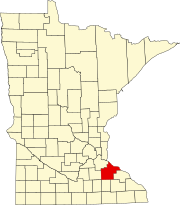
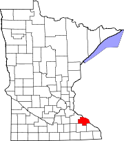
Wabasha County Minnesota Incorporated and Unincorporated areas Lake City Highlighted.svg
Location of Lake City
within Wabasha County
in the state of Minnesota
Coordinates: 44°26′44″N92°16′14″W / 44.44556°N 92.27056°W / 44.44556; -92.27056
Country United States
State Minnesota
Counties Wabasha, Goodhue
Area
[1]
  Total4.50 sq mi (11.64 km2)
  Land4.48 sq mi (11.60 km2)
  Water0.02 sq mi (0.04 km2)
Elevation
[2]
690 ft (210 m)
Population
 (2020)
  Total5,252
  Density1,172.58/sq mi (452.74/km2)
Time zone UTC-6 (Central (CST))
  Summer (DST) UTC-5 (CDT)
ZIP code
55041
Area code 651
FIPS code 27-34172 [3]
GNIS feature ID0646338 [2]
Website ci.lake-city.mn.us
Gate at the Lake City Marina LakeCityMNmarinasign2006.JPG
Gate at the Lake City Marina

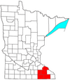
Lake City is a city in Goodhue and Wabasha counties in the U.S. state of Minnesota. It lies along Lake Pepin, a wide portion of the Mississippi River. The population was 5,252 at the 2020 census. Most of Lake City is located within Wabasha County with only a small portion in Goodhue County. Lake City is part of the Rochester, Minnesota Metropolitan Statistical Area. [4]

Contents

History

Lake City is located 65 miles (105 km) southeast of the Twin Cities at the intersection of U.S. Highways 61 and 63 on the Mississippi River at Lake Pepin. Lac de Pleurs (Lake of Tears) was the name given to Lake Pepin by Father Louis Hennepin, who camped on the shore of the lake in 1680. He christened the large body of water Lac de Pleurs after observing his Sioux captors weeping near the lake over the death of a chief's son. The war party of Isanti Sioux had captured Hennepin and his two companions several miles south along the Mississippi and were camping near the lake on their return north to their Sioux villages near present-day Mille Lacs.

The first known settler was Jacob Boody, who arrived in 1853. In the years to follow, several explorers passed through this area. The town was platted in 1855. The waters of Lake Pepin are deep enough to allow for a port, and in 1864 the Lake City town supervisors were given special powers by the State Legislature to create a port market for grain. Soon after, Lake City became noted as a profitable market for grain with the volume of trade in 1866 bringing in a little over a million and a half dollars.

Lake City became incorporated in 1872 and has become widely known for its attractive surroundings and bountiful fishing. The Sea Wing disaster occurred on July 13, 1890 when a strong squall line overturned the excursion vessel Sea Wing on Lake Pepin near Lake City. Over 200 people were aboard the vessel when it was overturned, and as a result 98 people drowned.

Water skiing was invented in Lake City by area resident, Ralph Samuelson, which he first performed in Lake Pepin during the summer of 1922. To commemorate this event, Lake City has adopted the nickname "The Birthplace of Water Skiing" and holds an annual town festival, called Water Ski Days. [5] Water Ski Days typically includes three days of water skiing exhibitions, live music, beer garden, street carnival, sports tournaments, and Grand Parade; it is held annually during the last full-weekend in June. In 2020 Water Ski Days was slated to be held June 26–28 but was cancelled due to COVID-19. [6] The festival that will be held in 2021 would have been the 50th, but will be the 49th because of the cancellation.

Lake City has three properties listed on the National Register of Historic Places: the 1872 James C. and Agnes M. Stout House, the 1899 Lake City City Hall, and the 1910 Williamson–Russell–Rahilly House. [7]

Geography

According to the United States Census Bureau, the city has a total area of 4.56 square miles (11.81 km2); 4.50 square miles (11.65 km2) is land and 0.06 square miles (0.16 km2) is water. [8] U.S. Highways 61 and 63 are two of the main routes in the community.

Demographics

Historical population
CensusPop.Note
1880 2,596
1890 2,128−18.0%
1900 2,74428.9%
1910 3,14214.5%
1920 2,846−9.4%
1930 3,21012.8%
1940 3,204−0.2%
1950 3,4577.9%
1960 3,4941.1%
1970 3,5942.9%
1980 4,50525.3%
1990 4,391−2.5%
2000 4,95012.7%
2010 5,0632.3%
2020 5,2523.7%
U.S. Decennial Census
Historical population
CensusPop.Note
1880 112
U.S. Census for Central Point [9]

2010 census

As of the census [10] of 2010, there were 5,063 people, 2,238 households, and 1,428 families living in the city. The population density was 1,125.1 inhabitants per square mile (434.4/km2). There were 2,687 housing units at an average density of 597.1 per square mile (230.5/km2). The racial makeup of the city was 99.3% White, 0.5% African American, 0.3% Native American, 0.8% Asian, 0.3% from other races, and 0.7% from two or more races. Hispanic or Latino of any race were 0.2% of the population.

There were 2,238 households, of which 24.4% had children under the age of 18 living with them, 51.3% were married couples living together, 8.3% had a female householder with no husband present, 4.2% had a male householder with no wife present, and 36.2% were non-families. 30.6% of all households were made up of individuals, and 15% had someone living alone who was 65 years of age or older. The average household size was 2.20 and the average family size was 2.72.

The median age in the city was 46.2 years. 20.2% of residents were under the age of 18; 6.7% were between the ages of 18 and 24; 21.8% were from 25 to 44; 27.7% were from 45 to 64; and 23.7% were 65 years of age or older. The gender makeup of the city was 48.1% male and 51.9% female.

2000 census

As of the census [3] of 2000, there were 4,950 people, 2,131 households, and 1,402 families living in the city. The population density was 1,166.9 inhabitants per square mile (450.5/km2). There were 2,347 housing units at an average density of 553.3 per square mile (213.6/km2). The racial makeup of the city was 96.81% White, 0.63% African American, 0.40% Native American, 1.11% Asian, 0.28% from other races, and 0.77% from two or more races. Hispanic or Latino of any race were 2.22% of the population.

There were 2,131 households, out of which 26.7% had children under the age of 18 living with them, 56.0% were married couples living together, 7.4% had a female householder with no husband present, and 34.2% were non-families. 29.2% of all households were made up of individuals, and 14.7% had someone living alone who was 65 years of age or older. The average household size was 2.30 and the average family size was 2.83.

In the city, the population was spread out, with 22.8% under the age of 18, 6.4% from 18 to 24, 26.1% from 25 to 44, 24.8% from 45 to 64, and 19.9% who were 65 years of age or older. The median age was 41 years. For every 100 females, there were 93.1 males. For every 100 females age 18 and over, there were 89.9 males.

The median income for a household in the city was $40,637, and the median income for a family was $47,146. Males had a median income of $35,321 versus $24,799 for females. The per capita income for the city was $20,944. About 3.2% of families and 6.0% of the population were below the poverty line, including 7.7% of those under age 18 and 5.1% of those age 65 or over.

Education

Lake City is the home of Bluffview Elementary, a K–6 public elementary school, Lincoln High School for grades 7–12 (public), and St. John's Lutheran School, a K–8 Lutheran School of the WELS. Previously, the town also was home to a Catholic School named St. Mary's.

Transportation

Amtrak’s Empire Builder , which operates between Seattle/Portland and Chicago, passes through the town on BNSF tracks, but makes no stop. The nearest station is located in Red Wing, 17 miles (27 km) to the northwest.

City Services

Public Safety

Lake City is Served by Full-time police and ambulance services that are city operated, and a paid on-call fire department serves the city, surrounding rural areas, and waters of Lake Pepin. [11]

Library

The Lake City Public Library, located at 201 South High Street, is a member of Southeastern Libraries Cooperating, which "provide services and support to public, school, academic, and special libraries in an 11 county region of Southeastern Minnesota." [12]

Media

Radio

FM radio stations
FrequencyCall signNameFormatOwner
94.9 KLCH Lake Hits 95 Oldies Q Media Group, LLC.

Notable people

Related Research Articles

<span class="mw-page-title-main">Pepin County, Wisconsin</span> County in Wisconsin, United States

Pepin County is a county in the U.S. state of Wisconsin. As of the 2020 census, the population was 7,318, making it the fourth-least populous county in Wisconsin; it is also the smallest county in Wisconsin by area. Its county seat is Durand.

<span class="mw-page-title-main">Wabasha County, Minnesota</span> County in Minnesota, United States

Wabasha County is a county in the U.S. state of Minnesota. As of the 2020 census, the population was 21,387. Its county seat is Wabasha.

<span class="mw-page-title-main">Round Lake Park, Illinois</span> Village in Illinois, United States

Round Lake Park is a village in Lake County, Illinois, United States. Per the 2020 census, the population was 7,680. It is located along the south side of the lake, Round Lake. Access to the lake from this town is private and only for residents of Round Lake Park.

<span class="mw-page-title-main">Lake Shore, Minnesota</span> City in Minnesota, United States

Lake Shore is a city in Cass County, Minnesota, United States. The population was 1,056 at the 2020 census. It is part of the Brainerd Micropolitan Statistical Area.

Florence Township is a township in Goodhue County, Minnesota, United States. The population was 1,450 at the 2000 census. A small part of the city of Lake City extends geographically within the township, but is a separate entity. The unincorporated area of Frontenac is also located within the township.

<span class="mw-page-title-main">Shorewood, Minnesota</span> City in Minnesota, United States

Shorewood is a city nestled in the woods along on the shores of Lake Minnetonka in Hennepin County, Minnesota, United States. The population was 7,307 at the 2010 census. The city was incorporated in 1956. Its area was originally part of the former Excelsior Township.
<span class="mw-page-title-main">Beaver Bay, Minnesota</span> City in Minnesota, United States

Beaver Bay is a city in Lake County, Minnesota, United States. The population was 120 at the 2020 census.

<span class="mw-page-title-main">Silver Bay, Minnesota</span> City in Minnesota, United States

Silver Bay is a city in Lake County, Minnesota, United States. The population was 1,857 at the time of the 2020 census. It is the largest population center in a natural tourism area which includes, Tettegouche State Park and the Split Rock Lighthouse. It is a port along Lake Superior for iron ore and has taconite mining facilities of its own.

<span class="mw-page-title-main">Isle, Minnesota</span> City in Minnesota, United States

Isle is a city in Mille Lacs County, Minnesota, United States. The population was 803 at the 2020 census, up from 751 in 2010.

<span class="mw-page-title-main">Vergas, Minnesota</span> City in Minnesota, United States

Vergas is a city in northern Otter Tail County, Minnesota, United States. The population was 348 at the 2020 census.

<span class="mw-page-title-main">Sturgeon Lake, Minnesota</span> City in Minnesota, United States

Sturgeon Lake is a city in Pine County, Minnesota, United States. The population was 439 at the 2010 census.
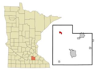
<span class="mw-page-title-main">Lonsdale, Minnesota</span> City in Minnesota, United States

Lonsdale is a city in Rice County, Minnesota, United States. The population was 4,686 at the 2020 census, with a 2024 estimate of 5,112. A fast growing exurb of the Minneapolis-Saint Paul metropolitan area, Lonsdale is located 40 miles south of downtown Minneapolis.

<span class="mw-page-title-main">Arnold, Minnesota</span> Census-designated place in Minnesota, US

Arnold is a former census-designated place (CDP), which was located in Rice Lake, Saint Louis County, Minnesota, United States. The population was 2,960 at the 2010 census. The census-designated place of Arnold was located entirely within the former Rice Lake Township, adjacent to the north side of the city of Duluth. Rice Lake Township was incorporated as the city of Rice Lake on October 22, 2015, thus rendering the census-designated place of Arnold to no longer exist.

<span class="mw-page-title-main">Hoyt Lakes, Minnesota</span> City in Minnesota, United States

Hoyt Lakes is a city in Saint Louis County, Minnesota. The population was 2,017 at the time of the 2010 census.

Pepin Township is a township in Wabasha County, Minnesota, United States. The population was 471 at the 2000 census. The unincorporated communities of Maple Springs, Camp Lacupolis and Reads Landing are located within the township.

<span class="mw-page-title-main">Wabasha, Minnesota</span> City in Minnesota, United States

Wabasha is a city and the county seat of Wabasha County, Minnesota, United States. The population was 2,559 at the time of the 2020 census. It is on the Mississippi River, near its confluence with the Zumbro River.

<span class="mw-page-title-main">Fifty Lakes, Minnesota</span> City in Minnesota, United States

Fifty Lakes is a city in Crow Wing County, Minnesota, United States. The population was 387 at the 2010 census. It is part of the Brainerd Micropolitan Statistical Area.

<span class="mw-page-title-main">Minnesota Lake, Minnesota</span> City in Minnesota, United States

Minnesota Lake is a city in Blue Earth and Faribault counties in the State of Minnesota. The population was 661 at the 2020 census. The bulk of the city is in Faribault County; a small part extends into Blue Earth County.

Nelson is a town in Buffalo County in the U.S. state of Wisconsin. The population was 571 at the 2010 census. The village of Nelson is located within the town. The unincorporated community of Misha Mokwa and railroad junction Trevino are located in the town. The unincorporated community of Urne is located partially in the town.

<span class="mw-page-title-main">Pepin, Wisconsin</span> Village in Wisconsin, United States

Pepin is a village in Pepin County, Wisconsin, United States. The population was 837 at the 2010 census. The village is located within the Town of Pepin.

References

  1. "2020 U.S. Gazetteer Files". United States Census Bureau. Retrieved July 24, 2022.
  2. 1 2 U.S. Geological Survey Geographic Names Information System: Lake City, Minnesota
  3. 1 2 "U.S. Census website". United States Census Bureau . Retrieved January 31, 2008.
  4. "Census.gov". Census.gov. Retrieved April 29, 2021.
  5. "Water Ski Days".
  6. "Water Ski Days 2020 canceled". Lake City Graphic. April 30, 2020. Retrieved April 29, 2021.
  7. "Minnesota National Register Properties Database". Minnesota Historical Society. 2009. Retrieved February 11, 2018.
  8. "US Gazetteer files 2010". United States Census Bureau. Archived from the original on July 2, 2012. Retrieved November 13, 2012.
  9. "Census of Population and Housing". Census.gov. Retrieved June 28, 2019.
  10. "U.S. Census website". United States Census Bureau . Retrieved November 13, 2012.
  11. "City Departments". www.ci.lake-city.mn.us. Retrieved April 29, 2021.
  12. "Home". SELCO.