Dennison, Minnesota

Last updated

Dennison
Goodhue County Minnesota Incorporated and Unincorporated areas Dennison Highlighted.svg
Location of Dennison, Minnesota
Coordinates: 44°24′32″N93°01′49″W / 44.40889°N 93.03028°W / 44.40889; -93.03028
Country United States
State Minnesota
Counties Goodhue, Rice
Area
[1]
  Total1.26 sq mi (3.26 km2)
  Land1.26 sq mi (3.26 km2)
  Water0.00 sq mi (0.00 km2)
Elevation
[2]
1,034 ft (315 m)
Population
 (2020)
  Total223
  Density176.98/sq mi (68.35/km2)
Time zone UTC-6 (Central (CST))
  Summer (DST) UTC-5 (CDT)
ZIP code
55018
Area code 507
FIPS code 27-15706 [3]
GNIS feature ID2394516 [2]

Dennison is a city in Goodhue and Rice counties in the U.S. state of Minnesota. The population was 212 at the 2010 census. [4] Most of Dennison is in Goodhue County, with only a small part that extends into Rice County.

Contents

History

A post office called Dennison has been in operation since 1885. [5] The city was named for Morris P. Dennison, the original owner of the town site. [6]

Geography

According to the United States Census Bureau, the city has a total area of 1.26 square miles (3.26 km2), all land. [7]

Minnesota State Highways 56 and 246 are nearby, along with Goodhue County 9.

Demographics

Historical population
CensusPop.Note
1910 184
1920 21818.5%
1930 26220.2%
1940 216−17.6%
1950 163−24.5%
1960 1799.8%
1970 20313.4%
1980 176−13.3%
1990 152−13.6%
2000 16810.5%
2010 21226.2%
2020 2235.2%
U.S. Decennial Census [8]

2010 census

As of the census [9] of 2010, there were 212 people, 77 households, and 53 families living in the city. The population density was 168.3 inhabitants per square mile (65.0/km2). There were 80 housing units at an average density of 63.5 per square mile (24.5/km2). The racial makeup of the city was 92.5% White, 4.7% African American, and 2.8% from two or more races. Hispanic or Latino of any race were 1.4% of the population.

There were 77 households, of which 31.2% had children under the age of 18 living with them, 61.0% were married couples living together, 6.5% had a female householder with no husband present, 1.3% had a male householder with no wife present, and 31.2% were non-families. 26.0% of all households were made up of individuals, and 5.2% had someone living alone who was 65 years of age or older. The average household size was 2.75 and the average family size was 3.28.

The median age in the city was 39 years. 28.8% of residents were under the age of 18; 6% were between the ages of 18 and 24; 24% were from 25 to 44; 33.5% were from 45 to 64; and 7.5% were 65 years of age or older. The gender makeup of the city was 51.4% male and 48.6% female.

2000 census

As of the census [3] of 2000, there were 168 people, 60 households, and 49 families living in the city. The population density was 132.3 inhabitants per square mile (51.1/km2). There were 64 housing units at an average density of 50.4 per square mile (19.5/km2). The racial makeup of the city was 91.67% White, 0.60% Native American, 1.79% Asian, and 5.95% from two or more races.

There were 60 households, out of which 41.7% had children under the age of 18 living with them, 65.0% were married couples living together, 8.3% had a female householder with no husband present, and 18.3% were non-families. 16.7% of all households were made up of individuals, and 3.3% had someone living alone who was 65 years of age or older. The average household size was 2.80 and the average family size was 3.06.

In the city, the population was spread out, with 30.4% under the age of 18, 7.1% from 18 to 24, 33.3% from 25 to 44, 20.2% from 45 to 64, and 8.9% who were 65 years of age or older. The median age was 35 years. For every 100 females, there were 107.4 males. For every 100 females age 18 and over, there were 116.7 males.

The median income for a household in the city was $51,667, and the median income for a family was $53,750. Males had a median income of $30,417 versus $30,000 for females. The per capita income for the city was $19,038. None of the families and 1.3% of the population were living below the poverty line.

Related Research Articles

<span class="mw-page-title-main">Randolph, Minnesota</span> City in Minnesota, United States

Randolph is a city in Dakota County, Minnesota, United States. The population was 436 at the 2010 census.

<span class="mw-page-title-main">Belle Creek Township, Goodhue County, Minnesota</span> Township in Minnesota, United States

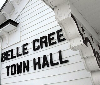
Belle Creek Township is a township in Goodhue County, Minnesota, United States. The population was 437 at the 2000 census.

Cannon Falls Township is a township in Goodhue County, Minnesota, United States. The population was 1,236 at the 2000 census.

Cherry Grove Township is a township in Goodhue County, Minnesota, United States. The population was 430 at the 2000 census.

Featherstone Township is a township in Goodhue County, Minnesota, United States. The population was 785 at the 2000 census.

Florence Township is a township in Goodhue County, Minnesota, United States. The population was 1,450 at the 2000 census. A small part of the city of Lake City extends geographically within the township, but is a separate entity. The unincorporated area of Frontenac is also located within the township.

<span class="mw-page-title-main">Goodhue, Minnesota</span> City in Minnesota, United States

Goodhue is a city in Goodhue County, Minnesota, United States. The population was 1,176 at the 2010 census.

Goodhue Township is a township in Goodhue County, Minnesota, United States. The population was 530 at the 2000 census.

Hay Creek Township is a township in Goodhue County, Minnesota, United States. The population was 862 at the 2000 census. The unincorporated community of Hay Creek is located within the township.

<span class="mw-page-title-main">Kenyon, Minnesota</span> City in Minnesota, United States

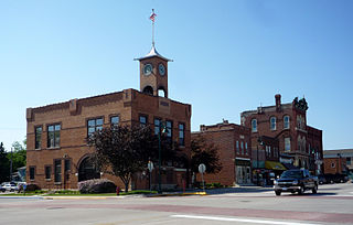
Kenyon is a city in southwestern Goodhue County, Minnesota, United States, located along the North Fork of the Zumbro River. It was founded in 1856 and named in honor of Kenyon College. It is known for the Boulevard of roses on main street, which is the namesake of the town festival "Rosefest" held every August. The population was 1,815 at the 2010 census.

Kenyon Township is a township in Goodhue County, Minnesota. The population was 437 at the time of the 2000 census. The township was organized in 1858 and named for an early storekeeper.

<span class="mw-page-title-main">Minneola Township, Goodhue County, Minnesota</span> Township in Minnesota, United States

Minneola Township is a township in Goodhue County, Minnesota, United States. The population was 657 at the 2000 census.

Roscoe Township is a township in Goodhue County, Minnesota, United States. The population was 784 at the 2000 census.

<span class="mw-page-title-main">Wacouta Township, Goodhue County, Minnesota</span> Township in Minnesota, United States

Wacouta Township is a township in Goodhue County, Minnesota, United States. The population was 410 at the 2000 census.

<span class="mw-page-title-main">Wanamingo, Minnesota</span> City in Minnesota, United States

Wanamingo is a community in Goodhue County, Minnesota, United States, incorporated as a city. It lies along the North Fork of the Zumbro River. The population was 1,086 at the 2010 census.

Wanamingo Township is a township in Goodhue County, Minnesota, United States. The population was 504 at the 2000 census.

Warsaw Township is a township in Goodhue County, Minnesota, United States. The population was 603 at the 2000 census.

Zumbrota Township is a township in Goodhue County, Minnesota, United States. The population was 591 at the 2000 census.

<span class="mw-page-title-main">Bellechester, Minnesota</span> City in Minnesota, United States

Bellechester is a city in Goodhue and Wabasha counties in the U.S. state of Minnesota. The population was 175 at the 2010 census. Most of Bellchester is in Goodhue County, with only a small part extending into Wabasha County.

<span class="mw-page-title-main">Pine Island, Minnesota</span> City in Minnesota, United States

Pine Island is a city in Goodhue and Olmsted counties in the U.S. state of Minnesota. Most of Pine Island is in Goodhue County, but a small part extends into Olmsted County, making that portion part of the Rochester metropolitan area. As of the 2020 census, the population was 3,769.

References

  1. "2020 U.S. Gazetteer Files". United States Census Bureau. Retrieved July 24, 2022.
  2. 1 2 U.S. Geological Survey Geographic Names Information System: Dennison, Minnesota
  3. 1 2 "U.S. Census website". United States Census Bureau . Retrieved January 31, 2008.
  4. "2010 Census Redistricting Data (Public Law 94-171) Summary File". American FactFinder. United States Census Bureau . Retrieved April 27, 2011.[ dead link ]
  5. "Goodhue County". Jim Forte Postal History. Archived from the original on June 19, 2015. Retrieved June 14, 2015.
  6. Upham, Warren (1920). Minnesota Geographic Names: Their Origin and Historic Significance. Minnesota Historical Society. p. 206.
  7. "US Gazetteer files 2010". United States Census Bureau. Archived from the original on January 25, 2012. Retrieved November 13, 2012.
  8. "Census of Population and Housing". Census.gov. Retrieved June 4, 2015.
  9. "U.S. Census website". United States Census Bureau . Retrieved November 13, 2012.