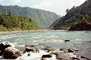
The Beas River is a river in north India. The river rises in the Himalayas in central Himachal Pradesh, India, and flows for some 470 kilometres (290 mi) to the Sutlej River in the Indian state of Punjab. Its total length is 470 kilometres (290 mi) and its drainage basin is 20,303 square kilometres (7,839 sq mi) large.
The Ravi River is a transboundary river crossing northwestern India and eastern Pakistan. It is one of five rivers associated with the Punjab region.

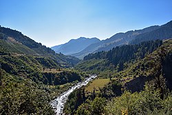
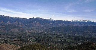
Kullu is a district in Himachal Pradesh, India. It borders Shimla district to the south, Mandi and Kangra districts to the west, and the Lahaul and Spiti district to the north and east. The largest valley in this mountainous district is the Kullu Valley. The Kullu valley follows the course of the Beas River, and ranges from an elevation of 833m above sea level at Aut to 3330m above sea level at the Atal Tunnel South Portal, below the Rohtang Pass. The town of Kullu, or simply Kullu, located on the right side of the Beas River, serves as the administrative headquarters of the Kullu district. The Kullu district also incorporates several riverine tributary valleys of the Beas, including those of the Parvati, Sainj, and Tirthan rivers, and thus some regions somewhat distant from the Kullu valley. The economy of the district relies mainly on horticulture, agriculture, tourism, and traditional handicrafts.
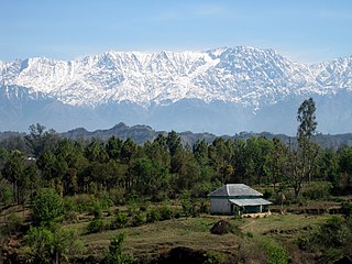
Dhauladhar is a mountain range which is part of a lesser Himalayan chain of mountains. It rises from the Shivalik hills, to the north of Kangra and Mandi. Dharamsala, the headquarters of Kangra district and the winter capital of Himachal Pradesh, lies on its southern spur in the Kangra Valley. Chamba lies to the North of this range.

Bhakra Nangal Dam is a concrete gravity dam on the Satluj River in Bhakra Village near Bilaspur in Bilaspur district, Himachal Pradesh in northern India. The dam forms the Gobind Sagar reservoir.

Maharana Pratap Sagar, also known as Pong Reservoir or Pong Dam Lake is a large reservoir in Fatehpur, Jawali and Dehra tehsil of Kangra district of the state of Himachal Pradesh in India. It was created in 1975, by building the highest earthfill dam in India on the Beas River in the wetland zone of the Siwalik Hills. Named in the honour of Maharana Pratap (1540–1597), the reservoir or the lake is a well-known wildlife sanctuary and one of the 49 international wetland sites declared in India by the Ramsar Convention. The reservoir covers an area of 24,529 hectares, and the wetlands portion is 15,662 hectares.
Jogindernagar, or Jogindar Nagar, is a municipality, and a sub district in Mandi district in the Indian state of Himachal Pradesh. Named after Raja Joginder Sen, the hill station is the terminus of the 163-kilometre-long (101 mi) Kangra Valley narrow-gauge railway. Jogindernagar is the third-largest city in the Mandi district. The only city in Asia with three hydro-electric power stations, its nickname is "The City of Powerhouses".
Himachal Pradesh is extremely rich in its hydroelectricity resources. The state has about twenty five percent of the national potential. About 27,436 MW of hydroelectric power can be generated in the state by the construction of various hydroelectric projects on the five perennial river basins. Out of total hydroelectric potential of the state, 10,519 MW is harnessed so far, out of which only 7.6% is under the control of Himachal Pradesh Government while the rest is exploited by the Central Government. The state government has been giving the highest priority for its development, since hydroelectric generation can meet the growing need of power for industry, agriculture and rural electrification. It is also the biggest source of income to the state as it provides electricity to other states.

Shanan Power House is situated 2 km from Jogindernagar in Himachal Pradesh, India. First power house of Himachal Pradesh is Bhuri singh project in Chamba. British Engineer Colonel B.C. Batty and his team in collaboration with the then ruler of Joginder Nagar region, Raja Karan Sen, designed and created it. The Shanan Power house is currently under the control of Punjab State Electricity Board and whole of the revenue goes to Punjab government. It is to be handed over to the Himachal Pradesh Government in 2024 after the completion of a 99-year lease.
Barot, a village originally developed in 1920s for Shanan Hydel Project, is now a tourist location in Mandi district in the Indian state of Himachal Pradesh. Barot was difficult to access until 1975, when a road was opened. It is situated 40 km from Jogindernagar and 65 km from Mandi, the District Headquarter. The road to Barot branches off at Jogindernagar-Mandi Highway and from Jogindernagar the distance is 40 km. It is sometimes possible to use the funicular trolley from Jogindernagar which reduces the distance to 12 km. The road route includes terraced fields and thick cedar forests, rising to Jhatingri at the hilltop. The remains of the summer palace of the former rulers of Mandi are located here. Through the little village of Tikkan, the road carries on to Barot. The town has a range of outdoor activities, including a trout breeding centre, from where fish are released into the Uhl river. A 30 km section of the river is used for angling.

The Kangra Valley Railway is a 2 ft 6 in gauge railway that runs from Pathankot, Punjab to Jogindernagar in Himachal Pradesh. It runs through the sub-Himalayan region of Kangra Valley and is 164 km (101.9 mi) long. It is on the UNESCO World Heritage Sites tentative list. The railway is part of the Firozpur division of Northern Railway. It is the longest Narrow Gauge line in India and also the longest 2 ft 6 in Gauge Railway in the World. The highest point on this line is Ahju station at an elevation of 1,290 meters (4,230 ft). There are 33 stops and 950 bridges.

The Indian Institute of Technology Mandi is one of eight newer Indian Institutes of Technology (IITs) established by the Ministry of Human Resource Development (MHRD).
Joginder Nagar Valley is a valley in the Indian state of Himachal Pradesh. The valley contains the town of Joginder Nagar, Bir-Billing, Chauntra and various other hill resorts surrounded by mountains on all sides. The valley falls in the mid-hill zone of the Dhauladhar mountain range in the foothills of the Indian Himalayas. Geographically, the valley starts near Ghatta at its westernmost point and stretches south-eastwards up to Ghatasani, 15 kilometres from the main town. On an average, the valley is stretched 20 kilometres in length and 10 kilometers in width.

Mandi is a major city and a municipal corporation in Mandi District in the Indian state of Himachal Pradesh. It is situated 145 kilometres (90 mi) north of state capital, Shimla in the north-west Himalayas at an average altitude of 880 m (2,890 ft) Mandi is connected to the Pathankot through National Highway 20 and to Manali and Chandigarh through National Highway 21. Mandi is approximately 184.6 km (114.7 mi) from Chandigarh, the nearest major city, and 440.9 km (274.0 mi) from New Delhi, the national capital. In the 2011 Indian census, Mandi city had a population of 26,422. Mandi district is currently the 2nd largest economy in the state next to Kangra. Mandi, in the state is having second highest sex ratio of 1013 females per thousand males.

The Pandoh Dam is an embankment dam on the Beas River in Mandi district of Himachal Pradesh, India. Under the Beas Project, the dam was completed in 1977 and its primary purpose is hydroelectric power generation. Part of a run-of-the-river power scheme, it diverts the waters of the Beas to the southwest through a 38 km (24 mi) long system of tunnels and channels. The water is used for power generation at the Dehar Power House before being discharged into the Sutlej River, connecting both rivers. The power house has an installed capacity of 990 MW. The system diverts 256 cumecs of Beas waters to the Satluj River. The project was completed in 1977.
The Beas River disaster refers to the 8 June 2014 drowning of 24 second-year engineering students and one tour operator from V.N.R. Vignana Jyothi Institute of Engineering and Technology of Hyderabad at the Beas River in Himachal Pradesh. The accident took place in the Thalout area of Mandi district and was the result of a sudden surge of river water released upstream from the Larji hydro electric project.
The Western Himalayas refers to the western half of the Himalayas, in northern Pakistan and northwestern India. It is also known as the Punjab Himalayas. Four of the five tributaries of the Indus River in Punjab rise in the Western Himalayas; while the fifth, the Sutlej cuts through the range after rising in Tibet.

Kamand is a small village in Development Block Mandi-Sadr, Mandi district, Himachal Pradesh, India. The village is situated on the left bank of the Uhl River. It is located on MDR23 Mandi-Bajaura Road, at a distance of 15 kilometres (9.3 mi) from Mandi town. The South Campus of IIT Mandi borders Kamand and the entrance to the campus branches off from MDR23 here. The Kamand Gram Panchayat is a local self-governance body that covers Kamand and 6 other villages.
Khanahr is a small village in Himachal Pradesh, India. The village is situated on the mountain slopes on the right bank of Kataula-ka-khad, a tributary of the Uhl River. It is located on MDR23 Mandi-Bajaura Road, at a distance of 18 kilometres (11 mi) from Mandi town. The sub-village of Salgi is located on the main road. The North Campus of IIT Mandi borders Salgi and the entrance to the campus branches off from MDR23 at Salgi.
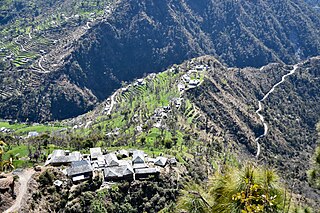
Kahra is a small village in Mandi district, Himachal Pradesh, India. The village is situated on a mountain ridge on the right bank of Neri-ki-khad, a tributary of the Uhl River. It is located 5 kilometres (3.1 mi) from MDR23 Mandi-Bajaura Road, at a distance of 20 kilometres (12 mi) from Mandi town. The South Campus of IIT Mandi borders Kahra and the road to Kahra passes through the campus. The economy of Kahra is largely agrarian.