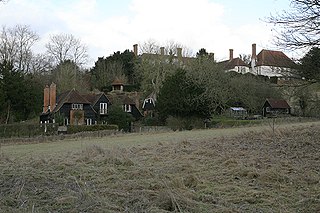
Upper Enham, formerly known as Upper Kings Enham, is a hamlet in the civil parish of Enham Alamein lying along MacCallum Road between Little London and Enham Alamein in the Test Valley district of Hampshire, England. At the 2011 Census the population of the hamlet was included in the civil parish of Wherwell. It lies 2.7 miles (4.3km) north from Andover, its nearest town.
In England, a civil parish is a type of administrative parish used for local government, they are a territorial designation which is the lowest tier of local government below districts and counties, or their combined form, the unitary authority. Civil parishes can trace their origin to the ancient system of ecclesiastical parishes which historically played a role in both civil and ecclesiastical administration; civil and religious parishes were formally split into two types in the 19th century and are now entirely separate. The unit was devised and rolled out across England in the 1860s.
Enham Alamein is a village and civil parish about 2½ miles north of Andover in the north of Hampshire, England. It was named Enham until 1945 and previously Lower Kings Enham.
Little London is a hamlet and civil parish which lies 3.5 miles north of Andover in Hampshire, England. The hamlet is in the parish of Smannell and has 53 houses. One side of the village has a number of original flint and mortar and thatch-roofed cottages whilst Ridges View is 1960s ex local authority houses. The pub closed in the 80's and the Post Office also has gone.
According to Cambridge University the important meeting of 16 May 1008 was held at Kings Enham. This meeting of 40 nobles including King Aethelred and Bishop Wulfstan with 350 retainers, put into draft a decree stating that England would now worship one Christian God, one King, and that all men would be subject to law. This signified the rebirth of England and it is thought that the reference to Lambs being raised here is not a reference to livestock, but to the followers of God, "The Flock".
History
1008: Eanham, i.e. Anglo-Saxon ēan-hām = "lamb" or ēan-hamm = "enclosure by a river or marsh, for lambs"
1066: Domesday Book "Etham"
1167: Enham[7]
1379: Enham Regis (= "Enham of the King")
1595: Kings Eneham[8]
1720: Enham[9]
1759: Upper Kings Inham, Lower Kings Inham (with given alternative of Lower Kings Enham)[10]
1900: Upper Kings Enham and Lower Kings Enham were each a group of a few houses.
1919: Upper Enham, Enham[11]
1945: Upper Enham with Lower Kings Enham or "Enham" renamed Enham Alamein (and still so as at April 2014)
El Alamein is a town in the northern Matrouh Governorate of Egypt. Located on the Mediterranean Sea, it lies 106 kilometres (66 mi) west of Alexandria and 240 kilometres (149 mi) northwest of Cairo. As of 2007, it had a population of 7,397 inhabitants.
Kings Ripton is a village and civil parish in Cambridgeshire, England. Kings Ripton lies approximately 3 miles (5 km) north-east of Huntingdon. Kings Ripton is situated within Huntingdonshire which is a non-metropolitan district of Cambridgeshire as well as being a historic county of England.
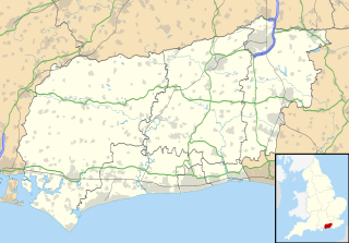
Upper Beeding is a village and civil parish in the Horsham District of West Sussex, England. It is located at the northern end of the River Adur gap in the South Downs four miles (6.4 km) north of Shoreham-by-Sea and has a land area of 1877 hectares (4637 acres). The site is a bridging point over the river: on the opposite bank are Bramber and Steyning, making the whole area somewhat built-up. The civil parish also includes the smaller village of Small Dole to the north, and the village of Edburton to the northeast.
Colsterdale is the valley of the River Burn, a tributary of the River Ure, in the Yorkshire Dales in North Yorkshire, England. It gives its name to a hamlet and civil parish in the upper part of the dale, about 7 miles (11 km) west of Masham. The population of the civil parish was estimated at 20 in 2010. The lower part of the dale is in the civil parish of Healey. The area is in Harrogate district.
Seagry is a civil parish in Wiltshire, England, about 4.5 miles (7.2 km) southeast of Malmesbury and 5.5 miles (8.9 km) northeast of Chippenham. Its main settlements are the village of Upper Seagry and the hamlet of Lower Seagry.
Lambs Green is a hamlet in the civil parish of Rusper and the Horsham District of West Sussex, England. It lies on the Rusper to Ifield road 3.1 miles (5 km) west of Crawley.
Lower Beeding is a village and civil parish in the Horsham District of West Sussex, England. The village lies on the B2110, B2115 and A281 roads 3.5 miles (6 km) southeast from Horsham, and is centred on Holy Trinity Church and The Plough public house, where the B2115 meets the B2110. The parish hamlets are Crabtree to the south of the village, and Ashfold Crossways and Plummer's Plain to the north-east. At Plummer's Plain there is a spring that is the official source of the River Ouse, which eventually reaches the sea at Newhaven.
Llanfihangel-y-Creuddyn is an ancient parish in the upper division of the hundred of Ilar, Ceredigion, West Wales, 7 miles south east from Aberystwyth, on the road to Rhayader, comprising the chapelry of Eglwys Newydd, or Llanfihangel y Creuddyn Uchaf, and the township of Llanfihangel y Creuddyn Isaf. It was also known as Lower Llanfihangel y Creuddyn, Lower Llanfihangel y Croyddin and Lower Llanfihangel y Croyddyn. This parish is situated on the rivers Ystwyth, Mynach and Rheidol and intersected by various other streams. An ancient parish was a village or group of villages or hamlets and the adjacent lands. Originally they held ecclesiastical functions, but from the sixteenth century onwards they also acquired civil roles. The parish may have been established as an ecclesiastical parish. Originally a medieval administrative unit, after 1597 ecclesiastical units acquired civil functions with the Elizabethan Poor Laws, which made the parishes responsible for welfare. The civil function was exercised through vestry meetings which administered the Poor Law and were responsible for local roads and bridges.
Leigh is a civil parish in the English county of Staffordshire. The parish includes the village of Church Leigh, together with the settlements of Withington, Upper Leigh, Lower Leigh, Morrilow Heath, Middleton Green, Dods Leigh, Godstone and Field.
Isington is a hamlet in the East Hampshire district of Hampshire, England. It lies just south of the A31 road, a mile (1.6 km) southwest of the village of Bentley and four miles (6.4 km) northeast of the market town of Alton. At the 2011 Census the Post Office confirm that the population was included in the civil parish of Binsted.
The Shelsleys are a group of small villages in the Malvern Hills District in the county of Worcestershire, England. The Shelsleys are near the village of Clifton-upon-Teme the Teme Vally, and they encompass the three very distinct hamlets and civil parishes Shelsley Beauchamp, Shelsley Kings and Shelsley Walsh. The three parishes share a parish council.
Neatham is a Roman hamlet in the civil parish of Holybourne in the East Hampshire district of Hampshire, England. Its nearest town is Alton,(where the 2011 Census population was included) which lies 1.6 miles (2.6 km) south-west from the hamlet.
Smannell is a village in Hampshire, England, located two miles north-east of Andover. It lies in the parish of Smannell and Enham Alamein. At the 2011 Census the parish name was given as Smannell.
Lower Caldecote is a hamlet located in the Central Bedfordshire district of Bedfordshire, England. It also forms part of the Northill civil parish. The nearest town to Lower Caldecote is Biggleswade.
Knights Enham is a small village and civil parish in the Test Valley district of Hampshire, England. It lies 1.4 miles (3.1 km) away from Andover. It is in the civil parish of Enham Alamein. The parish has an area of 794 acres (321 ha).
Marsh Court is a hamlet in the civil parish of Stockbridge in the Test Valley district of Hampshire, England. It is in the civil parish of Kings Somborne. Its nearest town is Stockbridge, which lies approximately 0.7 miles (1.4 km) north from the hamlet.
Upper Woodcott is a hamlet in the civil parish of Litchfield and Woodcott situated in the North Wessex Downs Area of Outstanding Natural Beauty in the Basingstoke and Deane district of Hampshire, England. Its nearest town is Whitchurch, which lies approximately 41⁄2 miles (7 km) south-east from the hamlet.
Pancrasweek is a civil parish and hamlet in the far west of Devon, England forming part of the local government district of Torridge and lying about three miles north west of the town of Holsworthy.
This page is based on this Wikipedia article Text is available under the CC BY-SA 4.0 license; additional terms may apply. Images, videos and audio are available under their respective licenses.