
Wendover is a town and civil parish at the foot of the Chiltern Hills in Buckinghamshire, England. It is situated at the point where the main road across the Chilterns between London and Aylesbury intersects with the once important road along the foot of the Chilterns. The town is 35 miles (56 km) north west of London and 5 miles (8 km) south east of Aylesbury.

The A272 is a road in southeast England. It follows an approximate east–west route from near Heathfield, East Sussex to the city of Winchester, Hampshire.

Stanwell is a village in the Borough of Spelthorne, Surrey, England. It is 16 miles (26 km) west of central London. A small corner of its land is used as industrial land for nearby Heathrow Airport. The rest of the village is made up of residential and recreational land. Historically part of the county of Middlesex, it has, like the rest of Spelthorne, been in Surrey since 1965. The village is to the south of the cargo-handling area of Heathrow Airport and to the east of the Staines Reservoirs. Stanwell is the northernmost settlement in Surrey, bordering Berkshire and Greater London.
Thruxton is just off the A303 road five miles (8.0 km) west of Andover. It is a village with a Manor House, thatched cottages and village green. Pillhill Brook runs from Thruxton Down through the grounds of the Manor House and along the village street to Mullen's Pond, a natural habitat for many species of migratory birds and wild plants.

Ludgershall is a town and civil parish 16 miles (26 km) north east of Salisbury, Wiltshire, England. It is on the A342 road between Devizes and Andover. The parish includes Faberstown which is contiguous with Ludgershall, and the hamlet of Biddesden which is 2 miles (3.2 km) to the east on the border with Hampshire.

Whitchurch is a town in the borough of Basingstoke and Deane in Hampshire, England. It is on the River Test, 13 miles (21 km) south of Newbury, Berkshire, 12 miles (19 km) north of Winchester, 8 miles (13 km) east of Andover and 12 miles (19 km) west of Basingstoke. Much of the town is a Conservation Area. Because of the amount of wildlife in and near the River Test, its course and banks are designated as Site of Special Scientific Interest. Whitchurch is the Gateway to the North Wessex Downs National Landscape; the third largest of Britain's National Landscapes.

Overton is a large village and parish in Hampshire, England, west of Basingstoke and east of Andover and Whitchurch. The village contains the smaller hamlets of Southington, Northington, Ashe, Polhampton, and Quidhampton, the latter two lying to the north of the village. The River Test has its source 1 mile (1.6 km) to the east in Ashe.
Abbotts Ann is a village in the parish of the same name, approximately 2 miles (3.2 km) south-west of Andover, Hampshire, England. The population of the civil parish at the 2011 Census, including Little Ann and Red Post Bridge, was 2,566.
Charlton is a small village and civil parish north-west of Andover. Due to the expansion of Andover in recent years the two settlements are now effectively contiguous. Charlton is separated from Andover by way of Charlton Park and Anton Lakes. This provides an effective natural gap. As of 2005, the village has a population of 2,053 people.
Ashmansworth is a village and civil parish in the Basingstoke and Deane district of the English county of Hampshire.

Barton Stacey is a village and undulating civil parish, which includes the hamlets of Bransbury, Newton Stacey, Drayton and Cocum, in the Test Valley district of Hampshire, England, centred about 7 miles (11 km) south-east of Andover. It is bounded to the north by the estate of Drayton Lodge, and, to the south, by the minor A30 road; both being east–west routes, and connected by The Street/Cocum Road, the main road that bisects the village. The distance between the A303 and A30 at this point is 2 miles (3.2 km), which is twice the width of the parish.

Micheldever is a village and civil parish in Hampshire, England, situated 6 miles (10 km) north of Winchester. It lies upon the River Dever.

Thakeham is a village and civil parish located north of the South Downs in the Horsham District of West Sussex, England. The village is situated approximately 12 miles south-west of Horsham and 11 miles north of the sea-side town of Worthing. Its nearest large village is Storrington. The parish includes the hamlets of Abingworth and Goose Green and has a land area of 1170.6 hectares.

Redbridge is a ward with a population of 14,432, 3.1 miles (5.0 km) to the west of the city centre of Southampton, England. The settlement is positioned at the mouth of the River Test and is the southern terminus of the former Andover Canal and Sprat and Winkle railway line, and the modern M271 motorway.

Upton is a hamlet in Hampshire, located approximately 7 miles north of Andover. It has a population of approximately 250. The River Swift, a winterbourne, runs through it and can flood between December and February, causing minor problems. Upton is also the home of the Crown Inn, which is popular with locals and residents in Andover.

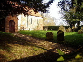
East Worldham is a village and former civil parish, now in the parish of Worldham, in the East Hampshire district of Hampshire, England. It is 1.9 miles (3.1 km) east of Alton; and 1.9 miles (3.1 km) south-west of Wyck. Hartley Mauditt and West Worldham are nearby, which, along with East Worldham, form the parish of Worldham. The village is just east of the A31 road and contains St Mary's Church and the Three Horse Shoes pub, amongst other buildings. Worldham Golf Course located just to west and Dean Farm Golf Course just to the east. For centuries the village and surrounding parish were owned by Winchester College. In 1931 the parish had a population of 208.
West Worldham is a small village and former civil parish, now in the parish of Worldham, in the East Hampshire district of Hampshire, England. It is 2.1 miles (3.4 km) southeast of the town of Alton. The village of East Worldham is to the East and Hartley Mauditt is to the South, which along with West Worldham form the current Parish of Worldham.

Anna Valley is part of the village and parish of Upper Clatford, Hampshire, United Kingdom. The settlement is located approximately 1.0 mile (1.6 km) south-west of the market town of Andover.
Woolton Hill is a village in Hampshire, England, in the civil parish of East Woodhay. The village lies approximately 4 miles (6 km) south-west of the centre of Newbury and encompasses the hamlet of Broad Layings on its northern edge.

Foxcotte is a small hamlet in the civil parish of Charlton in the Test Valley district of Hampshire, England. Its nearest town is Andover, which only lies approximately 1.7 miles (2.7 km) south-east from the hamlet.

