Vanderbilt, Texas

Last updated

Vanderbilt, Texas
TXMap-doton-Vanderbilt.PNG
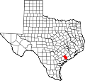
Location of Vanderbilt, Texas
Jackson County Vanderbilt.svg
Coordinates: 28°49′20″N96°36′57″W / 28.82222°N 96.61583°W / 28.82222; -96.61583
Country Flag of the United States.svg United States of America
State Flag of Texas.svg  Texas
County Flag of Jackson County, Texas.png Jackson
Area
  Total1.9 sq mi (4.9 km2)
  Land1.9 sq mi (4.9 km2)
  Water0.0 sq mi (0.0 km2)
Elevation
39 ft (12 m)
Population
 (2010)
  Total395
  Density207/sq mi (80.0/km2)
Time zone UTC-6 (Central (CST))
  Summer (DST) UTC-5 (CDT)
ZIP code
77991
Area code 361
FIPS code 48-74984 [1]
GNIS feature ID1370583 [2]

Vanderbilt is an unincorporated community and census-designated place (CDP) in Jackson County, Texas, United States. The population was 395 at the 2010 census. [3]

Contents

History

Vanderbilt was established in 1904, built around the St. Louis, Brownsville and Mexico Railway station of the old Mitchell spread in the George Ewing league. The community has served as a trade center for local farmers and traders. At one time there was a hotel in the community. A post office was built in 1907 and was in use through 1988, when a new one was built. The ZIP Code is 77991. By 1945, Vanderbilt had a population of 300 and about 10 stores and trading posts. The town's population reached 900 in 1962, the highest in its history. By 1971, the town was back down to 667, where it remained stable until 1990. Then, there were only five stores remaining in town, and the population decreased by the hundreds.

Geography

Vanderbilt is located in southwestern Jackson County at 28°49′20″N96°36′57″W / 28.82222°N 96.61583°W / 28.82222; -96.61583 (28.822110, -96.615708). [4] It is 13 miles (21 km) by road south of Edna, the county seat.

According to the United States Census Bureau, the Vanderbilt CDP has a total area of 1.9 square miles (4.9 km2), all land. [3]

Demographics

As of the census [1] of 2000, there were 411 people, 146 households, and 111 families residing in the CDP. The population density was 217.2 inhabitants per square mile (83.9/km2). There were 163 housing units at an average density of 86.1 per square mile (33.2/km2). The racial makeup of the CDP was 65.94% White, 10.46% African American, 0.24% Native American, 20.19% from other races, and 3.16% from two or more races. Hispanic or Latino of any race were 32.12% of the population.

There were 146 households, out of which 41.1% had children under the age of 18 living with them, 56.8% were married couples living together, 11.6% had a female householder with no husband present, and 23.3% were non-families. 22.6% of all households were made up of individuals, and 10.3% had someone living alone who was 65 years of age or older. The average household size was 2.82 and the average family size was 3.32.

In the CDP, the population was spread out, with 30.4% under the age of 18, 10.9% from 18 to 24, 25.8% from 25 to 44, 23.1% from 45 to 64, and 9.7% who were 65 years of age or older. The median age was 35 years. For every 100 females, there were 98.6 males. For every 100 females age 18 and over, there were 107.2 males.

Education

Vanderbilt is served by the Industrial Independent School District and is home to the Industrial High School Cobras.

The closest colleges to Vanderbilt are Victoria College [Victoria, TX] (27 mi; 2,511 students), Wharton County Junior College [Wharton, TX] (50 mi; 3,124 students), and Coastal Bend College [Beeville, TX] (83 mi; 2,150 students). The closest major university is the University of Houston–Victoria [Victoria, TX] (30 mi; 4,491 students).

Related Research Articles

<span class="mw-page-title-main">Wharton County, Texas</span> County in Texas, United States

Wharton County is a county located in the U.S. state of Texas. As of the 2020 census, its population was 41,570. Its county seat is Wharton. The county was named for brothers William Harris Wharton and John Austin Wharton.

<span class="mw-page-title-main">Austin County, Texas</span> County in Texas, United States

Austin County is a rural, agricultural dominated county in the U.S. state of Texas. As of the 2020 census, the population was 30,167. Its seat is Bellville. The county and region was settled primarily by German emigrants in the 1800s.

<span class="mw-page-title-main">Denali Park (CDP), Alaska</span> Census-designated place in Alaska, United States

Denali Park, formerly McKinley Park, is a census-designated place (CDP) in Denali Borough, in the U.S. state of Alaska. As of the 2020 census, the population of the CDP was 163, down from 185 at the 2010 census.

<span class="mw-page-title-main">Shorewood–Tower Hills–Harbert, Michigan</span> Census-designated place & unincorporated communities in Michigan, United States

Shorewood–Tower Hills–Harbert is a census-designated place (CDP) composed of several small unincorporated communities in Chikaming Township of Berrien County in the U.S. state of Michigan. The population was 1,249 at the 2020 census. The CDP is limited to Chikaming Township, although some of the communities extend into southern Lake Township. All of the communities are located either upon or just east of the dunes on the shore of Lake Michigan. Most of the communities lie west of Interstate 94, although the CDP includes a small area east of the freeway up to Sawyer, Michigan. The township is a popular resort destination.

<span class="mw-page-title-main">Spring Mills, Pennsylvania</span> Census designated place in Pennsylvania, United States

Spring Mills is an unincorporated community and census-designated place (CDP) in Centre County, Pennsylvania, United States. It is part of the State College, Pennsylvania Metropolitan Statistical Area. The population was 268 at the 2010 census.

<span class="mw-page-title-main">Portage Township, Potter County, Pennsylvania</span> Township in Pennsylvania, United States

Portage Township is a township in Potter County, Pennsylvania, United States. The population was 163 at the 2020 census.

<span class="mw-page-title-main">Hometown, Pennsylvania</span> CDP in Pennsylvania, United States

Hometown is a village in Rush Township, Schuylkill County, Pennsylvania, United States that sits astride a crossing point between important transportation corridors. The population was 1,399 at the 2000 census, and excepting for the area near the east–west PA 54 running mostly parallel to the tracks of the Reading, Blue Mountain, and Northern Railroad — once the important east-west shortline Nesquehoning & Mahanoy Railroad — and the PA 54 junction with PA 309.

<span class="mw-page-title-main">Welcome, South Carolina</span> Census-designated place in South Carolina, United States

Welcome is a census-designated place (CDP) in Greenville County, South Carolina, United States. The population was 6,668 at the 2010 census. It is part of the Greenville–Mauldin–Easley Metropolitan Statistical Area. Welcome has been noted for its colorful place name.

<span class="mw-page-title-main">Goldsmith, Texas</span> City in Texas, United States

Goldsmith is a city in Ector County, Texas, United States. The population was 257 at the 2010 census. It is part of the Odessa Metropolitan Statistical Area.

<span class="mw-page-title-main">New Territory, Sugar Land, Texas</span> Place in Texas, United States

New Territory is a master-planned community within the city of Sugar Land, Texas, United States. It was formerly a census-designated place (CDP) and in the extraterritorial jurisdiction of Sugar Land, in unincorporated Fort Bend County. It was annexed into Sugar Land on December 12, 2017. The population was 15,186 at the 2010 census, up from 13,861 at the 2000 census.

<span class="mw-page-title-main">Markham, Texas</span> CDP in Texas, United States

Markham is a census-designated place (CDP) in Matagorda County, Texas, United States. Named in 1903 for Charles H. Markham, a railroad engineer for Southern Pacific, the town was founded in 1901 as Cortes. In 1914, it was a designated stop on the Texas and New Orleans Railroad.

<span class="mw-page-title-main">Tierra Grande, Texas</span> CDP in Texas, United States

Tierra Grande is a census-designated place (CDP) in Nueces County, Texas, United States. The population was 403 at the 2010 census, up from 362 in 2000.

<span class="mw-page-title-main">Redford, Texas</span> CDP in Texas, United States

Redford is a census-designated place (CDP) in Presidio County, Texas, United States. The population was 90 at the 2010 census.

<span class="mw-page-title-main">La Victoria, Texas</span> CDP in Texas, United States

La Victoria is a census-designated place (CDP) in Starr County, Texas, United States. La Victoria went through some changes prior to the 2010 census. It gained area, had parts taken to form new CDPs, and lost additional area. Only a small part of 2010 La Victoria CDP was within the 2000 La Victoria CDP. The population was only 171 at the 2010 census down from 1,683 at the 2000 census.

<span class="mw-page-title-main">Cienegas Terrace, Texas</span> CDP in Texas, United States

Cienegas Terrace is a census-designated place (CDP) in Val Verde County, Texas, United States. The population was 3,424 at the 2010 census.

<span class="mw-page-title-main">Inez, Texas</span> CDP in Texas, United States

Inez is a census-designated place (CDP), on Interstate 69/U.S. Highway 59 fifteen miles northeast of Victoria, Texas, near the Jackson County, Texas line in Victoria County, Texas, United States. The population was 2,098 at the 2010 census. It is included in the Victoria, Texas, Metropolitan Statistical Area. The name is that of a daughter of a railroad developer.

Laredo Ranchettes is a census-designated place (CDP) in Webb County, Texas, United States. The population was 22 at the 2010 census.

Ranchitos Las Lomas is a census-designated place (CDP) in Webb County, Texas, United States. The population was 167 at the 2020 census. Las Lomas means "the hills" in Spanish.

<span class="mw-page-title-main">Hungerford, Texas</span> CDP in Texas, United States

Hungerford is a census-designated place (CDP) in northeastern Wharton County, Texas, United States. U.S. Route 59, Texas State Highway 60, and Farm to Market Road 1161 intersect in the community. The Kansas City Southern Railway Co. passes through Hungerford. The population was 347 at the 2010 census. It is located on what in the 1820s was part of colonist Alexander Jackson's land grant north of George E. Quinan's home. By the 1870s, the Quinan settlement grew up a short distance away, but its residents moved to the new town when the railroad came through Hungerford.

<span class="mw-page-title-main">Cross Lanes, West Virginia</span> Census-designated place in West Virginia, United States

Cross Lanes is a census-designated place (CDP) and suburb of Charleston in Kanawha County, West Virginia, United States. As of the 2010 census, its population was 9,995.

References

  1. 1 2 "U.S. Census website". United States Census Bureau . Retrieved January 31, 2008.
  2. "US Board on Geographic Names". United States Geological Survey. October 25, 2007. Retrieved January 31, 2008.
  3. 1 2 "Geographic Identifiers: 2010 Census Summary File 1 (G001): Vanderbilt CDP, Texas". American Factfinder. U.S. Census Bureau. Archived from the original on February 13, 2020. Retrieved December 6, 2018.
  4. "US Gazetteer files: 2010, 2000, and 1990". United States Census Bureau. February 12, 2011. Retrieved April 23, 2011.