
Thane district is a district in the Konkan Division of Maharashtra, India. At the 2011 Census it was the most populated district in the country, with 11,060,148 inhabitants; however, in August 2014 the district was split into two with the creation of a new Palghar district, leaving the reduced Thane district with a 2011 Census population of 8,070,032. The headquarters of the district is the city of Thane. Other major cities in the district are Navi Mumbai, Kalyan-Dombivli, Mira-Bhayander, Bhiwandi, Ulhasnagar, Ambarnath, Badlapur, Murbad and Shahapur.

Salsette Island is an island in Konkan division of the state of Maharashtra, on India's west coast. Administratively known as Greater Mumbai, the city district of Mumbai, Mumbai Suburban district, Mira Bhayander, and a portion of Thane lie within it, making it very populous and one of the most densely populated islands in the world. It has a population of more than 20 million inhabitants living on an area of about 619 square kilometres (239 sq mi).
Mira Road is a suburb north of Mumbai in Thane District and is also a part of the Mumbai Metropolitan Region. It falls within the Police Jurisdiction of Mira-Bhayander, Vasai-Virar Police Commissionerate. Mira Road is situated in the north-western portion of Salsette Island, Maharashtra state, India. Mira Road has a large Gujarati population followed by Marathis along with other ethnic groups.

Vasai is a historical place and city located in Palghar district; which was partitioned out of the Thana district in 2014. It also forms a part of Vasai-Virar twin cities in the Konkan division, Maharashtra, India and comes under Police Jurisdiction of Mira-Bhayander, Vasai-Virar Police Commissionerate.

Virar is a coastal city in taluka Vasai and district of Palghar, in India's Maharashtra state. It is clubbed into Vasai-Virar city, administered by Vasai-Virar Municipal Corporation. It lies in south part of Palghar District in Vasai Taluka and north to the city of Mumbai. It is an important part of Palghar District because Palghar is the outermost part of northern side of Mumbai Metropolitan Region and comes under Police Jurisdiction of Mira-Bhayander, Vasai-Virar Police Commissionerate.

Thane Creek is an inlet in the shoreline of the Arabian Sea that isolates the city of Mumbai from the Konkan region of the Indian mainland. It comprises the area between Mumbra Retibunder and the Mankhurd-Vashi Bridge. The creek is divided into two parts. The first part lies between Ghodbunder and Thane (Thana), a section from where the Ulhas river flows from the north of Mumbai Island to meet the Arabian Sea on the west. The second part of the waterway lies between the city of Thane and the Arabian Sea at Trombay / Uran, before the Gharapuri islands.

Mumbai Harbour, is a natural deep-water harbour in the southern portion of the Ulhas River estuary. The narrower, northern part of the estuary is called Thana Creek. The harbour opens to the Arabian Sea to the south. The historical island of Elephanta is one of the six islands that lie in the harbour.
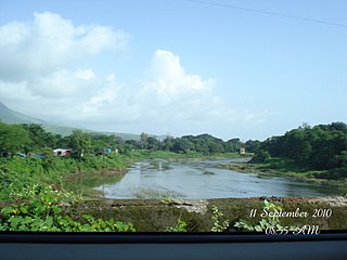
The Ulhas River is a river in Maharashtra, India. It is in the Thane, Raigad, and Pune districts of that state. It flows north and west from it source to where it splits into Vasai Creek and Thane Creek, near Thane. The Ulhas divides Salsette Island from the mainland, and is important for the water supply of Mumbai.

Fort Vasai is a ruined fort of the town of Vasai (Bassein), Palghar, Maharashtra, India. The structure was formally christened as the Fort of St. Sebastian in the Indo-Portuguese era. The fort is a monument of national importance and is protected by the Archaeological Survey of India.
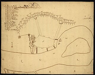
The Battle of Vasai or the Battle of Bassein was fought between the Marathas and the Portuguese rulers of Vasai, a town near Mumbai (Bombay) in the Konkan region of the present-day state of Maharashtra, India. The Marathas were led by Chimaji Appa, a brother of Peshwa Baji Rao I.

The Konkan Division is one of the six administrative divisions of Maharashtra state in India. It comprises the central portions of the Konkani region excluding Goa and Damaon, which were absorbed into Maharashtra owing to the States Reorganisation of India. Konkan Division is the western section of present-day Maharashtra, along the west coast of India. The two districts of the state capital Mumbai also fall into this division.

Chimaji Balaji Bhat (1707–1740), commonly referred to as Appa or Bhau, was the son of Balaji Vishwanath Bhat and the younger brother of Bajirao Peshwa of Maratha Empire. He was an able military commander who liberated the western coast of India from Portuguese rule. The high watermark of his career was the capture of Vasai fort from the Portuguese.
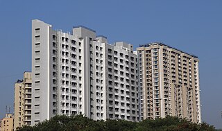
Mira-Bhayandar is a city and municipal corporation in Thane district in the state of Maharashtra, India located in the northern part of Salsette Island before the Vasai Creek, and shares a border with North Mumbai. Mira-Bhayandar is administered by Mira-Bhayandar Municipal Corporation (MBMC), with a population at the 2011 Census of 809,378. Mira-Bhayandar is a part of Mumbai Metropolitan Region (MMR) and Mira-Bhayander, Vasai-Virar (MBVV) Police Commissionerate.

Panju Island is an estuarine island in the Vasai Creek just north of Mumbai. The island is used by the Western Railway to connect the island of Salsette with the mainland at Vasai. It is located at 19.333°N 72.85°E with a maximum elevation of 1 m (3 ft).
Bhayandar also spells as Bhaindar or Bhayander is a suburb located in the western suburbs of Mumbai and the northern most suburb of the island on the western side, near the Vasai Creek. It has a large Gujarati and Marwari population as well other mixed populations as well. It falls under the North Central ward of the Municipal Corporation and comes under Police Jurisdiction of Mira-Bhayander, Vasai-Virar Police Commissionerate
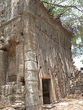
Bombay, also called Bom Bahia or Bom Baim in Indo-Portuguese creole, Mumbai in the local language; is the financial and commercial capital of India and one of the most populous cities in the world. It's also the cosmopolitan city centre of the Greater Bombay Metropolitan Area, and the cultural base of the Bollywood film industry. At the time of arrival of the Portuguese Armadas, Bombay was an archipelago of seven islands. Between the third century BCE and 1348, the islands came under the control of successive Hindu dynasties. The Delhi Sultanate had been ruling the area along with Chaul, New Bombay (Thana) & Damaon, with the administrative centre in Bassein (Vasai) since the raids of Malik Kafur in the Konkan region and across the Indian subcontinent. This territory in North Konkan along with the Bombay islands were later taken over by the Sultan of Guzerat from 1391 to 1534, when he had declared the end of the suzerainty to Delhi, after the Timurid invasion of it. Growing apprehensive of the power of the Moghal emperor Humayun, Sultan Bahadur Shah of Gujarat was obliged to sign the Treaty of Bassein on 23 December 1534; according to which, the seven islands of Bombay, Fort San Sebastian of Bassein in strategic town of Bassein (Vasai), and its dependencies were offered to the Portuguese East Indies. The places were only later officially surrendered on 25 October 1535, by the Sultan of Guzerat.

Vasai-Virar is an agglomeration of four previously governed municipal councils: Vasai (Bassein), Virar, Nallasopara and Navghar-Manikpur, as well as a few towns to the east and west of the urban area. It lies in the Konkan division of Maharashtra, India.

Bhayandar is a railway station on the Western line of the Mumbai Suburban Railway network.
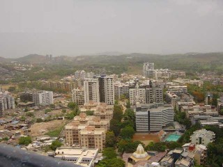
The Western Suburbs is the western precinct of the city of Mumbai, India. The Western Suburbs consist of Andheri, Bandra, Bhayander, Borivali, Dahisar, Goregaon, Jogeshwari, Juhu, Kandivali, Khar, Malad, Mira Road, Santacruz and Vile Parle. Geographically, the Western Suburbs lie at the western part of Salsette Island, is a continuous urban sprawl spanning the areas from Bandra to Bhayander, which is separated by the Vasai Creek from Vasai-Virar city and Mithi River from Mumbai city district.

Palghar District is a district in the state of Maharashtra in Konkan Division. The headquarters of the district is the town of Palghar. Other major cities in the district are Vasai-Virar, Talasari, Jawhar and Dahanu.


