Maharashtra Maritime Board

Last updated

Maharashtra Maritime Board Logo MMB, Logo.gif
Maharashtra Maritime Board Logo

The Maharashtra Maritime Board is governmental organisation in the state of Maharashtra, India. The board is tasked with the administration of ports and harbours, conservancy, licensing of crafts, levying of fees, regulation and control of traffic. Maharashtra Maritime Board (MMB) came into existence in 1996 and Commissioner, Water Transport was re-designated as chief executive officer, MMB. [1]

Contents

Commissionerate of Water Transport was formed in 1990 by amalgamating 3 departments within the Port Organisation, i.e. CPO, Hydrographer and Marine Engineer, for better co-ordination and to promote development of minor and intermediate ports in the State of Maharashtra, and to administer, control and manage these ports. [1] [2]

Background

Maharashtra is bestowed with a coastline of 720 km, of which Greater Mumbai District has approximately 114 km, Thane District 127 km, Raigad District 122 km, Ratnagiri District 237 km, and Sindhudurg District 120 km. There are 48 Intermediate & Non-Major Ports and 35 creeks on this coastline. [3] The Port Organisation under the Buildings and Communications Department was formed by the State Government on 1 April 1963 under the control of Chief Ports Officer – Maharashtra State. Administration of ports and harbours, conservancy, licensing of crafts, levying of fees and regulation/ control of traffic etc. were entrusted to this organisation. [2]

There are 48 intermediate and minor ports situated on the coast of Maharashtra, which are organised in five Groups, each headed by a Port Officer. Following five groups of ports were formed, which are each headed by a Port Officer:

No.GroupPorts
1.Bandra Group of Ports Dahanu, Tarapur, Navapur, Satpati, Kelwa-Mahim, Arnala (including Datiware), Vasal, Uttan, Versova, Manori and Bandra
2.Mora Group of Ports Trombay including Mahul, Panvel (Ulwa-Belapur), Mora, Karanja (including Rewas & Dharamtar), Mandwa, Thane, Bhiwandi and Kalyan
3.Rajpuri Group of PortsThal, Alibag, Revdanda, Borli-Mandala, Nandgaon, Murud-Janjira, Rajpuri (Dighi), Mandad, Kumbharu and Shrivardhan
4.Ratnagiri Group of Ports Bankot, Kelshi, Harnai, Dabhol, Palshet, Borya, Jaigad, Varoda (Tivrli), Ratnagiri, Purnagad and Jaitapur
5.Vengurla Group of Ports Vijaydurg, Devgad, Achara, Malvan, Nivati, Vengurla, Redi and Kiranpani

For better co-ordination between its three branches vide GR dated 31 August 1990 the State Government created a post of Commissioner, Water Transport as Head of Department of the state’s Port Organisation. [2] [3]

As a sequel to the liberalisation policy pursued by the Central Govt. in the early nineties, the State Govt. decided to transform this organization, thus far under the Commissioner, Water Transport, and constitute Maharashtra Maritime Board, with the Minister of Ports as its chairman. [1] [2]

Ports in Maharashtra

Mumbai has three ports, Mumbai Port , Jawaharlal Nehru Port (JNP) and another big port Dharamtar Port located in Mumbai Metropolitan Area. While Mumbai port has been acting as one of the major gateways for more than a century, JNP since its establishment in 1990s has emerged as a premier container handling port, accounting for almost 55% of the container traffic movement amongst the major ports in India. [2]

The operational minor ( non-major) ports under Maharashtra Maritime Board( MMB) handling cargo include the ports at Dahanu, Tarapur, Dharamtar, Ulwa-Belapur, Trombay, Revdanda, Dighi, Dabhol, Bankot, Kelshi, Ratnagiri, Jaigad, Vijaydurg and Redi. The total cargo handled at the minor ports increased from 8.5 Million Tonnes in 2002-03 to 11.1 Million Tonnes in 2005-06. The cargo commodities handled at the minor ports are bulk cargo and include coal, clinker, iron ore, limestone, cement, bauxite, sand, LPG, molasses etc. [2]

MMB has also conceptualised Inland Water Transport projects under the centrally sponsored Scheme of Ministry of Shipping, GoI. Some of these include [2] -

Efforts are also on to develop passenger water transport projects around Mumbai. [2] [3]

Board

Hon. Minister (Ports) Shri. Aslam Shaikh (Cabinet Minister for Ports Maharashtra )Chairman
Hon. State Minister (Ports)Vice Chairman
Secretary (Ports)Member
Secretary (Industries)Member
Secretary (Finance)Member
Representative of NavyMember
Chief Executive OfficerMember Secretary
Non-official membersSIX other members

Functions

The functions of the Maharashtra Maritime board are: [3]

Organization Chart Mm-organization-chart.jpg
Organization Chart

Performance Highlights

The following are the performance highlights of the Maharashtra Maritime Board: [3]

Developments

Port Project

The Government of Maharashtra has encouraged development of port sector and adopted an investor-friendly Port Policy. The port policy has evolved over the years with considerable changes during 1996, 2000, 2002. The salient features of the port policy are: [4]

Upcoming ports in Maharashtra

In our endeavour to develop the port sector for meeting the requirements of India’s growing economy and to address the needs of its industry, we have entered into six Concession Agreements for development of minor ports, namely: [4]

  1. Rewas-Aware Port
  2. Dighi Port
  3. Jaigad Port (Dhamankhol Bay)
  4. Jaigad Port (Lavgan)
  5. Vijaydurg Port
  6. Redi Port
  7. Yogayatan Port (Mankhurd)

Multipurpose Terminals

The Government of Maharashtra has declared a policy for construction of multipurpose jetties on 19 August 2005 to promote transportation of cargoes through short-sea shipping (SSS — Coastal Route).These Jetties can also handle international cargo through lighter-age operations. [4]

Salient Features of the policy

  • Site Identification be done by the developer
  • Project will be developed on Build, Own, Operate & Transfer (BOOT) basis
  • Period of concession will be up to a maximum of 30 years, which includes 2 years for construction
  • Techno-Economic Feasibility (TEFS) Report from the developer is a necessary requirement
  • Public Notification (Swiss challenge)

MMB invites entrepreneurs to set up multi purpose terminals along the Maharashtra coast-line for their multipurpose cargoes. These terminals would be of great help to cope with the surging need for maritime infrastructure, especially port facilities. [4]

Multi-purpose terminals in operation

Sr. No.PortCompany using terminalCargoStatus
1. Karanja (Navi Mumbai)PNP Maritime Services Ltd.Iron Ore, Coke/ Coal, Sulpher, BauxiteIn operation since 2015
2.Jaigad (Lavgan)Lavgan Dockyard Ltd.Bauxite, MolassesIn operation since 2005
3.Jaigad (Katale)Marine Syndicate Ltd.BauxiteIn operation since February, 2009

Permissions granted to multi-purpose terminals

Sr. No.PortCompany using terminalActivity/ Cargo to be handledStatus
1. TrombayMankhurd in Thane creekM/s. Yogayatan Ports Pvt. Ltd.Ship repair and Dry bulkAgreement signed
2. Karanja – Khopta village in Karanja CreekM/S. Continental Warehousing Corporation Ltd.Containers and Dry bulkAgreement signed
3. Revdanda – village Sanegaon in Kundalika river/ Revdanda creekM/S. Indo Energy International Ltd.Bulk cargoAgreement signed
4.Karanja (Chanje, Dist. Raigarh)M/s Karanja Infrastructure Pvt. Ltd.Bulk, bagged & containersAgreement signed

Captive Jetties

In order to facilitate import of raw materials and export of finished goods for industries located on Maharashtra’s coastal belt, the Government has floated a policy for construction of captive jetties on its coast. The broad features of the policy are: [4]

Captive terminals in operation

Sr. No.PortCompany using the TerminalCargoStatus
1. Panvel (Ulwa–Belapur) Ambuja Cements Ltd. Bulk CementIn operation since 1994
2. Alibag (Dharamtar) Ispat Industries Ltd.Iron Ore, Coke / Coal, Sponge Iron, ClinkerIn operation since 1994
3. Revdanda Vikram Ispat Ltd.Iron Ore/ Pallets / Fines, HBI, DRIIn operation since 1993
4. Ratnagiri (Pawas–Ranpar)Finolex Industries Ltd.EDC, Ethylene & LPGIn operation since 1993

Projects in progress

Sr. No.PortCompany using TerminalPermitted CargoStatus
1. Dabhol Ratnagiri Gas and Power Pvt. Ltd. (previously Dabhol Power Co.)LNG NapthaAgreement likely to be signed
2. Dharamtar – Dherand Supreme Petrochem Ltd.Styrene Monomer (Liquid cargo)30 years Concession Agreement signed on 29 June 2004

Permissions given by MMB

Sr. No.PortCompanyCargo
1. Vasai Good Earth Maritime Pvt. Ltd.Salt
2.Vasai-Bhayander Saurashtra CementBulk Cement
3. Dabhol GMR EnergyCoal
4. Dharamtar – Dherand/Shahapur Tata Power Coal
5.Dharamtar – Shahapur Reliance Infrastructure Ltd.Coal

Shipyards

MMB is encouraging private developers to set up shipyards on the Maharashtra coast. Government offers following incentives: [4]

Shipyards in operation

Sr. No.Port/LocationCompany
1.Usgaon, DabholM/s. Bharati Shipyard Ltd.
2.Bhagwati Bunder, Ratnagiri M/s. Bharati Shipyard Ltd.

Shipyard permissions given by MMB

Sr. No.Port/LocationCompanyStatus
1. Dharamtar, Masad-Khurd M/s. BHP Engg.Agreement signed
2.Dharamtar, MankuleM/s. SKS Logistics Ltd.Agreement yet to be signed
3. Khardi, Palghar, Dist. Thane M/s. Mech Marine Engrs. P. Ltd.Agreement yet to be signed
4. Safale, Palghar, Dist. ThaneM/s. King Prawns Ltd.Agreement yet to be signed
5.Belapur, Tal. Panvel, Dist. Raigad M/s. Maldar Dredgers & Salvagers Pvt. Ltd.Agreement signed
6.Tulsunde, Tal. Rajapur, Dist. Ratnagiri M/s. Safe & Sure Shipyard Ltd.Agreement yet to be signed
7.Turumbad, Murud-Janjira Dist. RaigadM/s. Bombay Marine Engg. Pvt. Ltd.Agreement yet to be signed
8.Mankule, DharamtarM/s. Amma Lines Ltd.Agreement yet to be signed
9.Rajpuri Creek Rohini/ TurumbadM/s. Das OffshoreAgreement signed
10.Village Kurul, Alibag M/s. Konkan Barge Builder Pvt. Ltd.Agreement yet to be signed

Inland Water Transport

Maharashtra has 35 creeks and rivers spread across 720 km long coast line. As per available information, approx. 15 million passengers in the coastal districts of the state use Inland Water Transport annually. The State Government has recognized the importance of Inland Water Transport and has tasked MSRDC as the implementing agency for development of passenger jetties on the Western Coast of Mumbai from Nariman Point to Borivali and on the Eastern Coast of Mumbai from South Mumbai to Navi Mumbai. [4] The Government of India, Ministry of Shipping under centrally sponsored scheme for development of inland water transport has approved eight projects in Maharashtra State at an estimated cost of Rs. 30 crores. The sites approved are Vishnupuri and Isapur in district Nanded, and Karanja, Mandwa, Rajpuri, Janjira, Dighi, and Agardanda in district Raigad. These projects are at various stages of implementation. [4] The minor ports of Maharashtra together handled around 130.48 lakh passenger traffic during April to December, 2006 of which 118.70 lakh passenger traffic was through mechanised vessels and 12.7 lakh was by non-mechanised vessels. [2] Maharashtra Maritime Board (MMB) is developing the following IWT projects under the Centrally Sponsored Scheme of Ministry of Shipping, GoI and includes: [2]

  1. In Godavari River at Vishnupuri, Nanded
  2. In Vashishti River (Dabhol Creek) at Dabhol to Dhopave
  3. In Savitri River (Bankot Creek) at Veshvi and Bagmandla
  4. In Jaigad Creek at Tavsal to Jaigad Port
  5. From South Mumbai to Amba River/Dharamtar Creek at Mandwa
  6. From South Mumbai to Amba River/Dharamtar Creek at Karanja
  7. In Mhasla/Mandad River (Rajpuri Creek) at Rajpuri
  8. In Mhasla/Mandad River (Rajpuri Creek) at Janjira Fort
  9. In Mhasla / Mandad River (Rajpuri Creek) at Dighi to Agardanda
  10. In Mhasla/Mandad River (Rajpuri Creek) at Agardanda to Dighi
  11. From South Mumbai to Amba River/Dharamtar Creek at Rewas
  12. For eco-tourism project at Isapur, District Nanded, Maharashtra

MMB has also formulated the following projects for IWT development which are under consideration by Ministry of Shipping, Government of India: [4]

MMB is also planning to develop passenger water transport projects around Mumbai. [4] Following is the proposed network [2] [4]

RouteFromTo
Western Sea RouteNariman PointBorivali
Eastern Sea RouteSouth Mumbai / Gateway of IndiaThane / Navi Mumbai
Cross Harbour RouteGateway of India / Ferry Wharf / South MumbaiMandwa – Rewas, JNPT, Elephanta

Marina

Marina development is a popular leisure activity throughout the world and reflects the economic development of an area. Due to high-end economic activities in the state, there is huge potential for developing marinas. Marinas attract users of speed boats & yachts and promote tourism. They also give rise to ancillary activities e.g. construction, maintenance facilities and logistic support for leisure activities; which in turn generate employment. Marinas would also help decongest water areas by eliminating un-authorised/ un-organised anchorages. [4]

Short-listed probable sites in and around Mumbai are:

Tourism & Water Sports

Dist. Sindhudurg, especially Malvan has already been declared as a marine park. This site has all the ingredients to be developed into a place of tourist attraction. This area is an ideal location for tourism and water sports activities. In addition, other potential area identified by the investors may also be considered for developing tourism and water sport activities. [4]

Wings of MMB

Marine Engineering Department

Chief Surveyor and Marine Engineer, Maharashtra Maritime Board is the Head of Department of Marine Engineering and Survey Section. This department undertakes Maintenance, Repairs and Operation of Floating Crafts. Currently, Maharashtra Maritime Board has 1 Dredger, 2 Barges, 1 Tug, 1 Mooring launch, 3 Survey Launches and 6 Speed Boats. [5] The Marine Engineering Department looks after designing & acquisition of marine crafts, development of dredging units, and execution of dredging activities. Department also undertakes acquisition and maintenance of navigational aids such as Buoys, Light Buoys, Beacons, Navigational Lights and Storm Warning Signals etc. [5] At present MMB has 47 Light-houses at various ports, 29 Navigational Buoys in navigational channels and 37 Storm warning signals to assist the fishermen, passenger traffic and commercial ships at various ports. Under Inland Vessel Act 1917, this department conducts surveys, inspections and certification of vessels. It also conducts examinations for granting Certificates of Competency as 1st Class Master, 2nd Class Master, Serang, Engineer, 1st Class Engine Driver and 2nd Class Engine Driver, after the applicants secure requisite I.V. service for appearing these examinations. [5]

Survey under Inland Vessel Act, 1917

Survey of Inland Vessels is conducted by the Chief Surveyor and Marine Engineer of the MMB. Inspection of I.V.s plying in inland waterways is carried out for checking their performance and suitability i.e. sea-keeping aspects in sheltered waters.

On payment of government prescribed fees by an applicant, MMB Surveyor boards a vessel for a reasonable time to inspect the vessel’s structure, machinery, equipments and appliances viz. life saving appliances, fire fighting equipments and navigational aids, underwater hull inspection reports, and certificates of Master and Engine Driver. Surveyor also conducts enquiry in case of an accident. [5]

The approved (by a Naval Architect) drawings and plans of the craft, which is under construction and intending to ply in inland waterways, throughout all its construction stages and final reports of trial of the vessel for seaworthiness, inclining experiment for stability, are to be sent for inspection by the MMB Surveyor.

If the surveyor is fully satisfied as to all the requirements having been complied with, and defects on the vessel, if any, is rectified to his full satisfaction, then he issues a declaration of survey to the applicant and also issues temporary certificate of survey.

The applicant on receipt of the declaration of survey delivers the papers (all copies of Life Saving Equipments, Fire Fighting Appliances and Master’s & Driver’s certificates along with the declaration ) to the O/o Chief Surveyor and Marine Engineer and takes the delivery of Certificate of Survey within 7 days. Unless specifically requested by the applicant, Certificate of Survey is not transmitted by post. [5]

Hydrographic Department

Hyrographer is the Head of the Hydrographic department within the MMB. Various hydrographic studies are carried out under his supervision.

These studies help establish need for dredging in the identified areas. He undertakes pre and post Hydrographic Surveys for dredging requirements and has a data bank of over 1150 bathymetric charts, which are made available to the users on payment. [5]

He also undertakes surveys related to navigational safety and port development, provides bathymetric data for all potential sites for planning and execution of various projects, and undertakes the work of publication of Tides every year. The Hydrographic Department has three full-fledged survey parties which are equipped with latest hydrographic equipment like Differential Global Positioning System (DGPS), dual frequency echo sounders, current meters, automatic tide gauge, digital level & HYPACK Hydrographic Software. [5]

Civil Engineering Department

Coastal Protection Works

  • Coastal Protection Works are carried out through Coastal Engineer under PWD and funds are provided through DPDC (Rs.15-20 crores)
  • There is no State Level Scheme to provide for coastal protection. [5]
  • Out of total 720 km of coastline, 400.49 km is naturally protected and 141.84 km has been artificially protected. The remaining 177.67 km is vulnerable to erosion and needs to be protected is proposed. Funds required to protect 177.67 km is Rs.1322 crores over next 15 years. A State Level Scheme
  • Maintenance funds are not provided till date. So, Rs.30 crores per year for next three years and thereafter Rs.15 crores per year are required. [5]

Regional Port Offices

The list of offices are as follows: [6]

Main Office: Office of Chief Executive Officer and Office of Chief Port OfficerIndian Mercantile Chambers, 3rd Floor, 14, Ramjibhai Kamani Marg, Ballard Estate, Mumbai 400 038.
HydrographerGovind Patil Marg, Khardanda, Mumbai 400 053, Telefax: 91-22-26044274.

Email: hydro@hathway.com

Marine EngineerDadabhai Navroji Road, Opp. Bhawans college, PWD Compound, Andheri(W), Mumbai 400058.
Regional Port Office (Bandra)Govind Patil Marg, Khardanda, Mumbai 400 053, Telefax: 91-22-26490873
Regional Port Office (Mora)Chendani Koliwada, Thana (east)
Regional Port Office (Murud-Janjira)Taluka Alibaug, Raigad district
Regional Port Office (Ratnagiri)Mandvi, Ratnagiri district 415612
Regional Port Office (Vengurla)At & Post Vengurla, Sindhudurg district

See also

Related Research Articles

<span class="mw-page-title-main">Short-sea shipping</span> Movement of cargo and passengers by sea along a coast, without crossing an ocean

The modern terms short-sea shipping, marine highway, and motorways of the sea, and the more historical terms coastal trade, coastal shipping, coasting trade, and coastwise trade, all encompass the movement of cargo and passengers mainly by sea along a coast, without crossing an ocean.

<span class="mw-page-title-main">Vasai Creek</span> Creek in Maharashtra, India

Vasai Creek, previously Bassein Creek, is an estuary and one of the two main distributaries of the Ulhas River, in Konkan division of Maharashtra, India. The Ulhas splits at the northeast corner of Salsette island into its two main distributaries, the other one being the Thane Creek, both of which empty west into the Arabian Sea at the Bombay Harbour.

Nagothana is a census town in Roha Taluka, in the Raigad district of the Indian state of Maharashtra. The Kanyakumari - Panvel National Highway # 66 (NH66) goes through this town.
<span class="mw-page-title-main">Adani Ports & SEZ</span> Indian private sector port operator

Adani Ports and Special Economic Zone Limited is an Indian port operator and logistics company. APSEZ is India's largest private port operator with a network of 12 ports and terminals, including India's first port-based SEZ at Mundra.

Rewas(Rewas-Bodani or Revas) is one of 48 “minor” ports of Maharashtra located at Rewas Creek, near Karanja creek at mouth of the Patalganga River about 10 kilometres (6 mi) southward of Jawaharlal Nehru Port (JNPT) and 16 kilometres (9.9 mi) south-east of Mumbai Port. It is controlled by the state government through an agency known as the “Maharashtra Maritime Board”.

The city of Nagpur is strategically located in central India. It has a vast railway network and its road network is well-maintained to avoid congestion. There are 4 modes of transportation in Nagpur. Nagpur is connected to India's four major metropolitan areas by road, rail and air. Auto rickshaws operate in most parts of the city, and are the main form of hired transport.
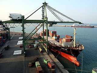
<span class="mw-page-title-main">V.O. Chidambaranar Port Authority</span> Port in  India

V.O. Chidambaranar Port Authority is a port in Thoothukudi, Tamil Nadu, and is one of the 13 major ports in India. It was declared to be a major port on 11 July 1974. It is second largest port in Tamil Nadu and third largest container terminal in India. V.O. Chidambaranar Port is an artificial port. This is the third international port in Tamil Nadu and it is second all-weather port. All V.O. Chidambaranar Port Authority's traffic handling has crossed 10 million tons from 1 April to 13 September 2008, registering a growth rate of 12.08 per cent, surpassing the corresponding previous year handling of 8.96 million tons. It has services to USA, China, Europe, Sri Lanka and Mediterranean countries. The Station Commander, Coast Guard Station Thoothukudi is located at V.O. Chidambaranar Port Authority, Tamil Nadu under the operational and administrative control of the Commander, Coast Guard Region (East), Chennai. The Coast Guard Station V.O. Chidambaranar Port Authority was commissioned on 25 April 1991 by Vice Admiral SW Lakhar, NM, VSM the then Director General Coast Guard. The Station Commander is responsible for Coast Guard operations in this area of jurisdiction in Gulf of Mannar. V.O. Chidambaranar Port Authority Thoothukudi is an ISO 9001:2008, ISO 14001:2004 and International Ship and Port Facility Security (ISPS) Code compliant port.

<span class="mw-page-title-main">Inland Waterways Authority of India</span>

Inland Waterways Authority of India (IWAI) is the statutory authority in charge of the waterways in India. It was constituted under IWAI Act-1985 by the Parliament of India. Its headquarters is located in Noida, Uttar Pradesh.

Agardanda is a village in Murud Janjira Taluka, Raigad district, Maharashtra, India. Located 9 kilometers south of Murud, Agardanda is getting prominence because of the ongoing construction of Dighi port, which is just across the narrow creek. It is also an important transit hub to get across to Dighi, through ferries plying throughout the day at regular intervals.

<span class="mw-page-title-main">Dharamtar</span> Sea port in Maharashtra, India

Dharamtar port is on the right bank of the Amba river and is 10 miles (16 km) from its mouth. Approximately 2 km (1.2 mi) from Wadkhal village on NH-17. The port is 0.5 km (0.31 mi) from the state highway that runs through Pen to Alibag and is 2 km (1.2 mi) away from National Highway 17 (Mumbai—Goa). The port is also adjacent to Mumbai–Goa–Konkan railway line with an approved rail siding. It is a tri-modal port with rail.
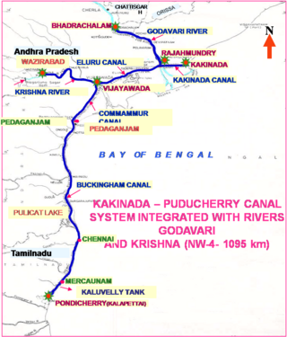
<span class="mw-page-title-main">National Waterway 4</span> Long waterway in India

National Waterway 4 (NW-4) is a 1,095 kilometres (680 mi) long waterway in India. It has been declared as an Indian National Waterway and is currently under development. It connects the Indian states of Telangana, Andhra Pradesh, Tamil Nadu, and the union territory of Puducherry. The NW-4 runs along the Coromandal Coast through Kakinada, Eluru, Commanur, Buckingham Canals and also through part of Krishna and Godavari rivers in South India. It was declared a National Waterway on 24 November 2008 under the Provisions of National Waterways Bill, 2006. It is being developed by the Inland Waterways Authority of India (IWAI), and was scheduled for completion by 2013. The National Waterways Act, 2016 has extended the length of NW-4 from 1,095 km (680 mi) to 2,890 km (1,800 mi) by connecting the Krishna and Godavari Rivers. The Project would be undertaken in 3 phases with first phase beginning in October, 2017 and to be completed by June, 2019

<span class="mw-page-title-main">JSW Group</span> Indian multinational conglomerate

JSW Group is an Indian industrial multinational conglomerate, based in Mumbai. It is led by Sajjan Jindal and is part of the O.P. Jindal Group. The Group's diverse businesses include steel, energy, infrastructure, cement and paints, across India, the United States, South America, and Africa.

Timblo Drydocks Private Limited is a privately owned shipbuilding company based in Goa, India. It was established in the early 1970s and owns a shipyard having area of 10 hectares located on the left banks of the River Zuari in Goa, with a water frontage of more than 350 metres (1,150 ft) and is equipped with two slipways and one assembly bay with side launching facilities.

Maharashtra is a state in western India. It is the country's second-most-populous state and third-largest state by area. Maharashtra is bordered by the Arabian Sea on the west, Gujarat and the Union territory of Dadra and Nagar Haveli on the northwest, Madhya Pradesh on the north and northeast, Chhattisgarh on the east, Karnataka on the south, Telangana on the southeast and Goa on the southwest. The state covers 307,731 km2 (118,816 sq mi), or 9.84 percent of India's total area.

<span class="mw-page-title-main">Vijaydurg Port</span> Port in  India

Vijaydurg Port is a natural harbour on the west coast of the district of Sindhudurg in Maharashtra, India. The port is situated midway between Malvan and Ratnagiri at the mouth of the Vijaydurg creek in Devgad taluka. Its coastal jurisdiction extends 10 km north up to the Jaitapur lighthouse. Goods weighing about 200 tons are generally loaded or unloaded at the port daily. The cargo brought by sea is transported by creek up to Kharepatan which is 26 miles up from Vijayadurg.

<span class="mw-page-title-main">Water transport in Mumbai</span>

Water transport in Mumbai consists of ferries, hovercraft and catamarans.
<span class="mw-page-title-main">Sagar Mala project</span> Indian shipping infrastructure project

The Sagarmala Programme is an initiative by the Government of India to enhance the performance of the country's logistics sector. The programme envisages unlocking the potential of waterways and the coastline to minimize infrastructural investments required to meet these targets.

Varanasi Multi-Modal Terminal or Varanasi Port is an Inland river port situated in the city of Varanasi, Uttar Pradesh. The port is located on the Ganges river. This port is built under the government's Jal Marg Vikas project. The port has provided a direct link with the Port of Kolkata and Haldia Port.

Water transport in India has played a significant role in the country's economy and is indispensable to foreign trade. India is endowed with an extensive network of waterways in the form of rivers, canals, backwaters, creeks and a long coastline accessible through the seas and oceans. It has the largest carrying capacity of any form of transport and is most suitable for carrying bulky goods over long distances. It is one of the cheapest mode of transport in India, as it takes advantage of natural track and does not require huge capital investment in construction and maintenance except in the case of canals. Its fuel efficiency contributes to lower operating costs and reduced environmental impact due to carbon. India has 14500 km of inland waterways. Out of which only 5685 km are navigable by mechanized vessels.
<span class="mw-page-title-main">Federal Agency for Maritime and River Transportation (Russia)</span>

The Federal Agency for Maritime and River Transport (Rosmorrechflot), is a federal executive body in Russian Federation. It is entrusted to manage state property, maintain transport security-related tasks and provide services in the field of maritime and inland waterway transport. It is under the jurisdiction of the Ministry of Transport of the Russian Federation.

References