
The Louisiana Purchase was the acquisition of the territory of Louisiana by the United States from the French First Republic in 1803. This consisted of most of the land in the Mississippi River's drainage basin west of the river. In return for fifteen million dollars, or approximately eighteen dollars per square mile, the United States nominally acquired a total of 828,000 sq mi in Middle America. However, France only controlled a small fraction of this area, most of which was inhabited by Native Americans; effectively, for the majority of the area, the United States bought the preemptive right to obtain Indian lands by treaty or by conquest, to the exclusion of other colonial powers.
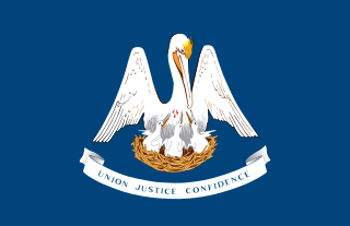
Louisiana is a state in the Deep South and South Central regions of the United States. It is bordered by the state of Texas to the west, Arkansas to the north, Mississippi to the east, and the Gulf of Mexico to the south; a large part of its eastern boundary is demarcated by the Mississippi River. Of the 50 U.S. states, it ranks 20th in land area and the 25th in population, with roughly 4.6 million residents. Reflecting its French heritage, Louisiana is the only U.S. state with political subdivisions termed parishes, which are equivalent to counties, making it one of only two U.S. states not subdivided into counties. The state's capital is Baton Rouge, and its largest city is New Orleans, with a population of roughly 383,000 people.
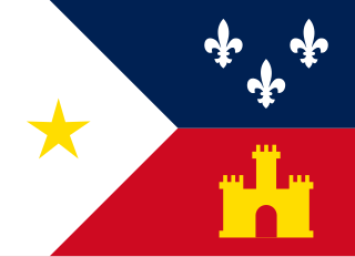
The Cajuns, also known as Louisiana Acadians, are a Louisiana French ethnicity mainly found in the U.S. state of Louisiana.
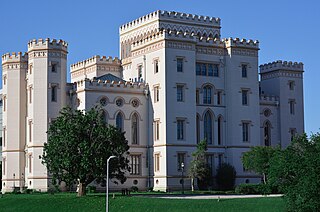
Baton Rouge is the capital city of the U.S. state of Louisiana. Located on the eastern bank of the Mississippi River, it is the parish seat of East Baton Rouge Parish, Louisiana's most populous parish. Since 2020, it has been the second-largest city in Louisiana after New Orleans; Baton Rouge is the 18th-most-populous state capital. According to the 2020 United States census, the city-proper had a population of 227,470; its consolidated population was 456,781 in 2020. The city is the center of the Greater Baton Rouge area—Louisiana's second-largest metropolitan area—with a population of 870,569 as of 2020, up from 802,484 in 2010. Baton Rouge is the fourth most populous city proper in the Deep South region of the southeastern United States.

Grant Parish is a parish located in the North Central portion of the U.S. state of Louisiana. As of the 2020 census, the population was 22,169. The parish seat is Colfax. The parish was founded in 1869 during the Reconstruction era.

Montgomery is a town in the far northwestern portion of Grant Parish, which is located in north-central Louisiana, United States. The population of Montgomery was 726 at the 2010 census. The town has a poverty rate of 37 percent and a median household income of just under $22,000. The median age is just under forty; the population in 2010 was 78 percent white.

Bountiful is a city in Davis County, Utah. As of the 2020 census, the city population was 45,762, an eight percent increase over the 2010 figure of 42,552. The city grew rapidly during the suburb growth of the late 1940s, 1950s, and 1960s and was Davis County's largest city until 1985, when it was surpassed by Layton. Bountiful is Utah's 18th-largest city.

The Territory of Louisiana or Louisiana Territory was an organized incorporated territory of the United States that existed from July 4, 1805, until June 4, 1812, when it was renamed the Missouri Territory. The territory was formed out of the District of Louisiana, which consisted of the portion of the Louisiana Purchase north of the 33rd parallel.
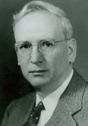
Asa Leonard Allen was an educator, attorney, and member of the United States House of Representatives from the state of Louisiana. He served eight terms as a Democrat from 1937 to 1953, having represented the now defunct 8th congressional district, centered about Alexandria.

Louisiana, or the Province of Louisiana, was a province of New Spain from 1762 to 1801 primarily located in the center of North America encompassing the western basin of the Mississippi River plus New Orleans. The area had originally been claimed and controlled by France, which had named it La Louisiane in honor of King Louis XIV in 1682. Spain secretly acquired the territory from France near the end of the Seven Years' War by the terms of the Treaty of Fontainebleau (1762). The actual transfer of authority was a slow process, and after Spain finally attempted to fully replace French authorities in New Orleans in 1767, French residents staged an uprising which the new Spanish colonial governor did not suppress until 1769. Spain also took possession of the trading post of St. Louis and all of Upper Louisiana in the late 1760s, though there was little Spanish presence in the wide expanses of what they called the "Illinois Country".
The Grant Parish School Board is an entity responsible for the operation of public schools in Grant Parish, Louisiana, United States. It is headquartered in the town of Colfax. The parish is named for Ulysses S. Grant (1822-1885), General-in-Chief of the United States Army / Union Army during the American Civil War (1861-1865) and later 18th President of the United States, served 1869–1877.

Verda T. "Vitamin" Smith, Jr. was a National Football League (NFL) running back for the Los Angeles Rams from 1949 through 1953.
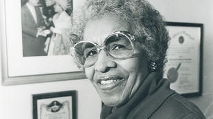
Verda Mae Freeman Welcome was an American teacher, civil rights leader, and Maryland state senator. Welcome was the second black woman to be elected to a state senate in the U.S.. She spent 25 years in the Maryland legislature and worked to pass legislation which enforced stricter employment regulations and discouraged racial discrimination.
Coochie Brake is a cypress swamp in Louisiana of more than 700 acres. It is between Verda and Atlanta. This swamp also referred to as a brake is home to alligators, massive cypress trees, deer and much more. Coochie Brake is a colorful local source full of history and folklore dating back to when it was a Spanish fort. Once owned by JM Ferguson, it is now a state owned property.

Louisiana Highway 122 (LA 122) is a state highway located in Grant Parish, Louisiana. It runs 26.10 miles (42.00 km) in an east–west direction from the junction of U.S. Highway 71 (US 71) and LA 1239-1 in Montgomery to LA 123 in Dry Prong.
Verda is an unincorporated community in Harlan County, Kentucky, United States. The Verda Post Office is closed.
Verda M. Colvin is an associate justice of the Supreme Court of Georgia and former judge of the Georgia Court of Appeals.

The Richard L. and Verda M. Alleman Farm Historic District is a nationally recognized historic district located southeast of Slater in rural Polk County, Iowa, United States. It was listed on the National Register of Historic Places in 2013. At the time of its nomination the district consisted of 18 resources, including nine contributing buildings, one contributing site, one contributing structure, one contributing object, three non-contributing buildings, and three non-contributing structures.


