The Larsen Islands are a small group of islands north-west of Moreton Point, the western extremity of Coronation Island, in the South Orkney Islands of Antarctica. They were discovered by Captains George Powell and Nathaniel Palmer on the occasion of their joint cruise in December 1821. The islands were named on Petter Sørlle's chart, based upon his survey of the South Orkney Islands in 1912–1913, in honour of Carl Anton Larsen.

Benton Lake National Wildlife Refuge is a 12,459-acre (5,042 ha) National Wildlife Refuge (NWR) in the central part of the U.S. state of Montana.

Baskett Slough National Wildlife Refuge is in northwestern Oregon, 10 miles (16 km) west of Salem in Polk County. The Refuge consists of 1,173 acres (4.75 km²) of cropland, which provide forage for wintering geese, 300 acres (1.2 km²) of forests, 550 acres (2.2 km²) of grasslands, and 500 acres (2.0 km²) of shallow water seasonal wetlands and 35 acres (0.14 km²) of permanent open water. In 1965, Baskett Slough National Wildlife Refuge was created to help ensure some of the original habitat remained for species preservation. The refuge is managed by the U.S. Fish and Wildlife Service, an agency of the U.S. Department of the Interior.

Hog Island is an uninhabited island located off the eastern shore of Washington Island in the town of Washington, Door County, Wisconsin, United States. The island has a land area of 2.14 acres (8,656 m2) and an elevation of 10 feet or 20 feet above Lake Michigan.

Protection Island is an island located in the Strait of Juan de Fuca just north of Discovery Bay in northeastern Jefferson County, Washington, United States. The island has a land area of 379 acres (153 ha). It is a federally protected National Wildlife Refuge; boats are not permitted within 200 yards (180 m) for the safety and health of wildlife on and near the shores. There is only one individual still living on the island not associated with the government. Marty Bluewater has lifetime use of his inholding cabin on the island's southern bluffs. The island also houses a caretaker, a volunteer hired by the United States Fish and Wildlife Service, to watch over the island and take care of its many inhabitants. Boat trips from nearby Port Townsend, Washington provide ecotourism visits for viewing wildlife from the adjacent waters.

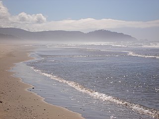
Oregon Islands National Wildlife Refuge is a U.S. National Wildlife Refuge off the southwestern Oregon Coast. It is one of six National Wildlife Refuges comprising the Oregon Coast National Wildlife Refuge Complex. The Oregon Islands provides wilderness protection to 1,853 small islands, rocks, and reefs plus two headlands, totaling 371 acres (150 ha) spanning 1,083 acres (438 ha) of Oregon's coastline from the Oregon–California border to Tillamook Head. There are sites in six of the seven coastal counties of Oregon. From north to south they are Clatsop, Tillamook, Lincoln, Lane, Coos, and Curry counties. The area is managed by the United States Fish and Wildlife Service.
Cape Meares National Wildlife Refuge is a National Wildlife Refuge of the Oregon Coast. It is one of six National Wildlife Refuges in the Oregon Coast National Wildlife Refuge Complex. Located on Cape Meares, the refuge was established in 1938 to protect a remnant of coastal old-growth forest and the surrounding habitat used by breeding seabirds. The area provides a home for a threatened bird species, the marbled murrelets. Peregrine falcons, once at the brink of extinction, have nested here since 1987. The refuge, with the exception of the Oregon Coast Trail, was designated a Research Natural Area in 1987.

Boone Township is one of nine townships in Crawford County, Indiana. As of the 2010 census, its population was 175 and it contained 124 housing units.

This is a list of the National Register of Historic Places listings in Perry County, Indiana.

Glenn Martin National Wildlife Refuge includes the northern half of Smith Island, which lies 11 miles (18 km) west of Crisfield, Maryland, and Watts Island, which is located between the eastern shore of Virginia and Tangier Island. Both islands are situated in the lower Chesapeake Bay.
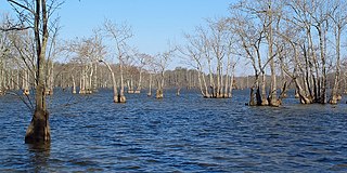
Mathews Brake National Wildlife Refuge encompasses 2,418 acres (9.79 km2) in west-central Mississippi. Established in 1980, the refuge is one of seven national wildlife refuges in the Theodore Roosevelt National Wildlife Refuge Complex. The primary habitat feature is Mathews Brake, the largest brake in Leflore County. Each winter the brake provides habitat for over 30,000 ducks.
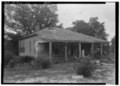
Falls View is a census-designated place (CDP) in Fayette County, West Virginia, United States. Falls View is located 4 miles (6.4 km) southwest of Gauley Bridge, on the north bank of the Kanawha River. As of the 2010 census, its population was 238. Falls View was established in the early 20th century as a residential village for managers from the Electro Metallurgical Co., part of the Union Carbide and Carbon Corporation. Electro Metallurgical operated four ferroalloy plants in the area, powered by hydroelectricity generated at the dam on Kanawha Falls.
The Peaceful River is a remote stream located on the east side of Attu Island, Alaska that was named by the United States Army during its occupation of the island in World War II. The stream originates from its headwaters at North Pass and flows eastward from there, eventually crossing under Attu Airfield where shortly thereafter it discharges into the Pacific Ocean. The river is a known habitat for multiple bird and fish species native to Attu island. In 1983 a nest of black-backed wagtails was discovered under a dilapidated wooden bridge on the river. This, along with another nest discovered on Attu, represented the first successful nesting records for the subspecies in Alaska. The Peaceful River is also a known habitat for various species of salmon. A survey conducted on the island determined that pink salmon were the dominant species in the river with 33,042 fish being observed in the river. The survey also revealed that salmon productivity could increase if culverts are maintained and concrete debris is removed from the river.

Cheal Point is a rocky headland 2 km (1.2 mi) east-south-east of Return Point, the south-western extremity of Coronation Island, in the South Orkney Islands of Antarctica.

Mount Faraway is a prominent, snow-covered mountain, 1,175 metres (3,850 ft) high, marking the southern extremity of the Theron Mountains of Antarctica. It was discovered by the Commonwealth Trans-Antarctic Expedition in 1956, and so named because during days of sledging toward this mountain they never seemed to be any nearer to it.

Moreton Point is a point 1 nautical mile (2 km) north of Return Point at the western end of Coronation Island, in the South Orkney Islands off Antarctica. It was roughly charted by Captains George Powell and Nathaniel Palmer in 1821, and was named by Discovery Investigations personnel on the Discovery II who charted the islands in 1933.
Harrison Bluff is a pale-colored trachyte headland forming the seaward termination of Trachyte Hill and marking the southern end of McDonald Beach on the western side of Mount Bird, Ross Island, Antarctica. Many skuas nest on the bluff. A survey station marked by a rock cairn was placed on the top of the northwest corner of the bluff by E.B. Fitzgerald of the Cape Bird party of the New Zealand Geological Survey Antarctic Expedition, 1958–59, and the bluff was named by the New Zealand Antarctic Place-Names Committee for J. Harrison, mountaineer-assistant with the expedition.

Matthews Island is the largest of the Robertson Islands in the South Orkney Islands off Antarctica. It lies immediately south-east of Coronation Island, from which it is separated by a narrow channel known as the Divide. Matthews Island was mapped as part of Coronation Island until January 1957 when a Falkland Islands Dependencies Survey (FIDS) party established its insularity. It was named by the UK Antarctic Place-Names Committee in 1959 for Drummond H. Matthews, a FIDS geologist at Signy Island in 1956.

The Madder Cliffs are reddish rock cliffs which form the north side of the entrance to Suspiros Bay, at the west end of Joinville Island, Antarctica. They rise steeply from the sea to about 305 metres (1,000 ft). The cliffs were surveyed by the Falkland Islands Dependencies Survey in 1953–54. The name, given in 1956 by the UK Antarctic Place-Names Committee, is descriptive of the red colour of the rocks, madder being a red vegetable pigment.
Etoi Ki is a summit in the Pima County, Arizona, United States. It is west of Kitt Peak National Observatory and northwest of the unincorporated community of Sells. It is rises adjacent to Arizona State Route 86 across the highway from Bird Nest Hill on the Tohono O'odham Indian Reservation, about 62 miles (100 km) west of Tucson and 24 miles (39 km) north of the Mexican border,