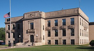
Vineland, Minnesota

Last updated

Vineland, Minnesota
Neyaashiing
USA Minnesota location map.svg
Red pog.svg
Vineland
Usa edcp location map.svg
Red pog.svg
Vineland
Coordinates: 46°09′49″N93°45′27″W / 46.16361°N 93.75750°W / 46.16361; -93.75750
Country United States
State Minnesota
County Mille Lacs
Township Kathio
Area
[1]
  Total9.87 sq mi (25.57 km2)
  Land9.32 sq mi (24.15 km2)
  Water0.55 sq mi (1.42 km2)
Elevation
1,253 ft (382 m)
Population
 (2020) [2]
  Total869
  Density93.21/sq mi (35.99/km2)
Time zone UTC-6 (Central (CST))
  Summer (DST) UTC-5 (CDT)
ZIP codes
56359 (Onamia)
56450 (Garrison)
Area code 320
GNIS feature ID653663 [3]
FIPS code 27-67180

Vineland is an unincorporated community and census-designated place (CDP) in the Mille Lacs Indian Reservation portion of Mille Lacs County, Minnesota, United States. The population was 869 as of the 2020 census, [2] down from 1,001 in 2010. [4] Its name in the Ojibwe language is Neyaashiing, meaning "on the point of land" due to its location on Indian Point (also known as University, Cormorant or Shawboshkung Point) of Mille Lacs Lake. It serves as the administrative center for the Mille Lacs Band of Ojibwe.

Contents

Vineland is located within ZIP code 56359, based in Onamia.

History

A post office called Vineland was established in 1891, and remained in operation until 1921. [5] The community was named for the Viking colony of Vinland. [6]

Geography

Vineland is in northwestern Mille Lacs County, in the northern part of Kathio Township. Its western border is the Crow Wing County line, while its eastern border is the shore of Mille Lacs Lake. U.S. Highway 169 runs through the community close to the lake, leading south 11 miles (18 km) to Onamia and north 9 miles (14 km) to Garrison.

According to the U.S. Census Bureau, the Vineland CDP has a total area of 9.87 square miles (25.6 km2), of which 9.32 square miles (24.1 km2) are land and 0.55 square miles (1.42 km2), or 5.57%, are water. [1]

Demographics

Historical population
CensusPop.Note
2000 607
2010 1,00164.9%
2020 869−13.2%
U.S. Decennial Census [7] [2]

As of the census [8] of 2000, there were 607 people, 174 households, and 136 families residing in the CDP. The population density was 92.9 inhabitants per square mile (35.9/km2). There were 189 housing units at an average density of 28.9 per square mile (11.2/km2). The racial makeup of the CDP was 5.11% White, 94.40% Native American, and 0.49% from two or more races. Hispanic or Latino of any race were 0.82% of the population.

There were 174 households, out of which 46.6% had children under the age of 18 living with them, 16.1% were married couples living together, 49.4% had a female householder with no husband present, and 21.8% were non-families. 15.5% of all households were made up of individuals, and 6.3% had someone living alone who was 65 years of age or older. The average household size was 3.47 and the average family size was 3.85.

In the CDP, the population was spread out, with 44.3% under the age of 18, 10.0% from 18 to 24, 25.7% from 25 to 44, 13.2% from 45 to 64, and 6.8% who were 65 years of age or older. The median age was 22 years. For every 100 females, there were 93.3 males. For every 100 females age 18 and over, there were 88.8 males.

The median income for a household in the CDP was $20,208, and the median income for a family was $18,958. Males had a median income of $22,813 versus $20,938 for females. The per capita income for the CDP was $7,738. About 41.5% of families and 40.6% of the population were below the poverty line, including 46.7% of those under age 18 and 25.6% of those age 65 or over.

Education

The school district is Onamia Public Schools. [9]

Related Research Articles

<span class="mw-page-title-main">Mille Lacs County, Minnesota</span> County in Minnesota, United States

Mille Lacs County is a county in the East Central part of the U.S. state of Minnesota. As of the 2020 census, the population was 26,459. Its county seat is Milaca. The county was founded in 1857, and its boundary was expanded in 1860.

Hazelton Township is a township in Aitkin County, Minnesota, United States. The population was 844 as of the 2010 census.

Lakeside Township is a township in Aitkin County, Minnesota, United States. The population was 463 as of the 2010 census.

Wealthwood Township is a township in Aitkin County, Minnesota, United States. The population was 268 as of the 2010 census.

<span class="mw-page-title-main">Ponemah, Minnesota</span> Census-designated place in Minnesota, US

Ponemah is a census-designated place (CDP) within the Lower Red Lake unorganized territory in Beltrami County, Minnesota, United States. The population was 724 at the 2010 census.

<span class="mw-page-title-main">Redby, Minnesota</span> Census-designated place in Minnesota, US

Redby Ojibwe: Madaabiimog) is a census-designated place (CDP) within the Lower Red Lake unorganized territory in Beltrami County, Minnesota, United States. The population was 1,334 at the 2010 census.

Dailey Township is a township in Mille Lacs County, Minnesota, United States. The population was 234 at the 2010 census.

<span class="mw-page-title-main">Foreston, Minnesota</span> City in Minnesota, United States

Foreston is a city in Mille Lacs County, Minnesota, United States. The population was 559 at the 2020 census.

Greenbush Township is a township in Mille Lacs County, Minnesota, United States. The population was 1,293 at the 2010 census.

<span class="mw-page-title-main">Isle, Minnesota</span> City in Minnesota, United States

Isle is a city in Mille Lacs County, Minnesota, United States. The population was 803 at the 2020 census, up from 751 in 2010.

Isle Harbor Township is a township in Mille Lacs County, Minnesota, United States. The population was 593 at the 2010 census.

Milaca Township is a township in Mille Lacs County, Minnesota, United States. The population was 1,617 at the 2010 census.

Milo Township is a township in Mille Lacs County, Minnesota, United States. The population was 1,385 at the 2010 census.

<span class="mw-page-title-main">Onamia, Minnesota</span> City in Minnesota, United States

Onamia is a city in Mille Lacs County, Minnesota, United States. The population was 784 as of the 2020 census, down from 878 in 2010. U.S. Highway 169 and Minnesota State Highway 27 are the main routes in the community.

Onamia Township is a township in Mille Lacs County, Minnesota, United States. The population was 575 at the 2010 census.

Princeton Township is a township in Mille Lacs County, Minnesota, United States. The population was 2,256 at the 2010 census.

South Harbor Township is a township in Mille Lacs County, Minnesota, United States. The population was 800 at the 2010 census.

<span class="mw-page-title-main">Wahkon, Minnesota</span> City in Minnesota, United States

Wahkon is a city in Mille Lacs County, Minnesota, United States. The population was 235 as of the 2020 census, up from 206 in 2010.

<span class="mw-page-title-main">Hinckley, Minnesota</span> City in Minnesota, United States

Hinckley is a city in Pine County, Minnesota, United States, located at the junction of Interstate 35 and Minnesota State Highway 48. The population was 1,800 at the 2010 census.

Mille Lacs Indian Reservation is the popular name for the land-base for the Mille Lacs Band of Ojibwe in Central Minnesota, about 100 miles (160 km) north of Minneapolis-St. Paul. The contemporary Mille Lacs Band reservation has significant land holdings in Mille Lacs, Pine, Aitkin and Crow Wing counties, as well as other land holdings in Kanabec, Morrison, and Otter Tail Counties. Mille Lacs Indian Reservation is also the name of a formal Indian reservation established in 1855. It is one of the two formal reservations on which the contemporary Mille Lacs Band retains land holdings. The contemporary Mille Lacs band includes several aboriginal Ojibwe bands and villages, whose members reside in communities throughout central Minnesota.

References

  1. 1 2 "2023 U.S. Gazetteer Files: Minnesota". United States Census Bureau. Retrieved January 26, 2024.
  2. 1 2 3 "P1. Race – Vineland CDP, Minnesota: 2020 DEC Redistricting Data (PL 94-171)". U.S. Census Bureau. Retrieved January 26, 2024.
  3. "Vineland". Geographic Names Information System . United States Geological Survey, United States Department of the Interior.
  4. "U.S. Census website". United States Census Bureau . Retrieved May 14, 2011.
  5. "Mille Lacs County". Jim Forte Postal History. Retrieved July 21, 2015.
  6. Upham, Warren (1920). Minnesota Geographic Names: Their Origin and Historic Significance. Minnesota Historical Society. p.  345.
  7. "Decennial Census Official Publications". U.S. Census Bureau. Retrieved January 26, 2024.
  8. "U.S. Census website". United States Census Bureau . Retrieved January 31, 2008.
  9. "2020 CENSUS - SCHOOL DISTRICT REFERENCE MAP: Mille Lacs County, MN" (PDF). U.S. Census Bureau. Archived (PDF) from the original on August 11, 2021. Retrieved August 11, 2021.