Virden, New Mexico

Last updated

Virden, New Mexico
Hidalgo County New Mexico Incorporated and Unincorporated areas Virden Highlighted.svg
Location of Virden, New Mexico
Usa edcp location map.svg
Red pog.svg
Virden, New Mexico
Location in the United States
Coordinates: 32°41′19″N109°0′0″W / 32.68861°N 109.00000°W / 32.68861; -109.00000
Country United States
State New Mexico
County Hidalgo
Area
[1]
  Total0.21 sq mi (0.55 km2)
  Land0.21 sq mi (0.55 km2)
  Water0.00 sq mi (0.00 km2)
Elevation
[2]
3,773 ft (1,150 m)
Population
 (2020) [3]
  Total126
  Density597.16/sq mi (230.07/km2)
Time zone UTC-7 (Mountain (MST))
  Summer (DST) UTC-6 (MDT)
ZIP Code
88045
Area code 575
FIPS code 35-83200
GNIS feature ID2413597 [2]

Virden is a village in Hidalgo County, New Mexico, United States. The population was 152 at the 2010 census. [4]

Contents

History

Known as Richmond prior to 1916, the area was originally owned by the New Mexico Mining Company, and was the location of a stamp mill for the silver ore mined in nearby Ralston. After the mine was closed, the site was sold in 1916 to Mormons who had left the Mormon Colonies in Chihuahua during the Mexican Revolution. The Mormons renamed the village after the rancher who sold them the land. [5]

Geography

Virden is located near the northern end of Hidalgo County on the north bank of the Gila River. New Mexico State Road 92 passes through the village, leading northwest 7 miles (11 km) to Duncan, Arizona, and south seven miles to its terminus at U.S. Route 70. Lordsburg, the Hidalgo County seat, is 32 miles (51 km) southeast of Virden via US 70.

According to the United States Census Bureau, Virden has a total area of 0.2 square miles (0.6 km2), all land. [4]

Demographics

Historical population
CensusPop.Note
1930 196
1940 2065.1%
1950 146−29.1%
1960 135−7.5%
1970 15111.9%
1980 24662.9%
1990 108−56.1%
2000 14332.4%
2010 1526.3%
2020 126−17.1%
U.S. Decennial Census [6] [3]

As of the census [7] of 2000, there were 143 people, 48 households, and 38 families residing in the village. The population density was 640.1 inhabitants per square mile (247.1/km2). There were 63 housing units at an average density of 282.0 per square mile (108.9/km2). The racial makeup of the village was 95.10% White, 1.40% African American, 1.40% from other races, and 2.10% from two or more races. Hispanic or Latino of any race were 13.29% of the population.

There were 48 households, out of which 39.6% had children under the age of 18 living with them, 77.1% were married couples living together, 2.1% had a female householder with no husband present, and 20.8% were non-families. 20.8% of all households were made up of individuals, and 8.3% had someone living alone who was 65 years of age or older. The average household size was 2.98 and the average family size was 3.50.

In the village, the population was spread out, with 33.6% under the age of 18, 8.4% from 18 to 24, 18.2% from 25 to 44, 25.2% from 45 to 64, and 14.7% who were 65 years of age or older. The median age was 32 years. For every 100 females, there were 113.4 males. For every 100 females age 18 and over, there were 115.9 males.

The median income for a household in the village was $29,375, and the median income for a family was $46,250. Males had a median income of $33,750 versus $0 for females. The per capita income for the village was $23,184. There were 2.6% of families and 14.1% of the population living below the poverty line, including 26.1% of under eighteens and 6.7% of those over 64.

Related Research Articles

<span class="mw-page-title-main">Sandoval County, New Mexico</span> County in New Mexico, United States

Sandoval County is located in the U.S. state of New Mexico. As of the 2020 census, the population was 148,834, making it the fourth-most populous county in New Mexico. The county seat is Bernalillo.

<span class="mw-page-title-main">Mora County, New Mexico</span> County in New Mexico, United States

Mora County is a county in the U.S. state of New Mexico. As of the 2020 census, the population was 4,189. Its county seat is the census-designated place (CDP) Mora. The county has another CDP, Watrous, a village, Wagon Mound, and 12 smaller unincorporated settlements. Mora became a formal county in the US, in what was then the New Mexico Territory, on February 1, 1860. Ecclesiastically, the county is within the Roman Catholic Archdiocese of Santa Fe. County population peaked at approximately 14,000 circa 1920, declining to about 4,000 to 5,000 since the 1970s; the 2018 estimate was 4,506.

<span class="mw-page-title-main">Luna County, New Mexico</span> County in New Mexico, United States

Luna County(Spanish: Condado de Luna) is a county located in the U.S. state of New Mexico. As of the 2020 census, the population was 25,427. Its county seat is Deming. This county abuts the Mexican border. Luna County comprises the Deming, NM Micropolitan Statistical Area.

<span class="mw-page-title-main">Hidalgo County, New Mexico</span> County in New Mexico, United States

Hidalgo County is the southernmost county of the U.S. state of New Mexico. As of the 2020 census, the population was 4,178. The county seat and largest city is Lordsburg. A bill creating Hidalgo from the southern part of Grant County was passed on February 25, 1919, taking effect at the beginning of 1920. The county was named for the town north of Mexico City where the Treaty of Guadalupe Hidalgo was signed, which in turn was named for Miguel Hidalgo y Costilla, the priest who is known as the "Father of Mexican Independence." The county is located on the Mexico–United States border.

<span class="mw-page-title-main">Grant County, New Mexico</span> County in New Mexico, United States

Grant County is a county located in the U.S. state of New Mexico. At the 2020 census, the population was 28,185. Its county seat is Silver City. The county was founded in 1868 and named for Ulysses S. Grant, the 18th President of the United States.

<span class="mw-page-title-main">Hidalgo, Illinois</span> Village in Illinois, United States

Hidalgo is a village in Jasper County, Illinois, United States. The population was 106 at the 2010 census.

<span class="mw-page-title-main">Elmira, Missouri</span> Village in Missouri, United States

Elmira is a village in northwest Ray County, Missouri, and part of the Kansas City metropolitan area within the United States. The population was 39 at the 2020 census.

<span class="mw-page-title-main">Corona, New Mexico</span> Village in New Mexico, United States

Corona is a village in Lincoln County, New Mexico, United States, located along U.S. Route 54. The population was 172 at the time of the 2010 census.

<span class="mw-page-title-main">Kirtland, New Mexico</span> Town in New Mexico, United States

Kirtland is a town, made up of part of the former census-designated place (CDP) of the same name in San Juan County, New Mexico, United States. The population of the former CDP was 6,190 at the 2000 census. It is part of the Farmington Metropolitan Statistical Area.
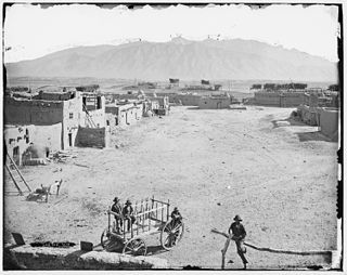
<span class="mw-page-title-main">Pueblo of Sandia Village, New Mexico</span> Village in Sandoval County, New Mexico, US

Pueblo of Sandia Village is a census-designated place (CDP) in Sandoval County, New Mexico, United States. The population was 344 at the 2000 census. It is part of the Albuquerque Metropolitan Statistical Area.

<span class="mw-page-title-main">San Ysidro, Sandoval County, New Mexico</span> Village in Sandoval County, New Mexico, United States

San Ysidro is a village in Sandoval County, New Mexico, United States. The population was 193 at the 2010 census. It is part of the Albuquerque Metropolitan Statistical Area.

<span class="mw-page-title-main">Encino, New Mexico</span> Village in New Mexico, United States

Encino is a village in Torrance County, New Mexico, United States. The population was 51 at the 2020 census. It is part of the Albuquerque Metropolitan Statistical Area.

<span class="mw-page-title-main">Willard, New Mexico</span> Village in New Mexico, United States

Willard is a village in Torrance County, New Mexico, United States. The population was 253 at the 2010 census. It is part of the Albuquerque Metropolitan Statistical Area. The village is not experiencing the same extreme growth that towns farther north in the state are. A wind farm has recently been constructed upon the mesa just south of the town. It provides power for about 25,000 homes in Arizona.

<span class="mw-page-title-main">Stryker, Ohio</span> Village in Ohio, United States

Stryker is a village in Williams County, Ohio, United States. The population was 1,259 at the 2020 census.

<span class="mw-page-title-main">Hidalgo, Texas</span> City in Texas, United States

Hidalgo is a city in Hidalgo County, Texas, United States. The population was 11,198 at the 2010 census, and in 2019 the estimated population was 14,183.

<span class="mw-page-title-main">Muniz, Texas</span> Census-designated place in Texas

Muniz is a census-designated place (CDP) in Hidalgo County, Texas, United States. The population was 1,593 at the 2020 United States Census. It is part of the McAllen–Edinburg–Mission Metropolitan Statistical Area.

<span class="mw-page-title-main">Progreso Lakes, Texas</span> City in Texas

Progreso Lakes is a city in Hidalgo County, Texas, United States. The population was 240 at the 2010 United States Census. The city, incorporated in 1979, is centered on Lion and Moon Lakes, two resacas or ox-bow lakes.

<span class="mw-page-title-main">San Carlos, Texas</span> Census-designated place in Texas

San Carlos is a community and census-designated place (CDP) in Hidalgo County, Texas. The population was 3,087 at the 2020 United States Census. It is part of the McAllen–Edinburg–Mission Metropolitan Statistical Area.

<span class="mw-page-title-main">South Alamo, Texas</span> Census-designated place in Texas

South Alamo is a census-designated place (CDP) in Hidalgo County, Texas, United States. The area is known locally as "Little Mex (Mexico)". The population was 3,414 at the 2020 United States Census. It is part of the McAllen–Edinburg–Mission Metropolitan Statistical Area.

<span class="mw-page-title-main">Blanchardville, Wisconsin</span> Village in Wisconsin, United States

Blanchardville is a village in Iowa and Lafayette counties in the U.S. state of Wisconsin. The population was 825 at the 2010 census. Of this, 648 were in Lafayette County, and 177 were in Iowa County.

References

  1. "ArcGIS REST Services Directory". United States Census Bureau. Retrieved October 12, 2022.
  2. 1 2 U.S. Geological Survey Geographic Names Information System: Virden, New Mexico
  3. 1 2 "Census Population API". United States Census Bureau. Retrieved October 12, 2022.
  4. 1 2 "Geographic Identifiers: 2010 Census Summary File 1 (G001): Virden village, New Mexico". American Factfinder. U.S. Census Bureau. Archived from the original on February 13, 2020. Retrieved August 24, 2017.
  5. Fugate, Francis L.; Fugate, Roberta B. (June 1989). Roadside history of New Mexico . Mountain Press Pub. Co. ISBN   9780878422425.
  6. "Census of Population and Housing". Census.gov. Retrieved June 4, 2015.
  7. "U.S. Census website". United States Census Bureau . Retrieved January 31, 2008.