Waghaz District

Last updated

Waghaz
واغظ
Afghanistan adm location map.svg
Red pog.svg
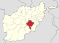
Waghaz
Location within Afghanistan [1]
Coordinates: 33°25′N68°13′E / 33.41°N 68.21°E / 33.41; 68.21
Country Afghanistan
Province Ghazni
Elevation
2,350 m (7,710 ft)
Population
 (2009) [2]
  Total27,900

Waghaz is a district in Ghazni province, Afghanistan. It was formed in 2005 from part of Muqur District, and has a population estimated at 27,900. [2]

Contents

Administration

Geography

Healthcare

Education

The Rana Kheil boys and girls school was renovated in 2003. Funding was provided by the School of Hope for the rehabilitation of the school building. [3]

Demographics

Infrastructure

Natural Resources

See also

Related Research Articles

<span class="mw-page-title-main">Ghazni</span> City in Ghazni Province, Afghanistan

Ghazni, historically known as Ghaznain (غزنين) or Ghazna (غزنه), also transliterated as Ghuznee, and anciently known as Alexandria in Opiana, is a city in southeastern Afghanistan with a population of around 190,000 people. The city is strategically located along Highway 1, which has served as the main road between Kabul and Kandahar for thousands of years. Situated on a plateau at 2,219 metres (7,280 ft) above sea level, the city is 150 kilometres (93 mi) south of Kabul and is the capital of Ghazni Province. The name Ghazni drives from the Persian word "ganj", meaning ‘treasure’.

<span class="mw-page-title-main">Ghazni Province</span> Province of Afghanistan

Ghazni is one of the 34 provinces of Afghanistan, located in southeastern Afghanistan. The province contains 19 districts, encompassing over a thousand villages and roughly 1.3 million people, making it the 5th most populous province. The city of Ghazni serves as the capital. It lies on the important Kabul–Kandahar Highway, and has historically functioned as an important trade center. The Ghazni Airport is located next to the city of Ghazni and provides limited domestic flights to Afghanistan's capital, Kabul.

<span class="mw-page-title-main">Ghor Province</span> Province of Afghanistan

Ghōr, also spelled Ghowr or Ghur, is one of the thirty-four provinces of Afghanistan. It is located in the western Hindu Kush in central Afghanistan, towards the northwest. The province contains eleven districts, encompassing hundreds of villages, and approximately 764,472 settled people. Firuzkoh is the capital of the province.

<span class="mw-page-title-main">Chaghcharan</span> City in Ghor, Afghanistan

Chaghcharān, also called Firozkoh, is a town and district in central Afghanistan, which serves as the capital of Ghor Province. It is located on the southern side of the Hari River, at an altitude of 2,230 m above sea level. Chaghcharan is linked by a 380 kilometres (240 mi) long highway with Herat to the west, and a 450 kilometres (280 mi) long highway with Kabul to the east. The town is served by Chaghcharan Airport.

<span class="mw-page-title-main">Jaghori District</span> District in Ghazni, Afghanistan

Jaghori is one of the main districts of the Ghazni province in Afghanistan. It is located in the highlands in the southern fringes of the Hazaristan region. It occupies 1,855 km2. in the upper Arghandab valley. The population is estimated to be around 560,000 in 2015. The district capital, Sange-e-Masha, is where major business transactions take place. The district is heavily dependent on agriculture, and migrant workers as the main sources of income. Other major marketplaces are in Ghojor and Anguri.

Malistan or Malestan, is a district in Ghazni province, Afghanistan. Its population, which is 100% Hazara, was estimated at 350,000 in 2009. The district capital is Mir Adina.

<span class="mw-page-title-main">Washir District</span> District in Helmand Province, Afghanistan

Washir is a district in the west of Helmand Province, Afghanistan. Its population was reported in 2012 as 15,200, from the Pashtun ethnic group believed to be of Noorzai tribe. The district centre is the village of Washir. The district of Washer borders Farah province to the north and is 80 kilometres south of Lashkar Gah.

Zari is a district in Balkh province, Afghanistan. It was created in 2005 from part of Kishindih district.

<span class="mw-page-title-main">Qarabagh District, Ghazni</span> District in Ghazni, Afghanistan

Qarabagh or Qara Bagh, is a district in Ghazni province, 56 km to the south-west of Ghazni city in eastern Afghanistan. The 1,800 km2 area is one of the most populated at 109,000; some reports count more than 218,000. The ethnic composition of the district includes Hazaras and Pashtuns. The landscape varies in different parts of the district - deserts in the southwest, plains in the southeast and mountains in the north. The district is seriously affected by drought, especially farming and animal husbandry. Health and education need serious improvement.

<span class="mw-page-title-main">Giro District</span> District in Ghazni Province, Afghanistan

The Giro District is located within southeastern Ghazni province in Afghanistan, 50 km South East of Ghazni city. The district is a wide plain with scattered low mountains. More than 40 000 residents are estimated, according to 2002 year's data. The district is within the heartland of the Tarakai tribe of Ghilji Pashtuns. The district center is Pana.

<span class="mw-page-title-main">Rashidan District</span> District in Ghazni, Afghanistan

Rashidan District is a new district in Ghazni province, Afghanistan; it was created from the larger Jaghatu district.

<span class="mw-page-title-main">Andar District</span> District in Ghazni Province, Afghanistan

Andar is one of the eastern districts of Ghazni Province in Afghanistan. The population has been estimated at 88,300, all Pashtun. The district center is Miray while the other main town is Andar. The district is named after the Andar Ghilji tribe of the Pashtuns. The district also contains the town of Sardeh Band on its edge near the border with Paktika Province.

<span class="mw-page-title-main">Dih Yak District</span> District in Ghazni Province, Afghanistan

Deh Yak is a rural district in the eastern part of Ghazni Province, Afghanistan, 30 km east from the city of Ghazni. The district has an area of 715 km2, containing 66 villages and a population of about 44,386. Ramak serves as the district's headquarters.

Zana Khan district is a mountainous district in Ghazni province, Afghanistan with more than 12,000 people living there. The district center is Dado.

<span class="mw-page-title-main">Ghazni District</span> District of Afghanistan

Ghazni District, is a district of Ghazni province, Afghanistan situated in the northeast part of the province. Capital of the district is Ghazni, which is also capital of Ghazni Province.

Khwaja Umari is a district in Ghazni province, Afghanistan. It was created in 2005 from the large Jaghatu District. The district center is the village of Khwaja Umari.

Khugyani, also known as Wali Muhammadi Shahid, is a district in Ghazni province, Afghanistan. It was previously part of Jaghatu District. Its territory had been enlarged during the Taliban regime and after then the district was returned to its original borders. To the east it is surrounded by Ghazni City District, to the south by Waghaz District, to the west by Jaghatu District, to the north by the Rashidan district and to the Northeast by Khwaja Umari district. The population is more than 28,000 people. The district center is Khogyani.

<span class="mw-page-title-main">Khodaidad</span> Politician from Afghanistan (born 1955)

General Khodaidad is a former Minister of Counter Narcotics of Afghanistan.

<span class="mw-page-title-main">Sardeh Band Dam</span> Dam in Ghazni, Afghanistan

The Sarda Dam is located near the town of Sardeh Band, in the eastern part of Andar District of Ghazni Province of Afghanistan. Part of its reservoir, which provides fresh water to much of southern Ghazni, is in neighboring Paktika Province. In recent years, the locals proposed to turn the area into a national park, similar to the Band-e Amir National Park in Bamyan Province.

<span class="mw-page-title-main">Ghazni offensive</span>

The Ghazni offensive began on 10 August 2018, when Taliban fighters launched an assault on the city of Ghazni, Afghanistan's sixth largest city and one which has been culturally and strategically important for much of the country's history. The attack resulted in the deaths of hundreds of insurgents, soldiers, police, and civilians. The city also sustained large-scale property damage. The battle, occurring only weeks before Afghanistan's 2018 parliamentary election, was the largest since a three-day truce in June had raised hopes of peace talks.

References

  1. "District Names". National Democratic Institute. Retrieved 10 November 2015.
  2. 1 2 "Afghanistan Election Data". National Democratic Institute. Retrieved 10 November 2015.
  3. "Renovation of Rana Kheil School". HAFO Construction & Production Company. Retrieved 10 November 2015.