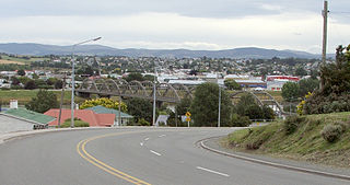
Balclutha is a town in South Otago, lying towards the end of the Clutha River, on the east coast of the South Island of New Zealand. It is about halfway between Dunedin and Gore on the Main South Line railway, State Highway 1 and the Southern Scenic Route. Balclutha has a population of 4,430, and is the largest town in South Otago.

Eketāhuna is a small rural settlement, in the south of the Tararua District and the Manawatū-Whanganui region of New Zealand's North Island.
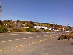
Kaitangata is a town near the coast of South Otago, New Zealand, on the left bank of the Matau Branch of the Clutha River ten kilometres south east of Balclutha. The town is known to its residents as Kai.

Albert Town is located to the east of Wānaka in Otago, New Zealand. Until recently only a farming settlement, the population boom in this area has led to much new development. The confluence of the Clutha and Hāwea Rivers is located here. The town was named after Prince Albert of Saxe-Coburg and Gotha. Albert Town was formerly called Newcastle.

Taieri Mouth is a small fishing village at the mouth of the Taieri River, New Zealand. Taieri Island (Moturata) lies in the ocean several hundred metres off the river's mouth.

Pongaroa is a town in the Tararua District, in the southeast of the North Island of New Zealand, 110 kilometres southwest of Hastings and 200 kilometres northeast of Wellington. The nearest town is Pahiatua, 50 kilometres to the west. Popular Ākitio Beach is 30 kilometres to the east. The township straddles Route 52, a road between Masterton and Waipukurau.

Clutha District is a local government district of southern New Zealand, with its headquarters in the Otago town of Balclutha. Clutha District has a land area of 6,334.47 km2 (2,445.75 sq mi) and an estimated population of 19,300 as of June 2024. Clutha District occupies the majority of the geographical area known as South Otago.
Dipton is a small town in the Southland region of New Zealand. It is located 20 kilometres south of Lumsden and 60 kilometres north of Invercargill. From 20 October 1875 until its closure on 13 December 1982, Dipton was situated on the Kingston Branch railway.

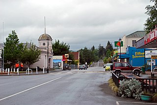
Clinton is a small town in South Otago, in New Zealand's South Island, with convenient road connections to Dunedin, Central Otago via Lawrence or Tapanui, the Catlins and Invercargill. It is located on State Highway 1 approximately halfway between Balclutha and Gore, and the Main South Line railway passes through the town.
Turua is a small village community on the banks of the Waihou River in the Hauraki Plains in the North Island of New Zealand. It is located close to the mouth of the river, 9 kilometres south of the Firth of Thames and 12 km south of Thames. It is connected by road to SH 25 in the north and SH 2 to the south.
Waiwera is a small town in the north of the Auckland Region in New Zealand. Waiwera is 6 km north of Orewa, 6 km south-east of Puhoi, 23 km south-east of Warkworth and approximately 35 km from the Auckland City centre. The settlement lies at the outlet of a river also called Waiwera. Less than 1 kilometre north of the Waiwera turn-off lies the turn-off to Wenderholm Regional Park which is situated on the far side of the headland to the north of the Waiwera River outlet.
Manutūkē is a settlement in the Gisborne District of New Zealand's North Island. It is located to the west of the city of Gisborne on State Highway 2, close to the mouth of the Waipaoa River.

Luggate is a small town in the South Island of New Zealand. It is located on State Highway 6 between Wānaka and Cromwell, near the junction with State Highway 8A, approximately 15 km from the Wānaka township, just past Wānaka Airport.
Stirling is a settlement in New Zealand. It is located in South Otago, approximately 5 km from Balclutha, and just north of the Matau Branch of the Clutha River.

Deanwell is a suburb in south-western Hamilton in New Zealand. It is named after Deanwell Properties, the developers who subdivided the area. It was defined as a suburb of Hamilton in 1974.

Pencarrow Head, also known as Pencarrow, is a headland in the Wellington Region of New Zealand and the name of the surrounding area, which was derived from Pencarrow, the family home of New Zealand Company director, Sir William Molesworth. The name is Cornish and formed from Pen which translates to English as head and Carrow which is a valley.
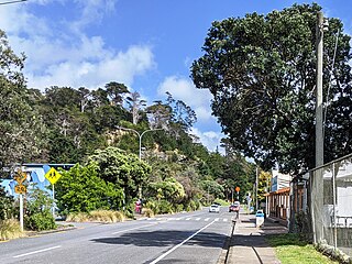
Wakefield is a settlement in the Tasman District of New Zealand's South Island, located about 25km south west of Nelson.
Waikeria is a rural community in the Otorohanga District and Waikato region of New Zealand's North Island.

Tokanui is a rural locality in the Waipa District and Waikato region of New Zealand's North Island.
Clydevale is a township on the banks of the Clutha River / Mata-Au, in the Clutha Valley, 29 kilometres north-west of Balclutha.