
Kaipara District is a territorial authority district in the Northland Region of New Zealand.

The South Wairarapa District is a district at the south-east tip of the North Island of New Zealand, governed by the South Wairarapa District Council. The district comprises the southernmost part of the Wairarapa, and is part of the Wellington Region.

Hauraki District is a territorial authority governed by the Hauraki District Council within the Waikato region of New Zealand. The seat of the council is at Paeroa.

Western Bay of Plenty District is a territorial district within the Bay of Plenty Region of New Zealand. The district envelops Tauranga city by land, and includes Matakana Island, at the entrance to Tauranga Harbour.

The Far North District is the northernmost territorial authority district of New Zealand, consisting of the northern part of the Northland Peninsula in the North Island. It stretches from North Cape / Otou and Cape Reinga / Te Rerenga Wairua in the north, down to the Bay of Islands, the Hokianga and the town of Kaikohe.
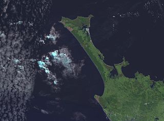
The Aupōuri Peninsula is a tombolo at the northern tip of the North Island of New Zealand. It projects between the Tasman Sea to the west and the Pacific Ocean to the east. It constitutes the northern part of the Far North District, incorporating North Cape, Houhora and the northern half of Awanui.

Central Otago District is local government district in New Zealand. It is administered by the Central Otago District Council, and it is in the Otago region, the top tier of local government in New Zealand. The major towns in the district are Alexandra, Cromwell, Roxburgh, Clyde and Ranfurly. The district covers 9,968 km2 (3,849 sq mi), making it the fourth-largest district in New Zealand by area, and is home to 26,500 people as of June 2024.

Westland District is a territorial authority district on the West Coast of New Zealand's South Island. It is administered by the Westland District Council. The district's population is 9,430.

Buller District is one of 53 districts of New Zealand, and is within the West Coast Region. It covers Westport, Karamea, Reefton and Inangahua Junction.
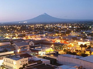
South Taranaki is a territorial authority on the west coast of New Zealand's North Island that contains the towns of Hāwera, Manaia, Ōpunake, Patea, Eltham, and Waverley. The District has a land area of 3,575.46 km2 and a population of 30,400. It is part of the greater Taranaki Region.
Waipu is a small town in Bream Bay, in the Northland Region of New Zealand. The town has a Scottish heritage; a highlight of the town's calendar is the annual Highland Games held at New Year. Near the town are the Waipu Caves, which contain a significant population of glow worms.
Ruakākā is a small town in the north of New Zealand approximately 30 kilometres south of Whangārei in the Bream Bay area. Originally a small beachside community, Ruakākā saw development in the 1980s as a result of the expansion of the nearby Marsden Point, New Zealand's sole oil refinery. A recently established timber processing plant at Marsden Point has further stimulated growth.
Raumanga is a suburb of Whangārei in the Northland Region of New Zealand. It is the site of Northland Polytechnic's main campus.

Whangarei District is a territorial authority district in the Northland Region of New Zealand that is governed by the Whangarei District Council. The district is made up in area largely by rural land, and includes a fifth of the Northland Region. It extends southwards to the southern end of Bream Bay, northwards to Whangaruru and almost to the Bay of Islands, and westwards up the Mangakahia River valley past Pakotai and almost to Waipoua Forest. It includes the Hen and Chicken Islands and the Poor Knights Islands.

Whangārei Heads is a locality and volcanic promontory on the northern side of the Whangārei Harbour in Northland, New Zealand. Whangārei is 29 km (18 mi) to the north-west, and Ocean Beach is 8 km (5.0 mi) to the south-east, with Taurikura between the two. Mount Manaia rises to 420 metres to the east.

Bream Bay is an embayment and area south-east of Whangārei, on the east coast of New Zealand. The bay runs from Bream Head, at the mouth of Whangārei Harbour, 22 kilometres south to the headland of Bream Tail, east of Langs Beach and north of Mangawhai. It was named by Captain James Cook. The Bream Bay area includes the towns of Ruakākā, One Tree Point and Waipu. A group of nature reserve islands lie outside Bream Bay: the Hen and Chicken Islands and Sail Rock.

Pataua is a settlement in Northland Region, New Zealand. It lies at the mouth of the Pataua River on the Pacific Ocean. Pataua North and Pataua South are separated by a footbridge over the estuary.

Taupō Bay is a bay, village and rural community in the Far North District and Northland Region of New Zealand's North Island. There are about 40 permanent residents, and 180 properties. The white sand beach is 1.5 km wide.
Tokerau Beach is a settlement on the northwestern side of Doubtless Bay on the Karikari Peninsula of Northland, New Zealand.

Langs Beach is a locality on the shore of Bream Bay in the Whangarei District and Northland Region of New Zealand. It is about 5 km southeast of Waipu Cove and 10 km northwest of Mangawhai Heads.


