
Chevy Chase is the colloquial name of an area that includes a town, several incorporated villages, and an unincorporated census-designated place in southern Montgomery County, Maryland; and one adjoining neighborhood in northwest Washington, D.C. Most derive from a late-19th-century effort to create a new suburb that its developer dubbed Chevy Chase after a colonial land patent.

Tenleytown–AU station is a subway station on the Red Line of the Washington Metro in Washington, D.C. Located in the Upper Northwest neighborhood, it is the last station on the Red Line heading outbound wholly within the District of Columbia; the next stop, Friendship Heights, lies within both the District and the state of Maryland. The station serves American University (AU).

Van Ness–UDC station is a Washington Metro station serving the Forest Hills and North Cleveland Park neighborhoods of Washington, D.C., United States. The island platformed station was opened on December 5, 1981, and is operated by the Washington Metropolitan Area Transit Authority (WMATA). Providing service for the Red Line, the station is on the 4200 block of Connecticut Avenue NW, with exits on either side of the street. The station is also close to the University of the District of Columbia (UDC), as well as to both Howard University School of Law and the Edmund Burke School.

Friendship Heights station is a Washington Metro station on the Red Line straddling the border of Washington, D.C., and Montgomery County, Maryland, United States. The station was opened on August 25, 1984, and is operated by the Washington Metropolitan Area Transit Authority (WMATA).

Tenleytown is a historic neighborhood in Northwest, Washington, D.C.

Northwest is the northwestern quadrant of Washington, D.C., the capital of the United States, and is located north of the National Mall and west of North Capitol Street. It is the largest of the four quadrants of the city, and it includes the central business district, the Federal Triangle, and the museums along the northern side of the National Mall, as well as many of the District's historic neighborhoods.

Friendship Heights is an urban commercial and residential neighborhood in northwest Washington, D.C., and southern Montgomery County, Maryland. Though its borders are not clearly defined, Friendship Heights consists roughly of the neighborhoods and commercial areas around Wisconsin Avenue north of Fessenden Street NW and Tenleytown to Somerset Terrace and Willard Avenue in Maryland, and from River Road in the west to Reno Road and 41st Street in the east. Within Maryland west of Wisconsin Avenue is the Village of Friendship Heights, technically a special taxation district.

Forest Hills is a residential neighborhood in the northwest quadrant of Washington, D.C., United States, bounded by Connecticut Avenue NW to the west, Rock Creek Park to the east, Chevy Chase to the north, and Tilden Street NW to the south. The neighborhood is frequently referred to as Van Ness because it is served by the Van Ness–UDC station on the Washington Metro's Red Line and is near the Van Ness campus of the University of the District of Columbia (UDC).

Chevy Chase is a neighborhood in northwest Washington, D.C. It borders Chevy Chase, Maryland.

Connecticut Avenue is a major thoroughfare in the Northwest quadrant of Washington, D.C., and suburban Montgomery County, Maryland. It is one of the diagonal avenues radiating from the White House, and the segment south of Florida Avenue was one of the original streets in Pierre (Peter) Charles L'Enfant's plan for Washington. A five-mile segment north of Rock Creek was built in the 1890s by a real-estate developer.

Wisconsin Avenue is a major thoroughfare in Washington, D.C., and its Maryland suburbs. The southern terminus begins in Georgetown just north of the Potomac River, at an intersection with K Street under the elevated Whitehurst Freeway. Wisconsin Avenue ends just north of Bethesda, Maryland—though the road designated as Maryland Route 355 continues north for miles under the name of Rockville Pike.

The Rock Creek Railway, which operated independently from 1890 to 1895, was one of the first electric streetcar companies in Washington, D.C., and the first to extend into Maryland.

Streetcars and interurbans operated in the Maryland suburbs of Washington, D.C., between 1890 and 1962.

North Cleveland Park is a neighborhood in the Northwest quadrant of Washington, D.C.

Brightwood Park is a small neighborhood in Northwest Washington, D.C. in the United States. The neighborhood is bounded by Georgia Avenue NW to the west, Missouri Avenue NW to the northeast and Kennedy Street NW to the south. More recently, areas that are technically part of the northern extremity of the Petworth neighborhood have been increasingly referred to as Brightwood Park. Often these informal boundaries extend south to Emerson Street NW, and east to New Hampshire Avenue NW. Another definition places Hamilton Street NW as Brightwood Park's southern boundary. Yet another definition places Brightwood Park's southern boundary as Ingraham Street NW. The most expansive definition state Brightwood Park's borders as Missouri Avenue to the north, North Capitol Street on the east, Emerson Street to the south and Georgia Avenue on the west. It is located in Ward 4.
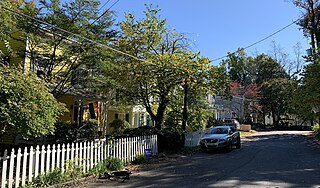
The Grant Road Historic District is located in the Tenleytown neighborhood of Washington, D.C. The two-block historic district is what remains of a former settlement in rural Washington County in the District of Columbia. It includes 13 contributing buildings and the road itself, a narrow remnant of a country road that was used by soldiers in the Civil War. Following the war, the road was named after Civil War general and President Ulysses S. Grant. Grant Road developed into a residential street lined with mostly small, two-story homes for working-class people.

Western Avenue is one of three boundary streets between Washington, D.C., and the state of Maryland. It follows a southwest-to-northeast line, beginning at Westmoreland Circle in the south and ending at Oregon Avenue NW in the north. It is roughly 3.5 miles (5.6 km) in length. First proposed in 1893, it was constructed somewhat fitfully from about 1900 to 1931.

The Connecticut Avenue Line, designated Route L2, is a daily bus route in Northwest Washington, D.C., United States. The L2 operates seven days a week.
Woodmont is a neighborhood in northwest Washington, D.C.

The Chevy Chase Land Company is a real estate holding and development company based in suburban Washington, D.C.

