
Meramec State Park is a public recreation area located near Sullivan, Missouri, about 60 miles from St. Louis, along the Meramec River. The park has diverse ecosystems such as hardwood forests and glades. There are over 40 caves located throughout the park, the geology of which is a mixture of limestone and dolomite. The most famous is Fisher Cave, located near the campgrounds. The park borders the Meramec Conservation Area.

Montauk State Park is a public recreation area occupying nearly 3,000 acres (1,200 ha) at the headwaters of the Current River, fifteen miles (24 km) southwest of Salem, Missouri. The state park contains a fish hatchery and is noted for its rainbow and brown trout angling. It was acquired in 1926. The park has several natural springs including Montauk Spring with a daily average flow of 53 million gallons of water.

Lake of the Ozarks State Park is a Missouri state park on the Grand Glaize Arm of the Lake of the Ozarks and is the largest state park in the state. This is also the most popular state park in Missouri, with over 2.5 million visitations in 2017.
The Big Buffalo Valley Historic District, also known as the Boxley Valley Historic District, is notable as a cultural landscape in Buffalo National River. It comprises the Boxley Valley in northern Arkansas, near the town of Ponca. The valley includes a number of family-operated farms, primarily dating between 1870 and 1930. The farms are situated on either side of the road that parallels the river, Highway 43. Many of these farms are still operated by the descendants of the original homesteaders. However, of fifty residences in the valley, thirty were vacant in 1987, at the time of historic designation.
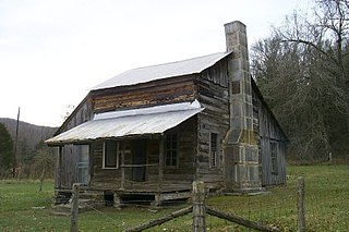
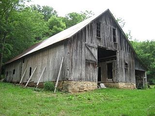
The Parker–Hickman Farm includes the oldest standing log structure in Buffalo National River. The farm was homesteaded in the 1840s by settlers from Tennessee. It embodies an agricultural landscape with farmstead, extant fields, fencerows, roads, cattle gates, garden and orchard plots, wooded slopes and springs. Unlike most farms in the Ozarks the landscape is remarkably intact and provides insights and evidence spanning portions of two centuries of Ozark history; not randomly chosen, it conveys a feeling of enclosure and exemplifies adaptive use of topography. Among farms of its kind in Missouri and Arkansas it was once typical but now survives as a rare baseline example for Ozark yeomanry farms of mixed economies. Parker–Hickman was an agricultural enterprise that continuously operated until 1982 from a farmstead which exemplifies the entire period, and a rare one for the Ozarks since it survives. Clustered around the farmstead are several structures: barns, sheds smokehouse, privy, fences, stock feeders and house that represent a cross-section of rural vernacular architecture still in their original location.

Roaring River State Park is a public recreation area covering of 4,294 acres (1,738 ha) eight miles (13 km) south of Cassville in Barry County, Missouri. The state park offers trout fishing on the Roaring River, hiking on seven different trails, and the seasonally open Ozark Chinquapin Nature Center.

Hubbell Family Farm and Kelly's Corners Cemetery is a historic farm complex, cemetery, and national historic district located at Kelly's Corners, Delaware County, New York. The district contains 19 contributing buildings, two contributing sites, and four contributing structures.

The Ozark Courthouse Square Historic District is a national historic district located at Ozark, Christian County, Missouri. It encompasses 19 contributing buildings in a 5.3-acre (2.1 ha) area in the central business district of Ozark. The central feature of the district, the Christian County Courthouse, is a three-story, Classical Revival style brick building designed by architect Henry H. Hohenschild. Other notable buildings include the Bank of Ozark/Masonic Lodge (1897), First Baptist Church (1919), Methodist Episcopal Church (1914), Robertson Brothers’ Store (1882), Ozark Drug (1905), Works Progress Administration Community Building (1934), Hospital, and Christian County Bank.

The Boyd–Wilson Farm is a 157-acre (64 ha) historic district in Franklin, Tennessee, United States. The circa 1840 farm includes an I-house.

Butler Historic District is a national historic district located at Butler, Butler County, Pennsylvania. The district includes 128 contributing buildings, 1 contributing site, and 4 contributing objects in the central business district of Butler. It includes primarily commercial and institutional buildings, with some residential buildings, built between about 1828 and 1952 in a number of popular architectural styles including Late Victorian. Notable buildings include the City Hall, former U.S. Post Office (1912), Koch Building, T.W. Phillips Co. Office Building, Masonic Temple (1910), Butler High School (1917), Butler YMCA (1895), Butler YMCA (1913), First Evangelical Lutheran Church (1897), St. Andrews United Presbyterian Church, John Quincy Adams Kennedy House, St. Mark's Evangelical Lutheran Church and School, First Baptist Church (1914), St. Paul's Roman Catholic Church (1909), and Butler Savings and Trust (1925). The contributing site is the Diamond, that contains the contributing objects including the Soldiers and Sailors Monument (1894). Located in the district and listed separately are the Butler County National Bank, the Sen. Walter Lowrie House, and the Butler County Courthouse.

Riner Historic District is a national historic district located at Riner, Montgomery County, Virginia. The district encompasses 23 contributing buildings and 1 contributing structure in the village of Riner. It includes a variety of vernacular residential, commercial, and institutional buildings dating from the 1850s to 1920s. Notable buildings include the Methodist Episcopal Church (1908), Bank of Riner (1912–1913), Jonathan E. Hall House / Store, Kinsey-Lawrence House (1908–1909), Dr. Stone Farm, Surface Mill, Auburn United Methodist Church (1885), and Sam Barnett Store.

A.S. Cooper Farm is a historic farm complex and national historic district located near Brownwood, Ashe County, North Carolina. The district encompasses 13 contributing buildings, 2 contributing sites, and 1 contributing structure. They are located in three primary clusters on the farm. The A.S. Cooper, Sr. cluster includes the A.S. Cooper, Sr. House, spring house, tool shed / wood shed, chicken coop, granary, and garage (1934). The second cluster is the barn / milking parlor, and silo complex. The third cluster includes the Albert Sidney Cooper, Jr. House (1918), small shed, kitchen building, shed, spring house, and barn. Associated with the complex is the family cemetery and agricultural landscape.

The Evergreen Ridge Stock Farm Historic District, also known as the Maasdam Farm, Massdam and Wheeler, and Glen and June German Farm, is an agricultural historic district located on the south side of Fairfield, Iowa, United States. It was listed on the National Register of Historic Places in 2007. At the time of its nomination it included four contributing buildings, one contributing site, one contributing structure, and one non-contributing building. The significance of the district is attributed to its historic use as a livestock farm. The contributing buildings include the Show Barn, the Stallion Barn, the Mare Barn, wind mill, chicken coop, and the farmyard. There were two different houses on the farm, and both have been removed. From 1910 to 1938 the farm was owned by J.G. Maasdam, who imported and bred award-winning Belgian, Percheron and other draft horses that were used for farming.
Harrisonville Courthouse Square Historic District is a national historic district located at Harrisonville, Cass County, Missouri. The district includes 34 contributing buildings, 1 contributing structure, and 1 contributing object in the central business district of Harrisonville. It developed between about 1880 and 1943, and includes representative examples of Italianate, Queen Anne, Colonial Revival, Tudor Revival, and Renaissance Revival style architecture. Notable buildings include the Cass County Courthouse (1897), New Method Laundry (1929), Cass County Democrat, Wooldridge Building, Bank of Harrisonville (1900-1901), Wirt's Opera House Building, Post Office Building (1925), Emmons Building/Bowman Building (1887), Evans Building (1890), White Motor Company, Stephen Stuart "Racket" Store, First National Bank of Harrisonville, and Deacon Building (1892).

Dulle Farmstead Historic District, also known as Pleasant Home Farm, is a historic home and farm and national historic district located near Jefferson City, Cole County, Missouri. It encompasses nine contributing buildings and one contributing structure and include the brick I-house form farmhouse (1902), the multi-purpose barn, the cattle barn (1933), the ice house, the garage (1942), two chicken shelters, two brooder houses, and an oak plank and iron beam bridge (1934).
Isiah Mansur Farmstead Historic District, also known as Rock Hall, is a historic home and farm and national historic district located near Richmond, Ray County, Missouri. The district encompasses eight contributing buildings, one contributing site, and three contributing structures on a farm developed between the mid-19th and mid-20th centuries. The contributing resources include the main farmhouse, a buggy house, a large barn, an engine house (c.1900), a small barn, a brooder house, a hen house, a smokehouse, a house well, a field well, and a wellhouse. The main farmhouse is a two-story, five bay, frame I-house.

Chilton-Williams Farm Complex, also known as Chilton Place, is a historic farm complex and national historic district located in the Ozark National Scenic Riverways near Eminence, Shannon County, Missouri. The district encompasses 15 contributing buildings and 2 contributing structures associated with a post-American Civil War Ozark farm. It developed between about 1869 and 1879 and includes the Chilton House, Williams-Baltz House, gambrel roofed barn, four small barns, two corn cribs, smokehouse, five sheds, privy, storm cellar, and chicken house.

The Podhajsky-Jansa Farmstead District is an agricultural historic district located southwest of Ely, Iowa, United States. It was listed on the National Register of Historic Places in 2000. At the time of its nomination it consisted of 12 resources, which included five contributing buildings, four contributing structures, and three non-contributing structures. The historic buildings include two small side gabled houses ; a two-story, frame, American Foursquare house ; a gabled barn that was moved here from another farm ; and a feeder barn. One of two corncribs (1933), a hog house, and a chicken house are the historic structures. Another corncrib and a couple of metal sheds from the mid to late 20th century are the non-contributing structures.

The Stoner Creek Rural Historic District, in Bourbon County, Kentucky near Paris, Kentucky, is a 22,000 acres (89 km2) historic district which was listed on the National Register of Historic Places in 2001. It included 526 contributing buildings, 207 contributing structures, seven contributing objects and 33 contributing sites.


