
Morden is a district and town in south London, England, within the London Borough of Merton. It is around 8 miles (13 km) south-southwest of Charing Cross. Morden adjoins Merton Park and Wimbledon to the north, Mitcham to the east, Sutton to the south and Worcester Park to the west.

The London Borough of Merton is a borough in south-west London, England.

Wandsworth is a London borough in southwest London; it forms part of Inner London. Its main settlements are Battersea, Putney, Tooting and Wandsworth Town. The borough borders the London Borough of Lambeth to the east, the London Borough of Merton and the Royal Borough of Kingston upon Thames to the south, the London Borough of Richmond upon Thames to the west and to the north three boroughs, namely the London Borough of Hammersmith and Fulham, Royal Borough of Kensington and Chelsea and the City of Westminster. The local authority is Wandsworth London Borough Council.

Colliers Wood is an area in south west London, England, in the London Borough of Merton. It is a mostly residential area, but has a busy high street around Colliers Wood tube station on London Underground's Northern line. The high street is part of the A24, a major road route roughly following the Northern Line, running from London through Tooting and other areas. The Colliers Wood ward had a population of 10,712 in 2011.

The A24 is a major road in England that runs for 53.2 miles (85.6 km) from Clapham in south-west London to Worthing on the English Channel in West Sussex via the suburbs of south-west London, as well as through the counties of Surrey and West Sussex.

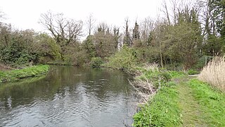
The River Wandle is a tributary of the River Thames in south London, England. With a total length of about 9 miles (14 km), the river passes through the London boroughs of Croydon, Sutton, Merton and Wandsworth, where it reaches the Thames. A short headwater – the Caterham Bourne – is in Surrey, the historic county of the river's catchment. Tributaries of the Wandle include the River Wrythe and the Norbury Brook.

The London Borough of Croydon has over 120 parks and open spaces within its boundaries, ranging from the 200 acre (80ha) Selsdon Wood Nature Reserve to many recreation grounds and sports fields scattered throughout the Borough. Croydon covers an area of 86.52 km², the 256th largest district in England. Croydon's physical features consist of many hills and rivers that are spread out across the borough and into the North Downs, Surrey and the rest of South London. Some of the open spaces in Croydon form part of the well-known London LOOP walks where the first section was opened on 3 May 1996 with a ceremony on Farthing Downs in Coulsdon. As a borough in Outer London it also contains some open countryside in the form of country parks. Croydon Council is associated with several other boroughs who are taking part in the Downlands Countryside Management Project. These boroughs are Sutton; and by Surrey County Council; the City of London Corporation; the Surrey districts of Reigate and Banstead and Tandridge; and the Countryside Agency. An additional partner is Natural Britain.

Merton is an ancient parish which was first in Surrey but since 1965 has been in London, bounded by Wimbledon to the north, Mitcham to the east, Morden, Cheam and Cuddington to the south and (New) Malden to the west. The 1871 Ordnance Survey map records its area as 1,764.7 acres (7.1 km2).

Merton Abbey is an area in southwest London, England. It lies between South Wimbledon and Colliers Wood in the London Borough of Merton. Merton Abbey takes its name from Merton Priory, which once stood on the northern edge of the district. The area is bounded by Merton High Street to the north, the River Wandle to the west, Christchurch Road to the east and Deen City Farm to the south.

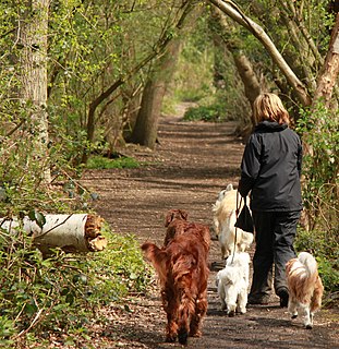
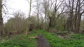
The Wandle Trail is a 12.5-mile (20 km) walking and cycling trail that follows the River Wandle from Croydon to Wandsworth in south-west London
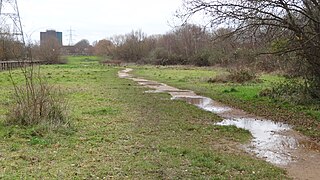
Wandle Meadow Nature Park is a 4.15 hectare local nature reserve and Site of Borough Importance for Nature Conservation, Grade 1, in Wimbledon in the London Borough of Merton. It is owned and managed by Merton Council.
Fishpond Wood and Beverley Meads is a 5.8 hectare local nature reserve adjacent to Wimbledon Common in the London Borough of Merton. It is owned by Merton Council, but is managed by the London Wildlife Trust.

Morden Park is a 50 hectare public park and Site of Borough Importance for Nature Conservation, Grade 1, in the district of Morden Park in the London Borough of Merton. An area of 28 hectares is also a Local Nature Reserve. It is owned and managed by Merton Council. The site includes the Morden Park mound, a Scheduled Ancient Monument, and Pyl Brook runs through the park.
Ravensbury Park is a public park in Mitcham in the London Borough of Merton. An area of 7 hectares is designated a Local Nature Reserve. The River Wandle runs along the southern boundary of the park, which is also part of the Upper Wandle River Site of Metropolitan Importance for Nature Conservation.
Bennett's Hole is a 1.2 hectare Local Nature Reserve in Mitcham in the London Borough of Merton. According to the Natural England details page about the site, it is owned by Merton Council and managed by the council and London Wildlife Trust, but it is not shown on the Trust's list of reserves.

Wilderness Island is the 2.7 hectare island between the Wandle and Wrythe in Carshalton in the London Borough of Sutton. It is designated a Local Nature Reserve and a Site of Metropolitan Importance for Nature Conservation, is owned by Sutton Council and is managed by the London Wildlife Trust.

Sutton Ecology Centre Grounds is a 1.3 hectare Local Nature Reserve and Site of Borough Importance for Nature Conservation, Grade 1, in Carshalton in the London Borough of Sutton. It is owned by Sutton Council and managed by the Council together with the Friends of Sutton Ecology Centre.

Cherry Wood is a 1.8 hectare Local Nature Reserve and Site of Borough Importance for Nature Conservation, Grade II, in Morden Park in the London Borough of Merton. It is owned by Merton Council and managed by the council together with the Friends of Cherry Wood.

Sir Joseph Hood Memorial Wood is a 1.7 hectare Local Nature Reserve and a Site of Borough Importance for Nature Conservation, Grade I, in Motspur Park in the London Borough of Merton. It adjoins Sir Joseph Hood Memorial Playing Fields, and both are owned and managed by Merton Council.
