
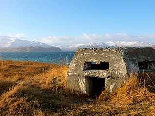
Alaska is a non-contiguous U.S. state on the northwest extremity of North America. It is in the Western United States region. The only other non-contiguous U.S. state is Hawaii. Alaska is also considered to be the northernmost, westernmost, and easternmost state in the United States. It borders the Canadian territory of Yukon and the province of British Columbia to the east. It shares a western maritime border, in the Bering Strait, with Russia's Chukotka Autonomous Okrug. The Chukchi and Beaufort Seas of the Arctic Ocean lie to the north, and the Pacific Ocean lies to the south. Technically a semi-exclave of the U.S., it is the largest exclave in the world.

The contiguous United States consists of the 48 adjoining U.S. states and the District of Columbia of the United States of America in central North America. The term excludes the only two non-contiguous states, which are Alaska and Hawaii, and all other offshore insular areas, such as the U.S. territories of American Samoa, Guam, the Northern Mariana Islands, Puerto Rico, and the U.S. Virgin Islands. The colloquial term "Lower 48" is also used, especially in relation to Alaska.

Aleutians East Borough is a 2nd class borough in the U.S. state of Alaska. As of the 2020 census the borough's population was 3,420. The borough seat is Sand Point.
Aleutians West Census Area is a census area located in the U.S. state of Alaska. As of the 2020 census, the population was 5,232, down from 5,561 in 2010.

Juneau, officially the City and Borough of Juneau, is the capital city of the U.S. state of Alaska, located in the Gastineau Channel and the Alaskan panhandle. Juneau was named the capital of Alaska in 1906, when the government of what was then the District of Alaska was moved from Sitka as dictated by the U.S. Congress in 1900. On July 1, 1970, the City of Juneau merged with the City of Douglas and the surrounding Greater Juneau Borough to form the current consolidated city-borough, which ranks as the second-largest municipality in the United States by area and is larger than both Rhode Island and Delaware.

Kodiak Island Borough is a borough in the U.S. state of Alaska. At the 2020 census, the population was 13,101, down from 13,592 in 2010. The borough seat is Kodiak.
Nome Census Area is a census area located in the U.S. state of Alaska, mostly overlapping with the Seward Peninsula. As of the 2020 census, the population was 10,046, up from 9,492 in 2010. It is part of the unorganized borough and therefore has no borough seat. Its largest community by far is the city of Nome.

Prince of Wales–Hyder Census Area is a census area located in the U.S. state of Alaska. As of the 2020 census, the population was 5,753, up from 5,559 in 2010. It is part of the unorganized borough and therefore has no borough seat. Its largest communities are Metlakatla and Craig. It was formerly part of the Census Bureau's Prince of Wales–Outer Ketchikan Census Area, but the name was changed in 2008 after most of the Outer Ketchikan was lost to annexation by the Ketchikan Gateway Borough.

Hoonah–Angoon Census Area is a census area located in the U.S. state of Alaska. As of the 2020 census, the population was 2,365, up from 2,150 in 2010. It is part of the unorganized borough and therefore has no borough seat. Its largest community is the city of Hoonah.

In the United States, a county or county equivalent is an administrative or political subdivision of a U.S. state or other territories of the United States which consists of a geographic area with specific boundaries and usually some level of governmental authority. The term "county" is used in 48 states, while Louisiana and Alaska have functionally equivalent subdivisions called parishes and boroughs, respectively. The specific governmental powers of counties vary widely between the states, with many providing some level of services to civil townships, municipalities, and unincorporated areas. Certain municipalities are in multiple counties; New York City is uniquely partitioned into five counties, referred to at the city government level as boroughs. Some municipalities have been consolidated with their county government to form consolidated city-counties, or have been legally separated from counties altogether to form independent cities. Conversely, counties in Connecticut, Rhode Island, eight of Massachusetts's 14 counties, and Alaska's Unorganized Borough have no government power, existing only as geographic distinctions.
Alaska Township is a township in Beltrami County, Minnesota, United States. The population was 197 as of the 2000 census. Alaska Township was named by settlers who had recently returned from a trip to Alaska.
In 45 of the 50 states of the United States, the county is used for the level of local government immediately below the state itself. Louisiana uses parishes, and Alaska uses boroughs. In Connecticut, Massachusetts, and Rhode Island, some or all counties within states have no governments of their own; the counties continue to exist as legal entities, however, and are used by states for some administrative functions and by the United States Census bureau for statistical analysis. There are 3,242 counties and county equivalent administrative units in total, including the District of Columbia and 100 county-equivalents in the U.S. territories.

Unimak Island is the largest island in the Aleutian Islands chain of the U.S. state of Alaska.

Chichagof Island, or Shee Kaax, is an island in the Alexander Archipelago of the Alaska Panhandle. At 75 miles (121 km) long and 50 miles (80 km) wide, it has a land area of 2,048.61 square miles (5,305.9 km2), making it the fifth largest island in the United States and the 109th largest island in the world. Its coastline measures 742 miles. There was a 2000 census population of 1,342 persons. It is one of the ABC islands of Alaska. Chichagof Island has the highest population of bears per square mile of any place on Earth.

Forrester Island Wilderness is a 2,832-acre (1,146 ha) wilderness area in the U.S. state of Alaska at Forrester Island. It was designated by the United States Congress in 1970. It is part of the Gulf of Alaska unit of the Alaska Maritime National Wildlife Refuge.
Stuart Island is an island on the southeast side of the Norton Sound of Alaska. The island is about 9.3 miles (15.0 km) long and 6.2 miles (10.0 km) wide with a land area of 52.195 square miles (135.18 km2) and had no resident population at the 2000 census. The name "Stuart's Island" was given during the third voyage of James Cook in September 1778.

Alaska occupies the northwestern portion of the North American continent and is bordered only by Canada on the east. It is one of two U.S. states not bordered by another state; Hawaii is the other. Alaska has more ocean coastline than all of the other U.S. states combined. About 500 miles (800 km) of Canadian territory consisting of British Columbia separate Alaska from Washington U.S. state. Alaska is thus an exclave of the United States that is part of the continental U.S. and the U.S. West Coast, but is not part of the contiguous U.S.

