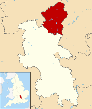
The City of Milton Keynes is a unitary authority area with both borough and city status, in Buckinghamshire. It is the northernmost district of the South East England Region. The borough abuts Bedfordshire, Northamptonshire and the remainder of Buckinghamshire.

Olney is a market town and civil parish in the unitary authority area of the City of Milton Keynes, Buckinghamshire, England. At the 2011 Census, it had a population of 6,477.
Caldecote is a tiny hamlet in the civil parish of Moulsoe in the City of Milton Keynes, Buckinghamshire, England, situated roughly 1 mile (1.6 km) south of Newport Pagnell, and roughly 3 miles (4.8 km) north-east of Central Milton Keynes.
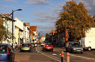
Newport Pagnell is a town and civil parish in the City of Milton Keynes, Buckinghamshire, England. The Office for National Statistics records Newport Pagnell as part of the Milton Keynes urban area.
Emberton is a village and civil parish in the unitary authority area of the City of Milton Keynes, in Buckinghamshire, England. The village is near the borders with Northamptonshire and Bedfordshire, just to the south of Olney, 4 miles (6.4 km) north of Newport Pagnell, and 7 miles (11 km) north-east of Central Milton Keynes.

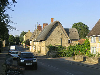
Calverton is a civil parish in the unitary authority area of the City of Milton Keynes, Buckinghamshire, England and just outside the Milton Keynes urban area, situated roughly 1 mile (1.6 km) south of Stony Stratford, and 4 miles (6.4 km) west of Central Milton Keynes. The parish consists of one village, Lower Weald, and two hamlets, Upper Weald and Middle Weald. Lower Weald is the largest of the three settlements, and Manor Farm, the parish church and the former parochial school are within its boundaries.
Clifton Reynes is a village and civil parish in the unitary authority area of the City of Milton Keynes, Buckinghamshire, England. It is about a mile east of Olney. It shares a joint parish council with Newton Blossomville. It is situated roughly 8 miles (13 km) north of Central Milton Keynes and 9 miles (14 km) west of Bedford.
Cold Brayfield is a village and civil parish in the unitary authority area of the City of Milton Keynes, Buckinghamshire, England. It is about 3 miles (4.8 km) east of Olney, 8 miles (13 km) west of Bedford, and 10 miles (16 km) north of Central Milton Keynes on the Bedfordshire border. Nearby places are Lavendon and Turvey. It is in the civil parish of Newton Blossomville.

Hardmead is a small village in the unitary authority area of the City of Milton Keynes, Buckinghamshire, England. It is in the north of the Borough, about 7.5 miles (12.1 km) west of Bedford, 7 miles (11 km) north-east of Central Milton Keynes and 5 miles (8.0 km) north east of Newport Pagnell. The village is close to the A422 road, on a very small road linking that to nearby Newton Blossomville. Together with the neighbouring village of Astwood, it forms the civil parish of Astwood and Hardmead.

Lavendon is a village and civil parish in the unitary authority area of the City of Milton Keynes, Buckinghamshire, England. It is the northernmost village in the Milton Keynes UA and South East England, near Olney, about 8 miles (13 km) WNW of Bedford and 9 miles (14 km) NNE of Central Milton Keynes.
Little Linford is a village and former civil parish, now in the parish of Haversham-cum-Little Linford, in the City of Milton Keynes, Buckinghamshire, England. Located near the M1 motorway, the village is about 2 miles (3.2 km) north-west of Newport Pagnell and 3.5 miles (5.6 km) north of Central Milton Keynes. The village is separated from its neighbour and namesake Great Linford by the floodplain of the River Great Ouse. In 1931 the parish had a population of 45. On 1 April 1934 the parish was abolished and merged with Haversham to form "Haversham cum Little Linford".
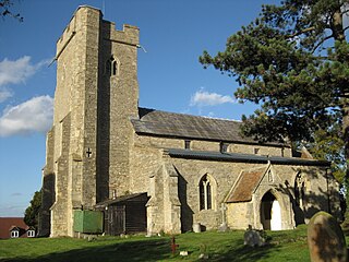
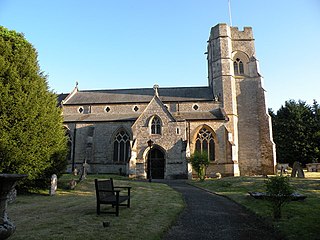
Moulsoe is a village and civil parish in the unitary authority area of the City of Milton Keynes, Buckinghamshire, England. It is on the border with Bedfordshire, and just east of the M1, situated about 2.5 miles (4.0 km) ESE of Newport Pagnell, and about 5 miles (8.0 km) NNE of Central Milton Keynes. The main road through the village is the Newport Road coming from the west, changing to the Cranfield Road going east at a bend by the church.

Newton Blossomville is a village in the unitary authority area of the City of Milton Keynes, Buckinghamshire, England. It is a civil parish, sharing a joint parish council with Clifton Reynes. At the 2011 census, the population of the parish was 329, an increase of 17.5% on the 280 figure for 2001

North Crawley is a village and civil parish in the unitary authority area of the City of Milton Keynes, Buckinghamshire, England. It is located near the border with Bedfordshire, about 3.5 miles (5.6 km) east of Newport Pagnell, and 6 miles (9.7 km) north-east of Central Milton Keynes.

Ravenstone is a village and civil parish in the unitary authority area of the City of Milton Keynes, Buckinghamshire, England. The village is about 2.5 miles (4 km) west of Olney, and 4 miles (6.4 km) north of Newport Pagnell and about 10 miles (16 km) from Central Milton Keynes. The 2011 Census recorded the parish population as 209.

Woburn Sands is a town that straddles the border between Buckinghamshire and Bedfordshire in England, and also is part of the Milton Keynes urban area. The larger part of the town is in Woburn Sands civil parish, which is in the City of Milton Keynes, Smaller parts of the town are in the neighbouring parishes of Aspley Guise and Aspley Heath. The meandering boundary between Buckinghamshire and Bedfordshire means the Lower and Middle Schools that serve all of the town are both in Aspley Guise CP. Bedfordshire Police and Thames Valley Police both deal with law enforcement issues in the town. At the 2011 Census, the population of the civil parish (only) was 2,916, that of the built-up area was 5,959. Woburn Sands, Aspley Guise and Aspley Heath each has its own centre but together the three settlements are a contiguous built-up area.
Weston Underwood is a village and civil parish in the unitary authority area of the City of Milton Keynes, Buckinghamshire, England. It is located about a mile west of Olney.
Aspley Heath is a village and civil parish in the Central Bedfordshire district of Bedfordshire, England, elevated and small in population and area, mostly covered by New Wavendon Heath and a smaller mixed eponymous woodland. It was until some time after 1912 part of Aspley Guise. The Office for National Statistics records the village as part of the Woburn Sands urban subdivision of the Milton Keynes urban area. In addition to the village of Aspley Heath itself, the civil parish also includes part of the town of Woburn Sands, the rest of which is in the City of Milton Keynes in Buckinghamshire.

Milton Keynes North is a constituency represented in the House of Commons of the UK Parliament since the 2019 United Kingdom general election by Ben Everitt, a Conservative.

