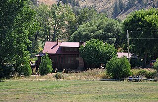
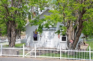
Dairy is an unincorporated community in Klamath County, Oregon, United States.
Woods is an unincorporated community in Tillamook County, Oregon, United States. Woods lies at the intersection of Brooten Road, Resort Drive, and Old Woods Road, along the Nestucca River just north of Pacific City and west of U.S. Route 101.
Antone is a former community in Wheeler County, in the U.S. state of Oregon. Antone is south of U.S. Route 26 between Mitchell and Dayville.

Richmond is an unincorporated community in Wheeler County, in the U.S. state of Oregon. Richmond lies on Richmond Road southeast of its intersection with Oregon Route 207 between Mitchell and Service Creek. The community had a post office from 1899 to 1952.

Service Creek is an unincorporated community in Wheeler County, in the U.S. state of Oregon. Service Creek lies on Oregon Route 19 near its intersection with Oregon Route 207. It is also near the mouth of a stream, Service Creek, formerly Sarvis Creek, that empties into the John Day River.
Keating is an unincorporated community in Baker County, in the U.S. state of Oregon. Keating lies off Keating Road north of its interchange with Oregon Route 86. Keating is northeast of Baker City.

New Princeton is an unincorporated community in Harney County, in the U.S. state of Oregon. It is along Oregon Route 78 between Burns and Burns Junction at an elevation of 4,111 feet (1,253 m) above sea level. The South Fork Malheur River begins near Round Mountain, southeast of New Princeton.
Libby, previously known as Easport, is an unincorporated community on Coalbank Slough in Coos County, Oregon, United States. It was named for a Native American woman. Its post office was established on June 11, 1890, and operated for just two years. Enoch Gore was postmaster.
Manhattan Beach is an unincorporated community in Tillamook County, Oregon, United States. It lies about a mile north of Rockaway Beach along U.S. Route 101. Manhattan Beach State Recreation Site is nearby.

Mayville is an unincorporated community in Gilliam County, Oregon, United States. It is located on Oregon Route 19. According to 1909 Oregon law, Mayville was the permanent meeting place of the board of commissioners of Gilliam and Wheeler counties. They met in Mayville each year to elect the president of the board. A post office was established in Mayville and "put in operation in October 1884 with Samuel Thornton postmaster." The community's name was originally made by Thornton's wife.
Pleasant Valley is an unincorporated community in Tillamook County, Oregon, United States. It is located about seven miles south of Tillamook, on U.S. Route 101.
Clarno is an unincorporated community in Wasco County, Oregon, United States. It is located along Oregon Route 218 near the John Day River.

Twickenham is an unincorporated community in Wheeler County, in the U.S. state of Oregon. It is located along the John Day River between Service Creek and Mitchell, Oregon. A bridge at Twickenham carries North Twickenham Road over the river.
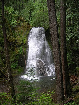
Yakso Falls is a 70-foot (21 m) waterfall on Little River, in the Cascade Range east of Roseburg in the U.S. state of Oregon. The waterfall is about 27 miles (43 km) from the unincorporated community of Glide along Little River Road, which becomes Forest Road 27.
Encina is an unincorporated community in Baker County, Oregon, United States. Encina is about 10 miles (16 km) southeast of Baker City near exit 313 of U.S. Route 30/Interstate 84.
Blalock was an unincorporated community located in the Columbia River Gorge in Gilliam County, Oregon, United States. The town displaced a Native American settlement originally named Táwash. Blalock was located about 7 miles (11 km) west of Arlington on Interstate 84/U.S. Route 30 at the mouth of Blalock Canyon. Blalock is still the name of a station on the Union Pacific Railroad.
Faubion is an unincorporated community in Clackamas County, Oregon, United States. It is located about 2 miles northwest of Rhododendron, in the Mount Hood Corridor on a loop road off U.S. Route 26 near the Zigzag River.
Gooseberry is an unincorporated community in Morrow County, Oregon, United States. Gooseberry lies along Ione–Gooseberry Road near its intersection with Oregon Route 206 between Heppner to the east and Condon to the west.
Rutledge is an unincorporated community in Sherman County, in the U.S. state of Oregon. It lies east of Grass Valley and U.S. Route 97 along Rutledge Road.

Sandlake is an unincorporated community in Tillamook County, Oregon, United States. It lies between Tillamook and Pacific City along Sandlake Road west of U.S. Route 101.


