Watersmeet, Michigan

Last updated
Watersmeet, Michigan
Watersmeet (CDP), MI location.png
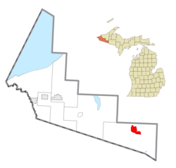
Location within Gogebic County
USA Michigan location map.svg
Red pog.svg
Watersmeet
Location within the state of Michigan
Usa edcp location map.svg
Red pog.svg
Watersmeet
Watersmeet (the United States)
Coordinates: 46°16′04″N89°10′41″W / 46.26778°N 89.17806°W / 46.26778; -89.17806 Coordinates: 46°16′04″N89°10′41″W / 46.26778°N 89.17806°W / 46.26778; -89.17806
Country United States
State Michigan
County Gogebic
Township Watersmeet
Area
[1]
  Total9.21 sq mi (23.84 km2)
  Land9.20 sq mi (23.83 km2)
  Water0.01 sq mi (0.01 km2)
Elevation
1,598 ft (487 m)
Population
 (2020)
  Total408
  Density44.35/sq mi (17.12/km2)
Time zone UTC-6 (Central (CST))
  Summer (DST) UTC-5 (EDT)
ZIP code(s)
49969
Area code(s) 906
FIPS code 26-84360 [2]
GNIS feature ID1622065 [3]

Watersmeet is an unincorporated community and census-designated place (CDP) in Watersmeet Township, Gogebic County, Michigan, in the United States. As of the 2010 census, the CDP had a population of 428, [2] out of a total population in the township of 1,417. The community was platted in 1884, designated as a station of the Milwaukee Lake Shore and Western Railroad. [4]

The community is located in the northern part of Watersmeet Township, in the western part of Michigan's Upper Peninsula, at the confluence of Duck Creek with the Middle Branch of the Ontonagon River. U.S. Routes 2 and 45 cross at the southern edge of town; US 2 leads southeast 30 miles (48 km) to Iron River and northwest 41 miles (66 km) to Wakefield, while US 45 leads north 46 miles (74 km) to Ontonagon on Lake Superior and south 26 miles (42 km) to Eagle River, Wisconsin. The community is also served by the State Line Trail. [5]

The community of Watersmeet was listed as a newly-organized census-designated place for the 2010 census, meaning it now has officially defined boundaries and population statistics for the first time. [6] According to the United States Census Bureau, the Watersmeet CDP has an area of 9.2 square miles (23.8 km2), of which 0.004 square miles (0.01 km2), or 0.06%, is water. [2]

Demographics

Historical population
CensusPop.
2020 408
U.S. Decennial Census [7]

Related Research Articles

Oscoda, Michigan Census-designated place & unincorporated community in Michigan, United States

Oscoda is an unincorporated community in the U.S. state of Michigan located on the northern side of the Au Sable River where it enters Lake Huron. The community of Au Sable is on the other side of the river. Oscoda is in Oscoda Township in Iosco County, and not in Oscoda County, which is to the northwest. Oscoda was incorporated as a village in 1885, but disincorporated in 1919 after forest fires devastated the area. The 1990 census population was 1,061, although 3,000 personnel were stationed at nearby Wurtsmith Air Force Base. Oscoda is a census-designated place (CDP) for statistical purposes. As of the 2000 census, the population was 992, and in 2010 the population was 903. The post office at Oscoda first opened with the name AuSable on September 23, 1856. The name changed to Oscoda on July 1, 1875.

Ontonagon County, Michigan County in Michigan, United States

Ontonagon County is a county in the Upper Peninsula of the U.S. state of Michigan. As of the 2020 Census, the population was 5,816, making it Michigan's third-least populous county. The county seat is Ontonagon. The county was set off in 1843, and organized in 1848. Its territory had been organized as part of Chippewa and Mackinac counties. With increasing population in the area, more counties were organized. After Ontonagon was organized, it was split to create Gogebic County. It is also the westernmost U.S. county that uses the Eastern Time Zone.

Gogebic County, Michigan County in Michigan, United States

Gogebic County is the westernmost county in the Upper Peninsula in the U.S. state of Michigan. As of the 2020 Census, the population was 14,380. The county seat is Bessemer. This was historically part of the territory of the Lake Superior Band of Chippewa, which had twelve bands in Michigan, Wisconsin and Minnesota. The Lac Vieux Desert Indian Reservation is in this county, in Watersmeet Township; it is the land base of one of the federally recognized tribes.

Watersmeet Township, Michigan Civil township in Michigan, United States

Watersmeet Township is a civil township of Gogebic County in the Upper Peninsula of the U.S. state of Michigan. The population was 1,417 at the 2010 census, slightly down from 1,472 at the 2000 census. Chippewa students made up half of the student body and winning high school basketball team in the early 2000s. It was featured in the 2007 documentary Nimrod Nation, shown on The Sundance Channel.

Michigan Center, Michigan Census-designated place & unincorporated community in Michigan, United States

Michigan Center is an unincorporated community and census-designated place (CDP) in Jackson County in the U.S. state of Michigan. The population was 4,672 at the 2010 census. The CDP is located within Leoni Township on the eastern border of the city of Jackson.

Comstock Park, Michigan Census-designated place & unincorporated community in Michigan, United States

Comstock Park is an unincorporated community and census-designated place (CDP) in Kent County in the U.S. state of Michigan. The population was 10,088 at the 2010 census. The community is located within Alpine Township to the west and Plainfield Township to the east.

Michigamme, Michigan Place in Michigan, United States

Michigamme is an unincorporated community in Marquette County in the U.S. state of Michigan. It is located within Michigamme Township on the north shores of Lake Michigamme. For statistical purposes, the United States Census Bureau has defined Michigamme as a census-designated place (CDP). The CDP had a population of 271 at the 2010 census.

Bergland is a census-designated place (CDP) and the primary community in Bergland Township, Ontonagon County, Michigan, United States. It is situated on the north shore of Lake Gogebic, the largest natural inland lake on the Upper Peninsula of Michigan. Highway M-28 passes through the center of town, leading east 19 miles (31 km) to Bruce Crossing and southwest 20 miles (32 km) to Wakefield. M-64 leads north from Bergland 17 miles (27 km) to the shore of Lake Superior and 30 miles (48 km) to Ontonagon, the county seat. Bergland is bordered to the west by the Lake Gogebic CDP.

Brutus, Michigan Census-designated place & unincorporated community in Michigan, United States

Brutus is an unincorporated community and census-designated place (CDP) in Emmet County in the U.S. state of Michigan. As of the 2010 census, the CDP had a population of 218. Brutus is located within Maple River Township.

Marenisco, Michigan Census-designated place & unincorporated community in Michigan, United States

Marenisco is an unincorporated community and census-designated place (CDP) in Marenisco Township, Gogebic County, Michigan, in the United States. As of the 2010 census, the CDP had a population of 254, out of a total population in the township of 1,727. The name of the community and the township was formed by combining the first three letters from Mary Enid Scott, the wife of E. H. Scott, a timber producer.

Ewen is an unincorporated community and census-designated place (CDP) in McMillan Township, Ontonagon County, Michigan, United States. It is situated on the Upper Peninsula of Michigan along Highway M-28, which leads east 39 miles (63 km) to Covington and west 35 miles (56 km) to Wakefield.

Walloon Lake, Michigan Census-designated place & unincorporated community in Michigan, United States

Walloon Lake is an unincorporated community and census-designated place in Charlevoix County in the U.S. state of Michigan. As of the 2010 census it had a population of 290.

Eastport, Michigan Census-designated place & unincorporated community in Michigan, United States

Eastport is an unincorporated community and census-designated place (CDP) in Torch Lake Township, Antrim County, in the U.S. state of Michigan. The population was 218 at the 2010 census.

White Pine, Michigan Census-designated place & unincorporated community in Michigan, United States

White Pine is an unincorporated community and census-designated place (CDP) in Ontonagon County in the U.S. state of Michigan. The CDP had a population of 474 at the 2010 census. White Pine is located within Carp Lake Township.

South Boardman, Michigan Census-designated place & unincorporated community in Michigan, United States

South Boardman is an unincorporated community and census-designated place (CDP) in Kalkaska County in the U.S. state of Michigan. At the 2010 census, the CDP had a population of 536. South Boardman is located within Boardman Township.

Rockland is a census-designated place (CDP) and the primary community in Rockland Township, Ontonagon County, Michigan, United States. It is along US Highway 45, which leads north 11 miles (18 km) to its terminus at Ontonagon on Lake Superior, and south 61 miles (98 km) to Eagle River, Wisconsin.

Greenland is an unincorporated community and census-designated place (CDP) in Greenland Township, Ontonagon County, Michigan, United States. It is 1 mile (1.6 km) north of Mass City. State highway M-38 forms the northern edge of the community, leading northwest 11 miles (18 km) to Ontonagon, the county seat, and east 30 miles (48 km) to Baraga.

Jennings, Michigan Census-designated place & unincorporated community in Michigan, United States

Jennings is an unincorporated community and census-designated place (CDP) in Missaukee County in the U.S. state of Michigan. The population was 264 at the 2010 census. The CDP is located mostly in Lake Township with a small portion extending north into Caldwell Township.

Vineyard Lake, Michigan Census-designated place & unincorporated community in Michigan, United States

Vineyard Lake is an unincorporated community and census-designated place (CDP) in Jackson County in the U.S. state of Michigan. The CDP had a population of 980 at the 2010 census. It is located within Columbia Township to the west and Norvell Township to the east.

Lake Gogebic is a census-designated place (CDP) in Bergland Township, Ontonagon County, Michigan, United States. It is situated on the north shore of Lake Gogebic, the largest natural inland lake on the Upper Peninsula of Michigan. The CDP includes the unincorporated communities of Lake Gogebic and Merriweather, and it is bordered to the east by the community of Bergland.

References

  1. "2020 U.S. Gazetteer Files". United States Census Bureau. Retrieved May 21, 2022.
  2. 1 2 3 "Geographic Identifiers: 2010 Demographic Profile Data (G001): Watersmeet CDP, Michigan". American Factfinder. U.S. Census Bureau. Retrieved December 19, 2016.[ dead link ]
  3. U.S. Geological Survey Geographic Names Information System: Watersmeet, Michigan
  4. Chicago and North Western Railway Company (1908). A History of the Origin of the Place Names Connected with the Chicago & North Western Railroad. p. 136.
  5. "Amazing Michigan Trails for Hiking, Biking and More". michigan.org. Michigan Economic Development Corporation. 2020. Retrieved November 30, 2020. Michigan’s longest and reddest rail-trail.
  6. "Michigan: 2010 Population and Housing Unit Counts 2010 Census of Population and Housing" (PDF). 2010 United States Census . United States Census Bureau. September 2012. p. III-5. Retrieved January 20, 2020.
  7. "Census of Population and Housing". Census.gov. Retrieved June 4, 2016.