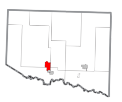
Iron River, Michigan

Last updated
Iron River, Michigan
Iron River (city), MI.png
Location within Iron County
USA Michigan location map.svg
Red pog.svg
Iron River
Location within the state of Michigan
Coordinates: 46°5′47″N88°38′26″W / 46.09639°N 88.64056°W / 46.09639; -88.64056
Country United States
State Michigan
County Iron
Area
[1]
  Total6.76 sq mi (17.50 km2)
  Land6.74 sq mi (17.45 km2)
  Water0.02 sq mi (0.05 km2)
Elevation
1,512 ft (461 m)
Population
 (2020)
  Total3,007
  Density446.41/sq mi (172.37/km2)
Time zone UTC-6 (Central (CST))
  Summer (DST) UTC-5 (CDT)
ZIP code
49935
Area code 906
FIPS code 26-40980 [2]
GNIS feature ID1620325 [3]
Website www.ironriver.org

Iron River is a city in Iron County in the U.S. state of Michigan. As of the 2020 census, the city population was 3,007. The city is situated at the southeast corner of Iron River Township, but is administratively autonomous. Iron River is the birthplace and home of four-time US Olympian and 2022 gold medalist Nick Baumgartner.

Contents

History

A post office called Iron River has been in operation since 1885. [4] The city took its name from the nearby Iron River. [5]

On July 1, 2000, the city of Stambaugh and the village of Mineral Hills were consolidated with the City of Iron River.

Geography

According to the United States Census Bureau, the city has a total area of 6.76 square miles (17.51 km2), of which 6.74 square miles (17.46 km2) is land and 0.02 square miles (0.05 km2) is water. [6]

The area is noted for its vast forest land, scenic lakes, and winter sports.

Iron River and the surrounding area is home of many lakes, and is not far from Lake Superior, the largest of the Great Lakes. In the summer, many people frequent the beaches, in the winter, there are often tents for ice fishing on the frozen lakes. [7]

Climate

This climatic region is typified by large seasonal temperature differences, with warm to hot (and often humid) summers and cold (sometimes severely cold) winters. According to the Köppen Climate Classification system, Iron River has a humid continental climate, abbreviated "Dfb" on climate maps. [8]

Demographics

Historical population
CensusPop.Note
1890 1,117
1900 1,48232.7%
1910 2,45065.3%
1920 4,29575.3%
1930 4,6658.6%
1940 4,416−5.3%
1950 4,048−8.3%
1960 3,754−7.3%
1970 2,684−28.5%
1980 2,426−9.6%
1990 2,095−13.6%
2000 1,929−7.9%
2010 3,02957.0%
2020 3,007−0.7%
Note: Stambaugh and Mineral Hills were consolidated with Iron River in July 2000.
Source for population: U.S. Decennial Census [9]

2010 census

At the 2010 census there were 3,029 people, 1,446 households, and 764 families living in the city. The population density was 449.4 inhabitants per square mile (173.5/km2). There were 1,770 housing units at an average density of 262.6 per square mile (101.4/km2). The racial makeup of the city was 96.3% White, 0.2% African American, 1.2% Native American, 0.3% Asian, 0.1% Pacific Islander, 0.2% from other races, and 1.7% from two or more races. Hispanic or Latino of any race were 1.9%. [10]

Of the 1,446 households, 22.5% had children under the age of 18 living with them, 36.7% were married couples living together, 12.3% had a single female householder, 3.8% had a single male householder, and 47.2% were non-families. 42.9% of households were one person, and 21.5% were one person aged 65 or older. The average household size was 2.02 and the average family size was 2.73.

The median age was 47.6 years. 19.6% of residents were under the age of 18; 6.8% were between the ages of 18 and 24; 20.4% were from 25 to 44; 28.5% were from 45 to 64; and 24.7% were 65 or older. The gender makeup of the city was 47.0% male and 53.0% female.

2000 census

At the 2000 census there were 1,929 people, 876 households, and 487 families living in the city. The population density was 555.7 inhabitants per square mile (214.6/km2). There were 988 housing units at an average density of 284.6 per square mile (109.9/km2). The racial makeup of the city was 95.33% White, 0.16% African American, 1.92% Native American, 0.21% Asian, 0.05% from other races, and 2.33% from two or more races. 0.78% of the population were Hispanic or Latino of any race. 15.4% were of German, 13.4% Swedish, 13.2% Italian, 9.9% Polish, 7.8% English, 7.6% Finnish, 5.9% French and 5.1% Irish ancestry according to Census 2000. 98.3% spoke English as their first language. [2] There were 876 households, 23.7% had children under the age of 18 living with them, 40.2% were married couples living together, 11.5% had a female householder with no husband present, and 44.4% were non-families. 40.3% of households were made up of individuals, and 23.7% had someone living alone who was 65 or older. The average household size was 2.09 and the average family size was 2.80.

The age distribution was 21.3% under the age of 18, 6.2% from 18 to 24, 20.8% from 25 to 44, 21.7% from 45 to 64, and 30.0% who were 65 or older. The median age was 47 years. For every 100 females, there were 81.5 males. For every 100 females age 18 and over, there were 80.2 males.

The median household income was $23,438 and the median family income was $33,942. Males had a median income of $28,083 versus $20,714 for females. The per capita income for the city was $15,728. 11.9% of the population and 6.5% of families were below the poverty line. Out of the total population, 12.5% of those under the age of 18 and 10.0% of those 65 and older were living below the poverty line.

Transportation

Roads

Airport

Bus

Trail

See also

Related Research Articles

<span class="mw-page-title-main">Gogebic County, Michigan</span> County in Michigan, United States

Gogebic County is a county in the Upper Peninsula of the U.S. state of Michigan. As of the 2020 census, the population was 14,380. The county seat is Bessemer. Gogebic County is the westernmost county in Michigan, and is one of four Michigan counties within the Central Time Zone. Gogebic County borders Wisconsin to the south, and has a shoreline on Lake Superior to the north.

<span class="mw-page-title-main">Fall River, Kansas</span> City in Greenwood County, Kansas

Fall River is a city in Greenwood County, Kansas, United States. As of the 2020 census, the population of the city was 131.

Clyde Township is a civil township of Allegan County in the U.S. state of Michigan. The population was 2,084 at the 2010 census.

<span class="mw-page-title-main">Bark River Township, Michigan</span> Civil township in Michigan, United States

Bark River Township is a civil township of Delta County in the U.S. state of Michigan. As of the 2010 census, the township population was 1,578, down from 1,650 at the 2000 census. The township takes its name from the Bark River.

<span class="mw-page-title-main">Gladstone, Michigan</span> City in Michigan, United States

Gladstone is a city in Delta County in the Upper Peninsula of the U.S. state of Michigan. First settled in 1877, Gladstone's original name was Minnewasca. The population was 5,257 according to the 2020 census. U.S. Highways 2 and 41 run concurrently through the city, connecting it to various other communities in the Upper Peninsula. The city of Escanaba lies roughly 14km (9mi) to the south.

<span class="mw-page-title-main">Norway, Michigan</span> City in Michigan, United States

Norway is a city in Dickinson County in the U.S. state of Michigan. The population was 2,845 at the 2010 census. It is part of the Iron Mountain, MI–WI Micropolitan Statistical Area.

<span class="mw-page-title-main">Bessemer, Michigan</span> City in Michigan, United States

Bessemer is a city in the U.S. state of Michigan. As of the 2020 census, the city population was 1,805. It is the county seat of Gogebic County.

<span class="mw-page-title-main">Erwin Township, Michigan</span> Civil township in Michigan, United States

Erwin Township is a civil township of Gogebic County in the U.S. state of Michigan. The population was 326 at the 2010 census, down from 357 at the 2000 census.

<span class="mw-page-title-main">Ironwood, Michigan</span> City in Michigan, United States

Ironwood is a city in Gogebic County in the Upper Peninsula of the U.S. state of Michigan, about 18 miles (29 km) south of Lake Superior. The city is on US Highway 2 across the Montreal River from Hurley, Wisconsin. It is the westernmost city in Michigan, situated on the same line of longitude as Clinton, Iowa and St. Louis, Missouri. The population was 5,045 at the 2020 census, down from 5,387 at the 2010 census. The city is bordered by Ironwood Township to the north, but the two are administered automously.

<span class="mw-page-title-main">Ironwood Charter Township, Michigan</span> Charter township in Michigan, United States

Ironwood Charter Township is a charter township of Gogebic County in the U.S. state of Michigan. The population was 2,333 at the 2010 census. The city of Ironwood borders on the south, but the two are administered autonomously.

<span class="mw-page-title-main">Marenisco Township, Michigan</span> Civil township in Michigan, United States

Marenisco Township is a civil township of Gogebic County in the U.S. state of Michigan. The population was 1,727 at the 2010 census, a significant increase from 1,051 at the 2000 census.

<span class="mw-page-title-main">Watersmeet Township, Michigan</span> Civil township in Michigan, United States

Watersmeet Township is a civil township of Gogebic County in the Upper Peninsula of the U.S. state of Michigan. The population was 1,417 at the 2010 census, slightly down from 1,472 at the 2000 census. Chippewa students made up half of the student body and winning high school basketball team in the early 2000s. It was featured in the 2007 documentary Nimrod Nation, shown on The Sundance Channel.

<span class="mw-page-title-main">Crystal Falls, Michigan</span> City in Michigan, United States

Crystal Falls is a city and the county seat of Iron County, Michigan. As of the 2020 census, the city population was 1,598. The city is located within Crystal Falls Township, but is a separate municipal entity. The area first developed as a major center for iron mining and the timber industry; it has become increasingly popular for tourism in recent years.

<span class="mw-page-title-main">Montague, Michigan</span> City in Michigan, United States

Montague is a city in Muskegon County in the U.S. state of Michigan. The population was 2,361 at the 2010 census. The city is located within Montague Township, but is politically independent.

<span class="mw-page-title-main">Manistique, Michigan</span> City in Michigan, United States

Manistique is the only city and county seat of Schoolcraft County in the U.S. state of Michigan. As of the 2020 census, the city population was 2,828.

<span class="mw-page-title-main">Mueller Township, Michigan</span> Civil township in Michigan, United States

Mueller Township is a civil township of Schoolcraft County in the U.S. state of Michigan. The population was 260 in 2020.

<span class="mw-page-title-main">Thompson Township, Michigan</span> Civil township in Michigan, United States

Thompson Township is a civil township of Schoolcraft County in the U.S. state of Michigan. As of 2020, its population was 808.

<span class="mw-page-title-main">Auburn, Pennsylvania</span> Borough in Pennsylvania, United States

Auburn is a borough in Schuylkill County, Pennsylvania, United States. The population was 663 at the 2020 census.

<span class="mw-page-title-main">Sanborn, Wisconsin</span> Town in Wisconsin, United States

Sanborn is a town in Ashland County in the U.S. state of Wisconsin. The population was 1,331 at the 2010 census. The unincorporated communities of Bayfront, Birch, Birch Hill, Diaperville, Franks Field, New Odanah, Odanah, and Sedgwick are located in the town. Long Island, one of the Apostle Islands, is also a part of the town. The entire town is part of the Bad River Reservation of the Bad River Band of the Lake Superior Tribe of Chippewa Indians.

<span class="mw-page-title-main">Hurley, Wisconsin</span> City in Wisconsin, United States

Hurley is a city in and the county seat of Iron County, Wisconsin, United States. The population was 1,547 at the 2010 census. It is located directly across the Montreal River from Ironwood, Michigan.

References

  1. "2020 U.S. Gazetteer Files". United States Census Bureau. Retrieved May 21, 2022.
  2. 1 2 "U.S. Census website". United States Census Bureau . Retrieved 2008-01-31.
  3. "US Board on Geographic Names". United States Geological Survey. 2007-10-25. Retrieved 2008-01-31.
  4. "Iron County". Jim Forte Postal History. Retrieved 21 March 2015.
  5. Chicago and North Western Railway Company (1908). A History of the Origin of the Place Names Connected with the Chicago & North Western and Chicago, St. Paul, Minneapolis & Omaha Railways. p. 86.
  6. "US Gazetteer files 2010". United States Census Bureau. Archived from the original on 2012-07-02. Retrieved 2012-11-25.
  7. "IRON Lakes - MICHIGAN".
  8. Climate Summary for Iron River, Michigan
  9. "Census of Population and Housing". Census.gov. Retrieved June 4, 2015.
  10. "U.S. Census website". United States Census Bureau . Retrieved 2012-11-25.
  11. "ST. IGNACE-SAULT STE. MARIE-IRONWOOD" (PDF). Indian Trails. January 15, 2013. Archived from the original (PDF) on July 4, 2014. Retrieved 2013-02-28.
  12. "Amazing Michigan Trails for Hiking, Biking and More". michigan.org. Michigan Economic Development Corporation. 2020. Retrieved November 30, 2020. Michigan's longest and reddest rail-trail.

46°05′34″N88°38′32″W / 46.09278°N 88.64222°W / 46.09278; -88.64222