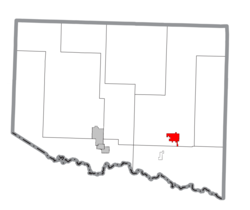
Crystal Falls, Michigan

Last updated
Crystal Falls, Michigan
CrystalFallsMichiganM69.jpg
Looking east at downtown Crystal Falls
Crystal Falls (city), MI.png
Location within Iron County
USA Michigan location map.svg
Red pog.svg
Crystal Falls
Location within the state of Michigan
Coordinates: 46°5′50″N88°19′56″W / 46.09722°N 88.33222°W / 46.09722; -88.33222
Country United States
State Michigan
County Iron
Area
[1]
  Total3.64 sq mi (9.42 km2)
  Land3.49 sq mi (9.05 km2)
  Water0.14 sq mi (0.38 km2)
Elevation
1,476 ft (450 m)
Population
 (2020)
  Total1,598
  Density457.62/sq mi (176.66/km2)
Time zone UTC-6 (Central (CST))
  Summer (DST) UTC-5 (CDT)
ZIP code
49920
Area code 906
FIPS code 26-19140 [2]
GNIS feature ID0624170 [3]

Crystal Falls is a city and the county seat of Iron County, Michigan. As of the 2020 census, the city population was 1,598. [4] The city is located within Crystal Falls Township, but is a separate municipal entity. The area first developed as a major center for iron mining and the timber industry; it has become increasingly popular for tourism in recent years.

Contents

History

Crystal Falls was platted in 1881. [5] It was named for a nearby icy waterfall on the Paint River. [6] A post office called Crystal Falls has been in operation since 1885. [7]

Geography

Iron County Courthouse Iron County Courthouse full view.jpg
Iron County Courthouse

According to the United States Census Bureau, the city has a total area of 3.61 square miles (9.35 km2), of which 3.47 square miles (8.99 km2) is land and 0.14 square miles (0.36 km2) is water. [8] The city is very hilly and the castle-like county courthouse (built in 1890) sits on the highest point, overlooking the downtown business district.

Climate

Michigan State University's study of Crystal Falls weather concluded that precipitation was well distributed throughout the year with the crop season, April–September, receiving an average of 20.30 inches (516 mm) or 68% of the average annual total for the 1962-80 period. During this same period the average wettest month was June with 3.96 inches (101 mm), while the average driest month was February with 1.02 inches (26 mm). The National Weather Service's 1971–2000 data shows a 30-year normal annual precipitation of 29.65 inches (753 mm).

The following precipitation extremes, based on the time period of this station's published record, are: greatest observation-day total, 3.86 inches, recorded June 14, 1981; greatest monthly total, 12.48 inches, recorded June 1981; and least monthly total, 0.00 inches, recorded on several occasions.

Summer precipitation comes mainly in the form of afternoon showers and thundershowers. Annually, thunderstorms will occur on an average of 33 days. There are normally 139.2 days with measurable precipitation.

The 1950-51 through 1979-80 average seasonal snowfall was 70.6 inches (1.79 m). During this period, 143 days per season averaged 1-inch (25 mm) or more of snow on the ground, but varied greatly from season to season.

The following snowfall extremes, based on the time period of this station's published record, are: greatest observation-day total, 18.0 inches, recorded March 7, 1926; greatest monthly total, 53.4 inches, recorded March 1939; greatest seasonal total, 143.2 inches, recorded during 1942–43; least seasonal total, 31.6 inches, recorded during 1963-64 and 1 earlier season; and greatest snow depth, 47 inches, recorded March 15, 1926.

Although there are no longer official temperature observations in Crystal Falls, Michigan State University concluded that temperatures are similar to those at the National Weather Service office in Marquette, Michigan. Temperature records kept from 1962 to 1989 by the National Climatic Data Center show a record high of 99 degrees on June 30, 1963, and July 20, 1977. The record low was -42 degrees on February 17, 1979. Annually, there were an average of 4.4 days with highs of 90 degrees or higher; 96.9 days with highs of 32 degrees or lower; 207.1 days with lows of 32 degrees or lower; and 55.1 days with lows of 0 degrees or lower. Freezing temperatures were recorded in every month except July, which had a record low of 33 degrees on July 6, 1965.

Climate data for Crystal Falls, Michigan
MonthJanFebMarAprMayJunJulAugSepOctNovDecYear
Average high °F (°C)20.8
(−6.2)
26.3
(−3.2)
36.5
(2.5)
50.5
(10.3)
65.8
(18.8)
74.0
(23.3)
78.6
(25.9)
75.9
(24.4)
66.2
(19.0)
53.7
(12.1)
37.4
(3.0)
25.1
(−3.8)
50.9
(10.5)
Average low °F (°C)−2.1
(−18.9)
1.0
(−17.2)
12.2
(−11.0)
26.0
(−3.3)
37.6
(3.1)
47.0
(8.3)
51.7
(10.9)
50.3
(10.2)
41.9
(5.5)
32.3
(0.2)
20.9
(−6.2)
6.4
(−14.2)
27.1
(−2.7)
Average precipitation inches (mm)1.24
(31)
0.82
(21)
1.79
(45)
2.17
(55)
2.92
(74)
3.86
(98)
3.57
(91)
3.59
(91)
3.66
(93)
2.67
(68)
2.01
(51)
1.35
(34)
29.65
(753)
Source: "Climatography of the United States," National Climatic Data Center (www.ncdc.noaa.gov)

Demographics

Historical population
CensusPop.Note
1900 3,231
1910 3,77516.8%
1920 3,394−10.1%
1930 2,995−11.8%
1940 2,641−11.8%
1950 2,316−12.3%
1960 2,203−4.9%
1970 2,000−9.2%
1980 1,965−1.7%
1990 1,922−2.2%
2000 1,791−6.8%
2010 1,469−18.0%
2020 1,5988.8%
U.S. Decennial Census [9]

2010 census

At the 2010 census there were 1,469 people in 700 households, including 402 families, in the city. The population density was 423.3 inhabitants per square mile (163.4/km2). There were 893 housing units at an average density of 257.3 per square mile (99.3/km2). The racial makup of the city was 96.9% White, 0.2% African American, 0.7% Native American, 0.2% Asian, 0.1% from other races, and 1.8% from two or more races. Hispanic or Latino residents of any race were 1.0%. [10]

Of the 700 households 22.3% had children under the age of 18 living with them, 41.9% were married couples living together, 11.0% had a female householder with no husband present, 4.6% had a male householder with no wife present, and 42.6% were non-families. 39.6% of households were one person and 20.2% were one person aged 65 or older. The average household size was 2.06 and the average family size was 2.73.

The median age was 48.3 years. 19.7% of residents were under the age of 18; 6.4% were between the ages of 18 and 24; 19.3% were from 25 to 44; 32.1% were from 45 to 64; and 22.5% were 65 or older. The gender makeup of the city was 49.4% male and 50.6% female.

2000 census

At the 2000 census there were 1,791 people in 795 households, including 470 families, in the city. The population density was 530.6 inhabitants per square mile (204.9/km2). There were 913 housing units at an average density of 270.5 per square mile (104.4/km2). The racial makup of the city was 98.05% White, 0.06% African American, 0.61% Native American, 0.11% Asian, 0.39% from other races, and 0.78% from two or more races. Hispanic or Latino of any race were 1.23%. [2] 17.1% were of Finnish, 15.5% Italian, 11.5% German, 9.4% Polish, 9.4% Swedish, 6.6% English and 5.3% French ancestry according to Census 2000. 97.5% spoke English, 1.1% Finnish and 1.1% Spanish as their first language.

Of the 795 households 24.8% had children under the age of 18 living with them, 46.0% were married couples living together, 9.4% had a female householder with no husband present, and 40.8% were non-families. 36.9% of households were one person and 22.3% were one person aged 65 or older. The average household size was 2.13 and the average family size was 2.78.

The age distribution was 22.2% under the age of 18, 6.1% from 18 to 24, 21.7% from 25 to 44, 21.3% from 45 to 64, and 28.7% 65 or older. The median age was 45 years. For every 100 females, there were 90.1 males. For every 100 females age 18 and over, there were 82.8 males.

The median household income was $26,637 and the median family income was $35,000. Males had a median income of $28,266 versus $20,144 for females. The per capita income for the city was $14,538. About 7.5% of families and 10.4% of the population were below the poverty line, including 15.6% of those under age 18 and 6.8% of those age 65 or over.

Arts and culture

Crystal Falls is home to the Crystal Theater, a regional performing arts center.

Crystal Falls used to have a high veteran population. After both World Wars, a lot of veterans settled in and around the area. Crystal Falls was the last town to still celebrate V-J Day until the early 2000s. They have two big festivals during the summer. A “bass” festival which is a weekend of fun activity and a marathon. Highlighted by the annual “WOPS” vs Sweeds softball game, the mushroom festival replaced the V-J Day celebrations and that has the Polack vs Finns softball game.

Head to the ice the last weekend in February on the Michigamme reservoir for the annual Fisheree tournament. A tradition that most locals look forward to all year.

In April 1992, Crystal Falls received international attention due to the discovery of a giant fungus, Armillaria bulbosa , in the nearby forest. The discovery was announced in articles in Nature and The New York Times . The fungus, known as the "humongous fungus", covered an area of more than 30 acres (120,000 m2) and had a total mass estimated at 100 tons. At the time it was believed to be one of the oldest living organism on earth, as well as one of the largest.

Although the fungus is actually located in nearby Mastodon Township, Michigan, the city of Crystal Falls adopted it as a tourist attraction, and holds a "Humungous Fungus Fest" as an annual event. [11]

Transportation

Related Research Articles

<span class="mw-page-title-main">Clifton, Arizona</span> Town in Greenlee County, Arizona

Clifton is a town in and is the county seat of Greenlee County, Arizona, United States, along the San Francisco River. The population of the town was 3,311 at the 2010 census, with a 2018 population estimate of 3,700. It was a place of the Arizona copper mine strike of 1983.

<span class="mw-page-title-main">Markleeville, California</span> Census-designated place in California, United States

Markleeville is a census-designated place (CDP) and the county seat of Alpine County, California, United States. The population was 191 at the 2020 census, down from 210 at the 2010 census.

<span class="mw-page-title-main">Susanville, California</span> City in California, United States

Susanville is a town in and the county seat of Lassen County, California, United States. Susanville is located on the Susan River in the southern part of the county, at an elevation of 4,186 feet (1,276 m). Its population is 16,728 as of the 2020 census, down from 17,947 from the 2010 census.

<span class="mw-page-title-main">Yosemite Valley, California</span> Census-designated place in California, United States

Yosemite Valley is a census-designated place (CDP) in Mariposa County, California, United States. It consists of the developed area of Yosemite Village and the other areas of the Yosemite Valley in Yosemite National Park. The population was 337 at the 2020 census.

<span class="mw-page-title-main">Hayfork, California</span> Census-designated place in California, United States

Hayfork is a census-designated place (CDP) in Trinity County, California, United States. Its population is 2,324 as of the 2020 census, down from 2,368 from the 2010 census.

<span class="mw-page-title-main">Angola, Indiana</span> City in Indiana, United States

Angola is a city in Pleasant Township, Steuben County, Indiana, United States. The population was 8,612 at the 2010 census. The city is the county seat of Steuben County. Angola was founded by Thomas Gale and Cornelius Gilmore on June 28, 1838, and is home to Trine University. The town is served by I-69 and the Indiana Toll Road.

<span class="mw-page-title-main">Ottawa, Kansas</span> City in Franklin County, Kansas

Ottawa is a city in, and the county seat of, Franklin County, Kansas, United States. It is located on both banks of the Marais des Cygnes River near the center of Franklin County. As of the 2020 census, the population of the city was 12,625. It is the home of Ottawa University.

<span class="mw-page-title-main">Junction City, Kansas</span> City in Geary County, Kansas

Junction City is a city in and the county seat of Geary County, Kansas, United States. As of the 2020 census, the population of the city was 22,932. Fort Riley, a major U.S. Army post, is nearby.

<span class="mw-page-title-main">Coldwater, Michigan</span> City in Michigan, United States

Coldwater is a city in and county seat of Branch County in the U.S. state of Michigan. The city had a population of 13,822 at the 2020 census. The city is mostly surrounded by Coldwater Township, but the two are administered autonomously.

<span class="mw-page-title-main">Iron Mountain, Michigan</span> City in Michigan, United States

Iron Mountain is a city and the county seat of Dickinson County, Michigan. The population was 7,518 at the 2020 census, down from 7,624 at the 2010 census. in the state's Upper Peninsula. Iron Mountain was named for the valuable iron ore found in the vicinity.

<span class="mw-page-title-main">Yerington, Nevada</span> City in Nevada, United States

Yerington is a city in Lyon County, Nevada, United States. The population was 3,048 at the 2010 census. It is the current county seat of Lyon County, with the first county seat having been established at Dayton on November 29, 1861. It is named after Henry M. Yerington, superintendent of the Virginia and Truckee Railroad from 1868 to 1910.

<span class="mw-page-title-main">Powers, Oregon</span> City in Oregon, United States

Powers is a city in Coos County, Oregon, United States. The population was 689 at the 2010 census.

<span class="mw-page-title-main">Gold Beach, Oregon</span> City in Oregon, United States

Gold Beach is a city in and the county seat of Curry County, Oregon, United States, on the Oregon Coast. The population was 2,241 at the 2020 census.

<span class="mw-page-title-main">Drain, Oregon</span> City in Oregon, United States

Drain is a city in Douglas County, Oregon, United States. The population was 1,151 at the 2010 census. Drain is named after town founder and politician Charles J. Drain, who donated 60 acres (24 ha) of nearby land to the Oregon and California Railroad in 1871.

<span class="mw-page-title-main">Moro, Oregon</span> City in Oregon, United States

Moro is a city in Sherman County, Oregon, United States. The population was 324 at the 2010 census. It is the county seat of Sherman County It’s currently the least-populous county seat in Oregon. Moro was incorporated on February 17, 1899, by the Oregon Legislative Assembly. It was named for Moro, Illinois.

<span class="mw-page-title-main">Custer, South Dakota</span> City in South Dakota, United States

Custer is a city in Custer County, South Dakota, United States. The population was 1,919 at the 2020 census. It is the county seat of Custer County.

<span class="mw-page-title-main">Randolph, Utah</span> Town in the state of Utah, United States

Randolph is a town in Rich County, Utah, United States and as of the 2010 census, the town population was 464. It is the county seat of Rich County. Randolph had the highest percentage of people of any city in the country vote for George W. Bush in the 2004 election, at 95.6% Randolph's municipal classification was officially changed from a city to a town on January 1, 2009. The controversial WWASPS boarding school Old West Academy is located just outside Randolph.

<span class="mw-page-title-main">Basin, Wyoming</span> Town in Wyoming, United States

Basin is a town in, and the county seat of, Big Horn County, Wyoming, United States. The population was 1,225 at the 2020 census. The community is located near the center of the Bighorn Basin with the Big Horn River east of the town. Basin's post office, built in 1919, is listed on the National Register of Historic Places.

<span class="mw-page-title-main">South Park Township, Allegheny County, Pennsylvania</span> Township in Pennsylvania, United States

South Park Township is a township in the southern part of Allegheny County, Pennsylvania, United States, near Pittsburgh. The population was 13,416 at the 2010 census.

Grays River is a census-designated place (CDP) in Wahkiakum County, Washington. Grays River stands on the north bank of the lower Grays River, which flows into the Columbia River Estuary. The National Register of Historic Places-listed Grays River Covered Bridge crosses the Grays River in the community. It is the only such bridge still in use in Washington. The population was 263 as of the 2010 census. The Grays River community is part of the Naselle-Grays River Valley School District, a K-12 school district of about 670 students.

References

  1. "2020 U.S. Gazetteer Files". United States Census Bureau. Retrieved May 21, 2022.
  2. 1 2 "U.S. Census website". United States Census Bureau . Retrieved 2008-01-31.
  3. "US Board on Geographic Names". United States Geological Survey. 2007-10-25. Retrieved 2008-01-31.
  4. "Find a County". National Association of Counties. Archived from the original on 2011-05-31. Retrieved 2011-06-07.
  5. Romig, Walter (1973). Michigan Place Names: The History of the Founding and the Naming of More Than Five Thousand Past and Present Michigan Communities. Wayne State University Press. p. 142. ISBN   0-8143-1838-X.
  6. Company, Chicago and North Western Railway (1908). A History of the Origin of the Place Names Connected with the Chicago & North Western and Chicago, St. Paul, Minneapolis & Omaha Railways. p. 61.
  7. "Iron County". Jim Forte Postal History. Retrieved 1 March 2015.
  8. "US Gazetteer files 2010". United States Census Bureau. Archived from the original on 2012-01-25. Retrieved 2012-11-25.
  9. "Census of Population and Housing". Census.gov. Retrieved June 4, 2015.
  10. "U.S. Census website". United States Census Bureau . Retrieved 2012-11-25.
  11. Sceurman M, Godfrey LS, Moran MM (2006). Weird Michigan. New York: Sterling. p. 41. ISBN   1-4027-3907-9 . Retrieved 2010-02-18.
  12. "ST. IGNACE-SAULT STE. MARIE-IRONWOOD" (PDF). Indian Trails. January 15, 2013. Archived from the original (PDF) on 2014-07-04. Retrieved 2013-02-28.

46°05′53″N88°20′02″W / 46.09806°N 88.33389°W / 46.09806; -88.33389