Watha, North Carolina

Last updated

Watha, North Carolina
NCMap-doton-Watha.PNG
Location of Watha, North Carolina
Coordinates: 34°39′04″N77°57′27″W / 34.65111°N 77.95750°W / 34.65111; -77.95750
Country United States
State North Carolina
County Pender
Area
[1]
  Total1.36 sq mi (3.52 km2)
  Land1.36 sq mi (3.52 km2)
  Water0.00 sq mi (0.00 km2)
Elevation
[2]
59 ft (18 m)
Population
 (2020)
  Total181
  Density133.09/sq mi (51.40/km2)
Time zone UTC-5 (Eastern (EST))
  Summer (DST) UTC-4 (EDT)
ZIP code
28478
Area codes 910, 472
FIPS code 37-71320 [3]
GNIS feature ID2406840 [2]

Watha is a town in Pender County, North Carolina, United States. The population was 190 at the 2010 census. It is part of the Wilmington Metropolitan Statistical Area.

Contents

Geography

According to the United States Census Bureau, the town has a total area of 0.9 square miles (2.3 km2), all land.

Demographics

Historical population
CensusPop.Note
1910 169
1920 1817.1%
1930 22725.4%
1940 214−5.7%
1950 2223.7%
1960 174−21.6%
1970 1814.0%
1980 1968.3%
1990 99−49.5%
2000 15152.5%
2010 19025.8%
2020 181−4.7%
2023 (est.)210 [4] 16.0%
U.S. Decennial Census [5]

As of the census [3] of 2000, there were 151 people, 65 households, and 44 families residing in the town. The population density was 165.6 inhabitants per square mile (63.9/km2). There were 71 housing units at an average density of 77.9 per square mile (30.1/km2). The racial makeup of the town was 90.07% White, 8.61% African American, 0.66% from other races, and 0.66% from two or more races. Hispanic or Latino of any race were 0.66% of the population.

There were 65 households, out of which 24.6% had children under the age of 18 living with them, 56.9% were married couples living together, 7.7% had a female householder with no husband present, and 30.8% were non-families. 26.2% of all households were made up of individuals, and 15.4% had someone living alone who was 65 years of age or older. The average household size was 2.32 and the average family size was 2.82.

In the town, the population was spread out, with 17.9% under the age of 18, 9.3% from 18 to 24, 21.2% from 25 to 44, 29.8% from 45 to 64, and 21.9% who were 65 years of age or older. The median age was 46 years. For every 100 females, there were 101.3 males. For every 100 females age 18 and over, there were 100.0 males.

The median income for a household in the town was $37,500, and the median income for a family was $45,625. Males had a median income of $31,250 versus $17,083 for females. The per capita income for the town was $15,654. There were 7.7% of families and 9.8% of the population living below the poverty line, including 12.0% of under eighteens and 18.2% of those over 64.

Related Research Articles

<span class="mw-page-title-main">Shamrock Lakes, Indiana</span> Town in Indiana, United States

Shamrock Lakes is a town in Licking Township, Blackford County, Indiana, United States. It was incorporated on May 21, 1973—and was the first community in Indiana to do so in 50 years. The small town consists of a group of six lakes that were created between 1960 and 1965, and the first lake was originally intended to be a water supply for a farmer's cattle. The community was listed on the front page of USA Today as one of only five places in the United States named after Ireland's clover emblem, the shamrock.

<span class="mw-page-title-main">Newtown, Indiana</span> Town in Indiana, United States

Newtown is a town in Richland Township, Fountain County, Indiana, United States. The population was 256 at the 2010 census.

<span class="mw-page-title-main">Salamonia, Indiana</span> Town in Indiana, United States

Salamonia is a town in Madison Township, Jay County, Indiana, United States. The population was 157 at the 2010 census. The town is situated along the Salamonie River, near its headwaters in Northern Indiana.

<span class="mw-page-title-main">Yetter, Iowa</span> City in Iowa, United States

Yetter is a city in Calhoun County, Iowa, United States. The population was 19 at the time of the 2020 census.

<span class="mw-page-title-main">Lynnville, Iowa</span> City in Iowa, United States

Lynnville is a city in Jasper County, Iowa, United States. The population was 380 at the time of the 2020 census.

<span class="mw-page-title-main">Perham, Maine</span> Town in the state of Maine, United States

Perham is a town in Aroostook County, Maine, United States. The population was 371 at the 2020 census. The town was named after Maine's 33rd governor, Sidney Perham.

<span class="mw-page-title-main">Vienna, Maine</span> Town in the state of Maine, United States

Vienna is a town in Kennebec County, Maine, United States. The population was 578 at the 2020 census.

Stetson is a town in Penobscot County, Maine, United States. The population was 1,186 at the 2020 census. It was named after its first proprietor, Amasa Stetson. His brother Simeon Stetson originally settled here as well, but moved to nearby Hampden in 1803. Simeon's sons Charles, George, and Isaiah founded a powerful mercantile and political family in Bangor.

<span class="mw-page-title-main">Trommald, Minnesota</span> City in Minnesota, United States

Trommald is a city in Crow Wing County, Minnesota, United States. The population was 99 at the 2020 census. It is part of the Brainerd Micropolitan Statistical Area.

<span class="mw-page-title-main">Plainfield, Ohio</span> Village in Ohio, United States

Plainfield is a village in Coshocton County, Ohio, United States, along Wills Creek. The population was 141 at the 2020 census.

<span class="mw-page-title-main">Central City, South Dakota</span> City in South Dakota, United States

Central City is a city in Lawrence County, South Dakota, United States. The population was 93 at the 2020 census.

<span class="mw-page-title-main">Ellenboro, West Virginia</span> Town in West Virginia, United States

Ellenboro is a town in Ritchie County, West Virginia, United States. The population was 222 at the 2020 census. The town is located at the junction of U.S. Route 50 and West Virginia Route 16; the North Bend Rail Trail also passes through the town. The town was named for Ellen Mariah Williamson, the eldest daughter of the family that granted a right of way for the Baltimore and Ohio Railroad to build their line through the town; an earlier name for the community was Shumley. Ellenboro was incorporated in 1903.

<span class="mw-page-title-main">Lakeside, Wisconsin</span> Town in Wisconsin, United States

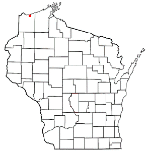
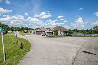
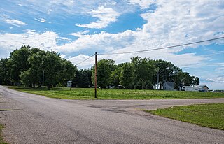
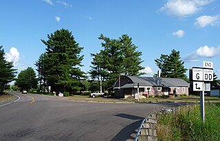
Lakeside is a town in Douglas County, Wisconsin, United States. The population was 609 at the 2000 census. The town was named for its location at the shore of Lake Superior.

<span class="mw-page-title-main">Wilson, Eau Claire County, Wisconsin</span> Town in Wisconsin, United States

Wilson is a town in Eau Claire County, Wisconsin, United States. The population was 485 at the 2010 census. The unincorporated community of Wilson is located in the town.

<span class="mw-page-title-main">Little River, Wisconsin</span> Town in Wisconsin, United States

Little River is a town in Oconto County, Wisconsin, United States. The population was 1,065 at the 2000 census. The unincorporated communities of County Line and Cullen are located in the town.

<span class="mw-page-title-main">Jefferson, Vernon County, Wisconsin</span> Town in Wisconsin, United States

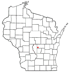
Jefferson is a town in Vernon County, Wisconsin, United States. The population was 974 at the 2000 census. The unincorporated communities of Bud, Esofea, and Springville are located with the town.

<span class="mw-page-title-main">St. Albans, Maine</span> Town in the state of Maine, United States

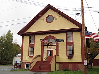
St. Albans is a town in Somerset County, Maine, United States. The population was 2,045 at the 2020 census.

Lowell is a town in Dodge County, Wisconsin, United States. The population was 1,169 at the 2000 census. The Village of Lowell and the unincorporated community of North Lowell are located in the town.

<span class="mw-page-title-main">Genoa (town), Wisconsin</span> Human settlement in Vernon County, Wisconsin, United States of America

Genoa is a town in Vernon County, Wisconsin, United States. The population was 705 at the 2000 census. The Village of Genoa is located within the town. The unincorporated community of Romance is located in the town of Genoa.

<span class="mw-page-title-main">Coloma (town), Wisconsin</span> Town in Wisconsin, United States

Coloma is a town in Waushara County, Wisconsin, United States. The population was 748 at the 2000 census. The coordinates shown are for the Village of Coloma, located within the town.

References

  1. "ArcGIS REST Services Directory". United States Census Bureau. Retrieved September 20, 2022.
  2. 1 2 U.S. Geological Survey Geographic Names Information System: Watha, North Carolina
  3. 1 2 "U.S. Census website". United States Census Bureau . Retrieved January 31, 2008.
  4. "City and Town Population Totals: 2020-2023". United States Census Bureau. May 16, 2024. Retrieved May 16, 2024.
  5. "Census of Population and Housing". Census.gov. Retrieved June 4, 2015.