Wentbridge Viaduct

Last updated

Wentbridge Viaduct
Wentbridge Viaduct - geograph.org.uk - 978120.jpg
Wentbridge Viaduct
Coordinates 53°38′56″N1°15′18″W / 53.649°N 1.255°W / 53.649; -1.255
CarriesA1 road
Crosses River Went
Locale Wentbridge, West Yorkshire, England
Other name(s)Wentbridge Flyover
Owner National Highways
Heritage status Grade II listed
Characteristics
MaterialConcrete
Steel
Total length472 feet (144 m)
Width87 feet (27 m)
Height100 feet (30 m)
No. of lanes 4
History
Construction startOctober 1959
Construction cost£803,000
OpenedNovember 1961
ReplacesWent Bridge
Location
Wentbridge Viaduct
References
[1]

Wentbridge Viaduct is a road bridge in West Yorkshire, England. The viaduct carries four lanes of the A1 road over the small valley of the River Went at an elevated level, replacing the previous bridge which was down on the valley floor and to the west in the village of Wentbridge. The viaduct, which is made from pre-stressed concrete, was opened in 1961, and is grade II listed.

Contents

History

The location of the bridge is 10 miles (16 km) north of Doncaster, 173 miles (278 km) north of London, and 5 miles (8 km) south of Ferrybridge. [2] [3] The viaduct straddles the valley of the River Went, with the village of Wentbridge to the west, and a nature reserve immediately to the east. [4] Before the building of the Wentbridge Bypass, traffic was required to go through Wentbridge village on a "torturous descent" which created bottlenecks, and over a Medieval bridge which was very narrow in the village of Wentbridge itself, before another incline took the road out of the Went Valley. [5] [6] To alleviate these problems, the Wentbridge bypass, including a new bridge over the valley, was approved in 1959. [7]

Construction of the viaduct required the use of 120 miles (190 km) of scaffolding, and 170,000 scaffolding fittings, all of which was required to withstand a wind force of 90 miles per hour (140 km/h) and support a weight of 8,200 tonnes (9,000 tons). [8] The original gap between the two valley sides was 1,000 feet (300 m), but this was shortened by the building of embankments at either side. [1] The bridge was designed by the Highways and Bridges division of West Riding County Council, though most design work was undertaken by Joe Sims. [9]

The viaduct was opened in November 1961, and has a total length of 472 feet (144 m), and a height of 100 feet (30 m). [10] The width of the bridge is 87 feet (27 m), which includes two 36-foot (11 m) sections with a 15 feet (4.6 m) gap dividing each pair of two-lane sections. [11] The distance between the two supports at ground level is 308 feet (94 m). [12] Two weeks after opening to motorists (11 December 1961), the traffic was stopped and a ribbon was unfurled across the carriageway for the official opening. [13] In 1959, the bridge was costed at £682,000 (equivalent to £16,880,000in 2021), but because of some extra works, including a two-lane bridge carrying the Went Edge Road over the southern end of Wentbridge Viaduct, the final price was £803,000 (equivalent to £19,016,000in 2021). [1]

The structure had a design capacity of 300 tonnes (330 tons) and was part of the Wentbridge Bypass, which took the road on higher ground away from Wentbridge, although the road does dip down, or sag, from the main road into the Went Valley. [14] [15]

The design of the bridge includes Freyssinet Hinges, the first time this type of hinge had been used in the United Kingdom. [16] Both the Royal Fine Art Commission and the Museum of Modern Art in New York highlighted the "aesthetic qualities" of the viaduct, with MOMA including it in their 1964 exhibition of 20th century engineering. [17] At the time of its opening, it was the longest bridge of its type in Europe. [18] In May 1998, the bridge was grade II listed by Historic England. [12]

In 2014, the bridge typically carried up to 86,000 vehicles per day, of which 19% were heavy goods vehicles. [19] National Highways undertook a renovation of the viaduct in 2023 to waterproof the bridge. [20]

See also

Related Research Articles

<span class="mw-page-title-main">Humber Bridge</span> Suspension bridge in England

The Humber Bridge, near Kingston upon Hull, East Riding of Yorkshire, England, is a 2.22 km single-span road suspension bridge, which opened to traffic on 24 June 1981. When it opened, the bridge was the longest of its type in the world; it was not surpassed until 1998, with the completion of the Akashi Kaikyō Bridge, and is now the twelfth-longest.

<span class="mw-page-title-main">M1 motorway</span> First inter-urban motorway in the UK

The M1 motorway connects London to Leeds, where it joins the A1(M) near Aberford, to connect to Newcastle. It was the first inter-urban motorway to be completed in the UK; the first motorway in the country was the Preston Bypass, which later became part of the M6.

<span class="mw-page-title-main">M62 motorway</span> Motorway in the United Kingdom

The M62 is a 107-mile-long (172 km) west–east trans-Pennine motorway in Northern England, connecting Liverpool and Hull via Manchester, Bradford, Leeds and Wakefield; 7 miles (11 km) of the route is shared with the M60 orbital motorway around Manchester. The road is part of the unsigned Euroroutes E20 and E22.

<span class="mw-page-title-main">Royal Tweed Bridge</span> Bridge in Northumberland

The Royal Tweed Bridge, also known as the New Bridge locally, is a road bridge in Berwick-upon-Tweed, Northumberland, England crossing the River Tweed. It was intended to divert traffic from the 17th century Berwick Bridge, and until the 1980s it formed part of the A1 road, the main route from London to Edinburgh. However, the construction of the A1 River Tweed Bridge to the west of Berwick has since reduced the Royal Tweed Bridge's importance.

<span class="mw-page-title-main">Appersett</span> Hamlet in Wensleydale, North Yorkshire, England

Appersett is a hamlet in the Yorkshire Dales in the Richmondshire district of North Yorkshire, England one mile (1.6 km) west of Hawes. It lies on the A684 road and an unclassified road runs alongside Widdale Beck to connect with the B6255 road between Hawes and Ingleton.

<span class="mw-page-title-main">Darrington, West Yorkshire</span> Village and civil parish in West Yorkshire, England

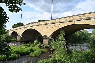
Darrington is a small village and civil parish in the City of Wakefield in West Yorkshire, England, 3 miles (4.8 km) from Pontefract and 25 miles (40 km) from the city of York. The village is split in two by the busy A1 trunk road which runs from London to Scotland. The 2011 census population was 1,403.

<span class="mw-page-title-main">A684 road</span> A road in Northern England

The A684 is an A road that runs through Cumbria and North Yorkshire, starting at Kendal, Cumbria and ending at Ellerbeck and the A19 road in North Yorkshire. It crosses the full width of the Yorkshire Dales, passing through Garsdale and the full length of Wensleydale.

<span class="mw-page-title-main">River Went</span> River in the United Kingdom

The River Went is a river in Yorkshire, England. It rises close to Featherstone and flows eastward, joining the River Don at Reedholme Common.

<span class="mw-page-title-main">Whitby, Redcar and Middlesbrough Union Railway</span> Former railway line in Yorkshire, England

The Whitby, Redcar and Middlesbrough Union Railway (WRMU), a.k.a. the Whitby–Loftus Line, was a railway line in North Yorkshire, England, built between 1871 and 1886, running from Loftus on the Yorkshire coast to the Esk at Whitby, and connecting Middlesbrough to Whitby along the coast.

Wentbridge is a small village in the City of Wakefield district of West Yorkshire, England. It lies around 3 miles (5 km) southeast of its nearest town of size, Pontefract, close to the A1 road.

<span class="mw-page-title-main">Scammonden Bridge</span> Bridge in Kirklees

Scammonden Bridge, also known locally as the Brown Cow Bridge, spans the Deanhead cutting carrying the B6114 Elland to Buckstones road over the M62 motorway in Kirklees, West Yorkshire, England. The bridge and Scammonden Reservoir to the west are named after Scammonden, the village that was flooded to accommodate the reservoir whose dam carries the motorway. On opening, the bridge was the longest concrete arch bridge in the UK.

<span class="mw-page-title-main">Meldon Viaduct</span> Bridge in United Kingdom

Meldon Viaduct is a disused railway viaduct crossing the West Okement River at Meldon, 2.5 miles (4.0 km) south-west of Okehampton, on the edge of Dartmoor in Devon, South West England. This truss bridge was constructed from wrought iron, instead of stone or brick arches. It opened in 1874 for a single track; in 1879 its width was doubled for a second track. Although regular services were withdrawn in 1968, the bridge was used for shunting by a local quarry. In the 1990s the remaining single track was removed.

<span class="mw-page-title-main">Bowling Tunnel</span> Railway tunnel in West Yorkshire, England

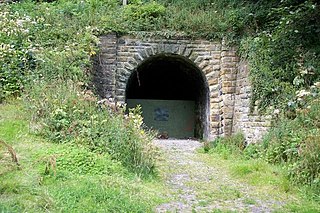
Bowling Tunnel is a railway Tunnel on the Calder Valley line, south of Bradford in West Yorkshire, England. The Tunnel was completed in 1850 after some difficulty in construction, and allowed trains from the south to access the second railway terminus in the town of Bradford. The Tunnel remains open to railway traffic with trains between Halifax and Bradford Interchange using it.

<span class="mw-page-title-main">Adam Viaduct</span> Grade II listed railway underbridge in Wigan, England

The Adam Viaduct is a grade II listed concrete underbridge in Wallgate, Wigan. The bridge, constructed in 1946, is the earliest 'post-tensioned' prestressed concrete railway bridge in the United Kingdom, with only some examples in Switzerland being earlier. It is bridge number 54 on the Kirkby branch line and is at a line distance of 18 miles 1,032 yards (29.91 km).

<span class="mw-page-title-main">Woodsmith Mine Tunnel</span> Tunnel in North Yorkshire, England

The Woodsmith Mine Tunnel is a 23-mile (37 km) long tunnel that will stretch between Woodsmith Mine at Sneatonthorpe near Whitby in North Yorkshire and the Wilton International complex on Teesside, England. The tunnel has been in development since 2016, but cutting of the tunnel bore did not start until April 2019, with a projected finish date of 2021, but it was still not complete by the end of 2023. By the end of July 2020, over 4 miles (6.4 km) of tunnel had been dug.

<span class="mw-page-title-main">Arten Gill Viaduct</span> Railway viaduct in Cumbria, England

Arten Gill Viaduct is an eleven-arch railway bridge in Dentdale, Cumbria, England. The viaduct carries the Settle to Carlisle railway line over Artengill Beck. The viaduct was originally designed to be further west, which is lower down the steep valley side, but by moving the line slightly eastwards, the viaduct could be installed at a higher location, thereby using fewer materials in its height. Arten Gill Viaduct is constructed partly from Dent Marble in the inside of the arches instead of the more usual brick. Dent Marble is a type of dark limestone which was quarried from Artengill beneath the viaduct itself. The viaduct is a grade II listed structure, and a scheduled monument.

<span class="mw-page-title-main">Ferrybridge services</span> Motorway service area in Yorkshire, England

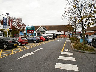
Ferrybridge services is a motorway services area (MSA) operated by Moto named after Ferrybridge in West Yorkshire, England. The site has easy access from the M62 motorway and the A1(M) motorway. Originally opened in 1985 under the Granada brand, the MSA at Ferrybridge has been under the Moto brand since 2001.

<span class="mw-page-title-main">Boothferry Bridge</span> Bridge over the River Ouse in Yorkshire, England

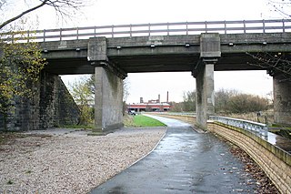
Boothferry Bridge is a crossing over the River Ouse, between the East Riding and West Yorkshire, England, some 2 miles (3.2 km) north-west of Goole. The bridge was opened in 1929, replacing a ferry crossing immediately west of the bridge's location. The Act of Parliament for the building of the bridge in 1925, gave priority to river traffic. This situation still exists, though there have been some attempts to change priorities. On opening, it was the furthest crossing downstream of the river, cutting 25 miles (40 km) off the journey south to London from Kingston upon Hull. The M62 Ouse Bridge opened up to the east of Boothferry Bridge in 1976.

<span class="mw-page-title-main">Selby toll bridge</span> Bridge in North Yorkshire, England

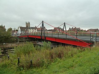
Selby Toll Bridge is one of three swing bridges in the town of Selby, North Yorkshire, England. A timber bridge over the River Ouse in the town was opened in c. 1793 to replace a ferry crossing that had existed since Medieval times. The bridge provided a connection between the West and East Ridings of Yorkshire across the River Ouse, and became the furthest downstream public bridge crossing over the river until 1929, when the Boothferry Bridge was built. The moving section of the original bridge used ball-bearings and cog wheels; the bridge is believed to be the first in the world to use ball-bearings. The replacement 1970s bridge, now only carries the A19 road as the A63 bypass was opened in 2004.

<span class="mw-page-title-main">Conisbrough Viaduct</span> Former railway viaduct in South Yorkshire, England

Conisbrough Viaduct is a former railway viaduct, near to Cadeby and Conisbrough in South Yorkshire, England. The viaduct consists of two sections of brick and stone on each bank, connected by a lattice girder section, some 113–116 feet (34–35 m) over the River Don. The height and space were required should shipping need to navigate along the river. The viaduct carried the Dearne Valley Railway over the River Don between 1909 and 1966, after closure it was converted into a foot and cycle path. The structure is grade II listed, and is notable for being one of the first bridges in Britain to be built using a rope system above the viaduct known as a "Blondin".

References

  1. 1 2 3 McCoubrey 2009, p. 177.
  2. Harper, Charles (1922) [1901]. Great North Road. Vol 2 : York to Edinburgh (2 ed.). London: Cecil Palmer. p. vi. OCLC   655268751.
  3. "State Of The Roads". The Times. No. 47345. 9 April 1936. p. 9. ISSN   0140-0460.
  4. "A1 Wentbridge Viaduct and Wentedge Road Bridge - National Highways". nationalhighways.co.uk. 13 January 2023. Retrieved 31 July 2023.
  5. McCoubrey 2009, p. 176.
  6. Mitchinson, James, ed. (12 February 2022). "A corner of Yorkshire; the Wentbridge Flyover". The Yorkshire Post. The Yorkshire Post Magazine. p. 3. ISSN   0140-0460.
  7. "Road Programme Volume 606: debated on Thursday 11 June 1959". hansard.parliament.uk. Retrieved 2 August 2023.
  8. "Mills Scaffold Co. Ltd Wentbridge Viaduct". The Times. No. 55291. 17 January 1962. p. 9. ISSN   0140-0460.
  9. "West Yorkshire Bridges". Municipal Journal, Public Works Engineer Contractor's Guide. 90 (13): 445. 1982. OCLC   4530317.
  10. "Viaduct opened". The Times. No. 55262. 12 December 1961. p. 6. ISSN   0140-0460.
  11. "Wentbridge bypass". Municipal Journal, Public Works Engineer Contractor's Guide. 68 (352): 3,225. 1960. OCLC   4530317.
  12. 1 2 Historic England. "Wentbridge Viaduct carrying bypass over valley of River Went (Grade II) (1323681)". National Heritage List for England . Retrieved 31 July 2023.
  13. McCoubrey 2009, p. 178.
  14. Mallett, G. P. (1996). Repair of concrete bridges. London: Telford. p. 52. ISBN   9780727720078.
  15. "Major Road Projects Volume 641: debated on Thursday 8 June 1961". hansard.parliament.uk. Retrieved 31 July 2023.
  16. Schacht, Gregor; Marx, Steffen (May 2015). "Concrete hinges in bridge engineering". Proceedings of the Institution of Civil Engineers - Engineering History and Heritage. 168 (2): 70. doi:10.1680/ehah.14.00020.
  17. Clark, James (2015). A1 Landmarks. Stroud: Amberley Publishing. p. 58. ISBN   9781445654508.
  18. "Work Planned and Work Completed". Official Architecture and Planning. 25 (3). Alexandrine Press: 134. March 1962. ISSN   2399-5327.
  19. "London to Leeds (East) Route Strategy Evidence Report" (PDF). assets.publishing.service.gov.uk. April 2014. p. 6. Retrieved 1 August 2023.
  20. "Overnight A1 closures to refurbish Wentbridge Viaduct". BBC News. 12 July 2023. Retrieved 31 July 2023.

Sources