West Glendive, Montana

Last updated

West Glendive, Montana
Dawson County Montana Incorporated and Unincorporated areas West Glendive Highlighted.svg
Location of West Glendive, Montana
Coordinates: 47°6′39″N104°44′53″W / 47.11083°N 104.74806°W / 47.11083; -104.74806
CountryUnited States
State Montana
County Dawson
Area
[1]
  Total3.85 sq mi (9.98 km2)
  Land3.84 sq mi (9.95 km2)
  Water0.01 sq mi (0.03 km2)
Elevation
2,119 ft (646 m)
Population
 (2020)
  Total1,998
  Density519.91/sq mi (200.73/km2)
Time zone UTC-7 (Mountain (MST))
  Summer (DST) UTC-6 (MDT)
Area code 406
FIPS code 30-79086
GNIS feature ID1853191

West Glendive is a census-designated place (CDP) in Dawson County, Montana, United States. The population was 1,998 at the 2020 census. [2]

Contents

Geography

West Glendive is located in south-central Dawson County at 47°06′39″N104°44′53″W / 47.110710°N 104.748022°W / 47.110710; -104.748022 (47.110710, -104.748022), [3] on the west side of the Yellowstone River, across from the city of Glendive. (A portion of Glendive extends west across the river to touch the West Glendive CDP.) Interstate 94 passes through the CDP, with access from Exits 210, 211, and 213. I-94 leads southwest 75 miles (121 km) to Miles City and east past Glendive 99 miles (159 km) to Dickinson, North Dakota. Montana Highway 16 leads northeast from West Glendive 52 miles (84 km) along the Yellowstone River to Sidney.

According to the U.S. Census Bureau, the West Glendive CDP has a total area of 3.9 square miles (10.1 km2), of which 0.01 square miles (0.03 km2), or 0.30%, is water. [2]

Demographics

Historical population
CensusPop.Note
2000 1,833
2010 1,9486.3%
2020 1,9982.6%
U.S. Decennial Census [4]

As of the census [5] of 2000, there were 1,833 people, 725 households, and 548 families residing in the CDP. The population density was 530.4 inhabitants per square mile (204.8/km2). There were 768 housing units at an average density of 222.2/sq mi (85.7/km2). The racial makeup of the CDP was 97.93% White, 0.27% African American, 0.33% Native American, 0.33% Asian, 0.05% Pacific Islander, 0.38% from other races, and 0.71% from two or more races. Hispanic or Latino of any race were 0.87% of the population.

There were 725 households, out of which 32.6% had children under the age of 18 living with them, 66.9% were married couples living together, 6.3% had a female householder with no husband present, and 24.3% were non-families. 21.7% of all households were made up of individuals, and 8.8% had someone living alone who was 65 years of age or older. The average household size was 2.52 and the average family size was 2.91.

In the CDP, the population was spread out, with 25.7% under the age of 18, 5.6% from 18 to 24, 27.0% from 25 to 44, 27.1% from 45 to 64, and 14.6% who were 65 years of age or older. The median age was 40 years. For every 100 females, there were 93.8 males. For every 100 females age 18 and over, there were 96.5 males.

The median income for a household in the CDP was $33,487, and the median income for a family was $40,242. Males had a median income of $31,582 versus $18,448 for females. The per capita income for the CDP was $16,100. About 11.2% of families and 14.3% of the population were below the poverty line, including 15.6% of those under age 18 and 18.4% of those age 65 or over.

See also

Related Research Articles

<span class="mw-page-title-main">Gallatin County, Montana</span> County in Montana, United States

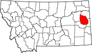
Gallatin County is located in the U.S. state of Montana. With its county seat in Bozeman, it is the second-most populous county in Montana, with a population of 118,960 in the 2020 Census.

<span class="mw-page-title-main">Dawson County, Montana</span> County in Montana, United States

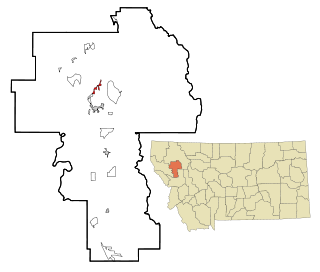
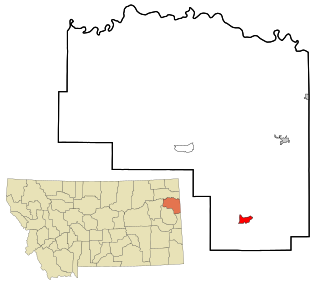
Dawson County is a county located in the U.S. state of Montana. As of the 2020 census, the population was 8,940. Its county seat is Glendive.

<span class="mw-page-title-main">Belfry, Montana</span> Census-designated place in Montana, United States

Belfry is a census-designated place (CDP) in Carbon County, Montana, United States. It is part of the Billings, Montana Metropolitan Statistical Area. The population was 218 at the 2010 census. It is located approximately 11 miles (18 km) from the Wyoming border, roughly halfway between Billings, Montana and Cody, Wyoming.

<span class="mw-page-title-main">Black Eagle, Montana</span> CDP in Montana, United States

Black Eagle is a census-designated place (CDP) in Cascade County, Montana, United States. The population was 904 at the 2010 census. It is a suburb of Great Falls.

<span class="mw-page-title-main">Ulm, Montana</span> CDP in Montana, United States

Ulm is a census-designated place (CDP) in Cascade County, Montana, United States. It was originally a large ranch owned by Indiana-born cattleman William Ulm. The population was 738 at the 2010 census. It is part of the Great Falls, Montana Metropolitan Statistical Area. The Zip Code is 59485.

<span class="mw-page-title-main">Glendive, Montana</span> City in Montana, United States

Glendive is a city in and the county seat of Dawson County, Montana, United States, and home to Dawson Community College. Glendive was established by the Northern Pacific Railway when they built the transcontinental railroad across the northern tier of the western United States from Minnesota to the Pacific Coast. The town was the headquarters for the Yellowstone Division that encompassed 875 route miles (1,408 km); 546 (879) in main line and 328 (528) in branches with the main routes from Mandan, North Dakota, to Billings, Montana, and from Billings to Livingston. The town of Glendive is an agricultural and ranching hub of eastern Montana sited between the Yellowstone River and the Badlands. Makoshika State Park is located just east of Glendive.

<span class="mw-page-title-main">Richey, Montana</span> Town in Montana, United States

Richey is a town in Dawson County, Montana, United States. It is located to the north of Glendive, the county seat. The population was 164 at the 2020 census. The town has a strong agriculture economy with wheat, oats and barley as the main crops as well as significant cattle and sheep ranches.

<span class="mw-page-title-main">Four Corners, Montana</span> Census-designated place in Montana, United States

Four Corners is a census-designated place (CDP) in Gallatin County, Montana, United States. The population was 5,901 at the 2020 census, up from 3,146 in 2010. It is part of the Bozeman, MT Micropolitan Statistical Area.

<span class="mw-page-title-main">Herron, Montana</span> Census-designated place in Montana, United States

Herron is a census-designated place (CDP) in Hill County, Montana, United States. The population was 43 at the 2010 census.

<span class="mw-page-title-main">Kings Point, Montana</span> Census-designated place in Montana, United States

Kings Point is a census-designated place (CDP) in Lake County, Montana, United States. The population was 151 at the 2010 census, down from 169 in 2000.

<span class="mw-page-title-main">Gardiner, Montana</span> Unincorporated community in Park County, Montana, United States

Gardiner is a unincorporated community in Park County, Montana, United States, along the 45th parallel. As of the 2020 census, the population of the community and nearby areas was 833.

<span class="mw-page-title-main">Terry, Montana</span> Town in Montana, United States

Terry, incorporated in 1910, is a town in and the county seat of Prairie County, Montana, United States. The population was 562 at the 2020 census.

<span class="mw-page-title-main">Knife River, Montana</span> Former CDP in Montana, United States

Knife River was a census-designated place (CDP) in Richland County, Montana, United States. The population was 320 at the 2010 census. The CDP primarily consisted of the unincorporated community of Savage. The Knife River CDP was not recorded at the 2020 census; instead, a smaller CDP named "Savage", comprising only the built-up portion of the town, was listed.

<span class="mw-page-title-main">Sidney, Montana</span> City in Montana, United States

Sidney is a city in and the county seat of Richland County, Montana, United States, less than 10 mi (16 km) west of the North Dakota border. The population was 6,346 at the 2020 census. The city lies along the Yellowstone River and is in proximity to the badlands of the Dakotas. Sidney is approximately midway between Glendive, Montana and Williston, North Dakota.

<span class="mw-page-title-main">Ballantine, Montana</span> CDP in Montana, United States

Ballantine is a census-designated place (CDP) in Yellowstone County, Montana, United States. It lies approximately nine miles (14 km) northeast of Billings on Interstate 94. The population was 346 at the 2000 census. Ballantine, along with the communities of Pompey's Pillar, Worden, and Huntley, is part of the Huntley Project, an irrigation district created by the United States Bureau of Reclamation. The majority of Ballantine's population lives on scattered farms and ranches surrounding the actual townsite.

<span class="mw-page-title-main">Huntley, Montana</span> CDP in Montana, United States

Huntley is a census-designated place (CDP) in Yellowstone County, Montana, United States. The population was 411 at the 2000 census. Huntley lent its name to the Huntley Project, a federal irrigation project that began delivering water to the arid district in 1907. Today, Huntley is an eastern suburb of Billings and is located east of Shepherd and west of Worden.

<span class="mw-page-title-main">Shepherd, Montana</span> CDP in Montana, United States

Shepherd is a census-designated place (CDP) in Yellowstone County, Montana, United States. The population was 193 at the 2000 census. Shepherd is a Billings suburb located to the northeast. The unincorporated town was named after R.E. Shepherd, a prominent early settler and owner of the Billings Land and Irrigation Company and the Merchants National Bank. The post office opened in 1915.

<span class="mw-page-title-main">Worden, Montana</span> CDP in Montana, United States

Worden is a census-designated place (CDP) in Yellowstone County, Montana, United States. The population was 506 at the 2000 census. Worden, along with Ballantine, Huntley, and Pompey's Pillar, is part of the Huntley Project, an irrigation district established by the United States Bureau of Reclamation in 1907.

<span class="mw-page-title-main">Helena West Side, Montana</span> Census-designated place in Montana, United States

Helena West Side is a census-designated place (CDP) in Lewis and Clark County, Montana, United States. The population was 1,637 at the 2010 census, down from 1,711 at the 2000 census due to annexation of part of the CDP by the city of Helena. It is part of the Helena Micropolitan Statistical Area.

<span class="mw-page-title-main">Fox Lake, Montana</span> CDP in Montana, United States

Fox Lake is a census-designated place (CDP) in Richland County, Montana, United States. The population was 158 at the 2010 census.

References

  1. "ArcGIS REST Services Directory". United States Census Bureau. Retrieved September 5, 2022.
  2. 1 2 "Geographic Identifiers: 2010 Demographic Profile Data (G001): West Glendive CDP, Montana". U.S. Census Bureau, American Factfinder. Archived from the original on February 13, 2020. Retrieved November 2, 2015.
  3. "US Gazetteer files: 2010, 2000, and 1990". United States Census Bureau. February 12, 2011. Retrieved April 23, 2011.
  4. United States Census Bureau. "Census of Population and Housing" . Retrieved December 30, 2020.
  5. "U.S. Census website". United States Census Bureau . Retrieved January 31, 2008.

Commons-logo.svg Media related to West Glendive, Montana at Wikimedia Commons