Dickinson, North Dakota | |
|---|---|
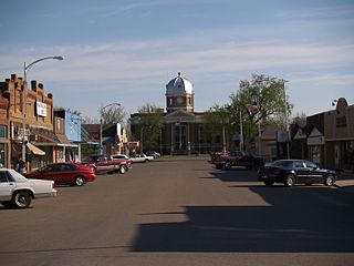
Downtown Dickinson (2008) | |
| Nickname: Queen City [1] | |
 Location of Dickinson, North Dakota | |
| Coordinates: 46°53′01″N102°47′20″W / 46.88361°N 102.78889°W | |
| Country | United States |
| State | North Dakota |
| County | Stark |
| Founded | 1881 |
| Incorporated | May 30, 1883 |
| Government | |
| • Type | City Commission |
| • Mayor | Scott J. Decker |
| • U.S Representative | Kelly Armstrong (R) |
| Area | |
| • City | 13.267 sq mi (34.361 km2) |
| • Land | 13.200 sq mi (34.188 km2) |
| • Water | 0.067 sq mi (0.174 km2) |
| Elevation | 2,461 ft (750 m) |
| Population | |
| • City | 25,679 |
| • Estimate (2022) [5] | 24,979 |
| • Density | 1,892/sq mi (730.6/km2) |
| • Urban | 25,674 [6] |
| • Urban density | 2,095/sq mi (808.7/km2) |
| • Metro | 38,054 |
| • Metro density | 8.47/sq mi (3.271/km2) |
| Time zone | UTC–7 (Mountain (MST)) |
| • Summer (DST) | UTC–6 (MDT) |
| ZIP Codes | 58601, 58602 [7] |
| Area code | 701 |
| FIPS code | 38-19620 |
| GNIS feature ID | 1035991 [3] |
| Sales tax | 6.5% [8] |
| Highways | I-94, I-94 Bus., ND 22 |
| Website | dickinsongov.com |


Dickinson is a city in and the county seat of Stark County, North Dakota, United States. [9] The population was 25,679 at the 2020 census, [4] and was estimated to be 24,979 in 2022, [5] making it the 7th most populous city in North Dakota. Dickinson is home to the Ukrainian Cultural Institute, which has a museum and holds events year round for the local Ukrainian community. [10] Western North Dakota has a high concentration of people of Ukrainian descent.
Contents
- History
- Geography
- Climate
- Demographics
- 2020 census
- 2010 census
- 2000 census
- Education
- K–12
- Higher education
- Law enforcement
- Media
- Television
- Radio
- Sites of interest
- Sports
- Notable people
- References
- External links
Since the North Dakota oil boom the city has become one of the fastest-growing cities in the United States. According to the 2020 census, the city is estimated to have a population of 25,679, however, other sources have estimates of the population at 33,646 or possibly exceeding 35,000. [11] The rapid growth of the city has led to an increase in crime and homelessness within the city limits. [12] [13]
Dickinson is the principal city of the Dickinson Micropolitan Statistical Area, a micropolitan area that covers Billings and Stark counties and had a combined population of 34,591 at the 2020 census.