Langdon, North Dakota

Last updated

Langdon, North Dakota
Langdon, North Dakota 7-19-2009.jpg
Business district of Langdon
ND Cavalier County Langdon.svg
Location of Langdon, North Dakota
Coordinates: 48°45′45″N98°22′29″W / 48.76250°N 98.37472°W / 48.76250; -98.37472
CountryUnited States
State North Dakota
County Cavalier
Founded1885
Government
   Mayor Jerry Nowatzki
Area
[1]
  Total1.58 sq mi (4.09 km2)
  Land1.55 sq mi (4.01 km2)
  Water0.03 sq mi (0.08 km2)
Elevation
[2]
1,611 ft (491 m)
Population
 (2020) [3]
  Total1,909
  Estimate 
(2022) [4]
1,849
  Density1,234.00/sq mi (476.45/km2)
Time zone UTC-6 (Central (CST))
  Summer (DST) UTC-5 (CDT)
ZIP code
58249
Area code 701
FIPS code 38-44780
GNIS feature ID1036117 [2]
Highways ND 1, ND 5
Website cityoflangdon.com

Langdon is a city in Cavalier County, North Dakota, United States. It is the county seat of Cavalier County. [5] The population was 1,909 at the 2020 census. [3] Langdon was designated as the county seat in 1884 and was incorporated in 1885.

Contents

History

A post office has been in operation in Langdon since 1886. [6] The city was named for Robert Bruce Langdon, a politician and railroad official. [7]

On October 29, 1887, The Courier, an early Langdon newspaper, reported that Rosa Lake, Lemon, Olga, and Langdon were all vying for the position of county seat. Anecdotal stories tell of several settlers who succeeded in voting several times by simply changing their hats and coats. When all votes were tallied, it was found that Langdon had polled 301 votes, Olga 246, Rosa Lake 55, and Lemon 11. It was alleged that the Langdon precinct had cast 150 votes with a total of only 50 qualified voters. However, the county seat remained in Langdon. [8]

On Memorial Day (then called Decoration Day) 1909, a tornado struck on the prairie a mile to a mile and a half southeast of Langdon, then moved seven miles in a northwest direction. [9] The tornado, locally dubbed The Vulcan, killed five people and injured 29. [9] Notably, Mrs. M.L. Sullivan ran for safety but the tornado hit as she arrived at her cellar door. [9] When the winds subsided, she was standing in the cellar with its broken doorknob in her hand. [9] Katie Diamond was lifted above treetops and telephone poles, and then dropped in a yard, virtually unscathed. [9] The tornado destroyed many barns, two elevators, the Great Northern water tank and several feet of railroad track. [9]

In the winter of 1935–36 Langdon recorded 75 consecutive days with a high temperature below 32 °F or 0 °C, and 32 consecutive days with a high temperature colder than −20 °F or −28.9 °C. [10]

City Council of Langdon, North Dakota, 1894 Langdon, N.D., City Council, 1894.jpg
City Council of Langdon, North Dakota, 1894

Geography

According to the United States Census Bureau, the city has a total area of 1.68 square miles (4.35 km2), of which 1.65 square miles (4.27 km2) is land and 0.03 square miles (0.08 km2) is water. [11]

Demographics

Historical population
CensusPop.Note
1890 291
1900 1,188308.2%
1910 1,2142.2%
1920 1,2281.2%
1930 1,221−0.6%
1940 1,54626.6%
1950 1,83818.9%
1960 2,15117.0%
1970 2,1821.4%
1980 2,3357.0%
1990 2,241−4.0%
2000 2,101−6.2%
2010 1,878−10.6%
2020 1,9091.7%
2022 (est.)1,849 [4] −3.1%
U.S. Decennial Census [12]
2020 Census [3]

2010 census

As of the census of 2010, there were 1,878 people, 894 households, and 506 families living in the city. The population density was 1,138.2 inhabitants per square mile (439.5/km2). There were 1,057 housing units at an average density of 640.6 per square mile (247.3/km2). The racial makeup of the city was 97.2% White, 0.2% African American, 0.7% Native American, 0.2% Asian, 0.1% Pacific Islander, 0.4% from other races, and 1.2% from two or more races. Hispanic or Latino of any race were 0.8% of the population.

There were 894 households, of which 21.4% had children under the age of 18 living with them, 49.0% were married couples living together, 5.5% had a female householder with no husband present, 2.1% had a male householder with no wife present, and 43.4% were non-families. 40.0% of all households were made up of individuals, and 23.8% had someone living alone who was 65 years of age or older. The average household size was 2.04 and the average family size was 2.73.

The median age in the city was 50.1 years. 19.1% of residents were under the age of 18; 5.9% were between the ages of 18 and 24; 17.9% were from 25 to 44; 28.5% were from 45 to 64; and 28.5% were 65 years of age or older. The gender makeup of the city was 47.9% male and 52.1% female.

2000 census

As of the census of 2000, there were 2,101 people, 917 households, and 565 families living in the city. The population density was 1,233.1 inhabitants per square mile (476.1/km2). There were 1,178 housing units at an average density of 691.4 per square mile (267.0/km2). The racial makeup of the city was 98.57% White, 0.14% African American, 0.29% Native American, 0.10% Asian, 0.14% from other races, and 0.76% from two or more races. Hispanic or Latino of any race were 0.76% of the population.

There were 917 households, out of which 26.3% had children under the age of 18 living with them, 54.4% were married couples living together, 5.1% had a female householder with no husband present, and 38.3% were non-families. 36.6% of all households were made up of individuals, and 22.6% had someone living alone who was 65 years of age or older. The average household size was 2.20 and the average family size was 2.89.

In the city, the population was spread out, with 23.2% under the age of 18, 4.1% from 18 to 24, 20.9% from 25 to 44, 23.3% from 45 to 64, and 28.4% who were 65 years of age or older. The median age was 46 years. For every 100 females, there were 87.6 males. For every 100 females age 18 and over, there were 84.1 males.

The median income for a household in the city was $28,839, and the median income for a family was $37,121. Males had a median income of $31,010 versus $19,342 for females. The per capita income for the city was $15,670. About 4.9% of families and 8.8% of the population were below the poverty line, including 10.3% of those under age 18 and 11.9% of those age 65 or over.

Education

Langdon's high school underwent a name change because of surrounding schools closing. The school was renamed "Langdon Area High School" (instead of "Langdon High School") in the fall of 2001. The official mascot of Langdon Area High School is the Cardinal.

Students from Langdon Area Schools perform better than state averages in several areas. Graduation rates, for example, typically exceed state averages by several points. Since 2005, in all areas where comparable statistics were available, Langdon outperformed state averages from 4.5% to 15.4%. [13]

Langdon's students also tend to outperform their District's Adequate Yearly Progress goals in both the proficiency and participation categories. In some cases, these differences are quite significant. For example, the District's 2007–2008 proficiency goal in mathematics was 65.5%, whereas the district's actual proficiency was measured at 97.7%, a difference of 32.2%. [13] A similarly large difference can be seen in reading proficiency scores. Despite this high achievement, however, the District is not considered by the state to have achieved Annual Yearly Progress in the 2007–2008 school year. However, this may be a statistical anomaly given the District's consistently high performance in previous years. For example, in the 2006–2007 school year, reading participation was 100% and mathematics participation was 99.5%. Even though the 2007–2008 rates in these areas were very high (97.7% in both cases) such a score still represents a decline from previous years. Similar patterns of small declines from already high figures can be seen in the areas of graduation rates (0.4% decline, from 95% to 94.6%) and attendance (0.1% decline, from 97.3% to 97.2%). These small changes may keep the District from being listed as having made adequate yearly progress, despite their high overall proficiency. Additionally, in some areas the 2007–2008 figures represent significant improvement over those from the 2006–2007 school year, where Landgon underperformed state averages in the key areas of reading (−10.2%) and mathematics (−7.4%) proficiency. This indicates a positive trend for the District, although one which will need to reevaluated when the 2008–2009 data become available to determine whether it is part of a larger pattern or not.

In addition to student academic performance, average daily attendance at Langdon Area Schools is slightly higher than the state average (97.2% versus 96.7%), a general pattern which has held true since at least 2005. [13]

Local media

Four radio stations are based in Langdon. Simmons Broadcasting owns and operates; KNDK (AM), KLME, KAOC, and KYTZ.

Climate

This climatic region is typified by large seasonal temperature differences, with warm to hot (and often humid) summers and cold (sometimes severely cold) winters. According to the Köppen Climate Classification system, Langdon has a warm-summer humid continental climate, abbreviated "Dwb" on climate maps. [14]

The city was devastated by a tornado in May 1909.

Climate data for Langdon, North Dakota (1991–2020 normals, extremes 1897–present)
MonthJanFebMarAprMayJunJulAugSepOctNovDecYear
Record high °F (°C)52
(11)
59
(15)
77
(25)
97
(36)
111
(44)
106
(41)
112
(44)
102
(39)
103
(39)
91
(33)
74
(23)
64
(18)
112
(44)
Mean maximum °F (°C)34.4
(1.3)
35.0
(1.7)
48.3
(9.1)
69.5
(20.8)
82.8
(28.2)
85.9
(29.9)
86.6
(30.3)
89.9
(32.2)
85.1
(29.5)
74.3
(23.5)
51.7
(10.9)
37.6
(3.1)
91.9
(33.3)
Average high °F (°C)12.5
(−10.8)
17.1
(−8.3)
29.8
(−1.2)
48.0
(8.9)
63.5
(17.5)
71.9
(22.2)
76.6
(24.8)
76.5
(24.7)
67.3
(19.6)
50.9
(10.5)
32.3
(0.2)
18.2
(−7.7)
47.1
(8.4)
Daily mean °F (°C)3.7
(−15.7)
7.6
(−13.6)
20.9
(−6.2)
37.8
(3.2)
51.9
(11.1)
61.7
(16.5)
66.2
(19.0)
65.1
(18.4)
55.7
(13.2)
40.7
(4.8)
24.0
(−4.4)
10.2
(−12.1)
37.1
(2.8)
Average low °F (°C)−5.0
(−20.6)
−2.0
(−18.9)
12.0
(−11.1)
27.6
(−2.4)
40.4
(4.7)
51.6
(10.9)
55.8
(13.2)
53.8
(12.1)
44.0
(6.7)
30.6
(−0.8)
15.7
(−9.1)
2.2
(−16.6)
27.2
(−2.7)
Mean minimum °F (°C)−27.6
(−33.1)
−24.4
(−31.3)
−11.7
(−24.3)
10.9
(−11.7)
25.6
(−3.6)
39.0
(3.9)
44.2
(6.8)
41.7
(5.4)
28.8
(−1.8)
14.8
(−9.6)
−3.1
(−19.5)
−19.8
(−28.8)
−29.8
(−34.3)
Record low °F (°C)−50
(−46)
−51
(−46)
−40
(−40)
−15
(−26)
6
(−14)
24
(−4)
30
(−1)
28
(−2)
7
(−14)
−7
(−22)
−31
(−35)
−42
(−41)
−51
(−46)
Average precipitation inches (mm)0.45
(11)
0.36
(9.1)
0.59
(15)
1.14
(29)
3.13
(80)
4.17
(106)
3.44
(87)
2.45
(62)
2.11
(54)
1.52
(39)
0.75
(19)
0.64
(16)
20.75
(527)
Average snowfall inches (cm)8.2
(21)
6.1
(15)
6.1
(15)
4.4
(11)
1.2
(3.0)
0.0
(0.0)
0.0
(0.0)
0.0
(0.0)
0.0
(0.0)
2.6
(6.6)
8.1
(21)
10.6
(27)
47.3
(120)
Average precipitation days (≥ 0.01 in)7.55.46.15.911.112.910.89.38.47.86.47.398.9
Average snowy days (≥ 0.1 in)7.65.54.51.90.40.00.00.00.01.45.27.433.9
Source: NOAA [15] [16]

Langdon, North Dakota, was the epicenter of the cold wave of 1936: [17]

It remained below freezing (day and night) for 92 consecutive days; from November 30 through February 29 Langdon’s warmest February temperature was a frigid 15 °F (−9.4 °C).

Langdon holds the record for most consecutive days below 0 °F (−17.8 °C) at 41 consecutive days, January 11 though February 20. This is a record for any location in the contiguous U.S.

Related Research Articles

<span class="mw-page-title-main">Pierre, South Dakota</span> Capital city of South Dakota, United States

Pierre is the capital city of the U.S. state of South Dakota and the seat of Hughes County. The population was 14,091 at the 2020 census, making it the 2nd least populous US state capital after Montpelier, Vermont. It is South Dakota's 9th most populous city. Founded in 1880, it was selected as the state capital when the territory was admitted as a state. Pierre is the principal city of the Pierre Micropolitan Statistical Area, which includes all of Hughes and Stanley counties.

<span class="mw-page-title-main">Hettinger, North Dakota</span> City in North Dakota, United States

Hettinger is a city in, and the county seat of, Adams County, North Dakota, United States. The population was 1,074 at the 2020 census.

<span class="mw-page-title-main">Willow City, North Dakota</span> City in North Dakota, United States

Willow City is a city in Bottineau County, North Dakota, United States. The population was 149 at the 2020 census. Willow City was founded in 1887.

<span class="mw-page-title-main">Scranton, North Dakota</span> City in North Dakota, United States

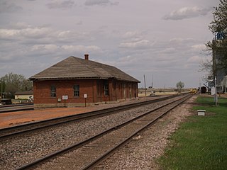
Scranton is a small town in Bowman County, North Dakota, United States. The population was 258 at the 2020 census.

<span class="mw-page-title-main">Lincoln, North Dakota</span> City in North Dakota, United States

Lincoln is a city in Burleigh County, North Dakota, United States. It is a suburb of adjacent Bismarck, and also a core city of the Bismarck-Mandan Metropolitan Statistical Area. The population was 4,257 at the 2020 census, making it the 14th most populous city in North Dakota. Lincoln was founded in 1977.

<span class="mw-page-title-main">Oakes, North Dakota</span> City in North Dakota, United States

Oakes is the most populous city in Dickey County, North Dakota, United States. The population was 1,798 at the 2020 census. Oakes was founded in 1886.

<span class="mw-page-title-main">Killdeer, North Dakota</span> City in North Dakota, United States

Killdeer is a city in Dunn County, North Dakota, United States. The population was 939 at the 2020 census.

<span class="mw-page-title-main">Beach, North Dakota</span> City in North Dakota, United States

Beach is a city in and the county seat of Golden Valley County in the State of North Dakota. The population was 981 at the 2020 census. Beach was incorporated in 1909. Walter Losinski was elected mayor of Beach in June 2022.

<span class="mw-page-title-main">Golva, North Dakota</span> City in North Dakota, United States

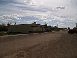
Golva is a city in Golden Valley County, North Dakota, United States. The population was 84 at the 2020 census. Golva was founded in 1915.

<span class="mw-page-title-main">Cavalier, North Dakota</span> City in North Dakota, United States

Cavalier is the largest city in Pembina County, North Dakota, United States. It is the county seat of Pembina County. The population was 1,246 at the 2020 census. Cavalier was founded in 1875 and became the county seat in 1911.

<span class="mw-page-title-main">Park River, North Dakota</span> City in North Dakota, United States

Park River is a city in Walsh County, North Dakota, United States. The population was 1,424 at the 2020 census. Park River was founded in 1884.

<span class="mw-page-title-main">Kenmare, North Dakota</span> City in North Dakota, United States

Kenmare is a city in Ward County, North Dakota, United States. The population was 961 at the 2020 census. Kenmare is part of the Minot Micropolitan Statistical Area.

<span class="mw-page-title-main">Mitchell, South Dakota</span> City in South Dakota, United States

Mitchell is a city in and the county seat of Davison County, South Dakota, United States. The population was 15,660 at the 2020 census making it the sixth most populous city in South Dakota.

<span class="mw-page-title-main">Webster, South Dakota</span> City in South Dakota, United States

Webster is a city in and the county seat of Day County, South Dakota, United States. The population was 1,728 at the 2020 census.

<span class="mw-page-title-main">Timber Lake, South Dakota</span> City in South Dakota, United States

Timber Lake is a city in and the county seat of Dewey County, South Dakota, United States. The population was 509 at the 2020 census.

<span class="mw-page-title-main">Gregory, South Dakota</span> City in South Dakota, United States

Gregory is a city in western Gregory County, South Dakota, United States. The population was 1,221 at the 2020 census.

<span class="mw-page-title-main">Kadoka, South Dakota</span> City in South Dakota, United States

Kadoka is a city in, and the county seat of, Jackson County, South Dakota, United States. The population was 543 at the 2020 census. The town occupies about 2.3 square miles.

<span class="mw-page-title-main">Wessington Springs, South Dakota</span> City in South Dakota, United States

Wessington Springs is a city in central Jerauld County, South Dakota, United States. The population was 956 at the 2010 census. It is the county seat of Jerauld County.

<span class="mw-page-title-main">Howard, South Dakota</span> City in South Dakota, United States

Howard is a city in Miner County, South Dakota, United States. The population was 848 at the 2020 census. It is the county seat and most populous city in Miner County.

<span class="mw-page-title-main">Centerville, South Dakota</span> City in South Dakota, United States

Centerville is a city in Turner County, South Dakota, United States. The population was 918 at the 2020 census. Centerville is part of the Sioux Falls, South Dakota metropolitan area.

References

  1. "ArcGIS REST Services Directory". United States Census Bureau. Retrieved September 20, 2022.
  2. 1 2 U.S. Geological Survey Geographic Names Information System: Langdon, North Dakota
  3. 1 2 3 "Explore Census Data". United States Census Bureau . Retrieved October 13, 2023.
  4. 1 2 "City and Town Population Totals: 2020-2022". United States Census Bureau. October 13, 2023. Retrieved October 13, 2023.
  5. "Find a County". National Association of Counties. Retrieved June 7, 2011.
  6. "Cavalier County". Jim Forte Postal History. Retrieved January 6, 2015.
  7. Olstad, Geneva Roth (2000). Main Street, North Dakota in Vintage Postcards. Arcadia Publishing. p. 58. ISBN   978-0-7385-0726-2.
  8. "Battle for County Seat". Historical Marker Database. The Courier. Retrieved October 12, 2023.
  9. 1 2 3 4 5 6 Jackson, William (2008). Almanac of North Dakota Mysteries & Oddities, 2009-2010. Dickinson, ND: Valley Star Books, Inc. pp. 10–12. ISBN   978-0-9677349-8-9.
  10. Jackson, William (2021). Dakota Mysteries & Oddities, 2022 Edition. Dickinson, ND: Valley Star Publishing. p. 50. ISBN   978-0-9677349-9-6.
  11. "US Gazetteer files 2010". United States Census Bureau. Archived from the original on July 2, 2012. Retrieved June 14, 2012.
  12. United States Census Bureau. "Census of Population and Housing" . Retrieved August 3, 2013.
  13. 1 2 3 "Home" (PDF). May 16, 2023.
  14. Climate Summary for Langdon, North Dakota
  15. "NowData - NOAA Online Weather Data". National Oceanic and Atmospheric Administration. Retrieved September 24, 2021.
  16. "Station: Langdon EXP FARM, ND". U.S. Climate Normals 2020: U.S. Monthly Climate Normals (1991-2020). National Oceanic and Atmospheric Administration. Retrieved September 24, 2021.
  17. "The Most Anomalous Weather Events in U.S. History: Part 2". Weather Underground.