Thompson, North Dakota

Last updated

Thompson, North Dakota
Thompson, North Dakota.jpg
S&T Quick Stop, the town's gas station and convenience store.
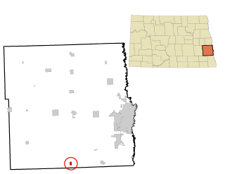
ND Grand Forks County Thompson.svg
Location of Thompson, North Dakota
Coordinates: 47°46′31″N97°06′19″W / 47.77528°N 97.10528°W / 47.77528; -97.10528
CountryUnited States
State North Dakota
County Grand Forks
Metro Greater Grand Forks
Founded1881
Government
   Mayor Jeremy Hughes
Area
[1]
  Total0.47 sq mi (1.23 km2)
  Land0.47 sq mi (1.21 km2)
  Water0.01 sq mi (0.02 km2)
Elevation
[2]
869 ft (265 m)
Population
 (2020) [3]
  Total1,101
  Estimate 
(2022) [4]
1,068
  Density2,352.56/sq mi (909.26/km2)
Time zone UTC-6 (Central (CST))
  Summer (DST) UTC-5 (CDT)
ZIP code
58278
Area code 701
FIPS code 38-78660
GNIS feature ID1036294 [2]
Highways ND 15
Website cityofthompsonnd.com

Thompson is a city in Grand Forks County, North Dakota, United States. It is part of the "Grand Forks, ND-MN Metropolitan Statistical Area" or "Greater Grand Forks". It is located on the border of Allendale and Walle townships, with Walle on the east and Allendale on the west. The population was 1,101 at the 2020 census. [3] Thompson was founded in 1881.

Contents

History

Elevated view of Thompson, North Dakota, 1890s Elevated view of Thompson, N.D., 1890s.jpg
Elevated view of Thompson, North Dakota, 1890s

The first residents of the town were businessmen who had come to support the needs of new settlers to the area. The town was first called Norton because the first buildings of the town were adjacent to land owned by George Norton. However, when the railroad came in 1881, the name caused an issue, since there was already a nearby town of Norton in Minnesota. [5]

Albert Thompson, co-owner of a general store with his brother Robert, was commissioned postmaster in January 1881. The name of the town was then changed to Thompson in honor of Albert Thompson. [5]

Geography

According to the United States Census Bureau, the city has a total area of 0.47 square miles (1.22 km2), of which 0.46 square miles (1.19 km2) is land and 0.01 square miles (0.03 km2) is water. [6]

Demographics

Historical population
CensusPop.Note
1930 273
1940 2761.1%
1950 270−2.2%
1960 2907.4%
1970 2910.3%
1980 785169.8%
1990 93018.5%
2000 1,0068.2%
2010 986−2.0%
2020 1,10111.7%
2022 (est.)1,068 [4] −3.0%
U.S. Decennial Census [7]
2020 Census [3]

2010 census

As of the census of 2010, there were 986 people, 356 households, and 293 families living in the city. The population density was 2,143.5 inhabitants per square mile (827.6/km2). There were 362 housing units at an average density of 787.0 per square mile (303.9/km2). The racial makeup of the city was 98.1% White, 0.3% African American, 1.0% Native American, 0.1% Asian, 0.1% from other races, and 0.4% from two or more races. Hispanic or Latino of any race were 0.9% of the population.

There were 356 households, of which 42.1% had children under the age of 18 living with them, 73.0% were married couples living together, 7.0% had a female householder with no husband present, 2.2% had a male householder with no wife present, and 17.7% were non-families. 14.9% of all households were made up of individuals, and 4.8% had someone living alone who was 65 years of age or older. The average household size was 2.77 and the average family size was 3.04.

The median age in the city was 36.8 years. 28.4% of residents were under the age of 18; 6.9% were between the ages of 18 and 24; 27.2% were from 25 to 44; 30.5% were from 45 to 64; and 7.1% were 65 years of age or older. The gender makeup of the city was 51.0% male and 49.0% female.

2000 census

As of the census of 2000, there were 1,006 people, 329 households, and 273 families living in the city. The population density was 2,177.6 inhabitants per square mile (840.8/km2). There were 339 housing units at an average density of 733.8 per square mile (283.3/km2). The racial makeup of the city was 97.71% White, 0.40% African American, 0.10% Native American, 0.70% Asian, 0.20% from other races, and 0.89% from two or more races. Hispanic or Latino of any race were 0.80% of the population.

There were 329 households, out of which 53.2% had children under the age of 18 living with them, 74.5% were married couples living together, 4.3% had a female householder with no husband present, and 17.0% were non-families. 15.2% of all households were made up of individuals, and 6.4% had someone living alone who was 65 years of age or older. The average household size was 3.06 and the average family size was 3.43.

In the city, the population was spread out, with 34.9% under the age of 18, 6.3% from 18 to 24, 33.4% from 25 to 44, 19.8% from 45 to 64, and 5.7% who were 65 years of age or older. The median age was 33 years. For every 100 females, there were 105.7 males. For every 100 females aged 18 and over, there were 97.9 males.

The median income for a household in the city was $54,514, and the median income for a family was $57,250. Males had a median income of $35,682 versus $21,298 for females. The per capita income for the city was $19,857. None of the families and 0.7% of the population were living below the poverty line, including no under eighteens and 7.7% of those over 64.

Transportation

Amtrak’s Empire Builder, which operates between Seattle/Portland and Chicago, passes through the town on BNSF tracks, but makes no stop. The nearest station is located in Grand Forks, 14 miles (23 km) to the north.

Related Research Articles

<span class="mw-page-title-main">Thompson Falls, Montana</span> City in Montana, United States

Thompson Falls is a city in and the county seat of Sanders County, Montana. The population was 1,336 at the time of the 2020 census.

<span class="mw-page-title-main">Harwood, North Dakota</span> City in North Dakota, United States

Harwood is a city in Cass County, North Dakota, United States. The population was 794 at the 2020 census. It has become a bedroom community of the nearby Fargo-Moorhead area. Harwood was founded in 1881.

<span class="mw-page-title-main">Horace, North Dakota</span> City in North Dakota, United States

Horace is a city in Cass County, North Dakota, United States. As of the 2020 census, the population was 3,085.
<span class="mw-page-title-main">Leonard, North Dakota</span> City in North Dakota, United States

Leonard is a city in Cass County, North Dakota, United States. The population was 248 at the 2020 census. Leonard was founded in 1881.

<span class="mw-page-title-main">Emerado, North Dakota</span> City in North Dakota, United States

Emerado is a city in Grand Forks County, North Dakota, United States located near Grand Forks Air Force Base. It is part of the "Grand Forks, ND-MN Metropolitan Statistical Area" or "Greater Grand Forks". The population was 443 at the 2020 census. Grand Forks Air Force Base is located near Emerado.
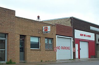
<span class="mw-page-title-main">Gilby, North Dakota</span> City in North Dakota, United States

Gilby is a city in Grand Forks County, North Dakota, United States. It is part of the "Grand Forks, ND-MN Metropolitan Statistical Area" or "Greater Grand Forks". The population was 243 at the 2020 census. Gilby was founded in 1887.

<span class="mw-page-title-main">Inkster, North Dakota</span> City in North Dakota, United States

Inkster is a small village in Grand Forks County, North Dakota, United States, with a population of 38 as of the 2020 census. Inkster was founded in 1884, in an area that had been settled by George T. Inkster in 1878.
<span class="mw-page-title-main">Larimore, North Dakota</span> City in North Dakota, United States

Larimore is a city in Grand Forks County, North Dakota, United States. It is located three miles south of the junction of U.S. Route 2 and North Dakota Highway 18. Larimore is part of the "Grand Forks, ND-MN Metropolitan Statistical Area" or "Greater Grand Forks". The population was 1,260 at the 2020 census.

<span class="mw-page-title-main">Manvel, North Dakota</span> City in North Dakota, United States

Manvel is a city in Grand Forks County, North Dakota, United States. It sits on the banks of the Turtle River. It is part of the "Grand Forks, ND-MN Metropolitan Statistical Area" or "Greater Grand Forks". The population was 377 at the 2020 census. Manvel was founded in 1881.

<span class="mw-page-title-main">Niagara, North Dakota</span> City in North Dakota, United States

Niagara is a city in Grand Forks County, North Dakota, United States. It is part of the "Grand Forks, ND-MN Metropolitan Statistical Area" or "Greater Grand Forks". The population was 46 at the 2020 census. Niagara was founded in 1883.
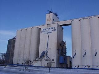
<span class="mw-page-title-main">Northwood, North Dakota</span> City in North Dakota, United States

Northwood is a city in Grand Forks County, North Dakota, United States. It is part of the "Grand Forks, ND-MN Metropolitan Statistical Area" or "Greater Grand Forks." The population was 982 at the 2020 census.
<span class="mw-page-title-main">Lakota, North Dakota</span> City in North Dakota, United States

Lakota is a city in Nelson County, North Dakota, United States. It is the county seat of Nelson County Lakota is located 63 miles west of Grand Forks and 27 miles east of Devils Lake. The population was 683 at the 2020 census, making Lakota the 75th-largest city in North Dakota.

<span class="mw-page-title-main">Ardoch, North Dakota</span> City in North Dakota, United States

Ardoch is a city in Walsh County, North Dakota, United States. The population was 31 at the 2020 census. Ardoch, named for the community of Ardoch, Ontario, was founded in 1881.

<span class="mw-page-title-main">Groton, South Dakota</span> City in South Dakota, United States

Groton is a city in southeastern Brown County, South Dakota, United States. The population was 1,380 at the 2020 census.

<span class="mw-page-title-main">Milbank, South Dakota</span> City in South Dakota, United States

Milbank is a city in Grant County, South Dakota, United States, located along the South Fork of the Whetstone River. The population was 3,544 at the 2020 census. It is the county seat of Grant County. Milbank is the birthplace of American Legion Baseball. The program was created in Milbank in 1925 and is now enjoyed by high school aged youth on more than five thousand teams in all fifty states.

<span class="mw-page-title-main">Gregory, South Dakota</span> City in South Dakota, United States

Gregory is a city in western Gregory County, South Dakota, United States. The population was 1,221 at the 2020 census.

<span class="mw-page-title-main">Dell Rapids, South Dakota</span> City in South Dakota, United States

Dell Rapids is a city in Minnehaha County, South Dakota, United States. The population was 3,996 at the 2020 census. It is known as "The Little City with the Big Attractions."

<span class="mw-page-title-main">Wilmot, South Dakota</span> City in South Dakota, United States

Wilmot is a city in Roberts County, South Dakota, United States. The population was 432 at the 2020 census.

<span class="mw-page-title-main">Redfield, South Dakota</span> City in South Dakota, United States

Redfield is a city in and the county seat of Spink County, South Dakota, United States. The population was 2,214 at the 2020 census. The city was named for J. B. Redfield, a railroad official.

<span class="mw-page-title-main">Reynolds, North Dakota</span> City in North Dakota, United States

Reynolds is a city in Grand Forks and Traill counties in the State of North Dakota. It is part of the Grand Forks, ND-MN Metropolitan Statistical Area or "Greater Grand Forks". The population was 277 at the 2020 census. Reynolds, named for pioneer settler Dr. Henry Reynolds, was founded in 1881.
References

  1. "ArcGIS REST Services Directory". United States Census Bureau. Retrieved September 20, 2022.
  2. 1 2 U.S. Geological Survey Geographic Names Information System: Thompson, North Dakota
  3. 1 2 3 "Explore Census Data". United States Census Bureau . Retrieved October 11, 2023.
  4. 1 2 "City and Town Population Totals: 2020-2022". United States Census Bureau. October 11, 2023. Retrieved October 11, 2023.
  5. 1 2 "Memories of Yesterday: Thompson Centennial, 1881-1981". www.digitalhorizonsonline.org. Retrieved March 15, 2021.
  6. "US Gazetteer files 2010". United States Census Bureau. Archived from the original on January 12, 2012. Retrieved June 14, 2012.
  7. United States Census Bureau. "Census of Population and Housing" . Retrieved July 20, 2013.