Niagara, North Dakota

Last updated

Niagara, North Dakota
Niagra, North Dakota.jpg
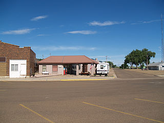
At the corner of Ransom and Second
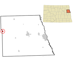
ND Grand Forks County Niagara.svg
Coordinates: 47°59′54″N97°52′18″W / 47.99833°N 97.87167°W / 47.99833; -97.87167
CountryUnited States
State North Dakota
County Grand Forks
Metro Greater Grand Forks
Founded1883
Area
[1]
  Total0.97 sq mi (2.50 km2)
  Land0.94 sq mi (2.43 km2)
  Water0.03 sq mi (0.07 km2)
Elevation
[2]
1,434 ft (437 m)
Population
 (2020) [3]
  Total46
  Estimate 
(2022) [4]
42
  Density48.99/sq mi (18.92/km2)
Time zone UTC-6 (Central (CST))
  Summer (DST) UTC-5 (CDT)
ZIP code
58266
Area code 701
FIPS code 38-56780
GNIS feature ID1036185 [2]

Niagara is a city in Grand Forks County, North Dakota, United States. It is part of the "Grand Forks, ND-MN Metropolitan Statistical Area" or "Greater Grand Forks". The population was 46 at the 2020 census. [3] Niagara was founded in 1883.

Contents

Geography

According to the United States Census Bureau, the city has a total area of 0.97 square miles (2.51 km2), of which 0.94 square miles (2.43 km2) is land and 0.03 square miles (0.08 km2) is water. [5]

Demographics

Historical population
CensusPop.Note
1900 392
1910 157−59.9%
1920 19926.8%
1930 2074.0%
1940 179−13.5%
1950 163−8.9%
1960 157−3.7%
1970 115−26.8%
1980 76−33.9%
1990 73−3.9%
2000 57−21.9%
2010 53−7.0%
2020 46−13.2%
2022 (est.)42 [4] −8.7%
U.S. Decennial Census [6]
2020 Census [3]

2010 census

As of the census of 2010, there were 53 people, 23 households, and 15 families living in the city. The population density was 56.4 inhabitants per square mile (21.8/km2). There were 29 housing units at an average density of 30.9 per square mile (11.9/km2). The racial makeup of the city was 98.1% White and 1.9% from two or more races. Hispanic or Latino of any race were 1.9% of the population.

There were 23 households, of which 39.1% had children under the age of 18 living with them, 52.2% were married couples living together, 13.0% had a male householder with no wife present, and 34.8% were non-families. 30.4% of all households were made up of individuals, and 21.7% had someone living alone who was 65 years of age or older. The average household size was 2.30 and the average family size was 2.87.

The median age in the city was 46.5 years. 24.5% of residents were under the age of 18; 5.7% were between the ages of 18 and 24; 18.9% were from 25 to 44; 32% were from 45 to 64; and 18.9% were 65 years of age or older. The gender makeup of the city was 58.5% male and 41.5% female.

2000 census

As of the census of 2000, there were 57 people, 27 households, and 18 families living in the city. The population density was 61.2 inhabitants per square mile (23.6/km2). There were 35 housing units at an average density of 37.6 per square mile (14.5/km2). The racial makeup of the city was 94.74% White, 1.75% Native American, and 3.51% from two or more races.

There were 27 households, out of which 14.8% had children under the age of 18 living with them, 55.6% were married couples living together, 7.4% had a female householder with no husband present, and 33.3% were non-families. 25.9% of all households were made up of individuals, and 14.8% had someone living alone who was 65 years of age or older. The average household size was 2.11 and the average family size was 2.50.

In the city, the population was spread out, with 17.5% under the age of 18, 1.8% from 18 to 24, 22.8% from 25 to 44, 29.8% from 45 to 64, and 28.1% who were 65 years of age or older. The median age was 54 years. For every 100 females, there were 96.6 males. For every 100 females age 18 and over, there were 88.0 males.

The median income for a household in the city was $30,000, and the median income for a family was $31,250. Males had a median income of $20,625 versus $16,750 for females. The per capita income for the city was $16,206. There were no families and 6.4% of the population living below the poverty line, including no under eighteens and none of those over 64.

Transportation

Amtrak’s Empire Builder, which operates between Seattle/Portland and Chicago, passes through the town on BNSF tracks, but makes no stop. The nearest station is located in Grand Forks, 39 miles (63 km) to the east.

Related Research Articles

<span class="mw-page-title-main">Dakota City, Iowa</span> City in Iowa, United States

Dakota City is a city in and the county seat of Humboldt County, Iowa, United States. The population was 759 at the time of the 2020 census. Dakota City shares its western border with the much larger city of Humboldt. It is the least populous county seat in Iowa.

<span class="mw-page-title-main">Fisher, Minnesota</span> City in Minnesota, United States

Fisher is a town in Polk County, Minnesota, United States. It is part of the Grand Forks-ND-MN Metropolitan Statistical Area. The population was 422 at the 2020 census. Fisher has become a bedroom community for the nearby Greater Grand Forks Metropolitan Area.

<span class="mw-page-title-main">Lengby, Minnesota</span> City in Minnesota, United States

Lengby is a city in Polk County, Minnesota, United States. It is part of the Grand Forks ND-MN Metropolitan Statistical Area. The population was 92 at the 2020 census.
<span class="mw-page-title-main">Hettinger, North Dakota</span> City in North Dakota, United States

Hettinger is a city in, and the county seat of, Adams County, North Dakota, United States. The population was 1,074 at the 2020 census.

<span class="mw-page-title-main">Dazey, North Dakota</span> City in North Dakota, United States

Dazey is a city in Barnes County, North Dakota, United States. The population was 78 at the 2020 census. Dazey was founded in 1883 after a local farmer, Charles Dazey, donated land to start a townsite.

<span class="mw-page-title-main">Esmond, North Dakota</span> City in North Dakota, United States

Esmond is a city in Benson County, North Dakota, United States. The population was 91 at the 2020 census. Esmond was founded in 1901.

<span class="mw-page-title-main">Maxbass, North Dakota</span> City in North Dakota, United States

Maxbass is a city in Bottineau County, North Dakota, United States. The population was 89 at the 2020 census. Maxbass was founded in 1905.

<span class="mw-page-title-main">Ayr, North Dakota</span> City in North Dakota, United States

Ayr is a city in Cass County, North Dakota, United States. The population was 11 at the 2020 census. Ayr was founded in 1883.

<span class="mw-page-title-main">Prairie Rose, North Dakota</span> City in North Dakota, United States

Prairie Rose is a city in Cass County, North Dakota, United States. The population was 56 at the 2020 census. The city is an enclave suburb of Fargo. Prairie Rose was founded in 1975 and it was incorporated in 1978. There are 21 homes in the city.
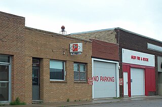
<span class="mw-page-title-main">Gilby, North Dakota</span> City in North Dakota, United States

Gilby is a city in Grand Forks County, North Dakota, United States. It is part of the "Grand Forks, ND-MN Metropolitan Statistical Area" or "Greater Grand Forks". The population was 243 at the 2020 census. Gilby was founded in 1887.

<span class="mw-page-title-main">Inkster, North Dakota</span> City in North Dakota, United States

Inkster is a small village in Grand Forks County, North Dakota, United States, with a population of 38 as of the 2020 census. Inkster was founded in 1884, in an area that had been settled by George T. Inkster in 1878.

<span class="mw-page-title-main">Manvel, North Dakota</span> City in North Dakota, United States

Manvel is a city in Grand Forks County, North Dakota, United States. It sits on the banks of the Turtle River. It is part of the "Grand Forks, ND-MN Metropolitan Statistical Area" or "Greater Grand Forks". The population was 377 at the 2020 census. Manvel was founded in 1881.

<span class="mw-page-title-main">Thompson, North Dakota</span> City in North Dakota, United States

Thompson is a city in Grand Forks County, North Dakota, United States. It is part of the "Grand Forks, ND-MN Metropolitan Statistical Area" or "Greater Grand Forks". It is located on the border of Allendale and Walle townships, with Walle on the east and Allendale on the west. The population was 1,101 at the 2020 census. Thompson was founded in 1881.

<span class="mw-page-title-main">Michigan City, North Dakota</span> City in North Dakota, United States

Michigan City is a city in Nelson County, North Dakota, United States. The population was 263 at the 2020 census. Though the official name is Michigan City, local residents commonly refer to the city as Michigan. The town population has been declining since the 1980 census.

<span class="mw-page-title-main">Hoople, North Dakota</span> City in North Dakota, United States

Hoople is a city in Walsh County, North Dakota, United States. The population was 247 at the 2020 census. Hoople, named for early settler Alan Hoople, was founded in 1889. Hoople's nickname is "Tatertown."

<span class="mw-page-title-main">Wagner, South Dakota</span> City in South Dakota, United States

Wagner is a city in Charles Mix County, South Dakota, United States. The population was 1,490 at the 2020 census. The city is served by Wagner Municipal Airport as well as YST Transit buses.

<span class="mw-page-title-main">Corsica, South Dakota</span> City in South Dakota, United States

Corsica is a city in Douglas County, South Dakota, United States. The population was 561 at the 2020 census.

<span class="mw-page-title-main">Presho, South Dakota</span> City in South Dakota, United States

Presho is a small city in Lyman County, South Dakota, United States. The population was 472 at the 2020 census.

<span class="mw-page-title-main">Reynolds, North Dakota</span> City in North Dakota, United States

Reynolds is a city in Grand Forks and Traill counties in the State of North Dakota. It is part of the Grand Forks, ND-MN Metropolitan Statistical Area or "Greater Grand Forks". The population was 277 at the 2020 census. Reynolds, named for pioneer settler Dr. Henry Reynolds, was founded in 1881.

<span class="mw-page-title-main">Niagara, Wisconsin</span> City in Wisconsin, United States

Niagara is a city in Marinette County, Wisconsin, United States. The population was 1,602 at the 2020 census. The city lies to the north of and adjacent to the Town of Niagara. It is part of the Marinette, WI–MI Micropolitan Statistical Area.
References

  1. "ArcGIS REST Services Directory". United States Census Bureau. Retrieved September 20, 2022.
  2. 1 2 U.S. Geological Survey Geographic Names Information System: Niagara, North Dakota
  3. 1 2 3 "Explore Census Data". United States Census Bureau . Retrieved December 14, 2023.
  4. 1 2 "City and Town Population Totals: 2020-2022". United States Census Bureau. December 14, 2023. Retrieved December 14, 2023.
  5. "US Gazetteer files 2010". United States Census Bureau. Archived from the original on January 12, 2012. Retrieved June 14, 2012.
  6. United States Census Bureau. "Census of Population and Housing" . Retrieved July 20, 2013.