Grand Forks County | |
---|---|
Coordinates: 47°55′N97°27′W / 47.92°N 97.45°W | |
Country | United States |
State | North Dakota |
Founded | January 4, 1873 (created) March 2, 1875 (organized) |
Seat | Grand Forks |
Largest city | Grand Forks |
Area | |
• Total | 1,440 sq mi (3,700 km2) |
• Land | 1,436 sq mi (3,720 km2) |
• Water | 3.1 sq mi (8 km2) 0.2% |
Population (2020) | |
• Total | 73,170 |
• Estimate (2023) | 72,708 |
• Density | 51/sq mi (20/km2) |
Time zone | UTC−6 (Central) |
• Summer (DST) | UTC−5 (CDT) |
Congressional district | At-large |
Website | www |
Grand Forks County is a county in the U.S. state of North Dakota. As of the 2020 census, its population was 73,170, [1] making it the third most populous county in North Dakota. Its county seat and largest community is Grand Forks. [2]
Using territory annexed from Pembina County, the Dakota Territory legislature created Grand Forks County on January 4, 1873. Its governing structure was not established at that time, nor was the territory attached to another county for administrative and judicial purposes. The government was organized on March 2, 1875.
The county's boundaries were altered in 1875, 1881, and 1883. It has retained its present boundary since 1883. [3] [4]
Grand Forks County is included in the Grand Forks, ND-MN Metropolitan Statistical Area.
Grand Forks County lies on the east side of North Dakota. Its eastern boundary line abuts the west boundary line of the state of Minnesota (across the Red River). The Red River flows northward along the county's east border, on its way to Lake Winnipeg and Hudson Bay. The Forest River flows eastward and northward across the upper western part of the county.
The terrain of Grand Forks County consists of low rolling hills, devoted to agriculture except around urban areas. [5] The terrain slopes to the north and east; its highest point is a hill at its southwestern corner, at 1,450 ft (440 m) ASL. [6] The county has a total area of 1,440 square miles (3,700 km2), of which 1,436 square miles (3,720 km2) is land and 3.1 square miles (8.0 km2) (0.2%) is water. [7]
The University of North Dakota has established a Field Biology Station on Forest River, at the county's northern border. In 2013 it partnered with ND Game & Fish Department to establish a 160-acre (0.65 km2) wildlife management area at the station, to monitor whitetail deer activity in the forest. [8] The field station is tasked with identifying plants native and endemic to the area. A total of 498 plants have been collected at the Forest River Biology Station and Wildlife Management Area. [9]
Source: [5]
Source: [5]
Census | Pop. | Note | %± |
---|---|---|---|
1880 | 6,248 | — | |
1890 | 18,357 | 193.8% | |
1900 | 24,459 | 33.2% | |
1910 | 27,888 | 14.0% | |
1920 | 28,795 | 3.3% | |
1930 | 31,956 | 11.0% | |
1940 | 34,518 | 8.0% | |
1950 | 39,448 | 14.3% | |
1960 | 48,677 | 23.4% | |
1970 | 61,102 | 25.5% | |
1980 | 66,100 | 8.2% | |
1990 | 70,683 | 6.9% | |
2000 | 66,109 | −6.5% | |
2010 | 66,861 | 1.1% | |
2020 | 73,170 | 9.4% | |
2022 (est.) | 72,708 | [10] | −0.6% |
U.S. Decennial Census [11] 1790-1960 [12] 1900-1990 [13] 1990-2000 [14] 2010-2020 [1] |
As of the 2020 census, there were 73,170 people, 30,658 households, and 16,186 families in the county. [15] The population density was 50.9 inhabitants per square mile (19.7/km2) There were 33,428 housing units.
As of the census of 2010, there were 66,861 people, 27,417 households, and 15,215 families in the county. The population density was 46.5 inhabitants per square mile (18.0/km2). There were 29,344 housing units at an average density of 20.4 units per square mile (7.9/km2). The racial makeup of the county was 90.3% white, 2.5% American Indian, 2.0% black or African American, 1.9% Asian, 0.1% Pacific islander, 0.8% from other races, and 2.4% from two or more races. Those of Hispanic or Latino origin made up 2.9% of the population. In terms of ancestry, 34.1% were German, 33.8% were Norwegian, 9.5% were Irish, 5.8% were Polish, 5.3% were English, and 2.9% were American.
Of the 27,417 households, 26.6% had children under the age of 18 living with them, 42.8% were married couples living together, 9.1% had a female householder with no husband present, 44.5% were non-families, and 32.1% of all households were made up of individuals. The average household size was 2.28 and the average family size was 2.91. The median age was 29.7 years.
The median income for a household in the county was $44,242 and the median income for a family was $65,804. Males had a median income of $40,622 versus $31,633 for females. The per capita income for the county was $24,276. About 8.2% of families and 17.5% of the population were below the poverty line, including 15.6% of those under age 18 and 10.3% of those age 65 or over.
Source: [5]
Range 56 | Range 55 | Range 54 | Range 53 | Range 52 | Range 51 | Range 50 | Range 49 | |
---|---|---|---|---|---|---|---|---|
Township 154 | Elkmount | Inkster | Strabane | Johnstown | Levant | Turtle River | Turte River | |
Township 153 | Plymouth | Agnes | Wheatfield | Gilby | Lakeville | Ferry | Ferry | |
Township 152 | Niagara | Elm Grove | Hegton | Mekinock | Blooming | Rye | Falconer | |
Township 151 | Moraine | Larimore | Arvilla | Chester | Oakville | Brenna | Grand Forks | |
Township 150 | Logan Center | Grace | Avon | Pleasant View | Fairfield | Allendale | Walle | Walle |
Township 149 | Loretta | Lind | Northwood | Washington | Union | Micbigan | Americus | Bentru |
Like all parts of North Dakota other than areas with reservations, Grand Forks County voters historically and currently vote Republican at the presidential level. In only one national election since 1964 has the county selected the Democratic Party candidate. However, the large student population has kept margins closer in recent elections.
Year | Republican | Democratic | Third party | |||
---|---|---|---|---|---|---|
No. | % | No. | % | No. | % | |
2020 | 16,987 | 54.85% | 12,880 | 41.59% | 1,105 | 3.57% |
2016 | 16,340 | 53.81% | 10,851 | 35.74% | 3,174 | 10.45% |
2012 | 15,060 | 50.15% | 14,032 | 46.73% | 937 | 3.12% |
2008 | 14,520 | 46.34% | 16,104 | 51.40% | 709 | 2.26% |
2004 | 17,298 | 56.77% | 12,646 | 41.50% | 526 | 1.73% |
2000 | 15,875 | 55.93% | 10,593 | 37.32% | 1,917 | 6.75% |
1996 | 11,606 | 44.92% | 11,376 | 44.03% | 2,854 | 11.05% |
1992 | 13,705 | 44.06% | 10,930 | 35.14% | 6,469 | 20.80% |
1988 | 14,801 | 53.76% | 12,494 | 45.38% | 236 | 0.86% |
1984 | 15,898 | 60.70% | 10,050 | 38.37% | 243 | 0.93% |
1980 | 14,257 | 57.65% | 6,997 | 28.29% | 3,477 | 14.06% |
1976 | 13,820 | 52.71% | 11,545 | 44.03% | 853 | 3.25% |
1972 | 13,361 | 56.92% | 9,416 | 40.11% | 698 | 2.97% |
1968 | 9,802 | 52.00% | 7,695 | 40.82% | 1,352 | 7.17% |
1964 | 7,367 | 40.53% | 10,740 | 59.09% | 68 | 0.37% |
1960 | 10,997 | 56.85% | 8,341 | 43.12% | 5 | 0.03% |
1956 | 10,289 | 62.17% | 6,231 | 37.65% | 30 | 0.18% |
1952 | 10,939 | 65.65% | 5,639 | 33.84% | 84 | 0.50% |
1948 | 6,374 | 46.23% | 6,996 | 50.74% | 419 | 3.04% |
1944 | 5,668 | 42.19% | 7,707 | 57.37% | 59 | 0.44% |
1940 | 7,043 | 45.42% | 8,396 | 54.15% | 67 | 0.43% |
1936 | 4,312 | 29.64% | 9,222 | 63.39% | 1,015 | 6.98% |
1932 | 5,090 | 39.46% | 7,579 | 58.75% | 231 | 1.79% |
1928 | 8,024 | 64.86% | 4,300 | 34.76% | 47 | 0.38% |
1924 | 6,690 | 62.81% | 943 | 8.85% | 3,018 | 28.34% |
1920 | 7,646 | 74.00% | 2,527 | 24.46% | 159 | 1.54% |
1916 | 2,159 | 41.94% | 2,814 | 54.66% | 175 | 3.40% |
1912 | 955 | 23.88% | 1,492 | 37.31% | 1,552 | 38.81% |
1908 | 2,740 | 57.41% | 1,750 | 36.66% | 283 | 5.93% |
1904 | 2,807 | 73.16% | 828 | 21.58% | 202 | 5.26% |
1900 | 2,603 | 61.33% | 1,532 | 36.10% | 109 | 2.57% |
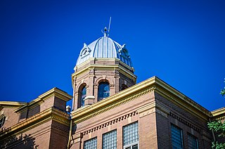
Albany County is a county in the U.S. state of Wyoming. As of the 2020 United States Census, the population was 37,066. Its county seat is Laramie, the site of the University of Wyoming. Its south border lies on the northern Colorado state line.
Roberts County is a county in the U.S. state of South Dakota. As of the 2020 census, the population was 10,280. Its county seat is Sisseton. The county was named either for S. G. Roberts of Fargo, North Dakota, or for Solomon Robar, an early local French fur trader. It was created on March 8, 1883, and fully organized by August 6 of that year. Its boundary was altered once, in 1885.
Meade County is a county in the U.S. state of South Dakota. As of the 2020 census, the population was 29,852, making it the 6th most populous county in South Dakota. Its county seat is Sturgis. The county was created in 1889 and named for Fort Meade, which was garrisoned as a United States military post in the area in 1878 and itself named for General George Meade.
Walsh County is a county in the U.S. state of North Dakota. As of the 2020 census, the population was 10,563. Its county seat is Grafton.
Traill County is a county in the U.S. state of North Dakota. As of the 2020 census listed the population at 7,997. Its county seat is Hillsboro, and its largest city is Mayville.
Sargent County is a county in the U.S. state of North Dakota. Its county seat is Forman, and its most populous city is Gwinner. The county is named in honor of Homer E. Sargent, a 19th-century general manager of the Northern Pacific Railroad Company. The county spans an agricultural region between the James River and Red River valleys in southeastern North Dakota dotted with various sloughs, lakes, and hills.
Ramsey County is a county in the U.S. state of North Dakota. As of the 2020 census, the population was 11,605. Its county seat is Devils Lake.
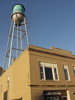
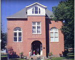
Nelson County is a county in the U.S. state of North Dakota. As of the 2020 census, the population was 3,015. Its county seat is Lakota.
McLean County is a county in the U.S. state of North Dakota. As of the 2020 census, the population was 9,771. Its county seat is Washburn.
McHenry County is a county in the U.S. state of North Dakota. As of the 2020 census, the population was 5,345. Its county seat is Towner.
LaMoure County is a county in the U.S. state of North Dakota. As of the 2020 census, the population was 4,093. Its county seat is LaMoure.
Griggs County is a county in the U.S. state of North Dakota. As of the 2020 census, the population was 2,306. Its county seat is Cooperstown.
Dunn County is a county in the U.S. state of North Dakota. As of the 2020 census, the population was 4,095. Its county seat is Manning.
Bowman County is a county in the U.S. state of North Dakota. As of the 2020 census, the population was 2,993. Its county seat is Bowman.
Bottineau County is a county in the U.S. state of North Dakota. As of the 2020 census, the population was 6,379. Its county seat is Bottineau.
Benson County is a county in the U.S. state of North Dakota. As of the 2020 census, the population was 5,964. Its county seat is Minnewaukan. The county was created on March 9, 1883 by the Dakota Territory legislature, and was named for Bertil W. Benson, a Dakota Territory legislator at the time. The county government was organized on June 4, 1884, and its boundary lines were altered by two legislative actions in 1885.
Polk County is a county in the northwestern part of the U.S. state of Minnesota. The population was 31,192 at the 2020 census. Its county seat is Crookston, and the largest community is East Grand Forks.
Kittson County is a county in the northwestern corner of the U.S. state of Minnesota along the Canada–US border, south of the Canadian province of Manitoba. As of the 2020 census, the population was 4,207. Its county seat is Hallock.
Emerado is a city in Grand Forks County, North Dakota, United States located near Grand Forks Air Force Base. It is part of the "Grand Forks, ND-MN Metropolitan Statistical Area" or "Greater Grand Forks". The population was 443 at the 2020 census. Grand Forks Air Force Base is located near Emerado.
Larimore is a city in Grand Forks County, North Dakota, United States. It is located three miles south of the junction of U.S. Route 2 and North Dakota Highway 18. Larimore is part of the "Grand Forks, ND-MN Metropolitan Statistical Area" or "Greater Grand Forks". The population was 1,260 at the 2020 census.