Sargent County, North Dakota

Last updated

Sargent County
SARGENT COUNTY COURTHOUSE.jpg
Map of North Dakota highlighting Sargent County.svg
Location within the U.S. state of North Dakota
North Dakota in United States.svg
North Dakota's location within the U.S.
Coordinates: 46°07′N97°38′W / 46.11°N 97.63°W / 46.11; -97.63
CountryFlag of the United States.svg United States
StateFlag of North Dakota.svg  North Dakota
FoundedApril 9, 1883 (created)
October 8, 1883 (organized) [1]
Named for H. E. Sargent
Seat Forman
Largest city Gwinner
Area
  Total867 sq mi (2,250 km2)
  Land859 sq mi (2,220 km2)
  Water8.4 sq mi (22 km2)  1.0%
Population
 (2020)
  Total3,862
  Estimate 
(2022)
3,795 Decrease2.svg
  Density4.5/sq mi (1.7/km2)
Time zone UTC−6 (Central)
  Summer (DST) UTC−5 (CDT)
Congressional district At-large
Website www.sargentnd.com

Sargent County is a county in the U.S. state of North Dakota. Its county seat is Forman, [2] and its most populous city is Gwinner. The county is named in honor of Homer E. Sargent, a 19th-century general manager of the Northern Pacific Railroad Company. The county spans an agricultural region between the James River and Red River valleys in southeastern North Dakota dotted with various sloughs, lakes, and hills.

Contents

As of the 2020 census, the population was 3,862. [3] It is the 29th-most populous county in North Dakota, and was the original home of the Bobcat Company, a manufacturer of farm and construction equipment that still produces a large number of skid-steer loaders at its facility in Gwinner.

History

The Dakota Territory created the county on April 9, 1883, with areas partitioned from Ransom County, from previously unorganized areas and from non-county areas in the Wahpeton and Sisseton Indian Reserve. It was named for H. E. Sargent, a railroad executive. [4] Its governing structure was not completed at that time, so it was attached to Richland for judicial purposes and to Ransom for administrative purposes. This arrangement only lasted until October 8, when the county government was effected, [1] [5] [6] with Milnor as the county seat. However, in 1884, in the county's first election, Forman was chosen as the county seat. [4]

The Northern Pacific Railway laid a line into the county in 1883, reaching Milnor. By 1900 it had been extended across the county. The county's population rapidly increased, reaching a peak in the 1920 United States census (9,655). [4]

The former Brampton Lutheran Church, moved to Norway in 1997 Emigrantkirka pa Sletta.jpg
The former Brampton Lutheran Church, moved to Norway in 1997

In 1997 the Brampton Lutheran Church (originally built in 1908) was moved to Sletta near Radøy in Norway and reconstructed there. It is now called Emigrantkirka (Emigrant Church).

The Sargent County Courthouse, a Beaux Arts-style building built in 1910, is listed on the U.S. National Register of Historic Places.

Geography

Soils of Sargent County Sargent Co ND Pie Chart No Text 3-7-17 Version.pdf
Soils of Sargent County

Sargent County lies near the southeastern corner of North Dakota, abutting the state's southern border with South Dakota. The county is almost exactly rectangular in shape (consisting of 24 sections of land), with a small protrusion in the county's southeastern corner for alignment with the boundaries of the Lake Traverse Indian Reservation. The county has a total area of 867 square miles (2,250 km2), of which 859 square miles (2,220 km2) is land and 8.4 square miles (22 km2) (1.0%) is water. [7]

Other than small portions of the western and northern sides of the county that lie in the James River and Sheyenne River watersheds, respectively, the vast majority of the county lies within the watershed of the Wild Rice River, whose source is the termination of a drainage ditch about two miles northeast of Brampton in southwestern Sargent County. It flows generally easterly through the southern part of the county, passing through Silver Lake and Lake Tewaukon before flowing further east into Richland County about five miles southeast of De Lamere.

The county's topography is varied, with the southern and western portions of the county being dominated by glacial hills, including the northern tip of the Coteau des Prairies standing prominently along the county's southern border, gradually transitioning into the much flatter landscape of the Red River Valley in the eastern portion of the county. The flatter areas of the county are largely devoted to the production of corn, soybean, and wheat, with much of the more hilly terrain being used as pastures for grazing livestock. [8] The terrain generally slopes to the south and east, with its highest point on its western boundary line at 1,365 ft (416 m) ASL, although a northwest–southeast rise on the eastern portion of its south boundary line rises to 1,729 ft (527 m) ASL. [9]

Sargent County is located within the Prairie Pothole Region of the northern Great Plains, and as such has a landscape that is covered in numerous wetlands. The majority of these wetlands are shallow sloughs that vary in size in wetter and drier years, but there are also a number of larger and deeper lakes. Lake Tewaukon, located within Tewaukon National Wildlife Refuge in the southeastern portion of the county, is one of the county's largest lakes. Meanwhile, the western end of the county contains a chain of lakes, the largest of which is Kraft Lake. Many of the county's lakes are populated with fish such as yellow perch and walleye, making fishing (including ice fishing in the winter months) a popular recreation for both locals and visitors to the county.

Outline map of Sargent County, North Dakota, 1909 Map of Sargent County, N.D., 1909.jpg
Outline map of Sargent County, North Dakota, 1909

Adjacent counties

National protected areas

Lakes [8]

  • Alkali Lake
  • Borg Lake
  • Buffalo Lake
  • Clouds Lake
  • Golden Hill Lake
  • Kraft Lake
  • Lake Dell
  • Lake Fedge
  • Lake Tewaukon
  • Pickell Lake
  • Silver Lake
  • Sprague Lake
  • Storm Lake
  • White Lake

Demographics

Historical population
CensusPop.Note
1890 5,076
1900 6,03919.0%
1910 9,20252.4%
1920 9,6554.9%
1930 9,298−3.7%
1940 8,693−6.5%
1950 7,616−12.4%
1960 6,856−10.0%
1970 5,937−13.4%
1980 5,512−7.2%
1990 4,549−17.5%
2000 4,366−4.0%
2010 3,829−12.3%
2020 3,8620.9%
2022 (est.)3,795 [10] −1.7%
U.S. Decennial Census [11]
1790–1960 [12] 1900–1990 [13]
1990–2000 [14] 2010–2020 [3]

2020 census

As of the census of 2020, there were 3,862 people.

2010 census

As of the census of 2010, there were 3,829 people, 1,675 households and 1,113 families in the county. The population density was 4.46 people per square mile (1.72 people/km2). There were 2,004 housing units at an average density of 2.33 units per square mile (0.90/km2). The racial makeup of the county was 98.0% white, 0.5% American Indian, 0.2% Asian, 0.1% Pacific islander, 0.1% black or African American, 0.3% from other races, and 0.7% from two or more races. Those of Hispanic or Latino origin made up 1.3% of the population. In terms of ancestry, 51.3% were German, 35.9% were Norwegian, 11.8% were Swedish, 8.4% were Irish, and 3.0% were American.

Of the 1,675 households, 27.1% had children under the age of 18 living with them, 57.3% were married couples living together, 4.7% had a female householder with no husband present, 33.6% were non-families, and 30.2% of all households were made up of individuals. The average household size was 2.26 and the average family size was 2.79. The median age was 45.9 years.

The median income for a household in the county was $49,318 and the median income for a family was $59,531. Males had a median income of $43,594 versus $30,152 for females. The per capita income for the county was $26,553. About 5.7% of families and 7.8% of the population were below the poverty line, including 10.5% of those under age 18 and 10.4% of those age 65 or over.

Population by decade

Sargent County, North Dakota

Law and government

Commissioners

Sargent County is governed by an elected and nonpartisan board of commissioners, each of which is elected at-large.

CommissionerIn office
since
Current term
expires in December
Jason Arth20162024
Lyle Bopp20182022
Mark Breker20202024
Richard Ruch20182022
Scott Johnson20222022

Transportation

Major highways

Communities

Cities

Census-designated place

Unincorporated communities

  • Cogswell
  • Crete
  • Stirum
  • Straubville

Townships

Politics

Sargent County is a swing county in presidential elections, having voted for both parties an equal number of times since 1980. From 1948 on, it has backed the national winner in every presidential election except for 1988, when a majority of the county's votes went to Democrat Michael Dukakis, and 2020, when a majority of the county's residents voted for Republican Donald Trump in his bid for reelection.

United States presidential election results for Sargent County, North Dakota [15]
Year Republican Democratic Third party
No.%No.%No.%
2020 1,26661.16%73835.65%663.19%
2016 1,08854.48%69434.75%21510.77%
2012 87943.80%1,07553.56%532.64%
2008 77840.37%1,11557.86%341.76%
2004 1,14752.14%1,02146.41%321.45%
2000 1,10350.50%95943.91%1225.59%
1996 81439.38%1,00348.52%25012.09%
1992 81636.20%96142.64%47721.16%
1988 1,11945.94%1,30653.61%110.45%
1984 1,38550.83%1,29547.52%451.65%
1980 1,56555.44%1,04837.12%2107.44%
1976 1,34444.34%1,64454.24%431.42%
1972 1,61654.48%1,33144.88%190.64%
1968 1,38648.65%1,30845.91%1555.44%
1964 1,18939.20%1,84060.67%40.13%
1960 1,59148.98%1,65550.95%20.06%
1956 1,66252.90%1,47346.88%70.22%
1952 2,12465.76%1,09033.75%160.50%
1948 1,38745.73%1,50649.65%1404.62%
1944 1,48850.72%1,42648.60%200.68%
1940 1,92250.01%1,89449.28%270.70%
1936 86324.13%2,30664.47%40811.41%
1932 78521.16%2,81875.98%1062.86%
1928 1,77246.88%1,98952.62%190.50%
1924 1,46843.68%2326.90%1,66149.42%
1920 2,78778.18%67318.88%1052.95%
1916 1,05052.61%86843.49%783.91%
1912 60537.00%64139.20%38923.79%
1908 1,01261.48%57634.99%583.52%
1904 1,04571.62%31021.25%1047.13%
1900 76556.25%56441.47%312.28%

See also

Related Research Articles

<span class="mw-page-title-main">Marshall County, South Dakota</span> County in South Dakota, United States

Marshall County is a county in the U.S. state of South Dakota. As of the 2020 census, the population was 4,306. Its county seat is Britton. The county was created on May 2, 1885, and was named for Marshall Vincent, who homesteaded near Andover, South Dakota.

<span class="mw-page-title-main">Campbell County, South Dakota</span> County in South Dakota, United States

Campbell County is a county in the U.S. state of South Dakota. As of the 2020 census, the population was 1,377, making it the fourth-least populous county in South Dakota. Its county seat is Mound City. The county was created in 1873 and organized in 1884. It was named for Norman B. Campbell, a Dakota Territory legislator in 1873 and son of General Charles T. Campbell.

<span class="mw-page-title-main">Brown County, South Dakota</span> County in South Dakota, United States

Brown County is a county in the U.S. state of South Dakota. As of the 2020 census, the population was 38,301, making it the fourth most populous county in South Dakota. Its county seat is Aberdeen. The county is named for Alfred Brown, of Hutchinson County, South Dakota, a Dakota Territory legislator in 1879.

<span class="mw-page-title-main">Towner County, North Dakota</span> County in North Dakota, United States

Towner County is a county in the U.S. state of North Dakota. As of the 2020 census, the population is 2,162. Its county seat is Cando. It is south of the Canada–US border with Manitoba.

<span class="mw-page-title-main">Stutsman County, North Dakota</span> County in North Dakota, United States

Stutsman County is a county in the U.S. state of North Dakota. As of the 2020 census, the population was 21,593, making it the 8th most populous county in North Dakota. Its county seat is Jamestown.

<span class="mw-page-title-main">Slope County, North Dakota</span> County in North Dakota, United States

Slope County is a county in the U.S. state of North Dakota. As of the 2020 census, the population was 706, making it the least populous county in North Dakota and the 18th-least populous county in the United States. The county seat is Amidon.

<span class="mw-page-title-main">Richland County, North Dakota</span> County in North Dakota, United States

Richland County is a county in the far southeast corner of the U.S. state of North Dakota. As of the 2020 census, the population was 16,529. Its county seat is Wahpeton.

<span class="mw-page-title-main">Ransom County, North Dakota</span> County in North Dakota, United States

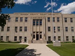
Ransom County is a county in the U.S. state of North Dakota. As of the 2020 census, the population was 5,703. Its county seat is Lisbon.

<span class="mw-page-title-main">Pierce County, North Dakota</span> County in North Dakota, United States

Pierce County is a county in the U.S. state of North Dakota. As of the 2020 census, the population was 3,990. Its county seat is Rugby.

<span class="mw-page-title-main">Nelson County, North Dakota</span> County in North Dakota, United States

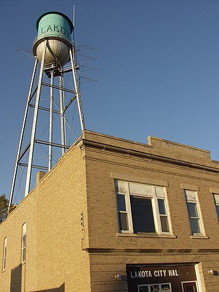
Nelson County is a county in the U.S. state of North Dakota. As of the 2020 census, the population was 3,015. Its county seat is Lakota.

<span class="mw-page-title-main">Mountrail County, North Dakota</span> County in North Dakota, United States

Mountrail County is a county in the northwestern part of North Dakota, United States. As of the 2020 census, the population was 9,809. Its county seat is Stanley. The county was originally created in 1873, then removed in 1892, annexed by Ward County. It was re-created and organized in 1909.

<span class="mw-page-title-main">McLean County, North Dakota</span> County in North Dakota, United States

McLean County is a county in the U.S. state of North Dakota. As of the 2020 census, the population was 9,771. Its county seat is Washburn.

<span class="mw-page-title-main">McKenzie County, North Dakota</span> County in North Dakota, United States

McKenzie County is a county in the U.S. state of North Dakota. As of the 2020 census, the population was 14,704. Its county seat is Watford City.

<span class="mw-page-title-main">Dickey County, North Dakota</span> County in North Dakota, United States

Dickey County is a county in the U.S. state of North Dakota. As of the 2020 census, the population was 4,999. Its county seat is Ellendale.

<span class="mw-page-title-main">Burke County, North Dakota</span> County in North Dakota, United States

Burke County is a county on the north edge of the U.S. state of North Dakota, adjacent to the south line of Canada. As of the 2020 census, the population was 2,201. The county seat is Bowbells. The county is named after John Burke, the tenth Governor of North Dakota.

<span class="mw-page-title-main">Barnes County, North Dakota</span> County in North Dakota, United States

Barnes County is a county in the U.S. state of North Dakota. As of the 2020 census, the population was 10,853. Its county seat is Valley City.

<span class="mw-page-title-main">Wibaux County, Montana</span> County in Montana, United States

Wibaux County is a county in the U.S. state of Montana. As of the 2020 census, the population was 937, making it the fourth-least populous county in Montana. Its county seat is Wibaux.

<span class="mw-page-title-main">Forman, North Dakota</span> City in North Dakota, United States

Forman is a city in and the county seat of Sargent County, North Dakota, United States. The population was 509 at the 2020 census. Forman was founded in 1883.

<span class="mw-page-title-main">Gwinner, North Dakota</span> City in North Dakota, United States

Gwinner is a city in Sargent County, North Dakota, United States. The population was 924 at the 2020 census. Gwinner was founded in 1900.

<span class="mw-page-title-main">Milnor, North Dakota</span> City in North Dakota, United States

Milnor is a city in Sargent County, North Dakota, United States. The population was 624 at the 2020 census.

References

  1. 1 2 The Sargent County website cites July 16, 1883 as the date of organization, when Territory Governor Ordway named the first commissioners.
  2. "Find a County". National Association of Counties. Retrieved June 7, 2011.
  3. 1 2 "State & County QuickFacts". United States Census Bureau. Retrieved April 5, 2023.
  4. 1 2 3 A Little History (Sargent County website, accessed February 24, 2019)
  5. "Dakota Territory, South Dakota, and North Dakota: Individual County Chronologies". Dakota Territory Atlas of Historical County Boundaries. The Newberry Library. 2006. Archived from the original on April 2, 2018. Retrieved February 24, 2019.
  6. "County History". North Dakota.gov. The State of North Dakota. Archived from the original on February 2, 2015. Retrieved February 4, 2015.
  7. "2010 Census Gazetteer Files". United States Census Bureau. August 22, 2012. Archived from the original on January 29, 2015. Retrieved February 1, 2015.
  8. 1 2 "Sargent County · North Dakota". Google Maps. Retrieved April 27, 2024.
  9. ""Find an Altitude/Sargent County ND" Google Maps (accessed February 24, 2019)". Archived from the original on May 21, 2019. Retrieved February 24, 2019.
  10. "Annual Estimates of the Resident Population for Counties: April 1, 2020 to July 1, 2022" . Retrieved April 5, 2023.
  11. "U.S. Decennial Census". United States Census Bureau. Retrieved February 1, 2015.
  12. "Historical Census Browser". University of Virginia Library. Retrieved February 1, 2015.
  13. Forstall, Richard L., ed. (April 20, 1995). "Population of Counties by Decennial Census: 1900 to 1990". United States Census Bureau. Retrieved February 1, 2015.
  14. "Census 2000 PHC-T-4. Ranking Tables for Counties: 1990 and 2000" (PDF). United States Census Bureau. April 2, 2001. Archived (PDF) from the original on March 27, 2010. Retrieved February 1, 2015.
  15. Leip, David. "Atlas of US Presidential Elections". uselectionatlas.org. Retrieved April 13, 2018.

46°07′N97°38′W / 46.11°N 97.63°W / 46.11; -97.63