Climate of North Dakota

Last updated

Koppen climate types of North Dakota, using 1991-2020 climate normals. Koppen Climate Types North Dakota.png
Köppen climate types of North Dakota, using 1991–2020 climate normals.
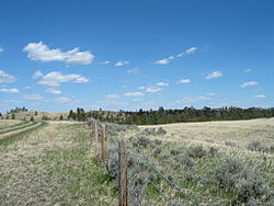
Western North Dakota lands along Interstate 94 in North Dakota. With an average 17 inches of precipitation a year, North Dakota is one of the driest states in the United States. NDSkyLine.jpg
Western North Dakota lands along Interstate 94 in North Dakota. With an average 17 inches of precipitation a year, North Dakota is one of the driest states in the United States.

North Dakota's climate is typical of a continental climate with cold winters and warm-hot summers. The state's location in the Upper Midwest allows it to experience some of the widest variety of weather in the United States, and each of the four seasons has its own distinct characteristics. The eastern half of the state has a humid continental climate (Köppen climate classification Dfb and Dwb) with warm to hot, somewhat humid summers and cold, windy winters, while the western half has a semi-arid climate (Köppen climate classification BSk ) with less precipitation and less humidity but similar temperature profiles. The areas east of the Missouri River get slightly colder winters, while those west of the stream get higher summer daytime temperatures. In general, the diurnal temperature difference is prone to be more significant in the west due to higher elevation and less humidity.

Contents

General climatology

Flooding in North Dakota in March 2010. Flooding in North Dakota.jpg
Flooding in North Dakota in March 2010.

Due to its location in the center of North America North Dakota experiences temperature extremes characteristic of a continental climate, with cold winters and hot summers. [2] Each season has distinctive upper air patterns which bring different weather conditions with them. One feature of a continental climate is that weather patterns can be unpredictable. For example, an Alberta clipper, a low pressure system originating in the province of Alberta in Canada, would be a common winter occurrence in North Dakota. But with the general unpredictability of weather in a continental climate, such a storm system could occur in spring, or in late autumn. Hot weather, though usually confined to July and August, can sometimes begin as early as April or May, and could spill over into September or October. [3]

Being 1,000 miles (1,609 km) from any large body of water (with the exception of Lake Superior), temperatures and precipitation in North Dakota can vary widely. North Dakota is far enough north to experience −60 °F (−51 °C) temperatures and blizzards during the winter months, but far enough south to experience 121 °F (49 °C) temperatures and tornado outbreaks in the summer. [4] The 181 °F degree (100 °C) variation between North Dakota's highest and lowest temperature is the 3rd largest variation of any U.S. State, and the largest of any non-mountainous state. [5]

North Dakota is far from major sources of moisture and is in the transition zone between the moist East and the semi-arid West, as precipitation and humidity decrease from east to west. Annual average precipitation across the state ranges from around 14 in (35.6 cm) in the west to 22 in (55.9 cm) in the east. [6] Snow is the main form of precipitation from November through March, while rain is the most common the rest of the year. It has snowed in North Dakota during every month except August. The ENSO also has a significant impact on North Dakota's weather. During El Niño, the jet stream is often weakened and shoved further north into Canada. This usually blocks arctic air from entering North Dakota and a milder zonal pattern takes place. The opposite phase, La Niña, strengthens the jet stream even more, making arctic air even colder and more dominant.

Statistics for ThreadEx cities

MonthJanFebMarAprMayJunJulAugSepOctNovDecYear
Record high °F (°C)63
(17)
73
(23)
81
(27)
93
(34)
102
(39)
111
(44)
114
(46)
109
(43)
105
(41)
95
(35)
79
(26)
66
(19)
114
(46)
Mean maximum °F (°C)46.7
(8.2)
49.9
(9.9)
66.7
(19.3)
80.2
(26.8)
87.1
(30.6)
93.2
(34.0)
98.3
(36.8)
98.2
(36.8)
93.0
(33.9)
82.1
(27.8)
63.9
(17.7)
49.4
(9.7)
101.4
(38.6)
Mean daily maximum °F (°C)23.2
(−4.9)
27.8
(−2.3)
41.0
(5.0)
56.0
(13.3)
68.3
(20.2)
77.9
(25.5)
84.7
(29.3)
83.5
(28.6)
73.4
(23.0)
57.1
(13.9)
40.6
(4.8)
27.7
(−2.4)
55.1
(12.8)
Daily mean °F (°C)12.8
(−10.7)
17.5
(−8.1)
30.1
(−1.1)
43.2
(6.2)
55.3
(12.9)
65.4
(18.6)
71.3
(21.8)
69.6
(20.9)
59.7
(15.4)
44.8
(7.1)
29.9
(−1.2)
17.9
(−7.8)
43.1
(6.2)
Mean daily minimum °F (°C)2.4
(−16.4)
7.2
(−13.8)
19.1
(−7.2)
30.4
(−0.9)
42.4
(5.8)
52.9
(11.6)
57.9
(14.4)
55.7
(13.2)
45.9
(7.7)
32.6
(0.3)
19.1
(−7.2)
8.1
(−13.3)
31.1
(−0.5)
Mean minimum °F (°C)−23.8
(−31.0)
−17.6
(−27.6)
−4.7
(−20.4)
13.4
(−10.3)
26.9
(−2.8)
39.7
(4.3)
46.2
(7.9)
43.3
(6.3)
29.8
(−1.2)
15.9
(−8.9)
−1.0
(−18.3)
−16.0
(−26.7)
−27.9
(−33.3)
Record low °F (°C)−45
(−43)
−45
(−43)
−36
(−38)
−12
(−24)
13
(−11)
30
(−1)
32
(0)
32
(0)
10
(−12)
−10
(−23)
−30
(−34)
−43
(−42)
−45
(−43)
Average precipitation inches (mm)0.48
(12)
0.52
(13)
0.84
(21)
1.34
(34)
2.50
(64)
3.36
(85)
3.07
(78)
2.50
(64)
1.72
(44)
1.43
(36)
0.69
(18)
0.60
(15)
19.05
(484)
Average snowfall inches (cm)8.9
(23)
7.5
(19)
8.5
(22)
4.6
(12)
0.4
(1.0)
0.0
(0.0)
0.0
(0.0)
0.0
(0.0)
0.0
(0.0)
2.5
(6.4)
8.0
(20)
10.1
(26)
50.5
(128)
Average precipitation days (≥ 0.01 in)7.87.97.58.110.411.69.78.07.37.26.67.799.8
Average snowy days (≥ 0.1 in)9.98.76.32.70.40.00.00.00.02.58.010.144.6
Average relative humidity (%)71.372.469.961.860.165.061.860.663.763.872.074.566.4
Average dew point °F (°C)2.3
(−16.5)
8.6
(−13.0)
18.9
(−7.3)
28.6
(−1.9)
39.6
(4.2)
50.5
(10.3)
54.9
(12.7)
52.0
(11.1)
42.4
(5.8)
32.2
(0.1)
19.8
(−6.8)
7.5
(−13.6)
29.8
(−1.2)
Mean monthly sunshine hours 149.4153.5222.3244.3296.1318.1354.6316.2245.9191.7122.6122.92,737.6
Percent possible sunshine 53536060646774726557434661
Average ultraviolet index 0.81.52.94.76.37.57.96.74.62.41.10.83.9
Source 1: NOAA (relative humidity and sun 1961–1990) [7] [8] [9]
Source 2: UV Index Today (1995 to 2022) [10]
Climate data for Fargo, North Dakota (Hector Int'l), 1991–2020 normals, [lower-alpha 3] extremes 1881–present [lower-alpha 4]
MonthJanFebMarAprMayJunJulAugSepOctNovDecYear
Record high °F (°C)55
(13)
66
(19)
80
(27)
100
(38)
104
(40)
104
(40)
114
(46)
106
(41)
102
(39)
97
(36)
74
(23)
65
(18)
114
(46)
Mean maximum °F (°C)39.8
(4.3)
42.0
(5.6)
57.5
(14.2)
78.3
(25.7)
88.9
(31.6)
92.4
(33.6)
92.9
(33.8)
92.2
(33.4)
89.7
(32.1)
79.5
(26.4)
59.4
(15.2)
42.6
(5.9)
95.8
(35.4)
Mean daily maximum °F (°C)18.2
(−7.7)
22.7
(−5.2)
36.3
(2.4)
54.1
(12.3)
68.7
(20.4)
78.1
(25.6)
82.1
(27.8)
80.7
(27.1)
72.0
(22.2)
55.8
(13.2)
38.1
(3.4)
24.0
(−4.4)
52.6
(11.4)
Daily mean °F (°C)9.2
(−12.7)
13.4
(−10.3)
27.2
(−2.7)
43.0
(6.1)
56.6
(13.7)
66.8
(19.3)
70.7
(21.5)
68.8
(20.4)
60.0
(15.6)
45.5
(7.5)
29.5
(−1.4)
15.7
(−9.1)
42.2
(5.7)
Mean daily minimum °F (°C)0.2
(−17.7)
4.1
(−15.5)
18.1
(−7.7)
31.9
(−0.1)
44.4
(6.9)
55.6
(13.1)
59.4
(15.2)
56.8
(13.8)
48.1
(8.9)
35.2
(1.8)
20.9
(−6.2)
7.5
(−13.6)
31.8
(−0.1)
Mean minimum °F (°C)−22.8
(−30.4)
−18.8
(−28.2)
−7.4
(−21.9)
15.9
(−8.9)
29.1
(−1.6)
42.4
(5.8)
47.3
(8.5)
44.4
(6.9)
31.7
(−0.2)
19.6
(−6.9)
1.3
(−17.1)
−15.1
(−26.2)
−25.0
(−31.7)
Record low °F (°C)−48
(−44)
−47
(−44)
−34
(−37)
−13
(−25)
14
(−10)
28
(−2)
36
(2)
32
(0)
17
(−8)
−4
(−20)
−27
(−33)
−36
(−38)
−48
(−44)
Average precipitation inches (mm)0.71
(18)
0.69
(18)
1.25
(32)
1.54
(39)
3.09
(78)
4.29
(109)
3.07
(78)
2.60
(66)
2.68
(68)
2.17
(55)
0.97
(25)
0.89
(23)
23.95
(608)
Average snowfall inches (cm)10.3
(26)
8.1
(21)
9.2
(23)
4.1
(10)
0.0
(0.0)
0.0
(0.0)
0.0
(0.0)
0.0
(0.0)
0.0
(0.0)
1.2
(3.0)
6.8
(17)
11.7
(30)
51.4
(131)
Average precipitation days (≥ 0.01 in)8.97.57.78.211.411.89.78.68.78.57.610.0108.6
Average snowy days (≥ 0.1 in)9.57.65.52.30.10.00.00.00.01.25.410.241.8
Average relative humidity (%)73.174.776.065.660.066.166.966.569.268.875.776.169.9
Mean monthly sunshine hours 140.9153.9212.3241.6283.2303.2350.2313.2231.2178.9113.1107.42,629.1
Percent possible sunshine 51535859616473716153404059
Average ultraviolet index 1235688753114
Source 1: NOAA (relative humidity and sun 1961–1990) [11] [12] [13] [14]
Source 2: Weather Atlas (UV) [15]
Climate data for Grand Forks International Airport, North Dakota (1991–2020 normals, [16] extremes 1893–present [17] )
MonthJanFebMarAprMayJunJulAugSepOctNovDecYear
Record high °F (°C)52
(11)
67
(19)
83
(28)
100
(38)
105
(41)
105
(41)
109
(43)
104
(40)
103
(39)
95
(35)
75
(24)
58
(14)
109
(43)
Mean maximum °F (°C)39.1
(3.9)
40.3
(4.6)
54.2
(12.3)
75.6
(24.2)
86.6
(30.3)
91.2
(32.9)
91.5
(33.1)
92.2
(33.4)
89.4
(31.9)
77.4
(25.2)
57.1
(13.9)
40.3
(4.6)
95.1
(35.1)
Mean daily maximum °F (°C)15.8
(−9.0)
20.5
(−6.4)
33.9
(1.1)
52.0
(11.1)
66.9
(19.4)
76.4
(24.7)
80.7
(27.1)
79.8
(26.6)
70.4
(21.3)
53.9
(12.2)
35.7
(2.1)
21.4
(−5.9)
50.6
(10.3)
Daily mean °F (°C)6.3
(−14.3)
10.6
(−11.9)
24.4
(−4.2)
40.7
(4.8)
54.1
(12.3)
64.6
(18.1)
68.9
(20.5)
67.0
(19.4)
57.9
(14.4)
43.2
(6.2)
26.7
(−2.9)
12.8
(−10.7)
39.8
(4.3)
Mean daily minimum °F (°C)−3.1
(−19.5)
0.7
(−17.4)
15.0
(−9.4)
29.3
(−1.5)
41.4
(5.2)
52.9
(11.6)
57.0
(13.9)
54.3
(12.4)
45.3
(7.4)
32.5
(0.3)
17.8
(−7.9)
4.2
(−15.4)
28.9
(−1.7)
Mean minimum °F (°C)−26.1
(−32.3)
−21.6
(−29.8)
−10.3
(−23.5)
14.0
(−10.0)
27.0
(−2.8)
40.9
(4.9)
46.3
(7.9)
42.9
(6.1)
31.0
(−0.6)
17.3
(−8.2)
−1.5
(−18.6)
−18.1
(−27.8)
−28.9
(−33.8)
Record low °F (°C)−43
(−42)
−42
(−41)
−36
(−38)
−9
(−23)
5
(−15)
28
(−2)
30
(−1)
30
(−1)
11
(−12)
−9
(−23)
−35
(−37)
−37
(−38)
−43
(−42)
Average precipitation inches (mm)0.49
(12)
0.51
(13)
0.91
(23)
1.21
(31)
2.80
(71)
3.77
(96)
3.52
(89)
2.81
(71)
2.26
(57)
1.88
(48)
0.92
(23)
0.66
(17)
21.74
(552)
Average snowfall inches (cm)9.9
(25)
7.1
(18)
7.4
(19)
3.5
(8.9)
0.0
(0.0)
0.0
(0.0)
0.0
(0.0)
0.0
(0.0)
0.0
(0.0)
1.6
(4.1)
6.6
(17)
12.3
(31)
48.4
(123)
Average precipitation days (≥ 0.01 in)8.46.87.37.710.712.110.28.88.68.47.08.8104.8
Average snowy days (≥ 0.1 in)10.27.75.82.30.20.00.00.00.01.35.710.243.4
Source: NOAA [18] [19]
Climate data for Williston, North Dakota (1991–2020 normals, [lower-alpha 5] extremes 1894–present [lower-alpha 6]
MonthJanFebMarAprMayJunJulAugSepOctNovDecYear
Record high °F (°C)58
(14)
66
(19)
84
(29)
92
(33)
106
(41)
108
(42)
110
(43)
108
(42)
104
(40)
93
(34)
76
(24)
63
(17)
110
(43)
Mean maximum °F (°C)44.0
(6.7)
46.7
(8.2)
65.1
(18.4)
79.0
(26.1)
86.6
(30.3)
93.5
(34.2)
98.0
(36.7)
98.9
(37.2)
93.3
(34.1)
80.3
(26.8)
60.4
(15.8)
46.1
(7.8)
100.6
(38.1)
Mean daily maximum °F (°C)22.1
(−5.5)
26.7
(−2.9)
40.1
(4.5)
55.6
(13.1)
67.4
(19.7)
76.7
(24.8)
84.5
(29.2)
83.9
(28.8)
72.6
(22.6)
55.9
(13.3)
38.4
(3.6)
26.1
(−3.3)
54.2
(12.3)
Daily mean °F (°C)11.6
(−11.3)
16.1
(−8.8)
28.8
(−1.8)
42.4
(5.8)
53.8
(12.1)
63.5
(17.5)
70.4
(21.3)
69.0
(20.6)
58.0
(14.4)
43.2
(6.2)
27.8
(−2.3)
16.1
(−8.8)
41.7
(5.4)
Mean daily minimum °F (°C)1.0
(−17.2)
5.5
(−14.7)
17.5
(−8.1)
29.2
(−1.6)
40.2
(4.6)
50.2
(10.1)
56.3
(13.5)
54.0
(12.2)
43.5
(6.4)
30.4
(−0.9)
17.1
(−8.3)
6.1
(−14.4)
29.3
(−1.5)
Mean minimum °F (°C)−25.8
(−32.1)
−19.5
(−28.6)
−7.6
(−22.0)
12.6
(−10.8)
24.4
(−4.2)
37.5
(3.1)
45.1
(7.3)
40.9
(4.9)
27.2
(−2.7)
12.0
(−11.1)
−4.6
(−20.3)
−19.8
(−28.8)
−29.2
(−34.0)
Record low °F (°C)−42
(−41)
−50
(−46)
−35
(−37)
−15
(−26)
10
(−12)
26
(−3)
34
(1)
32
(0)
13
(−11)
−9
(−23)
−27
(−33)
−50
(−46)
−50
(−46)
Average precipitation inches (mm)0.56
(14)
0.48
(12)
0.63
(16)
1.05
(27)
2.10
(53)
2.64
(67)
2.48
(63)
1.57
(40)
1.36
(35)
0.94
(24)
0.67
(17)
0.63
(16)
15.11
(384)
Average snowfall inches (cm)11.2
(28)
6.7
(17)
6.4
(16)
3.7
(9.4)
0.9
(2.3)
0.0
(0.0)
0.0
(0.0)
0.0
(0.0)
0.0
(0.0)
2.6
(6.6)
6.3
(16)
10.4
(26)
48.2
(122)
Average precipitation days (≥ 0.01 in)7.67.17.48.39.912.39.28.77.56.96.88.5100.2
Average snowy days (≥ 0.1 in)9.86.96.02.70.90.00.00.00.01.95.88.842.8
Average relative humidity (%)71.375.672.561.458.559.656.154.961.165.274.977.166.1
Average dew point °F (°C)3.4
(−15.9)
10.0
(−12.2)
19.9
(−6.7)
28.6
(−1.9)
38.8
(3.8)
48.6
(9.2)
52.2
(11.2)
49.5
(9.7)
41.2
(5.1)
31.1
(−0.5)
19.6
(−6.9)
7.5
(−13.6)
29.2
(−1.6)
Mean monthly sunshine hours 144.5169.7227.3250.3297.9326.0366.3331.5249.5197.1122.2125.52,807.8
Percent possible sunshine 53596261636876756659444863
Source: NOAA (relative humidity and dew point 1962–1990, sun 1961–1990) [lower-alpha 7] [21] [22] [23]

Seasons

Winter in North Dakota is characterized by cold (below freezing) temperatures and snowfall. Snow is the main form of winter precipitation, but freezing rain, ice, sleet, and sometimes even rain are all possible during the winter months. Common storm systems include Alberta clippers or Panhandle hooks, some of which evolve into blizzards. Annual snowfall averages from 26 inches (66 cm) in the central part of the state to 38 inches (96.5 cm) in the northeast and southwest. [24] Temperatures as low as −60 °F (−51 °C) have occurred during North Dakota winters. [4]

Spring is a time of major transition in North Dakota. Early spring commonly sees snowstorms, but by late spring as temperatures begin to moderate the state can experience tornado outbreaks, a risk which diminishes but does not cease through the summer and into the fall as North Dakota lies at the northern edge of Tornado Alley. Springtime flooding is a relatively common event in the Red River Valley, due to the river flowing north into Canada. The spring melt and the eventual runoff typically begins earlier in the southern part of the valley than in the northern part. [25] The most destructive flooding in eastern North Dakota occurred in 1997, which caused extensive damage to Grand Forks. [26]

Summer sees heat and humidity predominate in the east, while hotter and less humid conditions are generally present in the west. These humid conditions help kick off thunderstorm activity 22–34 days a year. Summer high temperatures in North Dakota average in the mid 80s (30 °C) in the west to the upper 70s (25 °C) in the east, with temperatures as hot as 121 °F (49 °C) possible. [4] The growing season in North Dakota usually begins in April, and harvest begins in September and October. Tornadoes are possible in North Dakota from April through October, but the peak tornado month is July, followed by June and August. The state averages 13 tornadoes per year. Depending on location, average annual precipitation ranges from 14 in (35.6 cm) to 22 in (55.9 cm). [6]

Autumn weather in North Dakota is largely the reverse of spring weather. The jet stream, which tends to weaken in summer, begins to re-strengthen, leading to a quicker changing of weather patterns and an increased variability of temperatures. By late October and November these storm systems become strong enough to form major winter storms. Fall and spring are the windiest times of the year in North Dakota.

Extreme weather

2017 Drought As of September 2017, the United States Drought Monitor recorded abnormally dry weather conditions across the entire state. [27] The drought is considered severe and unprecedented, and because of its nature as a "unpredictable, sudden event brought on by sustained high temperatures and little rain" leading to a rapid drop in soil moisture, it is considered a “flash drought”. [28] [29] [30] North Dakota Agriculture Commissioner Doug Goehring announced that predicted economic losses as a consequence from the drought could amount to as much as $4 billion or $5 billion. [31] [32]

Climatic and Hydrologic Aspects of the 1988-1992 Drought The 1988-92 drought was the second most severe drought 1930-1992

The Great Drought Drought struck down North Dakota in the 1930’s. Nine of the eleven years from 1929 through 1939 had less than average rainfall. June, 1929, was one of the driest Junes on record;

2011 Statewide Floods U.S. Geological Survey recorded 22 record crests state-wide in 2011

1997 Red River flood The Red River flood of 1997 was a major flood that occurred in April and May 1997 along the Red River of the North in Minnesota, North Dakota, and southern Manitoba. It was the most severe flood of the river since 1826.

1997 April Blizzard 20 years ago (April 4-7, 1997) North Dakota was hit with a Major Blizzard, bringing much of the state to a complete halt. Heavy snowfall (as much as 2 feet in some areas), and winds to 65 MPH, resulted in widespread impacts. This included 100,000 head of cattle killed (10% of the state herd), widespread power outages, and stranded numerous motorists. Damages totaled just under 45 million dollars. The additional snow at Bismarck (17.5 inches), brought the season snowfall total to 101.4 inches. This set an all-time seasonal snowfall record for Bismarck, which still stands today.

Blizzard of March 2-5, 1966 One of the most severe blizzards on record to impact the Northern Plains occurred 50 years ago between March 2-5 of 1966.  The blizzard was particularly memorable for its long duration, as well as for its very heavy snowfall totals of  20 to 30 inches in some locations and wind gusts exceeding 70 mph at times.  Snowfall totals reached as high as 38 inches, with drifts 30 to 40 feet high in some locations.

1996-1997 Record Snowfall Back in December of ’96, we had four days that it didn’t snow,” By the end of the November , just over 26 inches of snow had fallen in Fargo. Two Major storms in Nov. By the end of the December, another 20 inches of snow had fallen, pushing the season total to over 46 inches. One official blizzard in Dec. Keith Malakowsky: “Back in December of ’96, we had four days that it didn’t snow,” Three official blizzards in January. By the end of January the season’s total was just over 75 inches. February ended with season total of 83.4 inches falling in total. March had a blizzard and couple heavy snows. At the end of March, nearly 110 inches had fallen. April blizzard and when the last flake had fallen, the total snowfall in Fargo was 117 inches for the year.

Winter of 1935-1936 and 1936 Cold Wave The meteorological winter (December through February) of 1935/36 was the coldest on record for North Dakota. February 1936 was the coldest February on record in the contiguous U.S., narrowly eclipsing February 1899. It also was the coldest month ever in North Dakota.

1936 Heat Wave The climatological summer June-August of 1936 remains the warmest nationwide on record since 1895 with an average temperature of 74.0°F. The second warmest summer was that of 2012 with an average of 73.7°F. North Dakota set its all time record high of 121 Steele July 6. Bismarck recorded a low of just 83°F on July 11.

Cold Wave of 1996 Dangerously cold weather once again hit North Dakota. The town of Rolette(Rolette Co.) in north central North Dakota reported a morning low of 53 below. Many places reported lows from 35 to 45 below. Fargo tied its record low of 39 below . The temperature at Fargo remained at or below zero for 11 straight days(1/23/96-2/3/96). This ties the second longest subzero period, previously set in 1899. Daytime highs fared no better, as Bismarck reached a high of 26 below. Northwest winds up to 30 mph created wind chills to 100 below.

February 2019 The official state average February temperature was −2.9 °F or −19.4 °C. 2019 was the second coldest February in the 125-year period of record, and the coldest since 1936.

North Dakota Severe Weather History this link includes the number of tornadoes by county 1950-2021. Severity of tornadoes by county 1950-2021. Strength of non tornadic winds by county. Largest hail size reported by county. Number of tornadoes by year from 2011-2021 by county.

See also

Notes

  1. Mean monthly maxima and minima (i.e. the highest and lowest temperature readings during an entire month or year) calculated based on data at said location from 1991 to 2020.
  2. Records for Bismarck have been kept at the Bismarck Municipal Airport since January 1948 and at an undisclosed location from October 1874 to December 1947.
  3. Mean monthly maxima and minima (i.e. the highest and lowest temperature readings during an entire month or year) calculated based on data at said location from 1991 to 2020.
  4. Official records for Fargo were kept at the Weather Bureau Office in Moorhead, Minnesota from January 1881 to January 1942, and at Hector Int'l since February 1942. For more information, see ThreadEx
  5. Mean monthly maxima and minima (i.e. the expected highest and lowest temperature readings at any point during the year or given month) calculated based on data at said location from 1991 to 2020.
  6. Official records for Williston kept at the Weather Bureau Office from January 1894 to June 1948, Sloulin Field International Airport from July 1948 until October 22, 2019, and the new Williston Basin Int'l since October 23, 2019. [20]
  7. Only 22 to 24 years out of the 29 in the normals period were used to calculate the humidity normals.

Related Research Articles

<span class="mw-page-title-main">Climate of Virginia</span> Overview of the climate of the U.S. state of Virginia

The climate of Virginia, a state on the east coast of the United States, is mild compared to more northern areas of the United States such as New England and the Midwest. Most of Virginia east of the Blue Ridge mountains, the southern part of the Shenandoah Valley, and the Roanoke Valley, has a humid subtropical climate. In the mountainous areas west of the Blue Ridge, the climate is warm-summer humid continental or oceanic climate. Severe weather, in the form of tornadoes, tropical cyclones, and winter storms, impacts the state on a regular basis. Central Virginia received significant snowfall of 20 inches in December 2009.

The climate of Salt Lake City, Utah features cold and snowy winters, hot and dry summers, and modest to light seasonal rainfall. Lying in the Salt Lake Valley, the city is surrounded by mountains and the Great Salt Lake. Under the Köppen climate classification, Salt Lake City has either a Mediterranean climate (Csa) or dry-summer continental climate (Dsa) depending on which variant of the system is used, though it borders on a cold semi-arid climate (BSk) due to the city's relatively low precipitation.

<span class="mw-page-title-main">Climate of Minneapolis–Saint Paul</span>

The climate of Minneapolis–Saint Paul is the long term weather trends and historical events of the Minneapolis–Saint Paul metropolitan area in east central Minnesota. Minneapolis and St. Paul, together known as the Twin Cities, are the core of the 15th largest metropolitan area in the United States. With a population of 3.6 million people, the region contains approximately 60% of the population of Minnesota. Due to its location in the northern and central portion of the U.S., the Twin Cities has the coldest average temperature of any major metropolitan area in the nation. Winters are very cold, summer is warm and humid, snowfall is common in the winter and thunderstorms with heavy rainfall occur during the spring, summer and autumn. Though winter can be cold, the area receives more sunlight hours in mid-winter than many other warmer parts of the country, including all of the Great Lakes states, the Pacific Northwest, parts of the South, and almost all of the Northeast. Unless otherwise indicated, all normals data presented below are based on data at Minneapolis/St. Paul International Airport, the official Twin Cities climatology station, from the 1981−2010 normals period.

The climate of Bismarck in the U.S. state of North Dakota is humid continental, caused primarily by the combination of its mid-level latitude and location not far from the geographic centre of the U.S. Its summers are hot enough for it to border on having a Köppen Dwa classification, and precipitation is high enough for it to barely avoid being classified as semi-arid. The city's climate displays four very distinct seasons and great variation in temperatures over very short periods of time. Like other cities in the northern Great Plains, its climate is also fairly dry.

Milwaukee has a humid continental climate, with four distinct seasons and wide variations in temperature and precipitation in short periods of time. The city's climate is also strongly influenced by nearby Lake Michigan, which creates two varying climates within the Milwaukee area. The Urban heat island effect also plays a role in the city's climate, insulating it from winter cold, but keeping it cooler in spring and summer.

<span class="mw-page-title-main">Climate of Minnesota</span> Climatic conditions of Minnesota, US

Minnesota has a humid continental climate, with hot summers and cold winters. Minnesota's location in the Upper Midwest allows it to experience some of the widest variety of weather in the United States, with each of the four seasons having its own distinct characteristics. The area near Lake Superior in the Minnesota Arrowhead region experiences weather unique from the rest of the state. The moderating effect of Lake Superior keeps the surrounding area relatively cooler in the summer and warmer in the winter, giving that region a smaller yearly temperature variation. On the Köppen climate classification, much of the southern third of Minnesota—roughly from the Twin Cities region southward—falls in the hot summer zone (Dfa), and the northern two-thirds of Minnesota falls in the warm summer zone (Dfb).

The Climate of Grand Forks, North Dakota is a warm summer continental typical of cities located in the Great Plains, with four very distinct seasons and great variation in temperatures over very short periods of time. The city's climate is characterized by long, cold winters with moderate snowfall and warm summers which are typically humid.

Dallas is located in North Texas, built along the Trinity River. It has a humid subtropical climate that is characteristic of the southern plains of the United States. Dallas experiences mild winters and hot summers.
<span class="mw-page-title-main">Climate of Georgia (U.S. state)</span> Overview of the climate of the U.S. state of Georgia

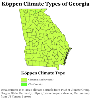
The climate of Georgia is a humid subtropical climate, with most of the state having short, mild winters and long, hot summers. The Atlantic Ocean on the east coast of Georgia and the hill country in the north impact the state's climate. Also, the Chattahoochee River divides Georgia into separate climatic regions with the mountain region to the northwest being cooler than the rest of the state; the average temperatures for the mountain region in January and July are 39 °F (4 °C) and 78 °F (26 °C) respectively. Winter in Georgia is characterized by mild temperatures and little snowfall around the state, with the potential for snow and ice increasing in the northern parts of the state. Summer daytime temperatures in Georgia often exceed 95 °F (35 °C). The state experiences widespread precipitation. Tornadoes and tropical cyclones are common.

<span class="mw-page-title-main">Climate of North Carolina</span> Overview of the climate of the U.S. state of North Carolina

North Carolina's climate varies from the Atlantic coast in the east to the Appalachian Mountain range in the west. The mountains often act as a "shield", blocking low temperatures and storms from the Midwest from entering the Piedmont of North Carolina.

<span class="mw-page-title-main">Climate of Pennsylvania</span> Overview of the climate of the U.S. state of Pennsylvania

The climate of Pennsylvania is diverse due to the multitude of geographic features found within the state. Straddling two major climate zones, the southeastern corner of Pennsylvania has the warmest climate. A portion of Greater Philadelphia lies at the southernmost tip of the humid continental climate zone, with the city proper being in the humid subtropical climate zone. Still, Philadelphia features colder, snowier winters than most locations with a humid subtropical climate. Moving west toward the mountainous interior of the state, the climate becomes markedly colder, the number of cloudy days increases, and winter snowfall amounts are greater.
<span class="mw-page-title-main">Climate of South Carolina</span> Overview of the climate of the U.S. state of South Carolina

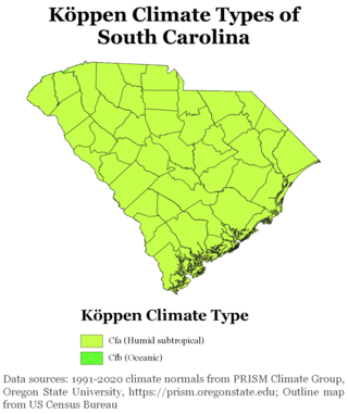
South Carolina has a humid subtropical climate, with hot summers throughout most of the state. But, an exception does occur in the Blue Ridge Mountains, as outlier pockets of an Oceanic Climate do exist. Mild winters predominate in the eastern and southern part of the state, but cool to occasionally cold winters are the standard in the northwestern area of the state, especially areas at or above 600 feet in elevation. On average, between 40 and 80 inches of precipitation falls annually across the state, potentially even in excess of 100 inches in portions of the Appalachian temperate rainforest. Tropical cyclones, and afternoon thunderstorms due to hot and humid conditions, contribute to precipitation during the summer and sometimes fall months, while extratropical cyclones contribute to precipitation during the fall, winter, and spring months. The coast experiences nearly all of their tropical weather impacts from storms coming directly from the Atlantic coast. The northwestern area of the state can receive impacts from both Atlantic basin storms moving westward from the coast and also occasionally very heavy rainfall and flooding from storms originating from the Gulf of Mexico that move inland towards the northeast after making landfall from the Florida Panhandle to Louisiana.

<span class="mw-page-title-main">Climate of New York (state)</span> Overview of the climate of the U.S. state of New York

The climate of New York (state) is generally humid continental, while the extreme southeastern portion of the state lies in the warmer humid subtropical climate zone. Winter temperatures average below freezing during January and February in much of the state of New York, but several degrees above freezing along the Atlantic coastline, including New York City.

<span class="mw-page-title-main">Climate of New Jersey</span> Overview of the climate of the U.S. state of New Jersey

The climate of New Jersey classification of the U.S. state of New Jersey is humid subtropical in South Jersey with a humid continental climate in North Jersey, particularly in the northwestern area of the state. The northwest part of New Jersey is the snowiest due to the higher elevations that earn it a Dfb classification. During the winters, New Jersey can experience Nor'easters, which are snowstorms that affect the Northeastern United States, and Atlantic Canada. However, many would-be snow events in the state end up turning to rain due to warm ocean air being brought in by the storm. New Jersey's climate is shaped by its proximity to the Atlantic Ocean which provides moisture and moderates temperatures. According to climatology research by the U.S. National Oceanic and Atmospheric Administration, New Jersey has been the fastest-warming state by average air temperature over a 100-year period beginning in the early 20th century, related to global warming.

<span class="mw-page-title-main">Climate of Allentown, Pennsylvania</span> Overview of the climate of Allentown, Pennsylvania, United States

The climate of Allentown, Pennsylvania is classified as a humid continental climate. Allentown's warmest month is July with a daily average temperature of 74.7 °F (23.7 °C) and the coldest month being January with a daily average of 29.4 °F (−1.4 °C). The average precipitation of Allentown is 45.35 inches (1,152 mm) per year.

<span class="mw-page-title-main">Climate of New England</span> Overview of the climate of New England

The climate of New England varies greatly across its 500-mile (800 km) span from northern Maine to southern Connecticut.

<span class="mw-page-title-main">2013–14 North American winter</span>

The 2013–14 North American winter was one of the most significant for the United States, due in part to the breakdown of the polar vortex in November 2013, which allowed very cold air to travel down into the United States, leading to an extended period of very cold temperatures. The pattern continued mostly uninterrupted throughout the winter and numerous significant winter storms affected the Eastern United States, with the most notable one being a powerful winter storm that dumped ice and snow in the Southeastern United States and the Northeastern United States in mid-February. Most of the cold weather abated by the end of March, though a few winter storms did affect the Western United States towards the end of the winter.

<span class="mw-page-title-main">2014–15 North American winter</span> Winter season in North America

The 2014–15 North American winter was frigid and prolifically wintry, especially across the eastern half of North America in the months of January–March. The season began early, with many places in North America experiencing their first wintry weather during mid-November. A period of below-average temperatures affected much of the contiguous United States, and several records were broken. An early trace of snowfall was recorded in Arkansas. There were greater accumulations of snow across parts of Oklahoma as well. A quasi-permanent phenomenon referred to as the polar vortex may have been partly responsible for the cold weather. Temperatures in much of the United States dropped 15 to 35 °F below average by November 19, following a southward "dip" of the polar vortex into the eastern two-thirds of the country. The effects of this dip were widespread, bringing about temperatures as low as 28 °F (−2 °C) in Pensacola, Florida. Following a significant snowstorm there, Buffalo, New York received several feet of snow from November 17–21. In addition, significant winter weather occurred throughout the season, including a major blizzard that struck the Northeastern United States at the end of January, another blizzard that affected much of the Northern United States days later in early February, and several significant snow events paired with very frigid temperatures for much of February.

<span class="mw-page-title-main">2015–16 North American winter</span>

The 2015–16 North American winter was not as frigid across North America and the United States as compared to the 2013–14 and 2014–15 winters. This was mainly due to a strong El Niño, which caused generally warmer-than-average conditions. However, despite the warmth, significant weather systems still occurred, including a snowstorm and flash flooding in Texas at the end of December and a large tornado outbreak at the end of February. The main event of the winter season, by far and large, was when a crippling and historic blizzard struck the Northeastern United States in late January, dumping up to 3 feet of snow in and around the metropolitan areas. Several other smaller snow events affected the Northeast as well, but for the most part the heaviest snowstorms and ice stayed out further west, such as a severe blizzard in western Texas in late December, and a major late-season snowstorm in Colorado in mid-April.
<span class="mw-page-title-main">2022–23 North American winter</span> Winter season in North America

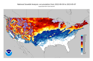
The 2022–23 North American winter was an unusually warm winter for the east and an unusually cold winter for the west in North America, as it occurred across the continent from late 2022 to early 2023. The winter season in North America began at the winter solstice, which occurred on December 21, 2022, and it ended at the March equinox, which occurred on March 20, 2023. The first day of meteorological winter began on December 1 and unofficially ended on February 28; winter storms may still occur outside of these limits.

References

  1. Galadriel Findlay Watson (2001). North Dakota. Weigl Publishers Inc. p. 8. ISBN   1-930954-53-0 . Retrieved September 4, 2009.
  2. "NCRFC Climate and Topography". NOAA . Retrieved November 10, 2006.
  3. "Mid-April Heat Wave". Minnesota Climatology Office. April 15, 2002. Retrieved November 10, 2006.
  4. 1 2 3 "North Dakota – Climate". City-Data. Retrieved August 20, 2007.
  5. "U.S. Extreme Record Temps & Differences". Golden Gate Weather Services. 2005. Retrieved November 23, 2006.
  6. 1 2 "Climate of North Dakota" (PDF). National Weather Service Forecast Office. Archived from the original (PDF) on September 26, 2007. Retrieved August 20, 2007.
  7. "NOWData – NOAA Online Weather Data". National Oceanic and Atmospheric Administration . Retrieved September 16, 2021.
  8. "Station Name: ND BISMARCK". U.S. Climate Normals 2020: U.S. Monthly Climate Normals (1991–2020). National Oceanic and Atmospheric Administration. Retrieved June 5, 2021.
  9. "WMO Climate Normals for BISMARCK/MUNICIPAL, ND 1961–1990". National Oceanic and Atmospheric Administration. Retrieved March 10, 2014.
  10. "Historical UV Index Data - Bismarck, ND". UV Index Today. Retrieved April 22, 2023.
  11. "NowData – NOAA Online Weather Data". National Oceanic and Atmospheric Administration . Retrieved June 19, 2021.
  12. "Thread Stations Extremes". National Oceanic and Atmospheric Administration. Retrieved September 13, 2011.
  13. "Station: Fargo Hector INTL AP, ND". U.S. Climate Normals 2020: U.S. Monthly Climate Normals (1991–2020). National Oceanic and Atmospheric Administration. Retrieved June 19, 2021.
  14. "WMO Climate Normals for FARGO/WSO AP ND 1961–1990". National Oceanic and Atmospheric Administration. Retrieved June 19, 2021.
  15. "Fargo, North Dakota, USA – Monthly weather forecast and Climate data". Weather Atlas. Retrieved July 4, 2019.
  16. Mean monthly maxima and minima (i.e. the highest and lowest temperature readings during an entire month or year) calculated based on data at said location from 1991 to 2020.
  17. Records for Grand Forks have been kept at the Grand Forks International Airport since April 1965, the former Grand Forks Municipal Airport from September 1948 through March 1965, and at Grand Forks University from January 1893 to August 1948.
  18. "NowData – NOAA Online Weather Data". National Oceanic and Atmospheric Administration. Retrieved September 24, 2021.
  19. "Station: Grand Forks INTL AP, ND". U.S. Climate Normals 2020: U.S. Monthly Climate Normals (1991–2020). National Oceanic and Atmospheric Administration. Retrieved September 24, 2021.
  20. "Threaded Extremes". threadex.rcc-acis.org. Retrieved February 16, 2021.
  21. "NowData – NOAA Online Weather Data". National Oceanic and Atmospheric Administration. Retrieved September 17, 2021.
  22. "Station: Williston Sloulin INTL AP, ND". U.S. Climate Normals 2020: U.S. Monthly Climate Normals (1991-2020). National Oceanic and Atmospheric Administration. Retrieved September 17, 2021.
  23. "WMO climate normals for Williston/Sloulin Field, ND 1961−1990". National Oceanic and Atmospheric Administration. Retrieved September 17, 2021.
  24. "Climate of North Dakota". Northern Prairie Wildlife Research Center. Retrieved August 21, 2007.
  25. "Anatomy of a Red River Flood". National Weather Service Weather Forecast Office. Retrieved August 19, 2007.
  26. "The Grand Forks Flood". Alan Draves. 2002. Retrieved August 20, 2007.
  27. "United States Drought Monitor > Home > State Drought Monitor". droughtmonitor.unl.edu. Archived from the original on September 7, 2017. Retrieved September 7, 2017.
  28. Osman, Mahmoud; Zaitchik, Benjamin F.; Badr, Hamada S.; Christian, Jordan I.; Tadesse, Tsegaye; Otkin, Jason A.; Anderson, Martha C. (February 8, 2021). "Flash drought onset over the contiguous United States: sensitivity of inventories and trends to quantitative definitions". Hydrology and Earth System Sciences. 25 (2): 565–581. doi: 10.5194/hess-25-565-2021 . ISSN   1027-5606.
  29. Hoell, Andrew; Perlwitz, Judith; Dewes, Candida; Wolter, Klaus; Rangwala, Imtiaz; Quan, Xiao-Wei; Eischeid, Jon (January 2019). "Anthropogenic Contributions to the Intensity of the 2017 United States Northern Great Plains Drought". Bulletin of the American Meteorological Society. 100 (1): S19–S24. doi: 10.1175/BAMS-D-18-0127.1 . ISSN   0003-0007.
  30. McLaughlin, Kathleen (September 7, 2017). "The unprecedented drought that's crippling Montana and North Dakota". The Guardian. ISSN   0261-3077 . Retrieved September 7, 2017.
  31. Service, John Hageman Forum News. "'History is being made' Farmers, ranchers assess impact of North Dakota drought". Bismarck Tribune. Retrieved September 7, 2017.
  32. Service, April Baumgarten Forum News. "Drought's toll likely billions of dollars for North Dakota economy". Bismarck Tribune. Retrieved September 7, 2017.