Lincoln, North Dakota

Last updated

Lincoln, North Dakota
Administrative building lincoln north dakota 2009.jpg
Administrative Building in Lincoln
ND Burleigh County Lincoln.svg
Location of Lincoln, North Dakota
Coordinates: 46°46′08″N100°41′52″W / 46.76889°N 100.69778°W / 46.76889; -100.69778
CountryUnited States
State North Dakota
County Burleigh
Founded1977
Government
   Mayor Gerarld L. Wise
Area
[1]
  Total1.55 sq mi (4.02 km2)
  Land1.55 sq mi (4.02 km2)
  Water0.00 sq mi (0.00 km2)
Elevation
[2]
1,690 ft (520 m)
Population
 (2020) [3]
  Total4,257
  Estimate 
(2022) [4]
4,358
  Density2,744.68/sq mi (1,059.72/km2)
Time zone UTC-6 (Central (CST))
  Summer (DST) UTC-5 (CDT)
ZIP code
58504
Area code 701
FIPS code 38-46640
GNIS feature ID1036131 [2]
Website cityoflincolnnd.com

Lincoln is a city in Burleigh County, North Dakota, United States. It is a suburb of adjacent Bismarck, and also a core city of the Bismarck-Mandan Metropolitan Statistical Area . The population was 4,257 at the 2020 census, [3] making it the 14th most populous city in North Dakota. Lincoln was founded in 1977.

Contents

Geography

According to the United States Census Bureau, the city has a total area of 1.12 square miles (2.90 km2), all land. [5]

Demographics

Historical population
CensusPop.Note
1980 656
1990 1,13272.6%
2000 1,73052.8%
2010 2,40639.1%
2020 4,25776.9%
2022 (est.)4,358 [4] 2.4%
U.S. Decennial Census [6]
2020 Census [3]

2010 census

As of the census of 2010, there were 2,406 people, 821 households, and 660 families living in the city. The population density was 2,148.2 inhabitants per square mile (829.4/km2). There were 836 housing units at an average density of 746.4 per square mile (288.2/km2). The racial makeup of the city was 94.6% White, 0.9% African American, 2.0% Native American, 0.1% Asian, 0.1% from other races, and 2.2% from two or more races. Hispanic or Latino of any race were 0.5% of the population.

There were 821 households, of which 51.3% had children under the age of 18 living with them, 63.8% were married couples living together, 9.6% had a female householder with no husband present, 6.9% had a male householder with no wife present, and 19.6% were non-families. 14.4% of all households were made up of individuals, and 2.6% had someone living alone who was 65 years of age or older. The average household size was 2.93 and the average family size was 3.22.

The median age in the city was 29.6 years. 32% of residents were under the age of 18; 8.3% were between the ages of 18 and 24; 35.9% were from 25 to 44; 20% were from 45 to 64; and 3.7% were 65 years of age or older. The gender makeup of the city was 51.3% male and 48.7% female.

2000 census

As of the census of 2000, there were 1,730 people, 527 households, and 452 families living in the city. The population density was 1,700.3 inhabitants per square mile (656.5/km2). There were 541 housing units at an average density of 531.7 per square mile (205.3/km2). The racial makeup of the city was 97.46% White, 0.23% African American, 1.50% Native American, 0.06% from other races, and 0.75% from two or more races. Hispanic or Latino of any race were 0.23% of the population.

There were 527 households, out of which 63.2% had children under the age of 18 living with them, 67.9% were married couples living together, 13.9% had a female householder with no husband present, and 14.2% were non-families. 11.4% of all households were made up of individuals, and 1.5% had someone living alone who was 65 years of age or older. The average household size was 3.28 and the average family size was 3.53.

In the city, the population was spread out, with 40.2% under the age of 18, 6.8% from 18 to 24, 37.2% from 25 to 44, 13.6% from 45 to 64, and 2.2% who were 65 years of age or older. The median age was 27 years. For every 100 females, there were 100.2 males. For every 100 females age 18 and over, there were 99.0 males.

The median income for a household in the city was $38,884, and the median income for a family was $40,703. Males had a median income of $28,417 versus $18,438 for females. The per capita income for the city was $13,233. About 3.1% of families and 3.8% of the population were below the poverty line, including 5.3% of those under age 18 and 5.7% of those age 65 or over.

Politics

Lincoln is governed by a City Council. The current mayor is Keli Berglund. [7]

Education

It is in the Bismarck Public School District 1. [8]

Residents are zoned to Lincoln Elementary School, [9] Wachter Middle School and Bismarck High School. [10]

Climate

This climatic region is typified by large seasonal temperature differences, with warm to hot (and often humid) summers and cold (sometimes severely cold) winters. According to the Köppen Climate Classification system, Lincoln has a humid continental climate, abbreviated "Dfb" on climate maps. [11]

Related Research Articles

<span class="mw-page-title-main">Dakota City, Nebraska</span> City in Dakota County, Nebraska, United States

Dakota City is a city in Dakota County, Nebraska, United States. The population was 1,919 at the 2010 census. It is the county seat of Dakota County. Tyson Foods' largest beef production plant is located in Dakota City.

<span class="mw-page-title-main">Reeder, North Dakota</span> City in North Dakota, United States

Reeder is a city in Adams County, North Dakota, United States. The population was 125 at the 2020 census.

<span class="mw-page-title-main">Leal, North Dakota</span> City in North Dakota, United States

Leal is a city in Barnes County in the state of North Dakota. The population was 27 at the 2020 census. Leal was founded in 1892. The name comes from the Scots word for "faithful," which in the phrase laund o the leal means Heaven.

<span class="mw-page-title-main">Maxbass, North Dakota</span> City in North Dakota, United States

Maxbass is a city in Bottineau County, North Dakota, United States. The population was 89 at the 2020 census. Maxbass was founded in 1905.

<span class="mw-page-title-main">Dodge, North Dakota</span> City in North Dakota, United States

Dodge is a city in Dunn County, North Dakota, United States. The population was 89 at the 2020 census. Dodge was founded in 1915.

<span class="mw-page-title-main">Dunn Center, North Dakota</span> City in North Dakota, United States

Dunn Center is a city in Dunn County, North Dakota, United States. The population was 227 at the 2020 census. Dunn Center was founded in 1914.

<span class="mw-page-title-main">Halliday, North Dakota</span> City in North Dakota, United States

Halliday is a city in Dunn County, North Dakota, United States. The population was 241 at the 2020 census. Halliday was founded in 1914.

<span class="mw-page-title-main">Killdeer, North Dakota</span> City in North Dakota, United States

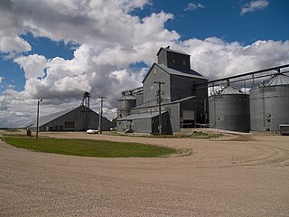
Killdeer is a city in Dunn County, North Dakota, United States. The population was 939 at the 2020 census.

<span class="mw-page-title-main">New Rockford, North Dakota</span> City in North Dakota, United States

New Rockford is a city in Eddy County, North Dakota, United States. It is the county seat of Eddy County. The population was 1,361 at the 2020 census. New Rockford was founded in 1883.

<span class="mw-page-title-main">Underwood, North Dakota</span> City in North Dakota, United States

Underwood is a city in McLean County, North Dakota, United States. The population was 784 at the 2020 census.

<span class="mw-page-title-main">Flasher, North Dakota</span> City in North Dakota, United States

Flasher is a city in Morton County, North Dakota, United States. It is part of the "Bismarck, ND Metropolitan Statistical Area" or "Bismarck-Mandan". The population was 217 at the 2020 census. Flasher was founded in 1902.

<span class="mw-page-title-main">Hebron, North Dakota</span> City in North Dakota, United States

Hebron is a city in Morton County, North Dakota, United States. It is part of the "Bismarck, ND Metropolitan Statistical Area" or "Bismarck-Mandan". The population was 794 at the 2020 census.

<span class="mw-page-title-main">New Salem, North Dakota</span> City in North Dakota, United States

New Salem is a city in Morton County, North Dakota, United States. It is part of the "Bismarck, ND Metropolitan Statistical Area" or "Bismarck-Mandan". The population was 973 at the 2020 census. New Salem was founded in 1883.

<span class="mw-page-title-main">Plaza, North Dakota</span> City in North Dakota, United States

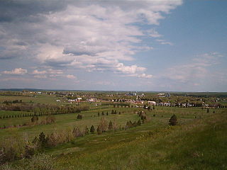
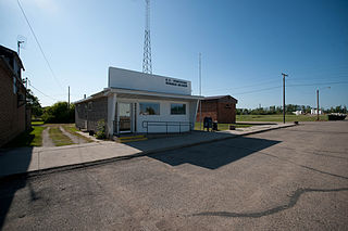
Plaza is a city in Mountrail County, North Dakota, United States. The population was 211 at the 2020 census. Plaza was founded in 1906. The business district is built around a central town square, city park or "plaza". A key feature of the plaza is a recently completed large covered gazebo.

<span class="mw-page-title-main">Christine, North Dakota</span> City in North Dakota, United States

Christine is a city in Richland County, North Dakota, United States. The population was 151 at the 2020 census. Christine was founded in 1883. It is part of the Wahpeton, ND–MN Micropolitan Statistical Area.

<span class="mw-page-title-main">Fairdale, North Dakota</span> City in North Dakota, United States

Fairdale is a city in Walsh County, North Dakota, United States. The population was 30 at the 2020 census. Fairdale was founded in 1905.

<span class="mw-page-title-main">Berthold, North Dakota</span> City in North Dakota, United States

Berthold is a town in Ward County, North Dakota, United States. The population was 490 at the 2020 census.

<span class="mw-page-title-main">Crooks, South Dakota</span> City in South Dakota, United States

Crooks is a city in Minnehaha County, South Dakota, United States and is a suburb of Sioux Falls. The population was 1,362 at the 2020 census. Crooks was named New Hope until 1904. The town's present name honors W. A. Crooks, a local politician.

<span class="mw-page-title-main">Hartford, South Dakota</span> City in South Dakota, United States

Hartford is a suburban American city in Minnehaha County, South Dakota, a few miles northwest of Sioux Falls. Its population was 3,354 at the 2020 census.

<span class="mw-page-title-main">Wilton, North Dakota</span> City in North Dakota, United States

Wilton is a city in Burleigh and McLean counties in North Dakota, United States. It is part of the "Bismarck, ND Metropolitan Statistical Area" or "Bismarck-Mandan". The population was 718 at the 2020 census. Founded in 1899, Wilton was named by General W. D. Washburn after the town of Wilton in his native state of Maine.

References

  1. "ArcGIS REST Services Directory". United States Census Bureau. Retrieved September 20, 2022.
  2. 1 2 U.S. Geological Survey Geographic Names Information System: Lincoln, North Dakota
  3. 1 2 3 "Explore Census Data". United States Census Bureau . Retrieved October 2, 2023.
  4. 1 2 "City and Town Population Totals: 2020-2022". United States Census Bureau. October 2, 2023. Retrieved October 2, 2023.
  5. "US Gazetteer files 2010". United States Census Bureau. Archived from the original on July 2, 2012. Retrieved June 14, 2012.
  6. "U.S. Decennial Census". Census.gov. Retrieved May 26, 2013.
  7. "City of Lincoln". www.cityoflincolnnd.com. Retrieved December 29, 2023.
  8. "2020 CENSUS - SCHOOL DISTRICT REFERENCE MAP: Burleigh County, ND" (PDF). U.S. Census Bureau . Retrieved December 26, 2023. - Detail map of Lincoln.
  9. "2022/23 Elementary Attendance Areas" (PDF). Bismarck Public School District 1 . Retrieved December 26, 2023. - Compare to Census maps.
  10. "2022/23 Secondary Attendance Areas" (PDF). Bismarck Public School District 1 . Retrieved December 26, 2023. - Compare to Census maps.
  11. Climate Summary for Lincoln, North Dakota