Long Lake Township, Burleigh County, North Dakota

Last updated

Long Lake Township is a civil township in Burleigh County in the U.S. state of North Dakota. As of the 2010 census, its population was 103. [1]

A civil township is a widely used unit of local government in the United States that is subordinate to a county. The term town is used in New England, New York, and Wisconsin to refer to the equivalent of the civil township in these states. Specific responsibilities and the degree of autonomy vary based on each state. Civil townships are distinct from survey townships, but in states that have both, the boundaries often coincide and may completely geographically subdivide a county. The U.S. Census Bureau classifies civil townships as minor civil divisions. Currently, there are 20 states with civil townships.

Burleigh County, North Dakota County in the United States

Burleigh County is a county in the U.S. state of North Dakota. As of the 2010 United States Census, the population was 81,308, making it the second-most populous county in North Dakota. Its county seat is Bismarck, the state capital. The county was named for a Dakota Territory political figure.

U.S. state constituent political entity of the United States

In the United States, a state is a constituent political entity, of which there are currently 50. Bound together in a political union, each state holds governmental jurisdiction over a separate and defined geographic territory and shares its sovereignty with the federal government. Due to this shared sovereignty, Americans are citizens both of the federal republic and of the state in which they reside. State citizenship and residency are flexible, and no government approval is required to move between states, except for persons restricted by certain types of court orders. Four states use the term commonwealth rather than state in their full official names.

Related Research Articles

Augusta, Illinois Village in Illinois, United States

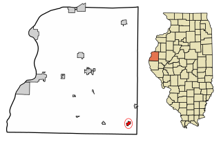
Augusta is a village in Hancock County, Illinois, United States. The population was 587 at the 2010 census, down from 657 at the 2000 census. It is located near Weinberg-King State Park.

Littleton, Maine Town in Maine, United States

Littleton is a town in Aroostook County, Maine, United States. The population was 1,068 at the 2010 census.

Au Train Township, Michigan Civil township in Michigan, United States

Au Train Township is a civil township of Alger County in the U.S. state of Michigan. As of the 2010 census, the township population was 1,138.

Pickford Township, Michigan Civil township in Michigan, United States

Pickford Township is a civil township of Chippewa County in the U.S. state of Michigan. As of the 2010 census, the township population was 1,595.

Whitefish Township, Michigan Civil township in Michigan, United States

Whitefish Township is a civil township of Chippewa County in the U.S. state of Michigan. The population was 575 at the 2010 census.

Lakefield, Minnesota City in Minnesota, United States

Lakefield is a city in Jackson County, Minnesota, United States. The population was 1,694 at the 2010 census.

Nome, North Dakota City in North Dakota, United States

Nome is a city in Barnes County, North Dakota, United States. The population was 62 at the 2010 census. Nome was founded in 1901.

Forward Township, Butler County, Pennsylvania Township in Pennsylvania, United States

Forward Township is a township in Butler County, Pennsylvania, United States. The population was 2,531 at the 2010 census.

Slippery Rock Township, Butler County, Pennsylvania Township in Pennsylvania, United States

Slippery Rock Township is a township in Butler County, Pennsylvania, United States. The population was 5,614 at the 2010 census.

Chest Township, Cambria County, Pennsylvania Township in Pennsylvania, United States

Chest Township is a township in Cambria County, Pennsylvania, United States. The population was 349 at the 2010 census. It is part of the Johnstown, Pennsylvania Metropolitan Statistical Area.

Boggs Township, Centre County, Pennsylvania Township in Pennsylvania, United States

Boggs Township is a township in Centre County, Pennsylvania, in the United States. It is part of the State College, Pennsylvania Metropolitan Statistical Area. It is located north of Bellefonte at approximately 40°54′48″N77°45′53″W. As of the 2010 census, the township population was 2,985.

Spring Township, Centre County, Pennsylvania Township in Pennsylvania, United States

Spring Township is a township in Centre County, Pennsylvania, United States. It is part of the State College, Pennsylvania Metropolitan Statistical Area. The population was 7,470 at the 2010 census, which was a 22.1% increase from the 2000 census.

Locust Township, Columbia County, Pennsylvania Township in Pennsylvania, United States

Locust Township is a township in Columbia County, Pennsylvania, United States. The population was 1,404 at the 2010 census.

Rush Township, Dauphin County, Pennsylvania Township in Pennsylvania, United States

Rush Township is a township in Dauphin County, Pennsylvania, in the United States. As of the 2010 census, the township population was 231, up from 180 at the 2000 census.

Young Township, Indiana County, Pennsylvania Township in Pennsylvania, United States

Young Township is a township in Indiana County, Pennsylvania, United States. It was named after John Young, the first president judge of Indiana county. The population was 1,775 at the 2010 census. It includes the communities of Clarksburg, Coal Run, Elders Ridge, Harttown, Iselin, Jacksonville, McIntyre, Scotland, Watson's Ridge, and West Lebanon.

Bell Township, Jefferson County, Pennsylvania Township in Pennsylvania, United States

Bell Township is a township in Jefferson County, Pennsylvania, United States. The population was 2,056 at the 2010 census. It was named for John H. Bell, a prominent citizen of the township.

Upper Leacock Township, Lancaster County, Pennsylvania Township in Pennsylvania, United States

Upper Leacock Township is a township in east central Lancaster County, Pennsylvania, United States. The population was 8,708 at the 2010 census.

Liberty Township, Trumbull County, Ohio Township in Ohio, United States

Liberty Township is one of the twenty-four townships of Trumbull County, Ohio, United States. The 2010 census found 21,982 people within the geographical area of the township, 12,034 of whom lived in the unincorporated portions of the township.

Sheldon Township, Iroquois County, Illinois Township in Illinois, United States

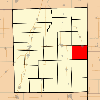
Sheldon Township is one of twenty-six townships in Iroquois County, Illinois, USA. As of the 2010 census, its population was 1,374 and it contained 613 housing units. Sheldon Township was formed from Concord Township on February 19, 1868.

Lincolnville, Indiana Unincorporated community in Indiana, United States

Lincolnville is an unincorporated community in Lagro Township, Wabash County, in the U.S. state of Indiana.

References

Coordinates: 46°40′40″N100°13′51″W / 46.67778°N 100.23083°W / 46.67778; -100.23083

Geographic coordinate system Coordinate system

A geographic coordinate system is a coordinate system that enables every location on Earth to be specified by a set of numbers, letters or symbols. The coordinates are often chosen such that one of the numbers represents a vertical position and two or three of the numbers represent a horizontal position; alternatively, a geographic position may be expressed in a combined three-dimensional Cartesian vector. A common choice of coordinates is latitude, longitude and elevation. To specify a location on a plane requires a map projection.