Wilton, North Dakota

Last updated

Wilton, North Dakota
Wilton, North Dakota.jpg
Motto(s): 
"A city rich in its past and future..."
ND McLean County Wilton.svg
Location of Wilton, North Dakota
Coordinates: 47°09′29″N100°47′03″W / 47.15806°N 100.78417°W / 47.15806; -100.78417
CountryUnited States
State North Dakota
Counties McLean, Burleigh
Founded1899
Government
   Mayor LeeAnn Domonoske-Kellar
Area
[1]
  Total0.57 sq mi (1.47 km2)
  Land0.56 sq mi (1.44 km2)
  Water0.01 sq mi (0.03 km2)
Elevation
[2]
2,172 ft (662 m)
Population
 (2020) [3]
  Total718
  Estimate 
(2022) [4]
711
  Density1,291.37/sq mi (498.47/km2)
Time zone UTC-6 (Central (CST))
  Summer (DST) UTC-5 (CDT)
ZIP code
58579
Area code 701
FIPS code 38-86580
GNIS feature ID1036337 [2]
Website wiltonnd.org

Wilton is a city in Burleigh and McLean counties in North Dakota, United States. It is part of the "Bismarck, ND Metropolitan Statistical Area" or "Bismarck-Mandan". The population was 718 at the 2020 census. [3] Founded in 1899, Wilton was named by General W. D. Washburn after the town of Wilton in his native state of Maine.

Contents

History

Wilton was platted in 1899 when the railroad was extended to that point. [5] The city was named after Wilton, Maine, the native home of an early settler. [6] The Wilton Train Station was completed in 1900 and the post office has been in operation at Wilton also since 1900. [7] [8] Wilton was originally built up chiefly by Ukrainians. [9]

Geography

According to the United States Census Bureau, the city has a total area of 0.64 square miles (1.66 km2), of which 0.63 square miles (1.63 km2) is land and 0.01 square miles (0.03 km2) is water. [10]

Climate

This climatic region is typified by large seasonal temperature differences, with warm to extremely hot (and often humid) summers and severely cold winters. According to the Köppen Climate Classification system, Wilton has a humid continental climate, abbreviated "Dfb" on climate maps. [11]

Demographics

Historical population
CensusPop.Note
1910 437
1920 108−75.3%
1930 14938.0%
1940 117−21.5%
1950 13414.5%
1960 105−21.6%
1970 11610.5%
1980 262125.9%
1990 728177.9%
2000 80710.9%
2010 711−11.9%
2020 7181.0%
2022 (est.)711 [4] −1.0%
U.S. Decennial Census [12]
2020 Census [3]
Main Street in Wilton, North Dakota, 1890s Main Street in Wilton, N.D., 1890s.jpg
Main Street in Wilton, North Dakota, 1890s
Hotel and general store in Wilton, North Dakota, 1890s Hotel and general store in Wilton, N.D., 1890s.jpg
Hotel and general store in Wilton, North Dakota, 1890s

2010 census

As of the census [13] of 2010, there were 711 people, 317 households, and 188 families residing in the city. The population density was 1,128.6 inhabitants per square mile (435.8/km2). There were 358 housing units at an average density of 568.3 per square mile (219.4/km2). The racial makeup of the city was 96.3% White, 2.1% Native American, 0.1% Asian, 0.6% from other races, and 0.8% from two or more races. Hispanic or Latino of any race were 1.3% of the population.

There were 317 households, of which 24.3% had children under the age of 18 living with them, 47.6% were married couples living together, 6.3% had a female householder with no husband present, 5.4% had a male householder with no wife present, and 40.7% were non-families. 35.0% of all households were made up of individuals, and 12.3% had someone living alone who was 65 years of age or older. The average household size was 2.17 and the average family size was 2.79.

The median age in the city was 46.7 years. 19.7% of residents were under the age of 18; 7.4% were between the ages of 18 and 24; 20.8% were from 25 to 44; 32.9% were from 45 to 64; and 19.3% were 65 years of age or older. The gender makeup of the city was 53.2% male and 46.8% female.

2000 census

As of the census of 2000, there were 807 people, 309 households, and 219 families residing in the city. The population density was 1,395.3 inhabitants per square mile (538.7/km2). There were 347 housing units at an average density of 599.9 per square mile (231.6/km2). The racial makeup of the city was 98.27% White, 0.12% African American, 0.74% Native American, and 0.87% from two or more races. Hispanic or Latino of any race were 0.37% of the population.

There were 309 households, out of which 37.9% had children under the age of 18 living with them, 57.6% were married couples living together, 9.1% had a female householder with no husband present, and 29.1% were non-families. 23.9% of all households were made up of individuals, and 12.6% had someone living alone who was 65 years of age or older. The average household size was 2.57 and the average family size was 3.04.

In the city, the population was spread out, with 28.5% under the age of 18, 6.8% from 18 to 24, 27.5% from 25 to 44, 22.1% from 45 to 64, and 15.1% who were 65 years of age or older. The median age was 37 years. For every 100 females, there were 93.5 males. For every 100 females age 18 and over, there were 93.0 males.

The median income for a household in the city was $34,583, and the median income for a family was $39,063. Males had a median income of $28,750 versus $20,833 for females. The per capita income for the city was $17,111. About 8.0% of families and 10.8% of the population were below the poverty line, including 12.2% of those under age 18 and 17.1% of those age 65 or over.

See also

Related Research Articles

<span class="mw-page-title-main">Hettinger, North Dakota</span> City in North Dakota, United States

Hettinger is a city in, and the county seat of, Adams County, North Dakota, United States. The population was 1,074 at the 2020 census.

<span class="mw-page-title-main">Dazey, North Dakota</span> City in North Dakota, United States

Dazey is a city in Barnes County, North Dakota, United States. The population was 78 at the 2020 census. Dazey was founded in 1883 after a local farmer, Charles Dazey, donated land to start a townsite.

<span class="mw-page-title-main">Esmond, North Dakota</span> City in North Dakota, United States

Esmond is a city in Benson County, North Dakota, United States. The population was 91 at the 2020 census. Esmond was founded in 1901.

<span class="mw-page-title-main">Minnewaukan, North Dakota</span> City in North Dakota, United States

Minnewaukan is a city in Benson County, North Dakota, United States. It serves as the county seat and is fourth largest city in the county, after Fort Totten, Leeds, and Maddock. The population was 199 at the 2020 census. Minnewaukan was founded in 1884.

<span class="mw-page-title-main">Maxbass, North Dakota</span> City in North Dakota, United States

Maxbass is a city in Bottineau County, North Dakota, United States. The population was 89 at the 2020 census. Maxbass was founded in 1905.

<span class="mw-page-title-main">Lincoln, North Dakota</span> City in North Dakota, United States

Lincoln is a city in Burleigh County, North Dakota, United States. It is a suburb of adjacent Bismarck, and also a core city of the Bismarck-Mandan Metropolitan Statistical Area. The population was 4,257 at the 2020 census, making it the fourteenth largest city in North Dakota. Lincoln was founded in 1977.

<span class="mw-page-title-main">Alice, North Dakota</span> City in North Dakota, United States

Alice is a city in Cass County, North Dakota, United States. The population was 41 at the 2020 census.

<span class="mw-page-title-main">Ayr, North Dakota</span> City in North Dakota, United States

Ayr is a city in Cass County, North Dakota, United States. The population was 11 at the 2020 census. Ayr was founded in 1883.

<span class="mw-page-title-main">North River, North Dakota</span> City in North Dakota, United States

North River is a city in Cass County, North Dakota, United States. The population was 55 at the 2020 census. North River was founded in 1973. It is a suburb/bedroom community directly adjacent to the city of Fargo.

<span class="mw-page-title-main">Wishek, North Dakota</span> City in North Dakota, United States

Wishek is a city in McIntosh County, North Dakota, United States. The population was 864 at the 2020 census.

<span class="mw-page-title-main">Lakota, North Dakota</span> City in North Dakota, United States

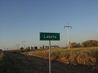
Lakota is a city in Nelson County, North Dakota, United States. It is the county seat of Nelson County Lakota is located 63 miles west of Grand Forks and 27 miles east of Devils Lake. The population was 683 at the 2020 census, making Lakota the 76th-largest city in North Dakota.

<span class="mw-page-title-main">Hankinson, North Dakota</span> City in North Dakota, United States

Hankinson is a city in Richland County, North Dakota, United States. The population was 921 at the 2020 census. Hankinson was founded in 1886. It is part of the Wahpeton, ND–MN Micropolitan Statistical Area.

<span class="mw-page-title-main">Forest River, North Dakota</span> City in North Dakota, United States

Forest River is a city in Walsh County, North Dakota, United States. The population was 109 at the 2020 census. Forest River was founded on July 13, 1887.

<span class="mw-page-title-main">Hoople, North Dakota</span> City in North Dakota, United States

Hoople is a city in Walsh County, North Dakota, United States. The population was 247 at the 2020 census. Hoople, named for early settler Alan Hoople, was founded in 1889. Hoople's nickname is "Tatertown."

<span class="mw-page-title-main">Park River, North Dakota</span> City in North Dakota, United States

Park River is a city in Walsh County, North Dakota, United States. The population was 1,424 at the 2020 census. Park River was founded in 1884.

<span class="mw-page-title-main">Kenmare, North Dakota</span> City in North Dakota, United States

Kenmare is a city in Ward County, North Dakota, United States. The population was 961 at the 2020 census. Kenmare is part of the Minot Micropolitan Statistical Area.

<span class="mw-page-title-main">Groton, South Dakota</span> City in South Dakota, United States

Groton is a city in southeastern Brown County, South Dakota, United States. The population was 1,380 at the 2020 census.

<span class="mw-page-title-main">Carthage, South Dakota</span> City in South Dakota, United States

Carthage is a city in Miner County, South Dakota, United States. The population was 127 at the 2020 census.

<span class="mw-page-title-main">Crooks, South Dakota</span> City in South Dakota, United States

Crooks is a city in Minnehaha County, South Dakota, United States and is a suburb of Sioux Falls. The population was 1,362 at the 2020 census. Crooks was named New Hope until 1904. The town's present name honors W. A. Crooks, a local politician.

<span class="mw-page-title-main">Hartford, South Dakota</span> City in South Dakota, United States

Hartford is a suburban American city in Minnehaha County, South Dakota, a few miles northwest of Sioux Falls. Its population was 3,354 at the 2020 census.

References

  1. "ArcGIS REST Services Directory". United States Census Bureau. Retrieved September 20, 2022.
  2. 1 2 U.S. Geological Survey Geographic Names Information System: Wilton, North Dakota
  3. 1 2 3 "Explore Census Data". United States Census Bureau . Retrieved October 2, 2023.
  4. 1 2 "City and Town Population Totals: 2020-2022". United States Census Bureau. October 2, 2023. Retrieved October 2, 2023.
  5. North Dakota: Counties, Towns & People. Watchmaker Publishing, Ltd. 2008. p. 61. ISBN   978-1-60386-191-5.
  6. Capace, Nancy (January 1, 2001). Encyclopedia of North Dakota. Somerset Publishers, Inc. p. 303. ISBN   978-0-403-09608-4.
  7. "National Register of Historic Places Inventory/Nomination: Minneapolis, St. Paul and Sault Sainte Marie Railroad Company Depot / Soo Line Depot". National Park Service. and accompanying photos
  8. "McLean County". Jim Forte Postal History. Retrieved October 25, 2015.
  9. Federal Writers' Project (1938). North Dakota, a Guide to the Northern Prairie State. WPA. p. 209. ISBN   978-1-62376-033-5.
  10. "US Gazetteer files 2010". United States Census Bureau. Archived from the original on January 25, 2012. Retrieved June 14, 2012.
  11. Climate Summary for Wilton, North Dakota
  12. United States Census Bureau. "Census of Population and Housing" . Retrieved July 19, 2013.
  13. "U.S. Census website". United States Census Bureau . Retrieved June 14, 2012.