Garrison, North Dakota

Last updated

Garrison, North Dakota
Garrison, North Dakota, July 2009 - 03.jpg
Garrison in 2009
ND McLean County Garrison.svg
Location of Garrison, North Dakota
Coordinates: 47°39′10″N101°25′0″W / 47.65278°N 101.41667°W / 47.65278; -101.41667
CountryUnited States
State North Dakota
County McLean
Founded1905
Government
   Mayor Stuart Merry
Area
[1]
  Total1.40 sq mi (3.62 km2)
  Land1.40 sq mi (3.62 km2)
  Water0.00 sq mi (0.00 km2)
Elevation
[2]
1,923 ft (586 m)
Population
 (2020) [3]
  Total1,462
  Estimate 
(2022) [4]
1,467
  Density1,045.03/sq mi (403.63/km2)
Time zone UTC-6 (Central (CST))
  Summer (DST) UTC-5 (CDT)
ZIP code
58540
Area code 701
FIPS code 38-29460
GNIS feature ID1036052 [2]
Highways ND 37
Website garrisonnd.com

Garrison is a city in McLean County, North Dakota, United States. The population was 1,462 at the 2020 census. [3]

Contents

History

Main Street, Garrison, 1920 Main Street and the hotel at Garrison, North Dakota 1920.tif
Main Street, Garrison, 1920

Garrison was laid out in 1905 when the Soo Line Railroad was extended to that point. [5] The town took its name from Garrison Creek. [6] A post office has been in operation at Garrison since 1903. [7]

Geography

According to the United States Census Bureau, the city has a total area of 1.38 square miles (3.57 km2), all land. [8]

Climate

Climate data for Garrison, North Dakota (1991–2020 normals, extremes 1948–present)
MonthJanFebMarAprMayJunJulAugSepOctNovDecYear
Record high °F (°C)54
(12)
63
(17)
78
(26)
93
(34)
96
(36)
102
(39)
105
(41)
108
(42)
104
(40)
95
(35)
75
(24)
61
(16)
108
(42)
Mean daily maximum °F (°C)19.5
(−6.9)
24.3
(−4.3)
36.7
(2.6)
52.8
(11.6)
65.8
(18.8)
74.5
(23.6)
81.3
(27.4)
81.2
(27.3)
71.3
(21.8)
55.0
(12.8)
37.9
(3.3)
25.0
(−3.9)
52.1
(11.2)
Daily mean °F (°C)10.6
(−11.9)
14.7
(−9.6)
27.0
(−2.8)
41.3
(5.2)
54.1
(12.3)
63.8
(17.7)
69.8
(21.0)
68.5
(20.3)
58.9
(14.9)
44.1
(6.7)
28.9
(−1.7)
16.7
(−8.5)
41.5
(5.3)
Mean daily minimum °F (°C)1.6
(−16.9)
5.1
(−14.9)
17.2
(−8.2)
29.7
(−1.3)
42.4
(5.8)
53.1
(11.7)
58.3
(14.6)
55.9
(13.3)
46.4
(8.0)
33.1
(0.6)
19.9
(−6.7)
8.5
(−13.1)
30.9
(−0.6)
Record low °F (°C)−48
(−44)
−37
(−38)
−31
(−35)
−12
(−24)
12
(−11)
28
(−2)
35
(2)
29
(−2)
17
(−8)
−3
(−19)
−27
(−33)
−42
(−41)
−48
(−44)
Average precipitation inches (mm)0.43
(11)
0.36
(9.1)
0.67
(17)
1.23
(31)
2.82
(72)
3.78
(96)
2.73
(69)
2.11
(54)
1.68
(43)
1.29
(33)
0.63
(16)
0.45
(11)
18.18
(462)
Average snowfall inches (cm)6.8
(17)
6.2
(16)
7.4
(19)
2.9
(7.4)
1.3
(3.3)
0.0
(0.0)
0.0
(0.0)
0.0
(0.0)
0.0
(0.0)
2.5
(6.4)
5.7
(14)
9.9
(25)
42.7
(108)
Average precipitation days (≥ 0.01 in)4.44.05.37.19.810.98.77.36.76.24.64.679.6
Average snowy days (≥ 0.1 in)4.23.93.11.30.40.00.00.00.01.02.84.621.3
Source: NOAA [9] [10]

Demographics

Historical population
CensusPop.Note
1910 406
1920 71475.9%
1930 1,02443.4%
1940 1,1179.1%
1950 1,89069.2%
1960 1,794−5.1%
1970 1,614−10.0%
1980 1,83013.4%
1990 1,530−16.4%
2000 1,318−13.9%
2010 1,45310.2%
2020 1,4620.6%
2022 (est.)1,467 [4] 0.3%
U.S. Decennial Census [11]
2020 Census [3]

2010 census

As of the census of 2010, there were 1,453 people, 654 households, and 378 families living in the city. The population density was 1,052.9 inhabitants per square mile (406.5/km2). There were 737 housing units at an average density of 534.1 per square mile (206.2/km2). The racial makeup of the city was 93.3% White, 0.1% African American, 4.5% Native American, 0.1% Asian, 0.1% from other races, and 2.0% from two or more races. Hispanic or Latino people of any race were 2.1% of the population.

There were 654 households, of which 21.6% had children under the age of 18 living with them, 49.2% were married couples living together, 5.2% had a female householder with no husband present, 3.4% had a male householder with no wife present, and 42.2% were non-families. 37.8% of all households were made up of individuals, and 22.6% had someone living alone who was 65 years of age or older. The average household size was 2.09 and the average family size was 2.74.

The median age in the city was 51.3 years. 18.6% of residents were under the age of 18; 5.2% were between the ages of 18 and 24; 18.7% were from 25 to 44; 26.8% were from 45 to 64; and 30.8% were 65 years of age or older. The gender makeup of the city was 47.1% male and 52.9% female.

2000 census

As of the census of 2000, there were 1,318 people, 590 households, and 362 families living in the city. The population density was 941.5 inhabitants per square mile (363.5/km2). There were 655 housing units at an average density of 467.9/sq mi (180.6/km2). The racial makeup of the city was 95.37% White, 2.43% Native American, 0.15% Asian, 0.23% from other races, and 1.82% from two or more races. Hispanic or Latino people of any race were 0.83% of the population.

There were 590 households, out of which 21.9% had children under the age of 18 living with them, 51.0% were married couples living together, 6.6% had a female householder with no husband present, and 38.6% were non-families. 36.1% of all households were made up of individuals, and 22.9% had someone living alone who was 65 years of age or older. The average household size was 2.08 and the average family size was 2.64.

In the city, the population was spread out, with 18.0% under the age of 18, 4.2% from 18 to 24, 19.1% from 25 to 44, 23.2% from 45 to 64, and 35.5% who were 65 years of age or older. The median age was 52 years. For every 100 females, there were 77.6 males. For every 100 females age 18 and over, there were 77.8 males.

The median income for a household in the city was $28,843, and the median income for a family was $37,583. Males had a median income of $29,943 versus $15,729 for females. The per capita income for the city was $16,591. About 6.5% of families and 8.5% of the population were below the poverty line, including 9.1% of those under age 18 and 9.1% of those age 65 or over.

Airport

Garrison Municipal Airport ( FAA LID : D05) is a public airport located one mile (1.6 km) west of the central business district of Garrison. It is owned by the Garrison Municipal Airport Authority. [12] It covers an area of 205 acres (83 ha) which contains two runways, a 13/31 with a 3,700 by 60 ft (1,128 x 18 m) asphalt surface and a 3/21 with a 2,900 by 120 ft (884 x 37 m) turf surface. [12] For the 12-month period ending July 31, 2007, the airport had 4,220 aircraft operations: 95% general aviation, 5% air taxi, and less than 1% military. [12]

Attractions

Related Research Articles

<span class="mw-page-title-main">Warwick, North Dakota</span> City in North Dakota, United States

Warwick is a city in Benson County, North Dakota, United States. The population was 55 at the 2020 census. Warwick was founded in 1907.

<span class="mw-page-title-main">Lignite, North Dakota</span> City in the United States

Lignite is a city in Burke County, North Dakota, United States. The population was 141 at the 2020 census. Lignite was founded in 1907 and was named for the quantities of lignite, a low-grade coal, present in the area.

<span class="mw-page-title-main">Alice, North Dakota</span> City in North Dakota, United States

Alice is a city in Cass County, North Dakota, United States. The population was 41 at the 2020 census.

<span class="mw-page-title-main">New Rockford, North Dakota</span> City in North Dakota, United States

New Rockford is a city in Eddy County, North Dakota, United States. It is the county seat of Eddy County. The population was 1,361 at the 2020 census. New Rockford was founded in 1883.
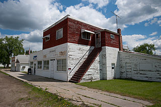
<span class="mw-page-title-main">McHenry, North Dakota</span> City in North Dakota, United States

McHenry is a city in Foster County, North Dakota, United States. The population was 64 at the 2020 census. McHenry was founded in 1899.

<span class="mw-page-title-main">Wishek, North Dakota</span> City in North Dakota, United States

Wishek is a city in McIntosh County, North Dakota, United States. The population was 864 at the 2020 census.
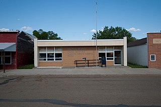
<span class="mw-page-title-main">Flasher, North Dakota</span> City in North Dakota, United States

Flasher is a city in Morton County, North Dakota, United States. It is part of the "Bismarck, ND Metropolitan Statistical Area" or "Bismarck-Mandan". The population was 217 at the 2020 census. Flasher was founded in 1902.
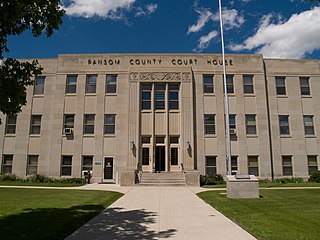
<span class="mw-page-title-main">Lisbon, North Dakota</span> City in North Dakota, United States

Lisbon is a city in and the county seat of Ransom County, North Dakota, United States. The population was 2,204 at the 2020 census.

<span class="mw-page-title-main">Tioga, North Dakota</span> City in North Dakota, United States

Tioga is a city in Williams County, North Dakota, United States. The population was 2,202 at the 2020 census.

<span class="mw-page-title-main">Chamberlain, South Dakota</span> City in South Dakota, United States

Chamberlain is a city in Brule County, South Dakota, United States. It is located on the east bank of the Missouri River, at the dammed section of the Lake Francis Case, close to where it is crossed by Interstate 90.

<span class="mw-page-title-main">Newell, South Dakota</span> City in South Dakota, United States

Newell is a city in Butte County, South Dakota, United States. The population was 584 at the 2020 census.

<span class="mw-page-title-main">Wagner, South Dakota</span> City in South Dakota, United States

Wagner is a city in Charles Mix County, South Dakota, United States. The population was 1,490 at the 2020 census. The city is served by Wagner Municipal Airport as well as YST Transit buses.

<span class="mw-page-title-main">Florence, South Dakota</span> Town in South Dakota, United States

Florence is a town in northwestern Codington County, South Dakota, United States. It is part of the Watertown, South Dakota Micropolitan Statistical Area. The population was 337 at the 2020 census.

<span class="mw-page-title-main">Mount Vernon, South Dakota</span> City in South Dakota, United States

Mount Vernon is a city in Davison County, South Dakota, United States. The population was 461 at the 2020 census. It is part of the Mitchell, South Dakota Micropolitan Statistical Area.
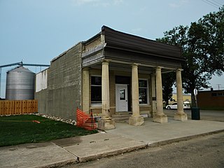
<span class="mw-page-title-main">Bowdle, South Dakota</span> City in South Dakota, United States

Bowdle ( is a city in Edmunds County, South Dakota, United States. The population was 470 at the 2020 census.

<span class="mw-page-title-main">Estelline, South Dakota</span> City in South Dakota, United States

Estelline is a city in Hamlin County, South Dakota, United States. It is part of the Watertown, South Dakota Micropolitan Statistical Area. The population was 749 at the 2020 census.

<span class="mw-page-title-main">Parkston, South Dakota</span> City in South Dakota, United States

Parkston is a city in Hutchinson County, South Dakota, United States. The population was 1,567 at the 2020 census.

<span class="mw-page-title-main">Kadoka, South Dakota</span> City in South Dakota, United States

Kadoka is a city in, and the county seat of, Jackson County, South Dakota, United States. The population was 543 at the 2020 census. The town occupies about 2.3 square miles.

<span class="mw-page-title-main">Murdo, South Dakota</span> City in South Dakota, United States

Murdo is a city in and county seat of Jones County, South Dakota, United States. The population was 475 at the 2020 census.

<span class="mw-page-title-main">Whitewood, South Dakota</span> City in South Dakota, United States

Whitewood is a city in Lawrence County, South Dakota, United States. The population was 879 at the 2020 census.

References

  1. "ArcGIS REST Services Directory". United States Census Bureau. Retrieved September 20, 2022.
  2. 1 2 U.S. Geological Survey Geographic Names Information System: Garrison, North Dakota
  3. 1 2 3 "Explore Census Data". United States Census Bureau . Retrieved October 22, 2023.
  4. 1 2 "City and Town Population Totals: 2020-2022". United States Census Bureau. October 22, 2023. Retrieved October 22, 2023.
  5. Gavett, Joseph L. (January 1, 2007). North Dakota Immigrants: Coming to America. Watchmaker Publishing, Ltd. p. 89. ISBN   978-1-929148-74-5.
  6. Federal Writers' Project (1938). North Dakota, a Guide to the Northern Prairie State. WPA. p. 211. ISBN   978-1-62376-033-5.
  7. "McLean County". Jim Forte Postal History. Retrieved October 25, 2015.
  8. "US Gazetteer files 2010". United States Census Bureau. Archived from the original on July 2, 2012. Retrieved June 14, 2012.
  9. "NowData - NOAA Online Weather Data". National Oceanic and Atmospheric Administration. Retrieved September 18, 2021.
  10. "Station: Garrison, ND". U.S. Climate Normals 2020: U.S. Monthly Climate Normals (1991–2020). National Oceanic and Atmospheric Administration. Retrieved September 18, 2021.
  11. United States Census Bureau. "Census of Population and Housing" . Retrieved July 19, 2013.
  12. 1 2 3 FAA Airport Form 5010 for D05 PDF , effective December 20, 2007