LaMoure County, North Dakota

Last updated

LaMoure County
La Moure County Courthouse.jpg
Map of North Dakota highlighting LaMoure County.svg
Location within the U.S. state of North Dakota
North Dakota in United States.svg
North Dakota's location within the U.S.
Coordinates: 46°28′N98°32′W / 46.47°N 98.53°W / 46.47; -98.53
CountryFlag of the United States.svg United States
StateFlag of North Dakota.svg  North Dakota
FoundedJanuary 4, 1873 (created)
October 27, 1881 (organized)
Named for Judson LaMoure
Seat LaMoure
Largest cityLaMoure
Area
  Total1,151 sq mi (2,980 km2)
  Land1,146 sq mi (2,970 km2)
  Water4.9 sq mi (13 km2)  0.4%
Population
 (2020)
  Total4,093
  Estimate 
(2022)
4,098 Increase2.svg
  Density3.6/sq mi (1.4/km2)
Time zone UTC−6 (Central)
  Summer (DST) UTC−5 (CDT)
Congressional district At-large
Website www.lamourecountynd.com

LaMoure County is a county in the U.S. state of North Dakota. As of the 2020 census, the population was 4,093. [1] Its county seat is LaMoure. [2]

Contents

History

The Dakota Territory legislature created the county on January 4, 1873, with Grand Rapids as the county seat. However, the county organization was not completed at that time, nor was the county attached to another county for administrative and judicial purposes. It was named for Judson LaMoure, [3] a member of the territorial/state legislature from 1872 to 1918. [4]

The county organization was effected on October 27, 1881. Its boundaries were altered in February 1881 and in March 1883. It has retained its present boundary since that time. [5] The present county seat, LaMoure, was founded in 1882, and the county seat was transferred to that community soon after. [6]

Outline map of LaMoure County, North Dakota, 1913 Map of LaMoure County, N.D., 1913.jpg
Outline map of LaMoure County, North Dakota, 1913

Geography

The James River flows southeasterly through the central portion of LaMoure County, and a tributary of the South Branch Maple River flows southerly from the center of the county. The county terrain consists of rolling hills, mostly devoted to agriculture. [7] The terrain slopes to the south and east; its highest point is on its upper west boundary line at 2,047 ft (624 m) ASL. [8] The county has a total area of 1,151 square miles (2,980 km2), of which 1,146 square miles (2,970 km2) is land and 4.9 square miles (13 km2) (0.4%) is water. [9]

LaMoure County hosts a Navy transmitter, the Naval Radio Transmitter Facility LaMoure.

Major highways

Airports

Adjacent counties

National protected area

Lakes [7]

  • Bone Hill Creek Lake
  • Cottonwood Lake
  • Lake Lamoure
  • Pearl Lake
  • Wild Rice Slough

Demographics

Historical population
CensusPop.Note
1880 20
1890 3,18715,835.0%
1900 6,04889.8%
1910 10,72477.3%
1920 11,5647.8%
1930 11,517−0.4%
1940 10,298−10.6%
1950 9,498−7.8%
1960 8,705−8.3%
1970 7,117−18.2%
1980 6,473−9.0%
1990 5,383−16.8%
2000 4,701−12.7%
2010 4,139−12.0%
2020 4,093−1.1%
2022 (est.)4,098 [10] 0.1%
U.S. Decennial Census [11]
1790-1960 [12] 1900-1990 [13]
1990-2000 [14] 2010-2020 [1]

2020 census

As of the census of 2020, there were 4,093 people.

2010 census

As of the census of 2010, there were 4,139 people, 1,825 households, and 1,182 families in the county. The population density was 3.61 people per square mile (1.39 people/km2). There were 2,238 housing units at an average density of 1.95 units per square mile (0.75/km2). The racial makeup of the county was 98.5% white, 0.4% American Indian, 0.1% black or African American, 0.1% Asian, 0.2% from other races, and 0.6% from two or more races. Those of Hispanic or Latino origin made up 0.8% of the population. In terms of ancestry, 63.0% were German, 27.6% were Norwegian, 6.2% were Swedish, 6.1% were Russian, 6.0% were English, and 2.8% were American.

Of the 1,825 households, 22.8% had children under the age of 18 living with them, 56.9% were married couples living together, 4.6% had a female householder with no husband present, 35.2% were non-families, and 32.7% of all households were made up of individuals. The average household size was 2.23 and the average family size was 2.82. The median age was 49.2 years.

The median income for a household in the county was $46,098 and the median income for a family was $60,932. Males had a median income of $41,250 versus $25,172 for females. The per capita income for the county was $27,056. About 6.8% of families and 9.1% of the population were below the poverty line, including 6.8% of those under age 18 and 16.9% of those age 65 or over.

Population by decade

LaMoure County, North Dakota

Communities

Cities

Unincorporated communities [7]

  • Alfred
  • Diesem
  • Medberry
  • Nortonville

Townships

Ghost town

U.S. Navy ships

The United States Navy commissioned two tank landing ships named for the county. The first, USS La Moure County (LST-883), was commissioned January 23, 1945, and served until December 7, 1959. The second, USS La Moure County (LST-1194), was commissioned December 1, 1971 and served until November 17, 2000.

Politics

LaMoure County voters are traditionally Republican. In only one national election since 1936 has the county selected the Democratic Party candidate (as of 2020).

United States presidential election results for LaMoure County, North Dakota [15]
Year Republican Democratic Third party
No.%No.%No.%
2020 1,64574.13%52723.75%472.12%
2016 1,48168.85%50223.34%1687.81%
2012 1,37762.76%74033.73%773.51%
2008 1,31058.46%86838.73%632.81%
2004 1,59268.18%71230.49%311.33%
2000 1,59064.42%68927.92%1897.66%
1996 1,22051.15%88036.90%28511.95%
1992 1,27045.96%79728.85%69625.19%
1988 1,64256.60%1,22342.16%361.24%
1984 1,97863.64%1,08634.94%441.42%
1980 2,13664.88%85025.82%3069.30%
1976 1,73549.04%1,71848.56%852.40%
1972 2,11059.62%1,39939.53%300.85%
1968 2,00857.90%1,26936.59%1915.51%
1964 1,60442.72%2,14557.12%60.16%
1960 2,51161.39%1,57538.51%40.10%
1956 2,43358.85%1,69440.98%70.17%
1952 3,20273.12%1,14526.15%320.73%
1948 1,99953.91%1,48139.94%2286.15%
1944 2,29861.25%1,42237.90%320.85%
1940 2,94363.70%1,63735.43%400.87%
1936 1,61433.13%2,41249.52%84517.35%
1932 1,13424.74%3,31072.22%1393.03%
1928 2,24555.00%1,80044.10%370.91%
1924 1,64743.23%2215.80%1,94250.97%
1920 2,99177.59%64516.73%2195.68%
1916 1,04547.59%99045.08%1617.33%
1912 43628.63%58838.61%49932.76%
1908 1,10464.75%55332.43%482.82%
1904 86077.13%19517.49%605.38%
1900 59758.41%40539.63%201.96%

See also

Related Research Articles

<span class="mw-page-title-main">Minnehaha County, South Dakota</span> County in South Dakota, United States

Minnehaha County is a county on the eastern border of the state of South Dakota. As of the 2020 census, the population was 197,214, making it the state's most populous county. It contains over 20% of the state's population. Its county seat is Sioux Falls, South Dakota's most populous city. The county was created in 1862 and organized in 1868. Its name was derived from the Sioux word Mnihaha, meaning "rapid water," or "waterfall".

<span class="mw-page-title-main">Lawrence County, South Dakota</span> County in South Dakota, United States

Lawrence County is a county in the U.S. state of South Dakota. As of the 2020 census, the population was 25,768, making it the 8th most populous county in South Dakota. Its county seat is Deadwood.

<span class="mw-page-title-main">Hutchinson County, South Dakota</span> County in South Dakota, United States

Hutchinson County is a county in the U.S. state of South Dakota. As of the 2020 census, the population was 7,427. Its county seat is Olivet. The county was created in 1862 and organized in 1871; it was named for John Hutchinson, first territorial secretary.

<span class="mw-page-title-main">Harding County, South Dakota</span> County in South Dakota, United States

Harding County is a county in the U.S. state of South Dakota. As of the 2020 census, the population was 1,311, making it the third-least populous county in South Dakota. Its county seat is Buffalo.

<span class="mw-page-title-main">Grant County, South Dakota</span> County in South Dakota, United States

Grant County is a county in the U.S. state of South Dakota. As of the 2020 census, the population was 7,556. The county seat is Milbank. The county was founded in 1873 and organized in 1878. It is named for Ulysses S. Grant, 18th President of the United States.

<span class="mw-page-title-main">Stutsman County, North Dakota</span> County in North Dakota, United States

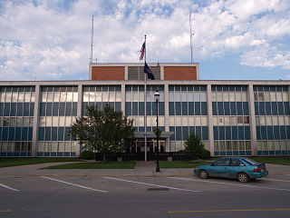
Stutsman County is a county in the U.S. state of North Dakota. As of the 2020 census, the population was 21,593, making it the 8th most populous county in North Dakota. Its county seat is Jamestown.

<span class="mw-page-title-main">Ramsey County, North Dakota</span> County in North Dakota, United States

Ramsey County is a county in the U.S. state of North Dakota. As of the 2020 census, the population was 11,605. Its county seat is Devils Lake.

<span class="mw-page-title-main">Nelson County, North Dakota</span> County in North Dakota, United States

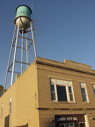
Nelson County is a county in the U.S. state of North Dakota. As of the 2020 census, the population was 3,015. Its county seat is Lakota.

<span class="mw-page-title-main">Mountrail County, North Dakota</span> County in North Dakota, United States

Mountrail County is a county in the northwestern part of North Dakota, United States. As of the 2020 census, the population was 9,809. Its county seat is Stanley. The county was originally created in 1873, then removed in 1892, annexed by Ward County. It was re-created and organized in 1909.

<span class="mw-page-title-main">McLean County, North Dakota</span> County in North Dakota, United States

McLean County is a county in the U.S. state of North Dakota. As of the 2020 census, the population was 9,771. Its county seat is Washburn.

<span class="mw-page-title-main">McIntosh County, North Dakota</span> County in North Dakota, United States

McIntosh County is a county in the U.S. state of North Dakota. As of the 2020 census, the population was 2,530. Its county seat is Ashley. The county is notable for being the county with the highest percentage of German-Americans in the United States, with over 76% of the county's residents being of German descent as of 2010.

<span class="mw-page-title-main">Logan County, North Dakota</span> County in North Dakota, United States

Logan County is a county in the U.S. state of North Dakota. As of the 2020 census, the population was 1,876. Its county seat is Napoleon.

<span class="mw-page-title-main">Grant County, North Dakota</span> County in North Dakota, United States

Grant County is a county in the U.S. state of North Dakota. As of the 2020 census, the population was 2,301. Its county seat is Carson.

<span class="mw-page-title-main">Dickey County, North Dakota</span> County in North Dakota, United States

Dickey County is a county in the U.S. state of North Dakota. As of the 2020 census, the population was 4,999. Its county seat is Ellendale.

<span class="mw-page-title-main">Burke County, North Dakota</span> County in North Dakota, United States

Burke County is a county on the north edge of the U.S. state of North Dakota, adjacent to the south line of Canada. As of the 2020 census, the population was 2,201. The county seat is Bowbells. The county is named after John Burke, the tenth Governor of North Dakota.

<span class="mw-page-title-main">Bottineau County, North Dakota</span> County in North Dakota, United States

Bottineau County is a county in the U.S. state of North Dakota. As of the 2020 census, the population was 6,379. Its county seat is Bottineau.

<span class="mw-page-title-main">Jud, North Dakota</span> City in North Dakota, United States

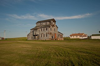
Jud is a rural city in LaMoure County, North Dakota, United States. The population was 65 at the 2020 census. Jud was founded in 1904 and named for county settler Judson LaMoure. It is located along unpaved 61st Street SE, 9 miles (14 km) west of U.S. Route 281 and 25 miles (40 km) south of Interstate 94 in the midst of settled farmland and open plains.

<span class="mw-page-title-main">Kulm, North Dakota</span> City in North Dakota, United States

Kulm is a city in LaMoure County, North Dakota, United States. The population was 368 at the 2020 census. Kulm was founded in 1892.

<span class="mw-page-title-main">LaMoure, North Dakota</span> City in North Dakota, United States

LaMoure is a city in LaMoure County, North Dakota, United States. The population was 764 at the 2020 census. It is the county seat of LaMoure County.

<span class="mw-page-title-main">Marion, North Dakota</span> City in North Dakota, United States

Marion is a city in LaMoure County, North Dakota, United States. The population was 125 at the 2020 census.

References

  1. 1 2 "State & County QuickFacts". United States Census Bureau. Retrieved April 6, 2023.
  2. "Find a County". National Association of Counties. Retrieved June 7, 2011.
  3. Gannett, Henry (1905). The Origin of Certain Place Names in the United States. US Govt Printing Office. p. 180.
  4. A Profile of Jud LaMoure (accessed February 21, 2019)
  5. "Dakota Territory, South Dakota, and North Dakota: Individual County Chronologies". Dakota Territory Atlas of Historical County Boundaries. The Newberry Library. 2006. Archived from the original on April 2, 2018. Retrieved February 21, 2019.
  6. LaMoure County website (home page) accessed February 22, 2019
  7. 1 2 3 "Lamoure County · North Dakota". Google Maps. Retrieved April 27, 2024.
  8. ""Find an Altitude/LaMoure County ND" Google Maps (accessed February 21, 2019)". Archived from the original on May 21, 2019. Retrieved February 22, 2019.
  9. "2010 Census Gazetteer Files". United States Census Bureau. August 22, 2012. Archived from the original on January 29, 2015. Retrieved January 28, 2015.
  10. "Annual Estimates of the Resident Population for Counties: April 1, 2020 to July 1, 2022" . Retrieved April 6, 2023.
  11. "U.S. Decennial Census". United States Census Bureau. Retrieved January 28, 2015.
  12. "Historical Census Browser". University of Virginia Library. Retrieved January 28, 2015.
  13. Forstall, Richard L., ed. (April 20, 1995). "Population of Counties by Decennial Census: 1900 to 1990". United States Census Bureau. Retrieved January 28, 2015.
  14. "Census 2000 PHC-T-4. Ranking Tables for Counties: 1990 and 2000" (PDF). United States Census Bureau. April 2, 2001. Archived (PDF) from the original on March 27, 2010. Retrieved January 28, 2015.
  15. Leip, David. "Atlas of US Presidential Elections". uselectionatlas.org. Retrieved April 12, 2018.

46°28′N98°32′W / 46.47°N 98.53°W / 46.47; -98.53