Dickey, North Dakota

Last updated

Dickey, North Dakota
Post office in Dickey, North Dakota 6-8-2008.jpg
Post office in Dickey
ND LaMoure County Dickey.svg
Location of Dickey, North Dakota
Coordinates: 46°32′11″N98°28′11″W / 46.53639°N 98.46972°W / 46.53639; -98.46972
CountryUnited States
State North Dakota
County LaMoure
Founded1885
Area
[1]
  Total0.24 sq mi (0.62 km2)
  Land0.24 sq mi (0.62 km2)
  Water0.00 sq mi (0.00 km2)
Elevation
1,355 ft (413 m)
Population
 (2020)
  Total42
  Density175.73/sq mi (67.77/km2)
Time zone UTC-6 (Central (CST))
  Summer (DST) UTC-5 (CDT)
ZIP code
58431
Area code 701
FIPS code 38-19580
GNIS feature ID1033635 [2]

Dickey is a city in LaMoure County, North Dakota, United States. The population was 42 at the 2020 census. [3]

Contents

History

Dickey was founded in 1885. George H. Dickey is the town's namesake. [4]

Geography

Dickey is located at 46°32′11″N98°28′11″W / 46.53639°N 98.46972°W / 46.53639; -98.46972 (46.536315, -98.469659). [5]

According to the United States Census Bureau, the city has a total area of 0.22 square miles (0.57 km2), all land. [6]

Demographics

Historical population
CensusPop.Note
1910 187
1920 1901.6%
1930 168−11.6%
1940 20320.8%
1950 165−18.7%
1960 143−13.3%
1970 118−17.5%
1980 74−37.3%
1990 53−28.4%
2000 577.5%
2010 42−26.3%
2020 420.0%
2021 (est.)48 [7] 14.3%
U.S. Decennial Census [8]
2020 Census [3]

2010 census

As of the census of 2010, there were 42 people, 20 households, and 10 families residing in the city. The population density was 190.9 inhabitants per square mile (73.7/km2). There were 31 housing units at an average density of 140.9 per square mile (54.4/km2). The racial makeup of the city was 100.0% White.

There were 20 households, of which 10.0% had children under the age of 18 living with them, 35.0% were married couples living together, 10.0% had a female householder with no husband present, 5.0% had a male householder with no wife present, and 50.0% were non-families. 40.0% of all households were made up of individuals, and 5% had someone living alone who was 65 years of age or older. The average household size was 2.10 and the average family size was 2.80.

The median age in the city was 39 years. 21.4% of residents were under the age of 18; 0.0% were between the ages of 18 and 24; 30.9% were from 25 to 44; 28.4% were from 45 to 64; and 19% were 65 years of age or older. The gender makeup of the city was 54.8% male and 45.2% female.

2000 census

As of the census of 2000, there were 42 people, 26 households, and 12 families residing in the city. The population density was 260.8 inhabitants per square mile (100.7/km2). There were 31 housing units at an average density of 141.8 per square mile (54.7/km2). The racial makeup of the city was 100.00% White.

There were 26 households, out of which 26.9% had children under the age of 18 living with them, 38.5% were married couples living together, 3.8% had a female householder with no husband present, and 53.8% were non-families. 53.8% of all households were made up of individuals, and 30.8% had someone living alone who was 65 years of age or older. The average household size was 2.19 and the average family size was 3.50.

In the city, the population was spread out, with 17.5% under the age of 18, 14.0% from 18 to 24, 21.1% from 25 to 44, 29.8% from 45 to 64, and 17.5% who were 65 years of age or older. The median age was 43 years. For every 100 females, there were 119.2 males. For every 100 females age 18 and over, there were 104.3 males.

The median income for a household in the city was $18,500, and the median income for a family was $23,750. Males had a median income of $28,333 versus $11,250 for females. The per capita income for the city was $10,547. There were 50.0% of families and 39.0% of the population living below the poverty line, including 16.7% of under eighteens and none of those over 64.

Related Research Articles

<span class="mw-page-title-main">Glencoe, Alabama</span> City in Alabama, United States

Glencoe is a city in Calhoun and Etowah counties in the U.S. state of Alabama. It is part of the Gadsden Metropolitan Statistical Area. The city incorporated in 1939. The population was 5,160 at the 2010 census.

<span class="mw-page-title-main">Willey, Iowa</span> City in Iowa, United States

Willey is a city in Carroll County, Iowa, United States. The population was 73 at the time of the 2020 census.

<span class="mw-page-title-main">Braddyville, Iowa</span> City in Iowa, United States

Braddyville is a city in Page County, Iowa, United States. The population was 147 at the 2020 census.

<span class="mw-page-title-main">Oslo, Minnesota</span> City in Minnesota, United States

Oslo is a city in Marshall County, Minnesota, United States. The population was 239 at the 2020 census.

<span class="mw-page-title-main">Elizabeth, Minnesota</span> City in Minnesota, United States

Elizabeth is a city in Otter Tail County, Minnesota, United States. The population was 168 at the 2020 census.

<span class="mw-page-title-main">Richville, Minnesota</span> City in Minnesota, United States

Richville is a city in Otter Tail County, Minnesota, United States. The population was 77 as of the 2020 census.

<span class="mw-page-title-main">Lake Henry, Minnesota</span> City in Minnesota, United States

Lake Henry is a city in Stearns County, Minnesota, United States. The population was 103 at the 2010 census. It is part of the St. Cloud Metropolitan Statistical Area.

<span class="mw-page-title-main">Country Club Hills, Missouri</span> City in Missouri, United States

Country Club Hills is a city in St. Louis County, Missouri, United States. The population was 1,274 at the 2010 census.

<span class="mw-page-title-main">Moline Acres, Missouri</span> City in Missouri, United States

Moline Acres is a city in St. Louis County, Missouri, United States. The population was 2,442 at the 2010 census.

<span class="mw-page-title-main">Ellendale, North Dakota</span> City in North Dakota, United States

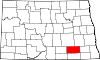
Ellendale is a city in Dickey County, North Dakota, United States. It is the capital city of Dickey County. The population was 1,125 at the 2020 census. Ellendale was founded in 1882. Ellendale is the home of Trinity Bible College, located on the former campus of the North Dakota State Normal and Industrial School and the Ellendale Opera House currently under renovation.

<span class="mw-page-title-main">Forbes, North Dakota</span> City in North Dakota, United States

Forbes is a city in Dickey County, North Dakota, United States. The population was 36 at the 2020 census.

<span class="mw-page-title-main">Fullerton, North Dakota</span> City in North Dakota, United States

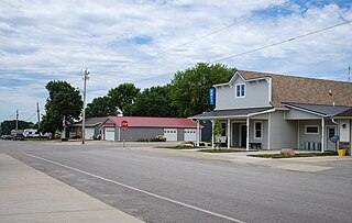
Fullerton is a town in Dickey County, North Dakota, United States. The population was 62 at the 2020 census.

<span class="mw-page-title-main">Ludden, North Dakota</span> City in North Dakota, United States

Ludden is a city in Dickey County, North Dakota, United States. The population was 15 at the 2020 census. Ludden was founded in 1886.

<span class="mw-page-title-main">Monango, North Dakota</span> City in North Dakota, United States

Monango is a city in Dickey County, North Dakota, United States. The population was 30 at the 2020 census. Monango was founded in 1886.

<span class="mw-page-title-main">Oakes, North Dakota</span> City in North Dakota, United States

Oakes is the most populous city in Dickey County, North Dakota, United States. The population was 1,798 at the 2020 census. Oakes was founded in 1886.

<span class="mw-page-title-main">Harrisburg, Oregon</span> City in Oregon, United States

Harrisburg is a city in Linn County, Oregon, United States. The population was 3,567 at the 2010 census.

<span class="mw-page-title-main">Crabtree, Pennsylvania</span> CDP in Pennsylvania, United States

Crabtree is a census-designated place (CDP) and former coal town in Salem Township, Westmoreland County, Pennsylvania, United States. The population was 277 at the 2010 census. It has its own post office, with postal code 15624.

<span class="mw-page-title-main">Snook, Texas</span> City in Texas, United States

Snook is a city in Burleson County, Texas, United States. The population was 506 at the 2020 census.

<span class="mw-page-title-main">Riverbend, Washington</span> Census-designated place in Washington, United States

Riverbend is an unincorporated community and census-designated place (CDP) in King County, Washington, United States. The population was 2,132 at the 2010 census.

<span class="mw-page-title-main">Dennison, Minnesota</span> City in Minnesota, United States

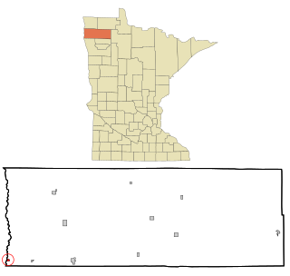
Dennison is a city in Goodhue and Rice counties in the U.S. state of Minnesota. The population was 212 at the 2010 census. Most of Dennison is in Goodhue County, with only a small part that extends into Rice County.

References

  1. "ArcGIS REST Services Directory". United States Census Bureau. Retrieved September 20, 2022.
  2. "US Board on Geographic Names". United States Geological Survey. October 25, 2007. Retrieved January 31, 2008.
  3. 1 2 "Explore Census Data". United States Census Bureau . Retrieved July 11, 2022.
  4. Gannett, Henry (1905). The Origin of Certain Place Names in the United States. Govt. Print. Off. pp.  106.
  5. "US Gazetteer files: 2010, 2000, and 1990". United States Census Bureau. February 12, 2011. Retrieved April 23, 2011.
  6. "US Gazetteer files 2010". United States Census Bureau. Archived from the original on July 2, 2012. Retrieved June 14, 2012.
  7. "City and Town Population Totals: 2020-2021". United States Census Bureau. July 11, 2022. Retrieved July 11, 2022.
  8. United States Census Bureau. "Census of Population and Housing" . Retrieved January 23, 2014.