Benson County, North Dakota

Last updated

Benson County
Benson County Courthouse 2009.jpg
Map of North Dakota highlighting Benson County.svg
Location within the U.S. state of North Dakota
North Dakota in United States.svg
North Dakota's location within the U.S.
Coordinates: 48°04′N99°22′W / 48.07°N 99.36°W / 48.07; -99.36
CountryFlag of the United States.svg United States
StateFlag of North Dakota.svg  North Dakota
FoundedMarch 9, 1883 (created)
June 4, 1884 (organized)
Named for Bertil W. Benson
Seat Minnewaukan
Largest community Fort Totten
Area
  Total1,439 sq mi (3,730 km2)
  Land1,389 sq mi (3,600 km2)
  Water51 sq mi (130 km2)  3.5%
Population
 (2020)
  Total5,964
  Estimate 
(2022)
5,770 Decrease2.svg
  Density4.1/sq mi (1.6/km2)
Time zone UTC−6 (Central)
  Summer (DST) UTC−5 (CDT)
Congressional district At-large
Website www.bensoncountynd.com

Benson County is a county in the U.S. state of North Dakota. As of the 2020 census, the population was 5,964. [1] Its county seat is Minnewaukan. [2] The county was created on March 9, 1883 [3] by the Dakota Territory legislature, and was named for Bertil W. Benson, a Dakota Territory legislator at the time. The county government was organized on June 4, 1884, and its boundary lines were altered by two legislative actions in 1885. [4]

Contents

White Horse Hill National Game Preserve and much of the Spirit Lake Indian Reservation are located within the county.

Geography

Much of the east boundary line of Benson County is delineated by the shore of Devils Lake, a closed-capture lake which would spill into the Sheyenne River in an overflow condition. The North Fork Sheyenne River flows southeasterly through the lower SW portion of the county.

The terrain of Benson County consists of rolling hills dotted with lakes, ponds and drainages. [5] The terrain slopes to the east, and its highest point is on the lower portion of its west boundary line, at 1,624 ft (495 m) ASL. [6] The county has a total area of 1,439 square miles (3,730 km2), of which 1,389 square miles (3,600 km2) is land and 51 square miles (130 km2) (3.5%) is water. [7]

Adjacent counties

Major highways

Protected areas

Lakes

  • Broken Bone Lake
  • Cranberry Lake
  • Free Peoples Lake
  • Horseshoe Lake
  • Lake Murie
  • Lake Yri
  • Long Lake
  • Sand Lake
  • Shin Bone Lake
  • Spring Lake
  • Stink Lake
  • Stony Lake
  • Wood Lake

[5]

Demographics

Historical population
CensusPop.Note
1890 2,460
1900 8,320238.2%
1910 12,68152.4%
1920 13,0953.3%
1930 13,3271.8%
1940 12,629−5.2%
1950 10,675−15.5%
1960 9,435−11.6%
1970 8,245−12.6%
1980 7,944−3.7%
1990 7,198−9.4%
2000 6,964−3.3%
2010 6,660−4.4%
2020 5,964−10.5%
2022 (est.)5,770 [8] −3.3%
U.S. Decennial Census [9]
1790-1960 [10] 1900-1990 [11]
1990-2000 [12] 2010-2020 [1]

2020 census

As of the census of 2020, there were 5,964 people.

2010 census

As of the census of 2010, there were 6,660 people, 2,233 households, and 1,628 families in the county. The population density was 4.8 inhabitants per square mile (1.9/km2). There were 2,950 housing units at an average density of 2.1 units per square mile (0.81/km2). The racial makeup of the county was 55.0% American Indian, 43.4% white, 0.2% from other races, and 1.4% from two or more races. Those of Hispanic or Latino origin made up 1.2% of the population. In terms of ancestry, 22.0% were Norwegian, 18.0% were German, 5.0% were Irish, and 0.6% were American.

Of the 2,233 households, 41.3% had children under the age of 18 living with them, 42.3% were married couples living together, 20.6% had a female householder with no husband present, 27.1% were non-families, and 23.2% of all households were made up of individuals. The average household size was 2.98 and the average family size was 3.46. The median age was 31.6 years.

The median income for a household in the county was $30,479 and the median income for a family was $34,597. Males had a median income of $31,729 versus $25,253 for females. The per capita income for the county was $14,545. About 26.1% of families and 35.6% of the population were below the poverty line, including 48.3% of those under age 18 and 16.9% of those age 65 or over.

Population by decade

Benson County, North Dakota

Communities

Cities and CDPs have population included as of 2020, and townships have the population as of 2020. The largest community by far is Fort Totten, followed by Leeds, Maddock and the county seat, Minnewaukan. There are nine cities in the county. The largest township by a 60% margin is Mission (935), which is on the south shore of Devils Lake and is popular for vacationing, as well as gambling at the Spirit Lake Casino and Resort. It is within the Spirit Lake Indian Reservation. It is followed by Wood Lake Township (471), immediately to the south of Mission Township and also included in the reservation. The third largest is Lallie Township (325), to the west of Fort Totten on the south shore of Devils Lake and within the reservation.

Cities

Census-designated place

Unincorporated communities

Townships

Politics

Typical of many counties in the state where a significant share of the population is Native American, Benson County leans Democratic in presidential elections. Prior to 2020, no Republican candidate had won the majority of the county's votes since Ronald Reagan in 1984. However, George W. Bush in 2000 & Donald Trump in 2016 both won a plurality of the county's votes.

United States presidential election results for Benson County, North Dakota [13]
Year Republican Democratic Third party
No.%No.%No.%
2020 1,09455.79%82241.92%452.29%
2016 92946.20%84241.87%24011.93%
2012 86840.24%1,23557.26%542.50%
2008 77332.56%1,56966.09%321.35%
2004 1,00244.61%1,19653.25%482.14%
2000 1,05548.98%95244.20%1476.82%
1996 85039.13%1,05948.76%26312.11%
1992 87433.30%1,12642.90%62523.81%
1988 1,31643.42%1,69155.79%240.79%
1984 1,72951.41%1,59947.55%351.04%
1980 2,14959.91%1,11931.20%3198.89%
1976 1,68945.34%1,97352.97%631.69%
1972 2,05055.09%1,63543.94%360.97%
1968 1,70746.86%1,77248.64%1644.50%
1964 1,48936.67%2,56663.20%50.12%
1960 2,25950.84%2,18149.09%30.07%
1956 2,34055.67%1,85144.04%120.29%
1952 3,19269.63%1,35329.52%390.85%
1948 1,92044.33%2,21651.17%1954.50%
1944 1,72643.04%2,26156.38%230.57%
1940 2,48545.85%2,89853.47%370.68%
1936 1,02019.02%3,34362.33%1,00018.65%
1932 1,17023.79%3,65074.23%971.97%
1928 2,62153.80%2,19445.03%571.17%
1924 1,87045.00%2465.92%2,04049.09%
1920 3,54081.10%68015.58%1453.32%
1916 1,21053.30%92240.62%1386.08%
1912 51526.13%59430.14%86243.73%
1908 1,36367.81%55327.51%944.68%
1904 1,11185.59%14311.02%443.39%
1900 1,08475.49%31922.21%332.30%

Education

School districts include: [14]

K-12:

Elementary districts:

See also

Related Research Articles

<span class="mw-page-title-main">Towner County, North Dakota</span> County in North Dakota, United States

Towner County is a county in the U.S. state of North Dakota. As of the 2020 census, the population is 2,162. Its county seat is Cando. It is south of the Canada–US border with Manitoba.

<span class="mw-page-title-main">Slope County, North Dakota</span> County in North Dakota, United States

Slope County is a county in the U.S. state of North Dakota. As of the 2020 census, the population was 706, making it the least populous county in North Dakota and the 18th-least populous county in the United States. The county seat is Amidon.

<span class="mw-page-title-main">Sheridan County, North Dakota</span> County in North Dakota, United States

Sheridan County is a county located in the U.S. state of North Dakota. As of the 2020 census, the population was 1,265, making it the third-least populous county in North Dakota. Its county seat is McClusky.

<span class="mw-page-title-main">Rolette County, North Dakota</span> County in the United States

Rolette County is a county in the U.S. state of North Dakota. As of the 2020 census, the population was 12,187. Its county seat is Rolla.

<span class="mw-page-title-main">Ransom County, North Dakota</span> County in North Dakota, United States

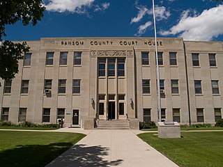
Ransom County is a county in the U.S. state of North Dakota. As of the 2020 census, the population was 5,703. Its county seat is Lisbon.

<span class="mw-page-title-main">Ramsey County, North Dakota</span> County in North Dakota, United States

Ramsey County is a county in the U.S. state of North Dakota. As of the 2020 census, the population was 11,605. Its county seat is Devils Lake.

<span class="mw-page-title-main">Pierce County, North Dakota</span> County in North Dakota, United States

Pierce County is a county in the U.S. state of North Dakota. As of the 2020 census, the population was 3,990. Its county seat is Rugby.

<span class="mw-page-title-main">McKenzie County, North Dakota</span> County in North Dakota, United States

McKenzie County is a county in the U.S. state of North Dakota. As of the 2020 census, the population was 14,704. Its county seat is Watford City.

<span class="mw-page-title-main">Griggs County, North Dakota</span> County in North Dakota, United States

Griggs County is a county in the U.S. state of North Dakota. As of the 2020 census, the population was 2,306. Its county seat is Cooperstown.

<span class="mw-page-title-main">Eddy County, North Dakota</span> County in North Dakota, United States

Eddy County is a county in the U.S. state of North Dakota. As of the 2020 census, the population was 2,347. Its county seat is New Rockford.

<span class="mw-page-title-main">Burleigh County, North Dakota</span> County in North Dakota, United States

Burleigh County is a county in the U.S. state of North Dakota. As of the 2020 census, the population was 98,458, making it the second most populous county in North Dakota. Its county seat is Bismarck, the state capital. The county was named for Dakota Territory political figure Walter A. Burleigh.

<span class="mw-page-title-main">Barnes County, North Dakota</span> County in North Dakota, United States

Barnes County is a county in the U.S. state of North Dakota. As of the 2020 census, the population was 10,853. Its county seat is Valley City.

<span class="mw-page-title-main">Fort Totten, North Dakota</span> CDP in North Dakota, United States

Fort Totten is a census-designated place (CDP) in Benson County, North Dakota, United States. The population was 1,243 at the 2010 census. Fort Totten is located within the Spirit Lake Reservation and is the site of tribal headquarters. The reservation has a total population estimated at 6,000. Although not formally incorporated as a city, Fort Totten has the largest population of any community in Benson County.

<span class="mw-page-title-main">Minnewaukan, North Dakota</span> City in North Dakota, United States

Minnewaukan is a city in Benson County, North Dakota, United States. It serves as the county seat and is fourth largest city in the county, after Fort Totten, Leeds, and Maddock. The population was 199 at the 2020 census. Minnewaukan was founded in 1884.

<span class="mw-page-title-main">Sheyenne, North Dakota</span> City in North Dakota, United States

Sheyenne is a city in Eddy County, North Dakota, United States. The population was 186 at the 2020 census. Sheyenne was founded in 1883. A community center and the Log Cabin Museum are located on Main Street. On the east end of town there is a park with campsites located on Warsing Dam. Sheyenne is also home to two Lutheran churches: Grace Lutheran and First Lutheran.

Rock Township is a civil township in Benson County, North Dakota, United States. As of the 2000 census, its population was 39.

<span class="mw-page-title-main">Saint Michael, North Dakota</span> Unincorporated community in North Dakota, United States

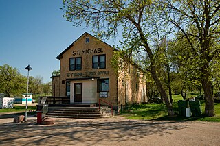
Saint Michael is an unincorporated community in southeastern Benson County, North Dakota, United States, on the Spirit Lake Dakota Reservation. It lies along North Dakota Highway 57 in Mission Township, southeast of the city of Minnewaukan, the county seat. It has a post office with the ZIP code 58370.

Mission Township is a civil township in Benson County, North Dakota, United States. As of the 2000 census, its population was 1,077. It is the most populous township in the county.

Oberon Public School District 16 is a school district headquartered in Oberon, North Dakota. It has grades K-7. It operates one school, Oberon Elementary School a.k.a. Oberon Public School.

References

  1. 1 2 "State & County QuickFacts". United States Census Bureau. Retrieved April 4, 2023.
  2. "Find a County". National Association of Counties. Archived from the original on May 31, 2011. Retrieved June 7, 2011.
  3. Another source shows the county's creation in 1879: ND Government - State History/Benson County (accessed February 13, 2019)
  4. "Dakota Territory, South Dakota, and North Dakota: Individual County Chronologies". Dakota Territory Atlas of Historical County Boundaries. The Newberry Library. 2006. Archived from the original on April 2, 2018. Retrieved February 2, 2015.
  5. 1 2 3 4 Benson County ND Google Maps (accessed February 13, 2019)
  6. ""Find an Altitude" Google Maps - Benson County ND (accessed February 13, 2019)". Archived from the original on May 21, 2019. Retrieved February 14, 2019.
  7. "2010 Census Gazetteer Files". United States Census Bureau. August 22, 2012. Archived from the original on January 29, 2015. Retrieved January 27, 2015.
  8. "Annual Estimates of the Resident Population for Counties: April 1, 2020 to July 1, 2022" . Retrieved April 4, 2023.
  9. "U.S. Decennial Census". United States Census Bureau. Retrieved January 27, 2015.
  10. "Historical Census Browser". University of Virginia Library. Retrieved January 27, 2015.
  11. Forstall, Richard L., ed. (March 27, 1995). "Population of Counties by Decennial Census: 1900 to 1990". United States Census Bureau. Retrieved January 27, 2015.
  12. "Census 2000 PHC-T-4. Ranking Tables for Counties: 1990 and 2000" (PDF). United States Census Bureau. April 2, 2001. Archived (PDF) from the original on March 27, 2010. Retrieved January 27, 2015.
  13. Leip, David. "Atlas of US Presidential Elections". uselectionatlas.org. Retrieved April 12, 2018.
  14. "2020 CENSUS - SCHOOL DISTRICT REFERENCE MAP: Benson County, ND" (PDF). U.S. Census Bureau. Archived (PDF) from the original on August 13, 2021. Retrieved July 23, 2022. - Text, 2010 map, 2010 text list

48°04′N99°22′W / 48.07°N 99.36°W / 48.07; -99.36