Fort Yates, North Dakota

Last updated

Fort Yates, North Dakota
Fort Yates Baptist Mission Fort Yates, North Dakota 6-12-2009.jpg
Fort Yates Baptist Mission in Fort Yates
ND Sioux County Fort Yates.svg
Location of Fort Yates, North Dakota
Coordinates: 46°05′12″N100°37′48″W / 46.08667°N 100.63000°W / 46.08667; -100.63000
CountryUnited States
Indian Reservation Standing Rock Indian Reservation
State North Dakota
County Sioux
Founded1863
Area
[1]
  Total0.06 sq mi (0.16 km2)
  Land0.06 sq mi (0.16 km2)
  Water0.00 sq mi (0.00 km2)
Elevation
[2]
1,634 ft (498 m)
Population
 (2020) [3]
  Total176
  Estimate 
(2022) [4]
169
  Density2,933.33/sq mi (1,126.65/km2)
Time zone UTC-6 (Central (CST))
  Summer (DST) UTC-5 (CDT)
ZIP code
58538
Area code 701
FIPS code 38-27860
GNIS feature ID1036043 [2]

Fort Yates is a city in Sioux County, North Dakota, United States. It is the tribal headquarters of the Standing Rock Sioux Tribe and county seat of Sioux County. [5] Since 1970 the population has declined markedly from more than 1,100 residents, as people have left for other locations for work. The population was 176 at the 2020 census. [3]

Contents

History

A primarily Native American settlement developed here after a US Army post at this site was established in 1863 as the Standing Rock Cantonment, intended for the US Army garrison to oversee the Hunkpapa and Blackfeet bands, and the Inhunktonwan and Cuthead of the Upper Yanktonai, of the Lakota Oyate. In 1878 the US Army renamed the fort to honor Captain George Yates, who was killed by the Lakota Oyate at the Battle of Little Big Horn in 1876. [6] The town that developed was also known as Fort Yates. The Army post and fort were decommissioned in 1903.

Fort Yates also served as the headquarters of the US Standing Rock Indian Agency, which in the late 19th century was headed by US Indian Service Agent James McLaughlin. Worried about the Hunkpapa Lakota chief Sitting Bull possibly taking part in the Ghost Dance movement, he ordered the arrest of the chief on December 14, 1890. During the bungled event the chief was shot and killed at dawn in his log cabin by agency non-Hunkpapa Dakota police.

Sitting Bull was buried at Fort Yates. In 1953, his family authorized his remains to be exhumed and transferred to a gravesite overlooking the Missouri River near his birthplace at Mobridge, South Dakota. A monument dedicated to Sitting Bull was installed at his burial site at Fort Yates. Another monument, with his bust on a pedestal, overlooks the Missouri River at the Mobridge burial site.

This city has become the tribal headquarters of the federally recognized Standing Rock Sioux Tribe, whose reservation encompasses it. They founded Sitting Bull College in Fort Yates, a tribal college now named for their noted 19th-century leader. Known also as "Long Soldier", it is the most populous electoral district of the reservation.

Northern Plains Overland Trails 1866-1877 map on display at the Fort Totten Historic Site Northern Plains Overland Trails 1866-1877 map on display at the Fort Totten Historic Site.jpg
Northern Plains Overland Trails 1866-1877 map on display at the Fort Totten Historic Site

Geography and climate

Fort Yates is located on the western bank of Lake Oahe.

According to the United States Census Bureau, the city has a total area of 0.06 square miles (0.16 km2), all land. [7] Fort Yates has a semiarid climate (Köppen BSk), with hot summers, cold and very dry winters (though sometimes moderated by chinook winds) and substantial diurnal temperature ranges.[ citation needed ] On February 2, 1992, the city recorded 72 °F or 22.2 °C, the highest ever recorded for any winter month in North Dakota. [8] Depending on the climatic maps and the data used the city can be considered the northernmost urban area of the humid continental climate (Dfa) in an isolated occurrence at 46 °N. At the same time that Fort Yates is around different climatic types and subtypes in a situation rare and unusual. Dfb to the northeast and west, Dwb to the northwest and east, BSk to the southwest and south, and Dwa to the west. [9]

Climate data for Fort Yates, North Dakota (1981-2010)
MonthJanFebMarAprMayJunJulAugSepOctNovDecYear
Record high °F (°C)64
(18)
72
(22)
85
(29)
99
(37)
107
(42)
110
(43)
119
(48)
111
(44)
107
(42)
95
(35)
80
(27)
69
(21)
119
(48)
Average high °F (°C)27.3
(−2.6)
32.5
(0.3)
43.3
(6.3)
59.2
(15.1)
70.4
(21.3)
80.1
(26.7)
87.1
(30.6)
86.0
(30.0)
74.2
(23.4)
60.8
(16.0)
42.3
(5.7)
29.4
(−1.4)
57.8
(14.3)
Daily mean °F (°C)14.6
(−9.7)
19.9
(−6.7)
30.5
(−0.8)
41.1
(5.1)
56.0
(13.3)
65.6
(18.7)
72.0
(22.2)
70.4
(21.3)
58.8
(14.9)
46.1
(7.8)
30.5
(−0.8)
17.8
(−7.9)
44.0
(6.7)
Average low °F (°C)2.0
(−16.7)
7.3
(−13.7)
17.6
(−8.0)
28.9
(−1.7)
41.5
(5.3)
51.2
(10.7)
56.9
(13.8)
54.8
(12.7)
43.4
(6.3)
31.3
(−0.4)
18.6
(−7.4)
6.1
(−14.4)
30.1
(−1.1)
Record low °F (°C)−41
(−41)
−50
(−46)
−33
(−36)
−7
(−22)
16
(−9)
28
(−2)
28
(−2)
29
(−2)
15
(−9)
−4
(−20)
−23
(−31)
−34
(−37)
−50
(−46)
Average precipitation inches (mm)0.19
(4.8)
0.32
(8.1)
0.55
(14)
1.04
(26)
2.49
(63)
2.83
(72)
2.39
(61)
1.57
(40)
1.49
(38)
1.30
(33)
0.43
(11)
0.23
(5.8)
14.83
(376.7)
Average snowfall inches (cm)6.1
(15)
9.6
(24)
11.3
(29)
2.3
(5.8)
0.0
(0.0)
0.0
(0.0)
0.0
(0.0)
0.0
(0.0)
0.0
(0.0)
0.3
(0.76)
2.0
(5.1)
4.8
(12)
36.2
(92)
Source: NOAA, [10] WRCC [11]

Demographics

Historical population
CensusPop.Note
1880 446
1890 51114.6%
1970 1,153
1980 771−33.1%
1990 183−76.3%
2000 22824.6%
2010 184−19.3%
2020 176−4.3%
2022 (est.)169 [4] −4.0%
U.S. Decennial Census [12]
2020 Census [3]
Sitting Bull Monument, Ft. Yates, North Dakota SittingBullMonument.jpg
Sitting Bull Monument, Ft. Yates, North Dakota

2010 census

As of the census of 2010, there were 184 people, 66 households, and 43 families residing in the city. The population density was 3,066.7 inhabitants per square mile (1,184.1/km2). There were 73 housing units at an average density of 1,216.7 per square mile (469.8/km2). The racial makeup of the city was 5.4% White, 92.4% Native American, 0.5% from other races, and 1.6% from two or more races. Hispanic or Latino of any race were 2.2% of the population.

There were 66 households, of which 45.5% had children under the age of 18 living with them, 22.7% were married couples living together, 30.3% had a female householder with no husband present, 12.1% had a male householder with no wife present, and 34.8% were non-families. 28.8% of all households were made up of individuals, and 7.5% had someone living alone who was 65 years of age or older. The average household size was 2.79 and the average family size was 3.26.

The median age in the city was 33.6 years. 31% of residents were under the age of 18; 8.7% were between the ages of 18 and 24; 27.6% were from 25 to 44; 22.8% were from 45 to 64; and 9.8% were 65 years of age or older. The gender makeup of the city was 53.3% male and 46.7% female.

U.S. Post office in Fort Yates Post office in Fort Yates North Dakota 6-12-2009.jpg
U.S. Post office in Fort Yates

2000 census

As of the census of 2000, there were 228 people, 73 households, and 47 families residing in the town. The population density was 3,688.4 inhabitants per square mile (1,424.1/km2). There were 78 housing units at an average density of 1,261.8 per square mile (487.2/km2). The racial makeup of the town was 93.42% Native American, 5.26% White, and 1.32% from two or more races. Hispanic or Latino of any race were 3.95% of the population.

There were 73 households, out of which 35.6% had children under the age of 18 living with them, 28.8% were married couples living together, 26.0% had a female householder with no husband present, and 35.6% were non-families. 26.0% of all households were made up of individuals, and 6.8% had someone living alone who was 65 years of age or older. The average household size was 3.12 and the average family size was 3.85.

In the town the population was spread out, with 35.5% under the age of 18, 15.4% from 18 to 24, 28.9% from 25 to 44, 14.9% from 45 to 64, and 5.3% who were 65 years of age or older. The median age was 24 years. For every 100 females, there were 94.9 males. For every 100 females age 18 and over, there were 88.5 males.

The median income for a household in the town was $25,500, and the median income for a family was $31,875. Males had a median income of $26,125 versus $25,000 for females. The per capita income for the town was $9,512. About 6.4% of families and 14.4% of the population were below the poverty line, including 8.2% of those under the age of eighteen and 17.6% of those 65 or over.

Fort Yates water treatment plant

The water treatment plant at Fort Yates, an integral part of The Standing Rock Rural Water System, is the primary source of drinking water for over three thousand people which includes the residents of Porcupine, Cannonball and Fort Yates as well the Prairie Knights Casino and Lodge. The intake is on the Missouri River. [13]

Education

It is in the Fort Yates School District, [14] which is integrated with the Standing Rock Community School.

See also

Related Research Articles

<span class="mw-page-title-main">Sioux County, North Dakota</span> County in North Dakota, United States

Sioux County is a county located along the southern border of the U.S. state of North Dakota. As of the 2020 census, the population was 3,898. Its eastern border is the Missouri River and its county seat is Fort Yates.

<span class="mw-page-title-main">Lakota, North Dakota</span> City in North Dakota, United States

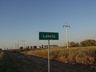
Lakota is a city in Nelson County, North Dakota, United States. It is the county seat of Nelson County Lakota is located 63 miles west of Grand Forks and 27 miles east of Devils Lake. The population was 683 at the 2020 census, making Lakota the 75th-largest city in North Dakota.

<span class="mw-page-title-main">Cannon Ball, North Dakota</span> CDP in Standing Rock Indian Reservation, United States

Cannon Ball is a census-designated place (CDP) on the Standing Rock Indian Reservation and in Sioux County, North Dakota, United States. It is located in the northeastern part of Sioux County, having developed at the confluence of the Cannonball River and Lake Oahe of the Missouri River. The population was 875 at the 2010 census.

<span class="mw-page-title-main">Solen, North Dakota</span> City in North Dakota, United States

Solen is a city in Sioux County, North Dakota, United States and on the Standing Rock Indian Reservation. The population was 70 at the 2020 census.

<span class="mw-page-title-main">Marmarth, North Dakota</span> City in North Dakota, United States

Marmarth is the largest city in Slope County in the U.S. State of North Dakota with a population of 101 as of 2020 census. It is situated in the southwestern part of Slope County, along the Bowman County line in the southwestern part of North Dakota, just seven miles east of the Montana border. Marmarth was founded as a railroad town along the Milwaukee Road from Seattle, WA to Chicago, IL. By 1920, Marmarth had over 1,300 residents. The town's population declined during most of the 20th century and was only 101 in 2021. There is one restaurant and one bar still located in Marmarth in 2013.

<span class="mw-page-title-main">Martin, South Dakota</span> City in South Dakota, United States

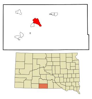
Martin is a city and the county seat of Bennett County, South Dakota, United States. The population was 938 at the 2020 census.

<span class="mw-page-title-main">Marty, South Dakota</span> CDP in South Dakota, United States

Marty is a census-designated place (CDP) in southern Charles Mix County, South Dakota, United States. The population was 677 at the 2020 census.

<span class="mw-page-title-main">Vermillion, South Dakota</span> City in South Dakota, United States

Vermillion is a city and the county seat of Clay County. It is in the southeastern corner of South Dakota, United States, and is the state's 12th-most populous city. According to the 2020 Census, the population was 11,695. The city lies atop a bluff near the Missouri River.

<span class="mw-page-title-main">McLaughlin, South Dakota</span> City in South Dakota, United States

McLaughlin is a city in northeastern Corson County, South Dakota, United States. The population was 663 at the 2010 census. It is the largest city on the Standing Rock Indian Reservation. Most Lakȟóta speakers refer to the town as Makáȟleča or Matȟó Akíčita.

<span class="mw-page-title-main">Wanblee, South Dakota</span> Census-designated place in South Dakota, United States

Wanblee is a census-designated place on the Pine Ridge Indian Reservation, located in Jackson County, South Dakota, United States. The population was 674 at the 2020 census, virtually all of whom are members of the Oglala band of Lakota Sioux. Wanbli is the Lakota word for eagle, and the town was named for its proximity to Wanbli hohpi paha. Wanblee is a few miles directly northeast of the North American continental pole of inaccessibility.

<span class="mw-page-title-main">Dell Rapids, South Dakota</span> City in South Dakota, United States

Dell Rapids is a city in Minnehaha County, South Dakota, United States. The population was 3,996 at the 2020 census. It is known as "The Little City with the Big Attractions."

<span class="mw-page-title-main">Oglala, South Dakota</span> CDP in South Dakota, United States

Oglala is a census-designated place (CDP) in West Oglala Lakota Unorganized Territory equivalent, Oglala Lakota County, South Dakota, United States. The population was 1,282 at the 2020 census. Its location is in the northwest of the Pine Ridge Indian Reservation.

<span class="mw-page-title-main">Pine Ridge, South Dakota</span> CDP in South Dakota, United States

Pine Ridge is a census-designated place (CDP) and the most populous community in Oglala Lakota County, South Dakota, United States. The population was 3,138 at the 2020 census. It is the tribal headquarters of the Oglala Sioux Tribe on the Pine Ridge Indian Reservation.

<span class="mw-page-title-main">Porcupine, South Dakota</span> CDP in South Dakota, United States

Porcupine is a census-designated place (CDP) in Oglala Lakota County, South Dakota, United States. The population was 925 at the 2020 census.

<span class="mw-page-title-main">Wounded Knee, South Dakota</span> CDP in South Dakota, United States

Wounded Knee is a census-designated place (CDP) on the Pine Ridge Indian Reservation in Oglala Lakota County, South Dakota, United States. The population was 364 at the 2020 census.

<span class="mw-page-title-main">Mission, South Dakota</span> City in South Dakota, United States

Mission is a city on the Rosebud Indian Reservation in northern Todd County, South Dakota, United States. The population was 1,156 at the 2020 census.

<span class="mw-page-title-main">Rosebud, South Dakota</span> CDP in South Dakota, United States

Rosebud also Sicanġu is a census-designated place (CDP) in Todd County, South Dakota, United States. The population was 1,455 at the 2020 census.

<span class="mw-page-title-main">St. Francis, South Dakota</span> Town in South Dakota, United States

St. Francis also Sápauŋ thí is a town on the Rosebud Indian Reservation in Todd County, South Dakota, United States. The population was 469 at the 2020 census.

<span class="mw-page-title-main">Mobridge, South Dakota</span> City in South Dakota, United States

Mobridge also Kȟowákataŋ Otȟúŋwahe is a city in Walworth County, South Dakota, United States. The population was 3,261 according to the 2020 census.

<span class="mw-page-title-main">Box Elder, South Dakota</span> City in South Dakota, United States

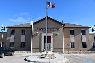
Box Elder is a city in Pennington and Meade counties in the State of South Dakota. The population was 11,746 according to the 2020 census, making it the 11th most populous city in South Dakota. Ellsworth Air Force Base lies on the northeast side of the city.

References

  1. "ArcGIS REST Services Directory". United States Census Bureau. Retrieved September 20, 2022.
  2. 1 2 U.S. Geological Survey Geographic Names Information System: Fort Yates, North Dakota
  3. 1 2 3 "Explore Census Data". United States Census Bureau . Retrieved November 12, 2023.
  4. 1 2 "City and Town Population Totals: 2020-2022". United States Census Bureau. November 12, 2023. Retrieved November 12, 2023.
  5. "Find a County". National Association of Counties. Archived from the original on May 31, 2011. Retrieved June 7, 2011.
  6. Hedren, Paul L. (2012). After Custer: Loss and Transformation in Sioux Country. Norman, OK: University of Oklahoma Press. p. 67. ISBN   978-0-8061-4216-6.
  7. "US Gazetteer files 2010". United States Census Bureau. Archived from the original on July 2, 2012. Retrieved June 14, 2012.
  8. Infoplease.com; North Dakota Record Monthly Temperatures
  9. "Interactive United States Koppen-Geiger Climate Classification Map". www.plantmaps.com. Retrieved October 12, 2018.
  10. "NOWData - NOAA Online Weather Data". National Oceanic and Atmospheric Administration . Retrieved May 4, 2013.
  11. "Ft Yates 4SW". Western Regional Climate Center. Retrieved December 26, 2016.
  12. United States Census Bureau. "Census of Population and Housing" . Retrieved January 21, 2014.
  13. Problems experienced by the Standing Rock Sioux tribes situated along the Missouri River, Senate Hearing, Washington, DC: U.S. Government Printing Office, November 18, 2004, retrieved December 2, 2016
  14. "2020 CENSUS - SCHOOL DISTRICT REFERENCE MAP: Sioux County, ND" (PDF). United States Census Bureau . Retrieved August 13, 2021.